 Access by request
D181: Çamarası Tumulus
Aphrodisias Regional Survey
2007-06-23
View/


Citation
Page reference: Christopher Ratté and Peter D. De Staebler (eds.). Aphrodisias V. The Aphrodisias Regional Survey (Verlag Philipp von Zabern: Darmstadt/Mainz, 2012), 49, 50 - Book catalogue no.: Tumuli cat. 05. <http://hdl.handle.net/2027.42/92913>
Other Identifiers
D181
Subjects
Tumuli 3: Hellenistic
Description
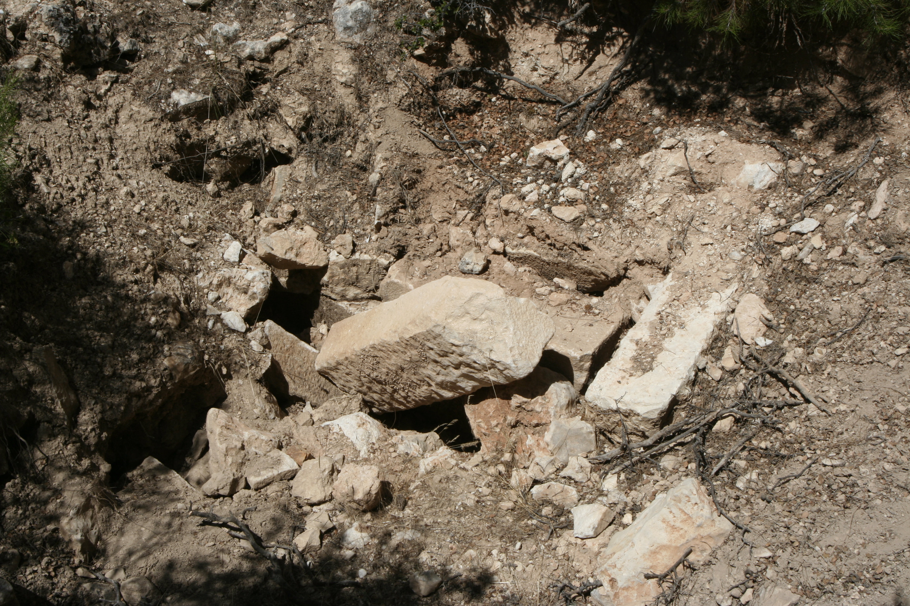
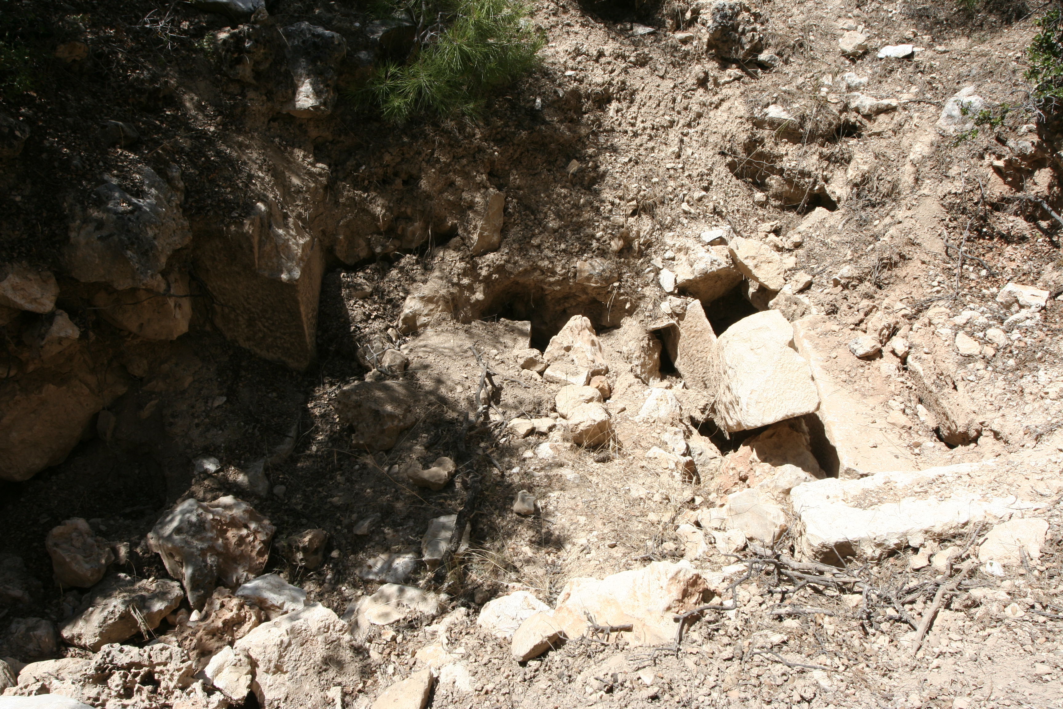
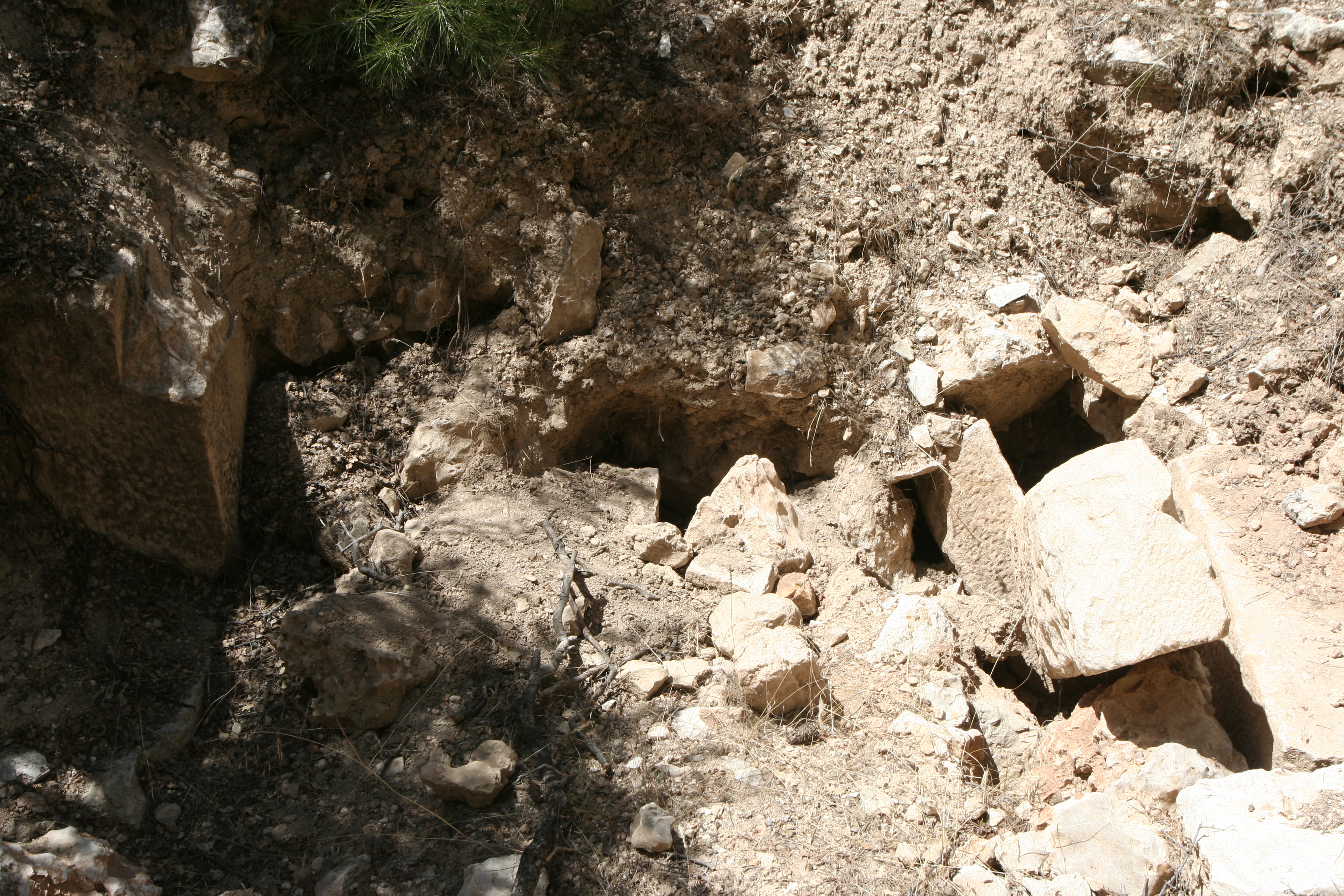
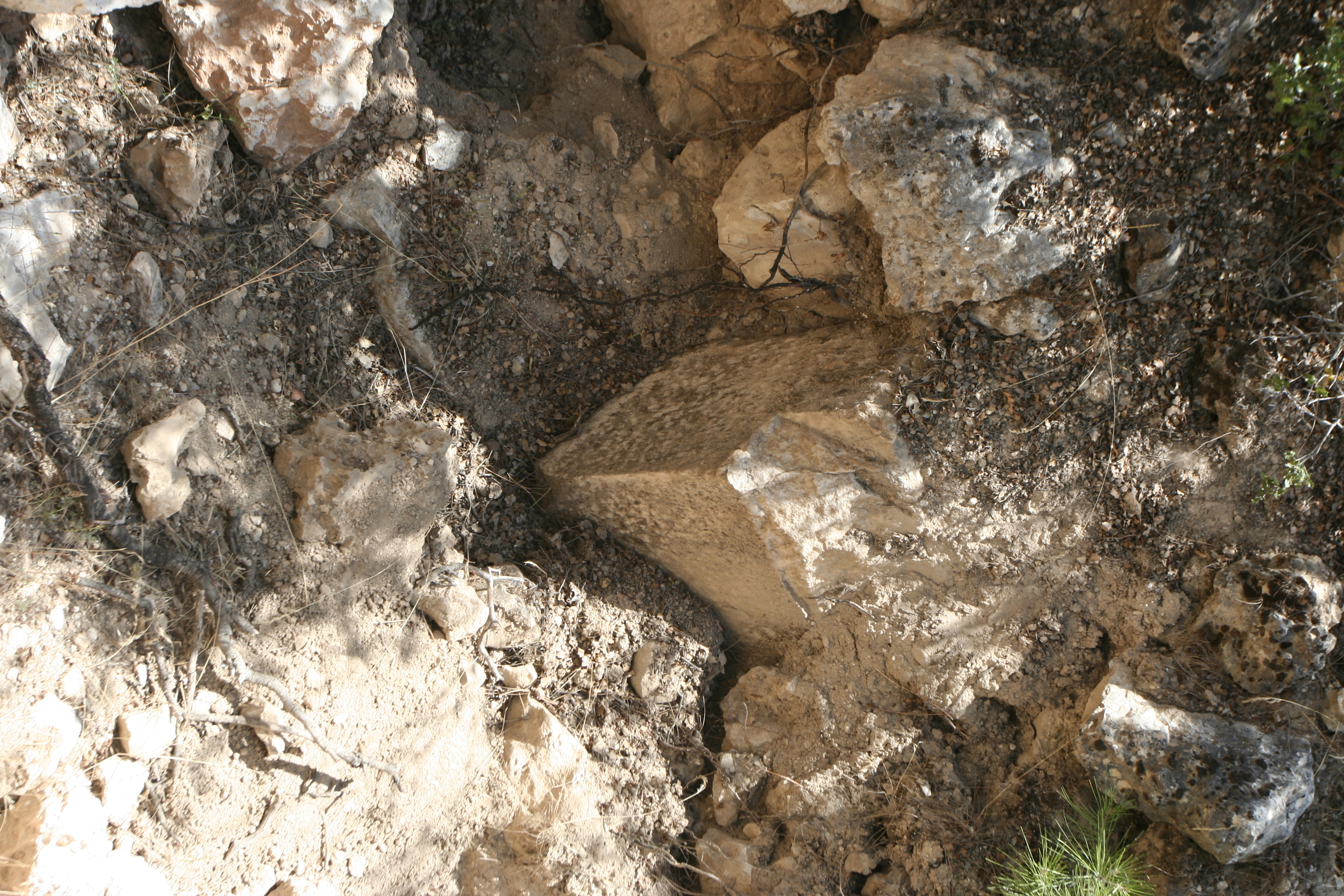
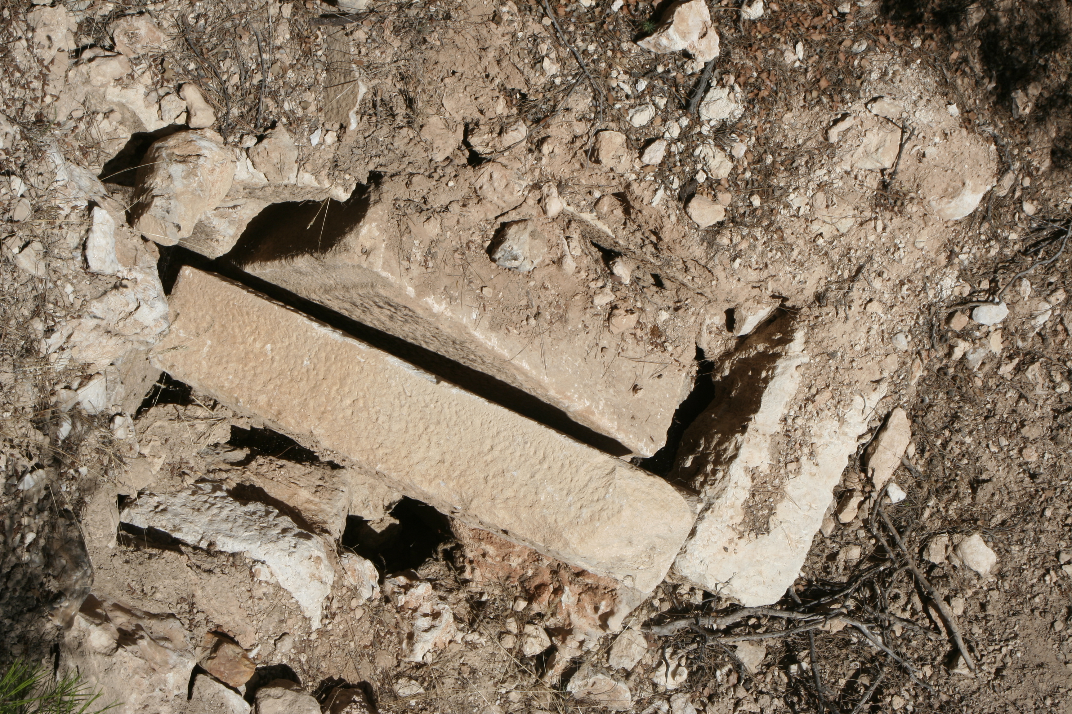
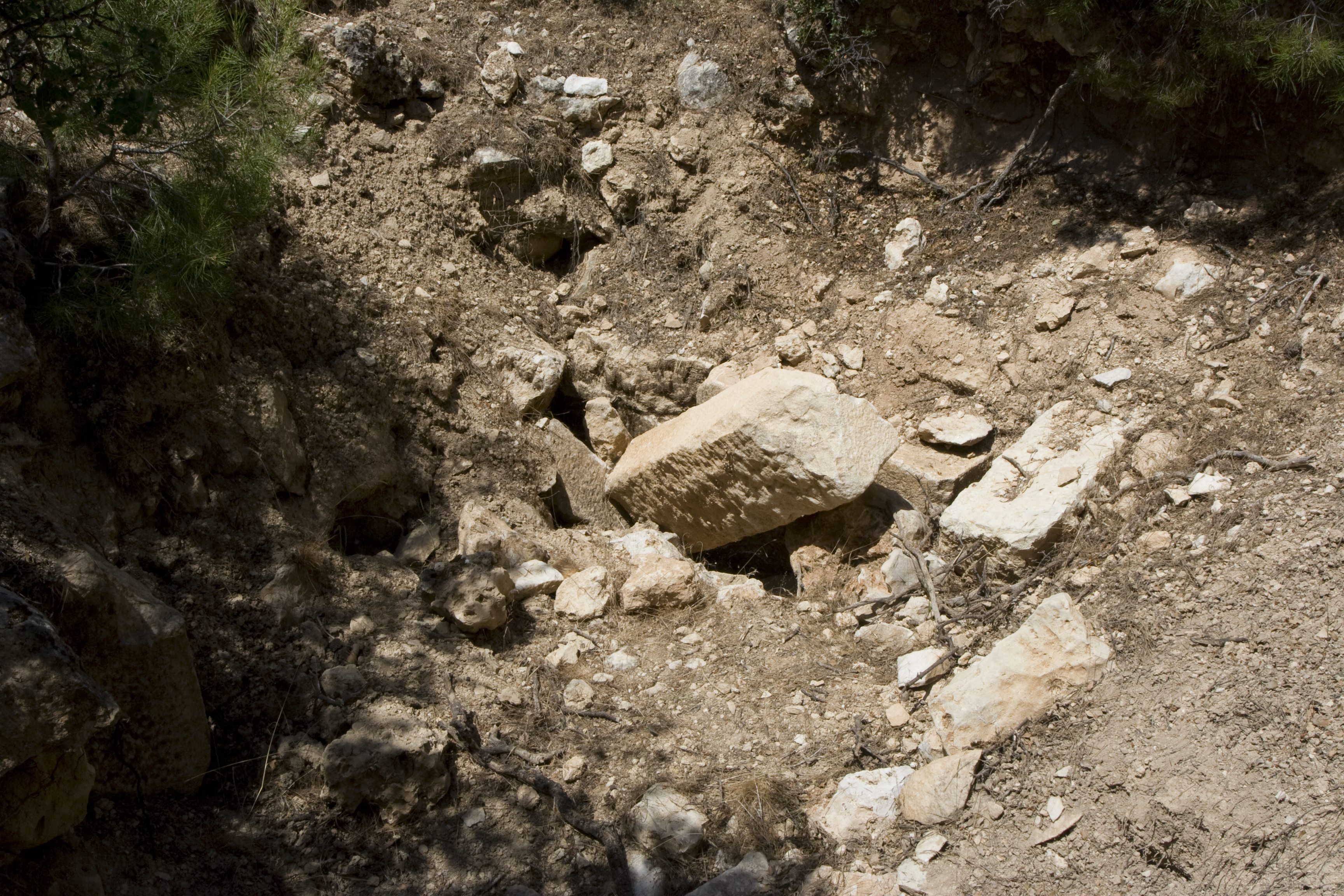
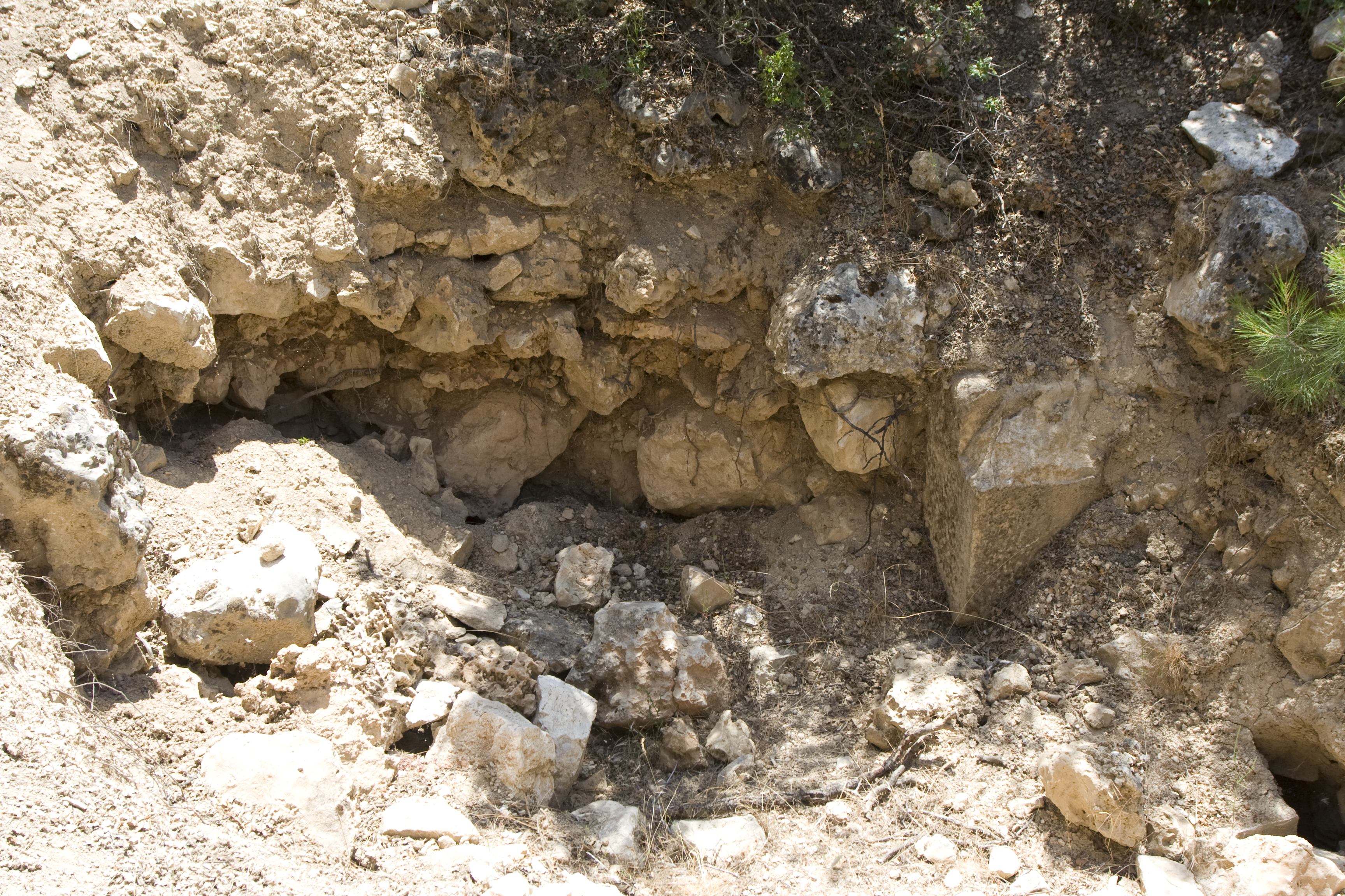
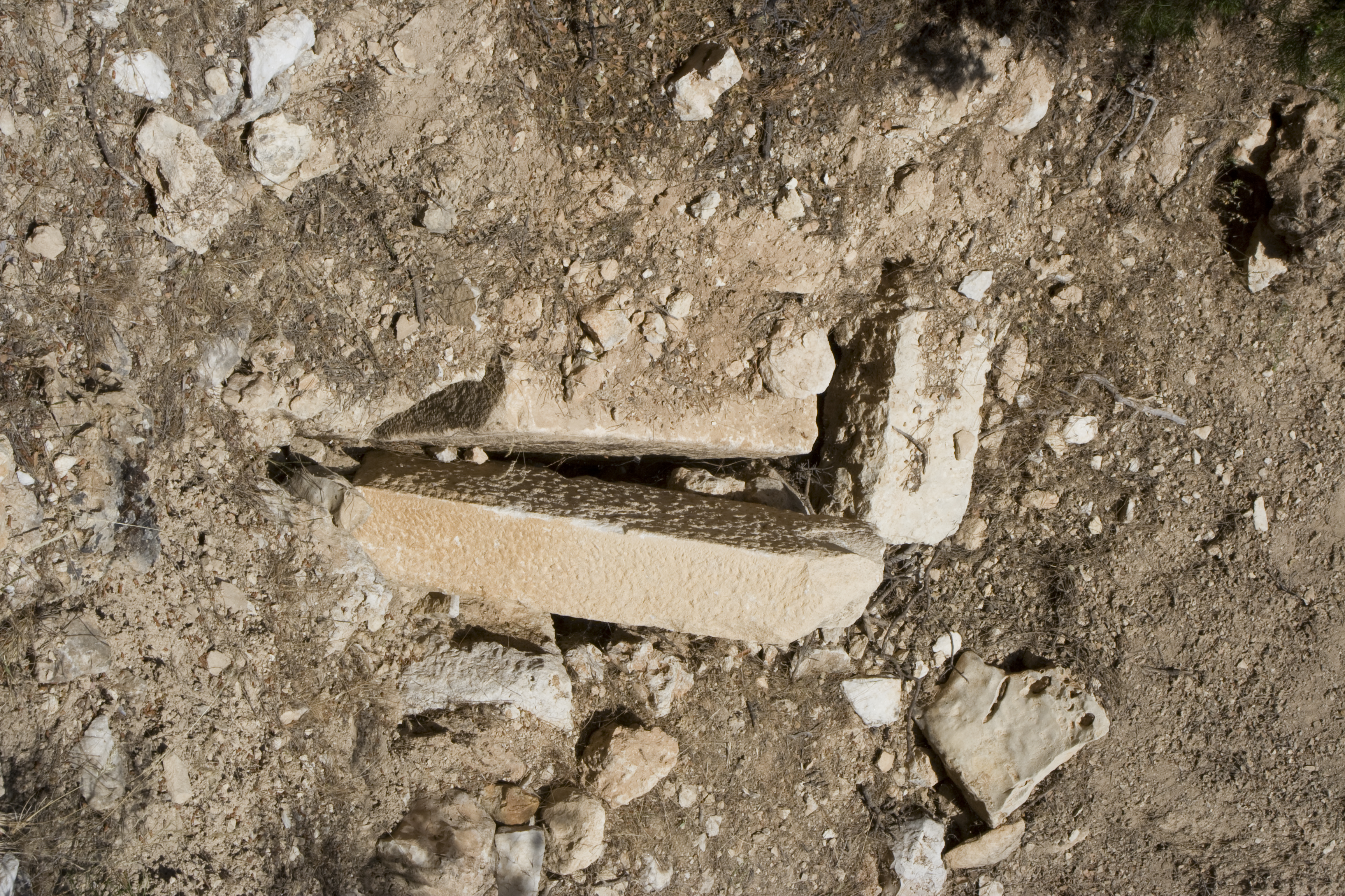
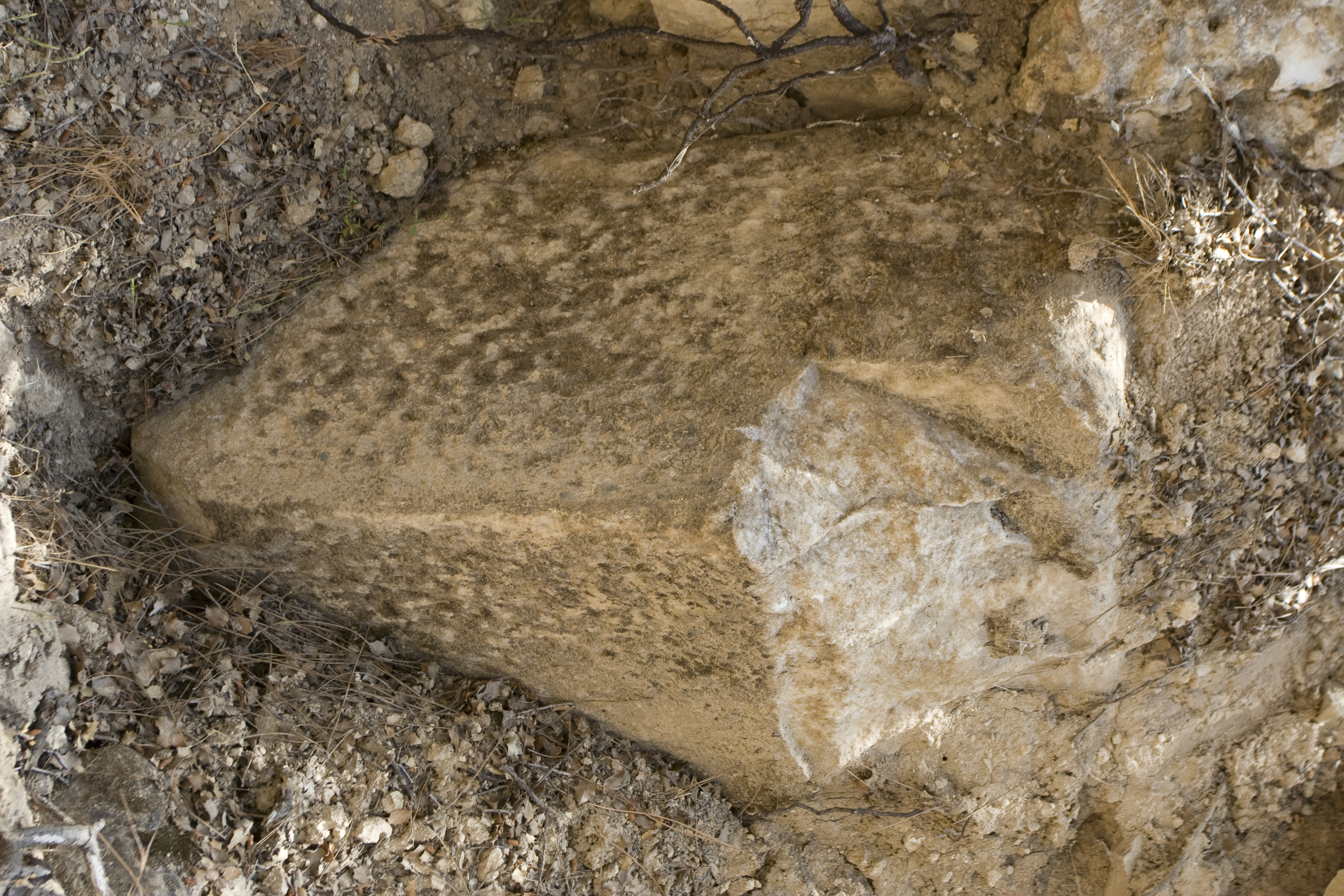
Local Name: Kızılcık, Çamarası Local Informant: Yusuf Zemin Local Information: Located 1 km southwest of the village, on the edge of a bluff ** looking northwest over the west end of the valley. Dug out by grave robbers about 10 years ago and partly filled back in. ** Prior to the looting a "window" was visible on the W side of mound and the marble floor was visible Latitude: 37.38.59.265 Longitude: 28.41.32.698 Elevation: 718m Dimensions: Chamber Width: 1.83m Description: All that remains visible today are a few displaced marble blocks and parts of what seem to be the east and west walls of a north–south-oriented chamber (W: 1.83 m). The chamber is built out of large white marble blocks (fully exposed H of one block: 0.68 m; L of another block: 0.90 m). The faces of the blocks are point-dressed, with drafted margins in places but not everywhere. The joints are banded (smoother at the front than at the back, but without the sharp distinction of anathyrosis). There are no visible clamps or dowels. Visible behind the east wall is a coarse limestone rubble packing. ** Based on masonry probably dates to 4th-3rd century BCE.
Types
Other
Metadata
Show full item recordCollections
Remediation of Harmful Language
The University of Michigan Library aims to describe library materials in a way that respects the people and communities who create, use, and are represented in our collections. Report harmful or offensive language in catalog records, finding aids, or elsewhere in our collections anonymously through our metadata feedback form. More information at Remediation of Harmful Language.
Accessibility
If you are unable to use this file in its current format, please select the Contact Us link and we can modify it to make it more accessible to you.