 Access by request
F031: Villa / Farmstead / tomb
Aphrodisias Regional Survey
2008-06-12
View/


Citation
Page reference: Christopher Ratté and Peter D. De Staebler (eds.). Aphrodisias V. The Aphrodisias Regional Survey (Verlag Philipp von Zabern: Darmstadt/Mainz, 2012), 28, 71, 86, 118. <http://hdl.handle.net/2027.42/93026>
Other Identifiers
F031
Subjects
Farmsteads Tombs 4: Roman 3: Hellenistic
Description
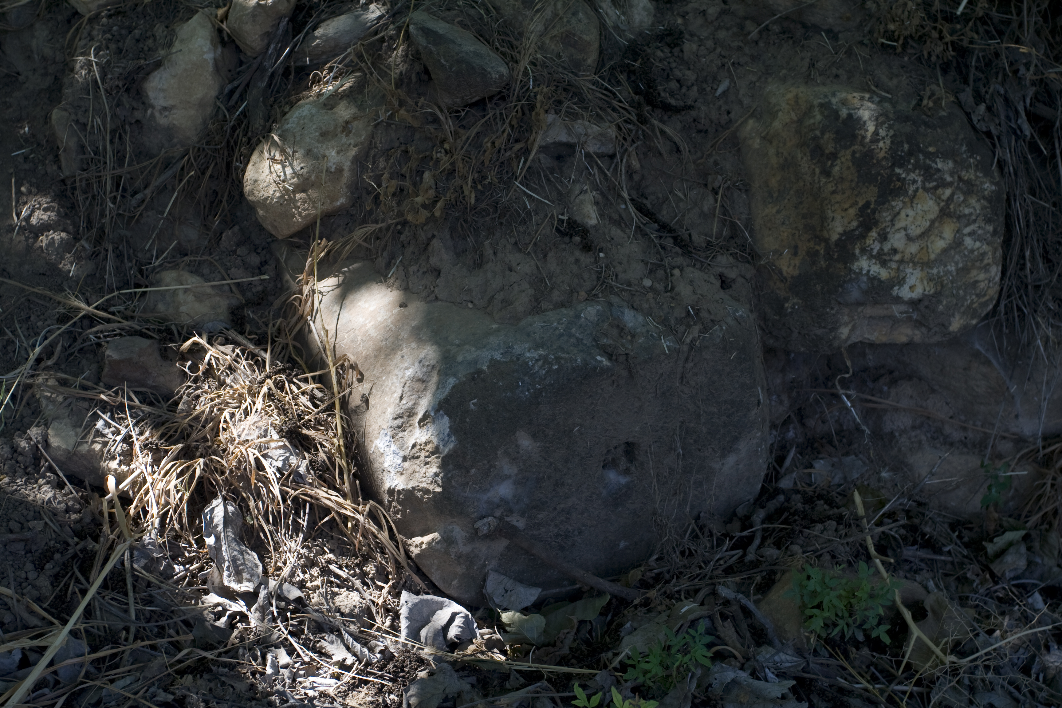
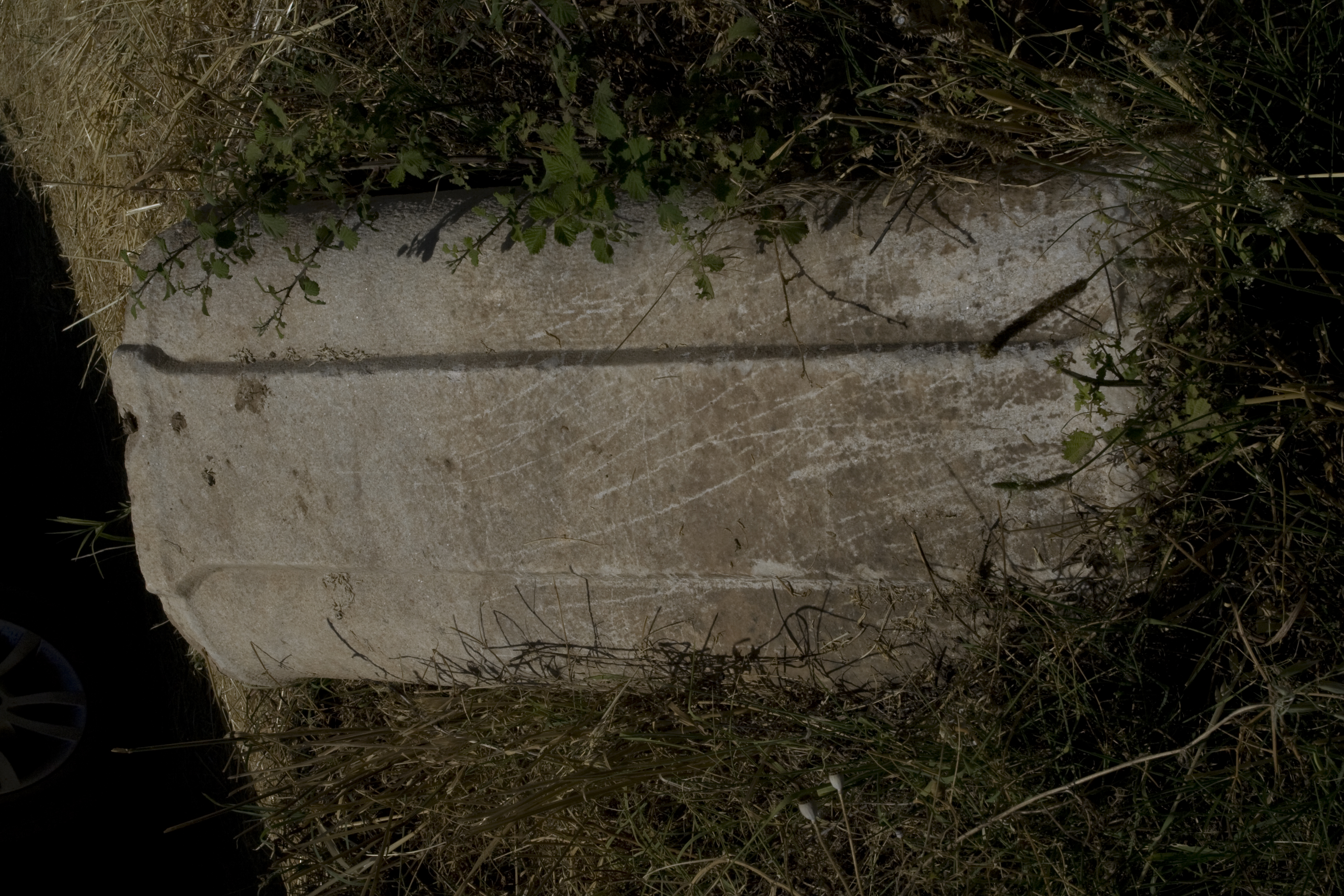
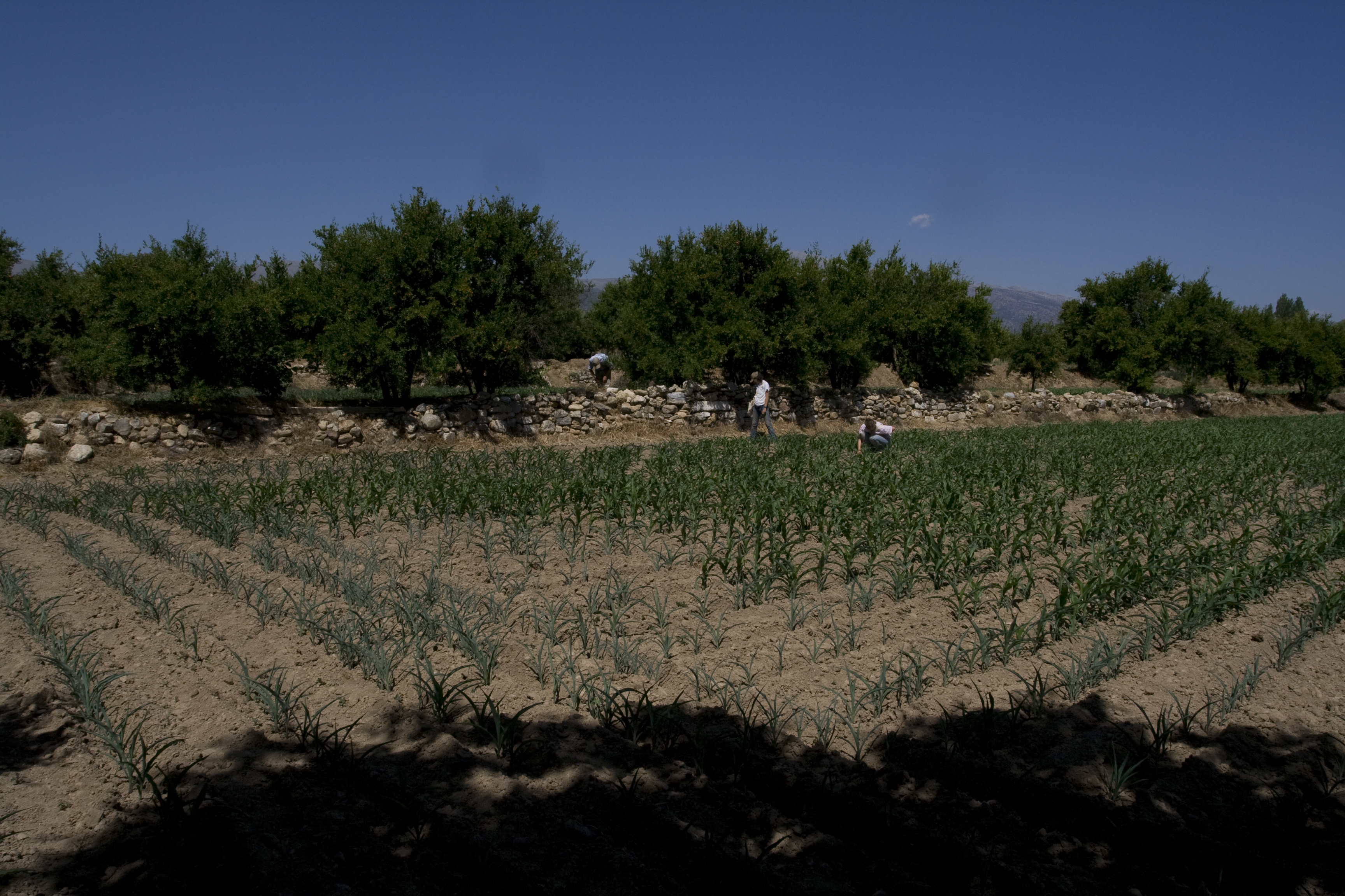
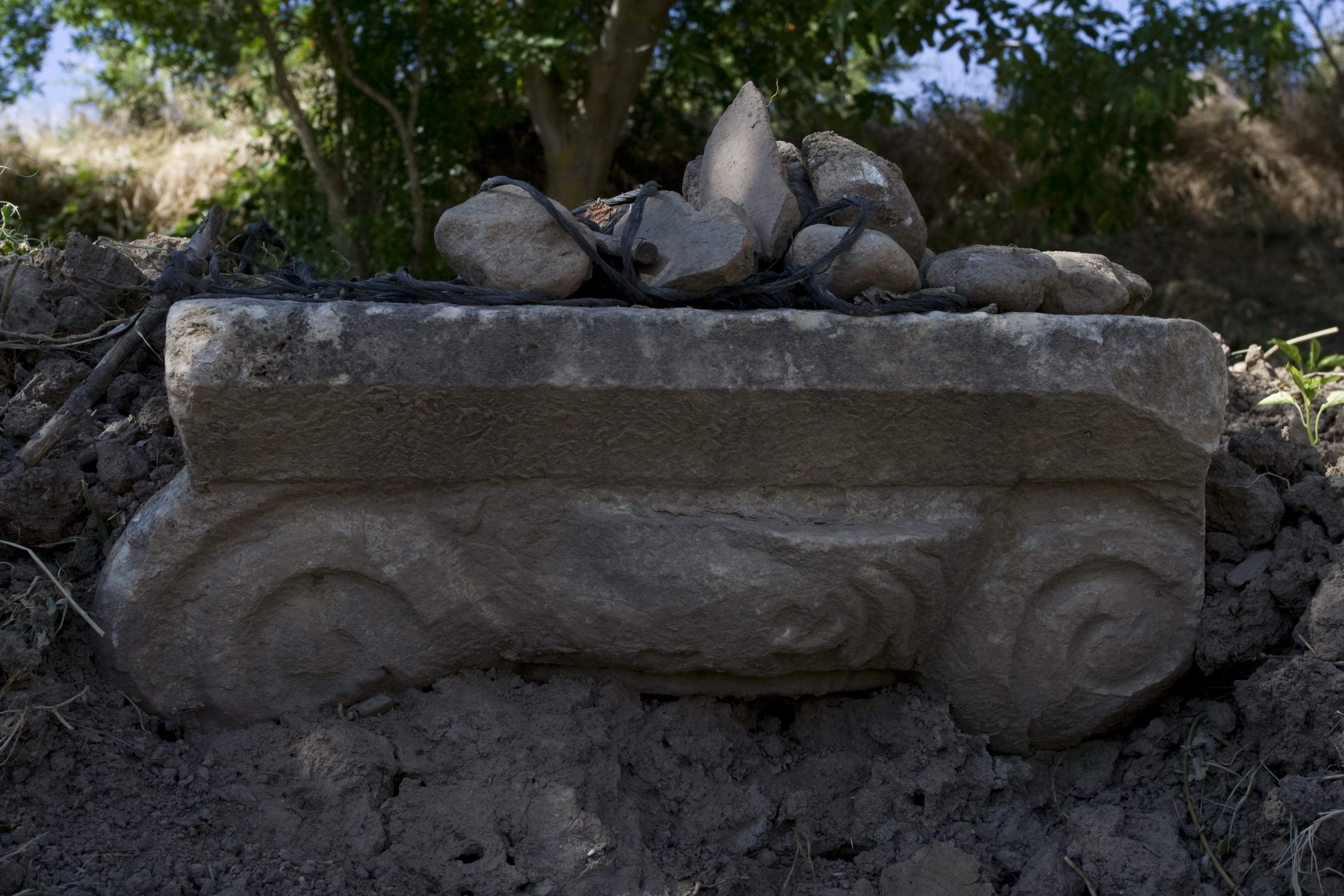
Latitude: 37.41.38.9 Longitude: 28.42.35.1 Dimensions: 100m E-W by 150m N-S Description: The site of a villa / farmstead / monumental tomb is located SSW of Aphrodisias, just north of the river. The pottery and tile scatter covers roughly 100m E-W and 150m N-S over 4 terraced fields. There is also a fair amount of clay pipe in the fields including one full segment (L: 0.39m; Outer Diam: 0.205m; Th: 0.025m). Several of the field walls serve as terrace walls, and they are full of marble petit appareil blocks (at least 30 in all) and large worked marble blocks. These include: 2 flat blocks with anathyrosis, 2 white marble double engaged column fragments, one with a dowel hole at base (1: pres L: 1.12m; W: 0.495m; D: 0.30m; 2: visible L: 0.40m; W: 0.38m; D: 0.26m), 2 monolithic white marble column fragments, and one well-preserved Ionic column capital. Pottery at the site includes several molded bowl fragments, LCW, and LBW together with the local TMW. Occupation appears to be primarily early and imperial Roman. Finds: Systematic pottery collection on 6/12/2008
Types
Other
Metadata
Show full item recordCollections
Remediation of Harmful Language
The University of Michigan Library aims to describe library materials in a way that respects the people and communities who create, use, and are represented in our collections. Report harmful or offensive language in catalog records, finding aids, or elsewhere in our collections anonymously through our metadata feedback form. More information at Remediation of Harmful Language.
Accessibility
If you are unable to use this file in its current format, please select the Contact Us link and we can modify it to make it more accessible to you.