 Access by request
A082: Yazır Quarry
Aphrodisias Regional Survey
2005-06-14

Citation
Page reference: Christopher Ratté and Peter D. De Staebler (eds.). Aphrodisias V. The Aphrodisias Regional Survey (Verlag Philipp von Zabern: Darmstadt/Mainz, 2012), 154, 156, 158, 172, 194, 195 - Book catalogue no.: Quarries cat. 1. <http://hdl.handle.net/2027.42/93128>
Other Identifiers
A082
Subjects
Quarries 4: Roman 3: Hellenistic 2: Protohistoric
Description
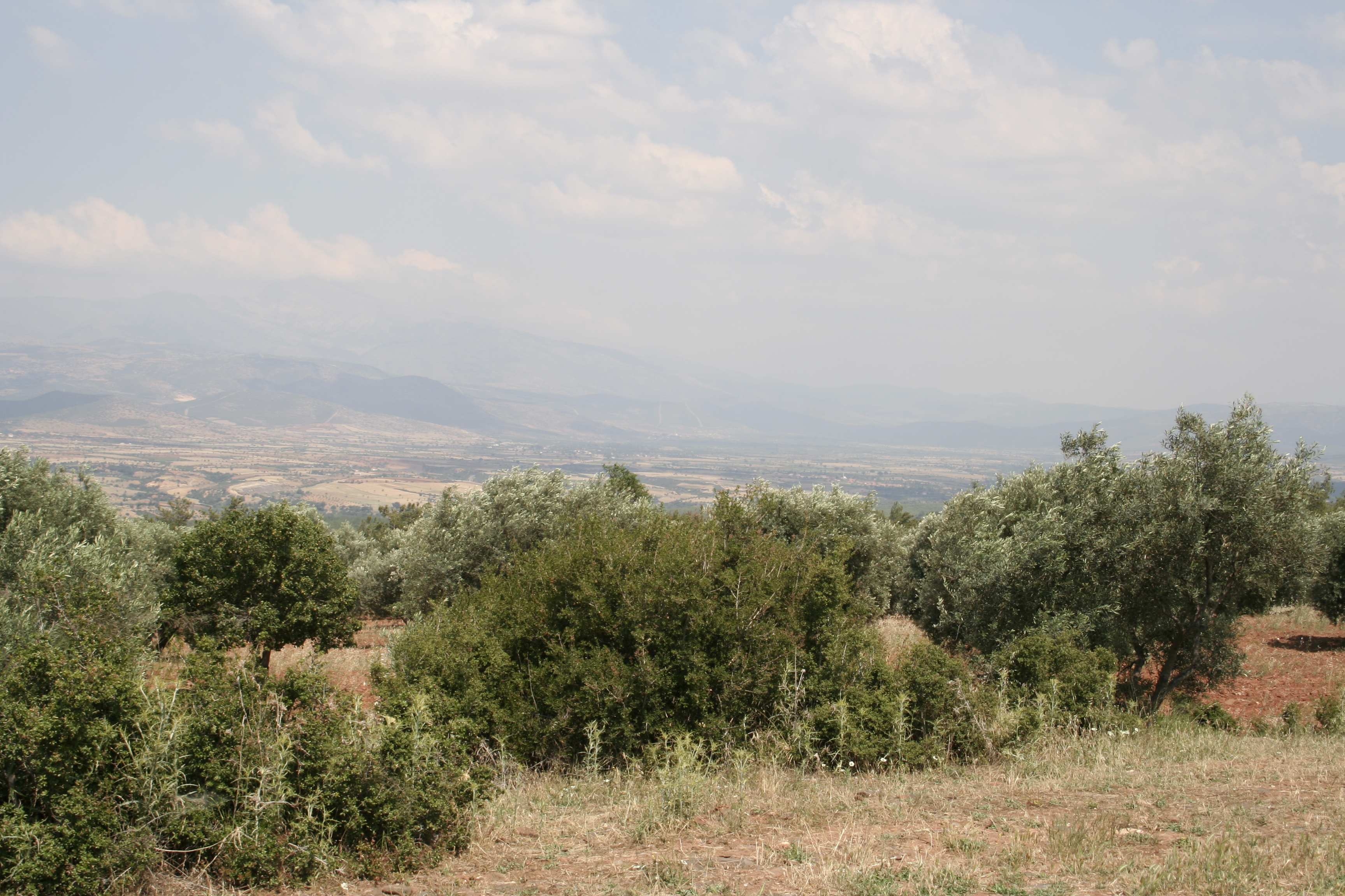
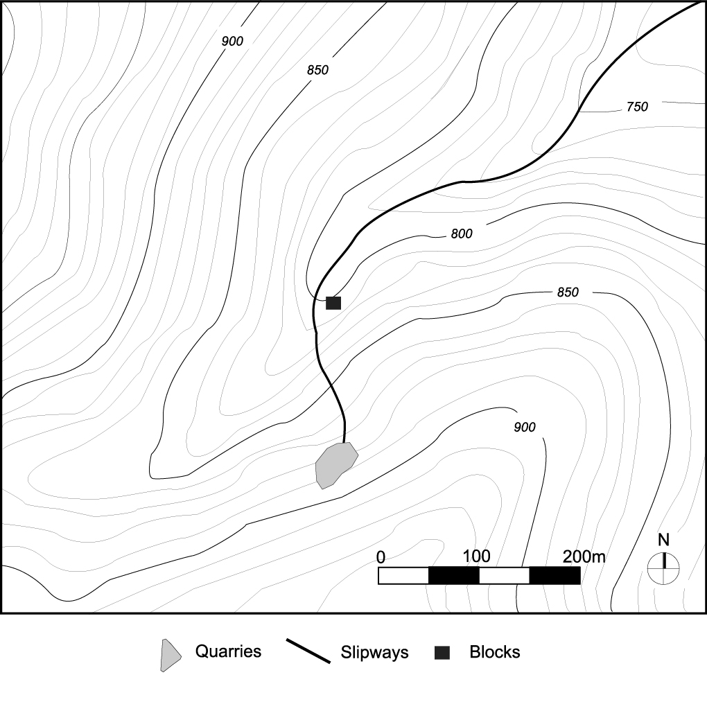
Local Name: Gâvur Pazarı, Gâvurpazaryeri Local Informant: Ali Karacam Local Information: Many stories exist about the hilltop called Gâvur Pazarı, where ruins were believed to be a treasury or a jewelry workshop. We were advised to talk to elders of the village for "more accurate" information. Latitude: 37.40.47.46 Longitude: 28.36.32.40 Elevation: 919m Dimensions: Quarry 1: H: 33 m, W: 38 m, D: 21 m [the largest individual quarry outside of the City Quarries and it preserves the highest face of all regional quarries] ** Capacity: ca. 6,750 m3 Description: NOTE: In addition to the large Roman colored marble quarry usually referred to as the "Yazır Quarry" are a series of small marble quarries at the crest of the ridge, probably for the construction of two front towers at the late Classical citadel (A083). ** Location: 1 km northeast of the modern village of Yazır, 100 m below the citadel (A083) on the northwestern side of Gâvur Pazarı hill. Accessible by unpaved road, 1 km south of Yazır, 11 km from Aphrodisias. Elevation ca. 850 masl. ** Number and dimensions of quarries: Single medium-sized ** quarry. ** Geological age, grain size, and color: Late Paleozoic. The white mottled areas range from medium to coarse grain, and the blue, fine to medium. Weathered surfaces of the quarry face partially covered in lichens. Mottled blue-gray and white color, ranging from horizontal lineations to swirling foliations. Strongly resembles kaplan postu quarried at Dokimeion. ** Modern quarrying: Winding road that runs by the quarry now provides access to the Demirag˘lar Quarries at the crest of the ridge, currently largest operating quarry in the survey region. Obscured by a steep hillside and towering pine trees, quarry has escaped notice of prospectors, who have drilled test cores on hill and quarry giallo anticato (sic), rosa silver, leopard white, and verde rosa several hundred m away. ** Joints and quality of marble: Few natural cracks on the north face, with considerable distance between the natural joints in stone, estimated ca. 15 m high and 5 m wide. On the west face, a number of horizontal joints run parallel to ground surface. Joint spacing on the west face ranges from 0.7 to 0.45 m high and 3 to 1 m wide. Quality of marble is very high. ** Quarry organization and evidence for extraction: Quarry opens to the west. Cut made into the hill is V-shaped in plan. Long, continuous pickmarks cover entire surface of north quarry face. On lower portions of west face, traces of heavy pickmarks and several wedge holes are visible. Pickmarks run both vertically and horizontally. Debris was apparently removed from the back of the quarry and thrown down the ** hillside. ** Blocks: Block abandoned in mouth of quarry (H: 0.6 m, W: 0.6 m, D: 1.6 m). Small rectangular block and column, both broken, lie in mountain stream below.
Types
Other
Metadata
Show full item recordCollections
Remediation of Harmful Language
The University of Michigan Library aims to describe library materials in a way that respects the people and communities who create, use, and are represented in our collections. Report harmful or offensive language in catalog records, finding aids, or elsewhere in our collections anonymously through our metadata feedback form. More information at Remediation of Harmful Language.
Accessibility
If you are unable to use this file in its current format, please select the Contact Us link and we can modify it to make it more accessible to you.