 Access by request
A008: Işıklar Aqueduct, Kavaklıdere Bridge
| dc.contributor.author | Aphrodisias Regional Survey | en_US |
| dc.date.accessioned | 2012-08-24T19:04:25Z | |
| dc.date.available | 2012-08-24T19:04:25Z | |
| dc.date.issued | 2005-06-02 | en_US |
| dc.identifier.citation | Page reference: Christopher Ratté and Peter D. De Staebler (eds.). Aphrodisias V. The Aphrodisias Regional Survey (Verlag Philipp von Zabern: Darmstadt/Mainz, 2012), 243, 247, 248, 249, 296 - Book catalogue no.: Aqueducts cat. 2. <http://hdl.handle.net/2027.42/93134> | en_US |
| dc.identifier.other | A008 | en_US |
| dc.identifier.uri | https://hdl.handle.net/2027.42/93134 | |
| dc.description | Local Name: Işıklar Deresi | en_US |
| dc.description | Latitude: 37.44.46.02 | en_US |
| dc.description | Longitude: 28.43.25.08 | en_US |
| dc.description | Elevation: 609m | en_US |
| dc.description | Axis: 120 degrees | en_US |
| dc.description | Dimensions: Preserved H: 6.10 m. ** Preserved length: 6.60 m. ** Pier width (base): 1.65 m. ** Projected arch span: 6.60 m. ** Height of projected arch bottom from streambed: c. 10.50 m. | en_US |
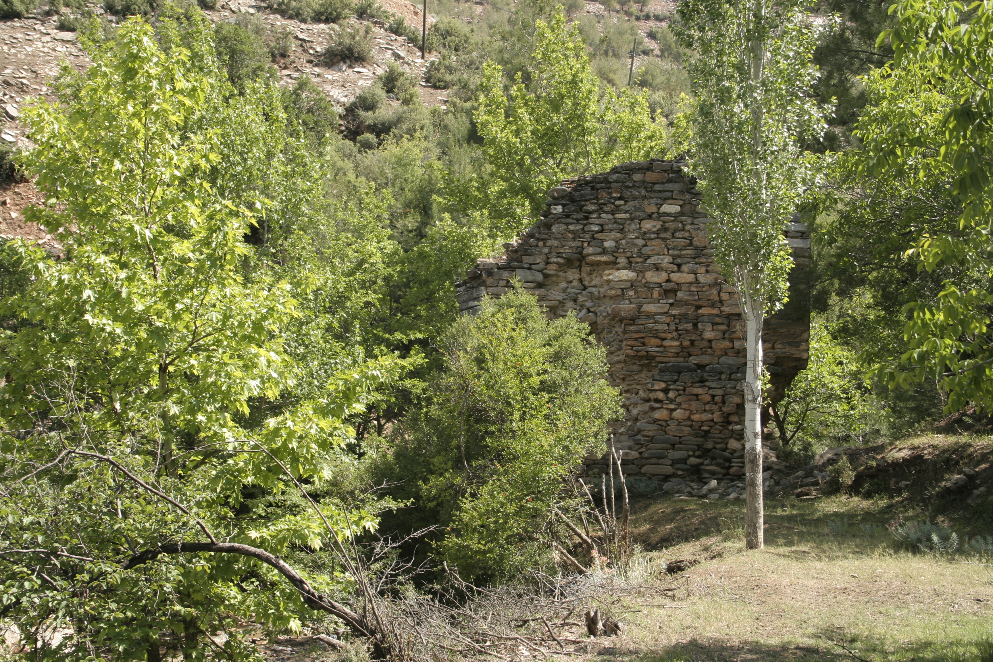
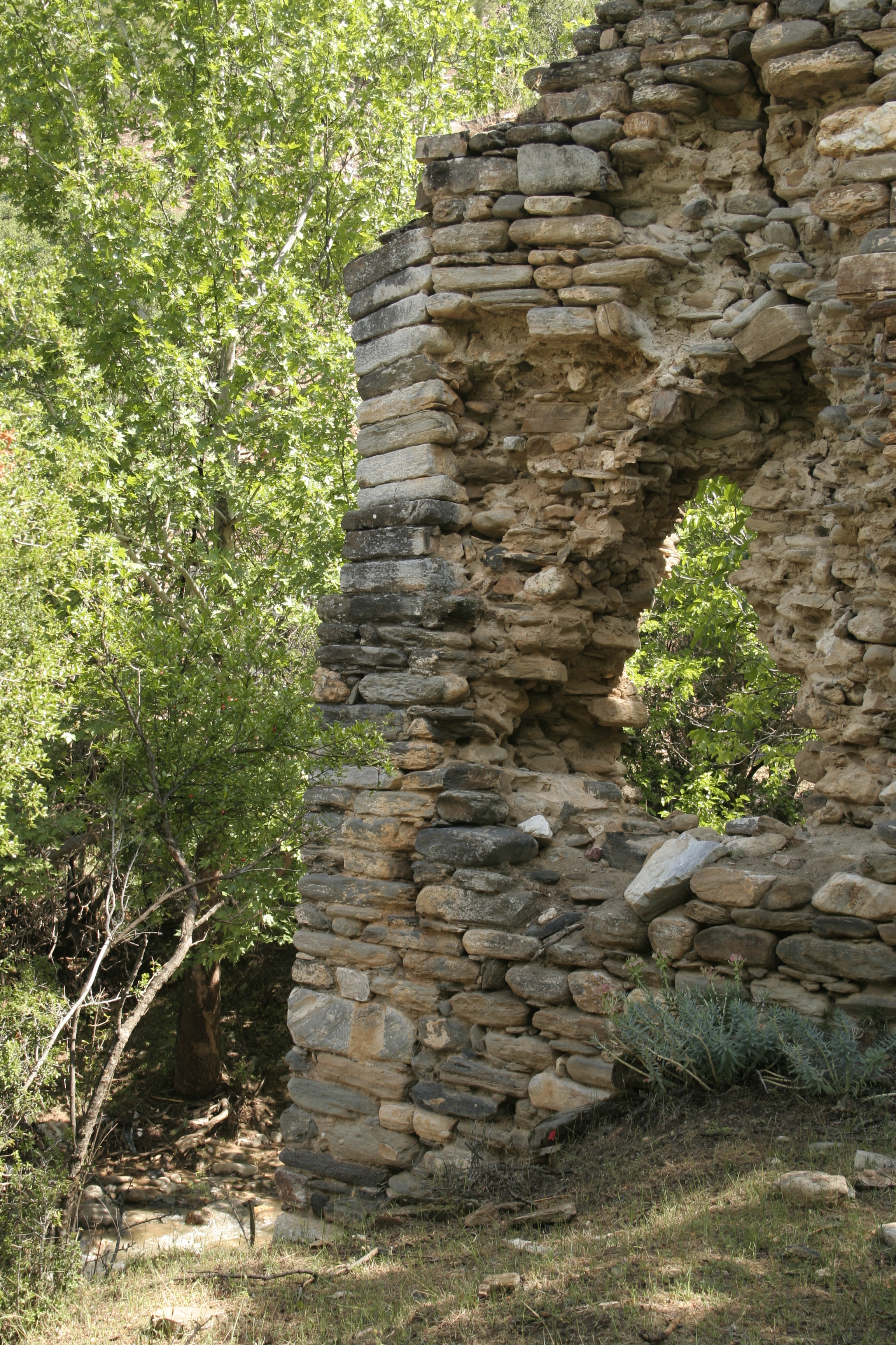
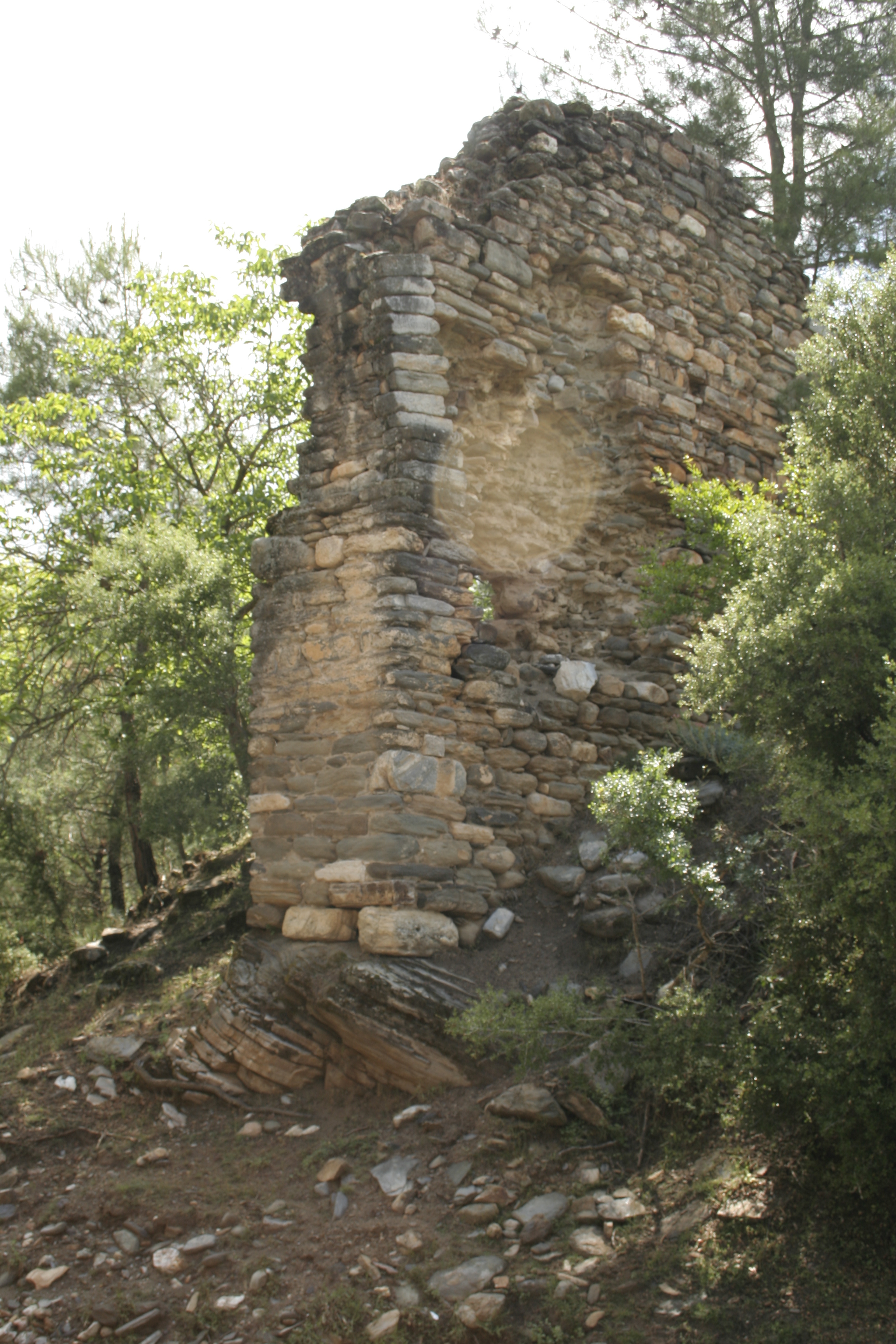
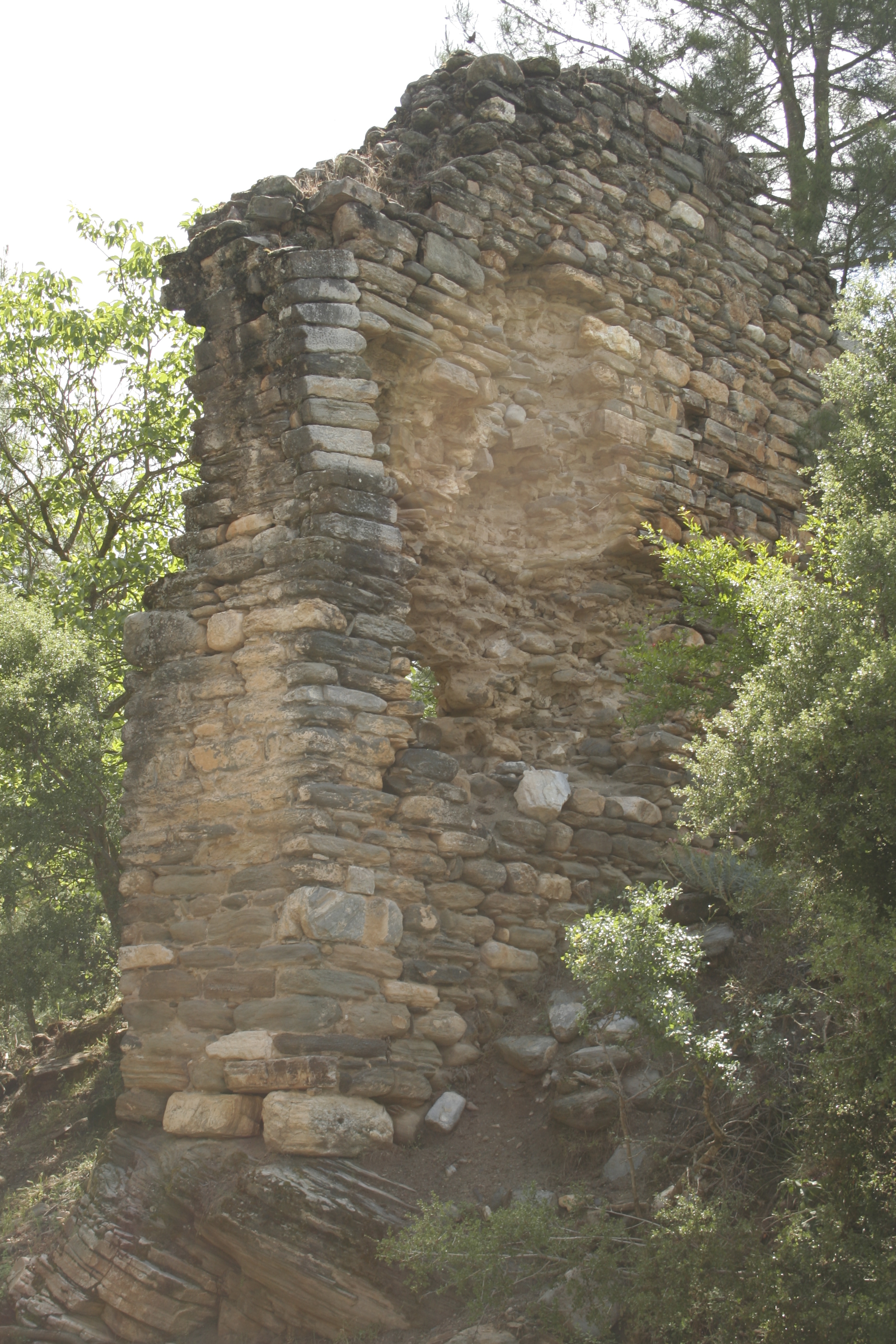
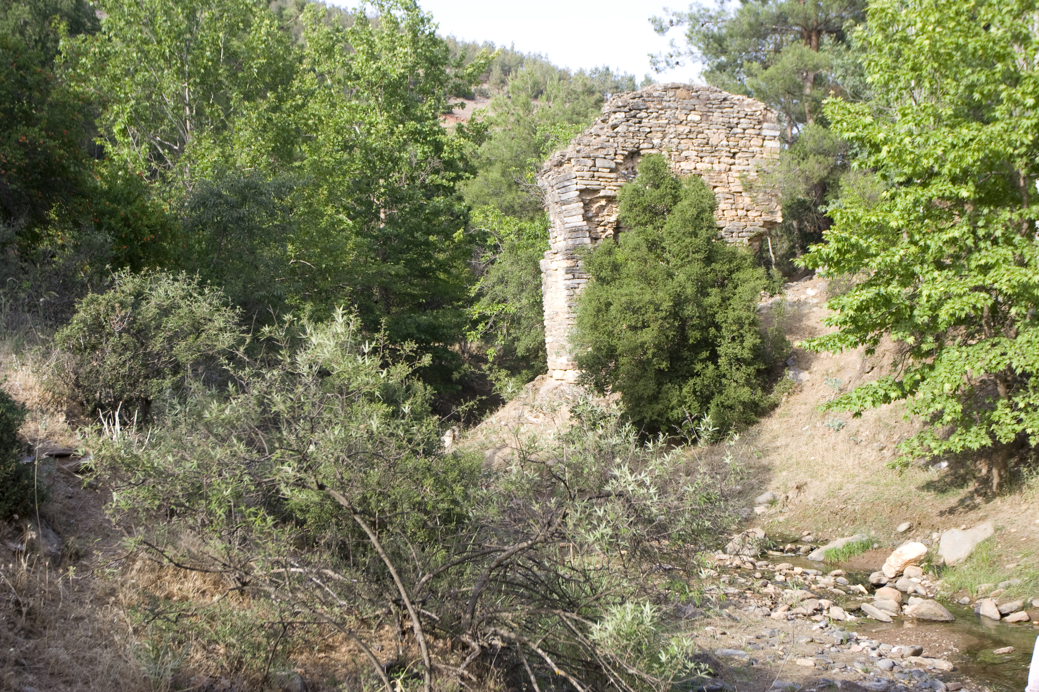
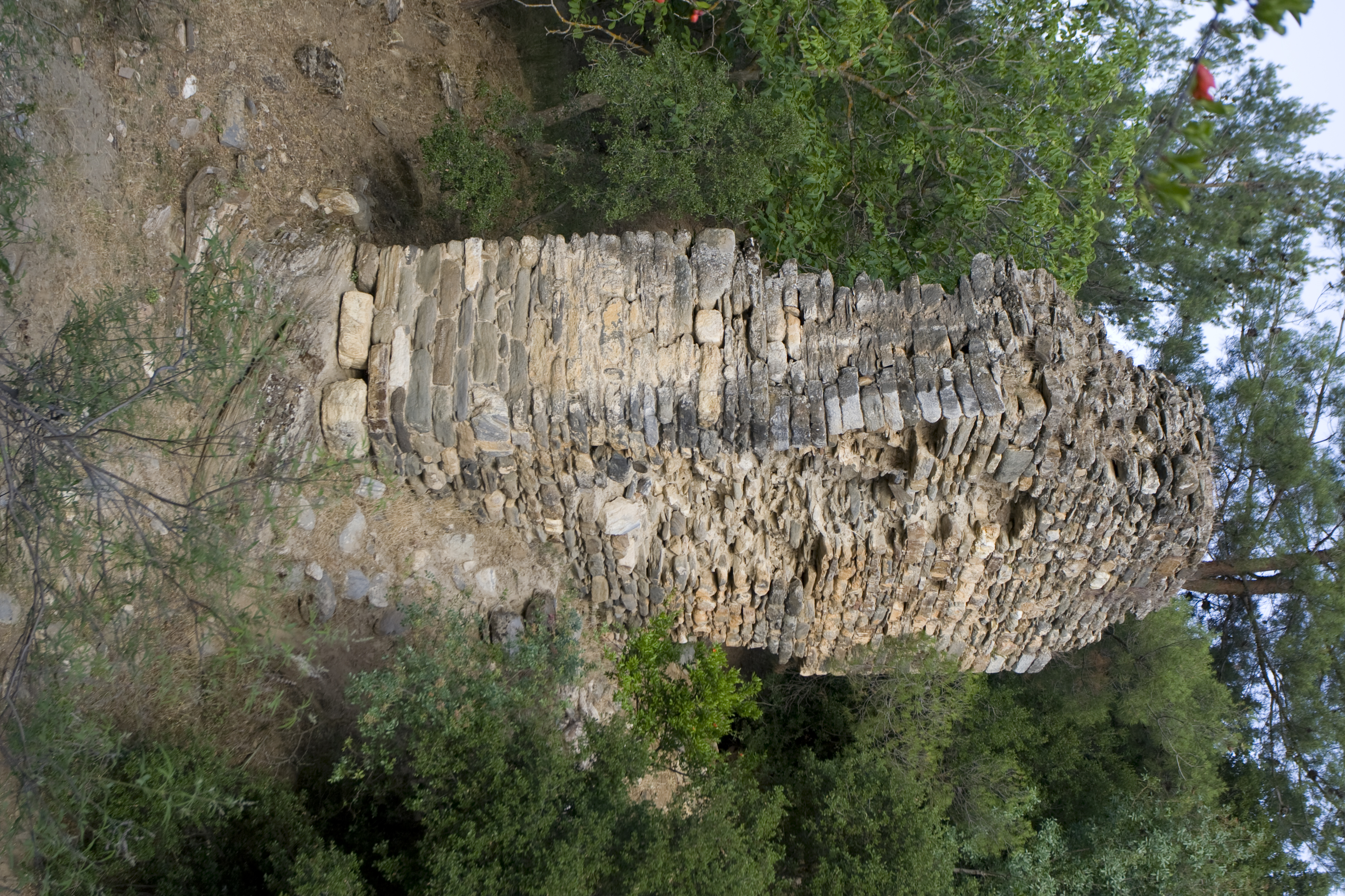
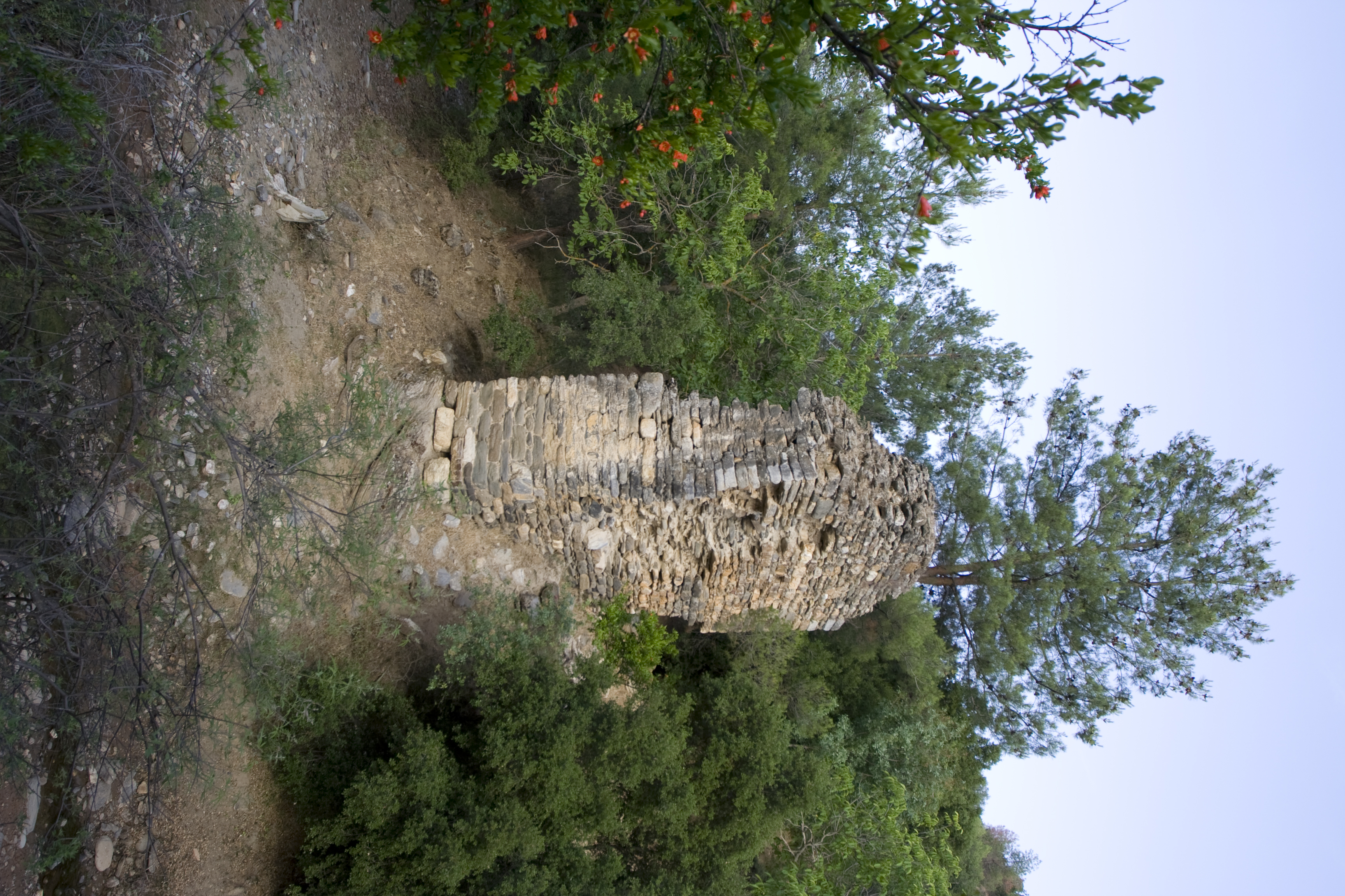
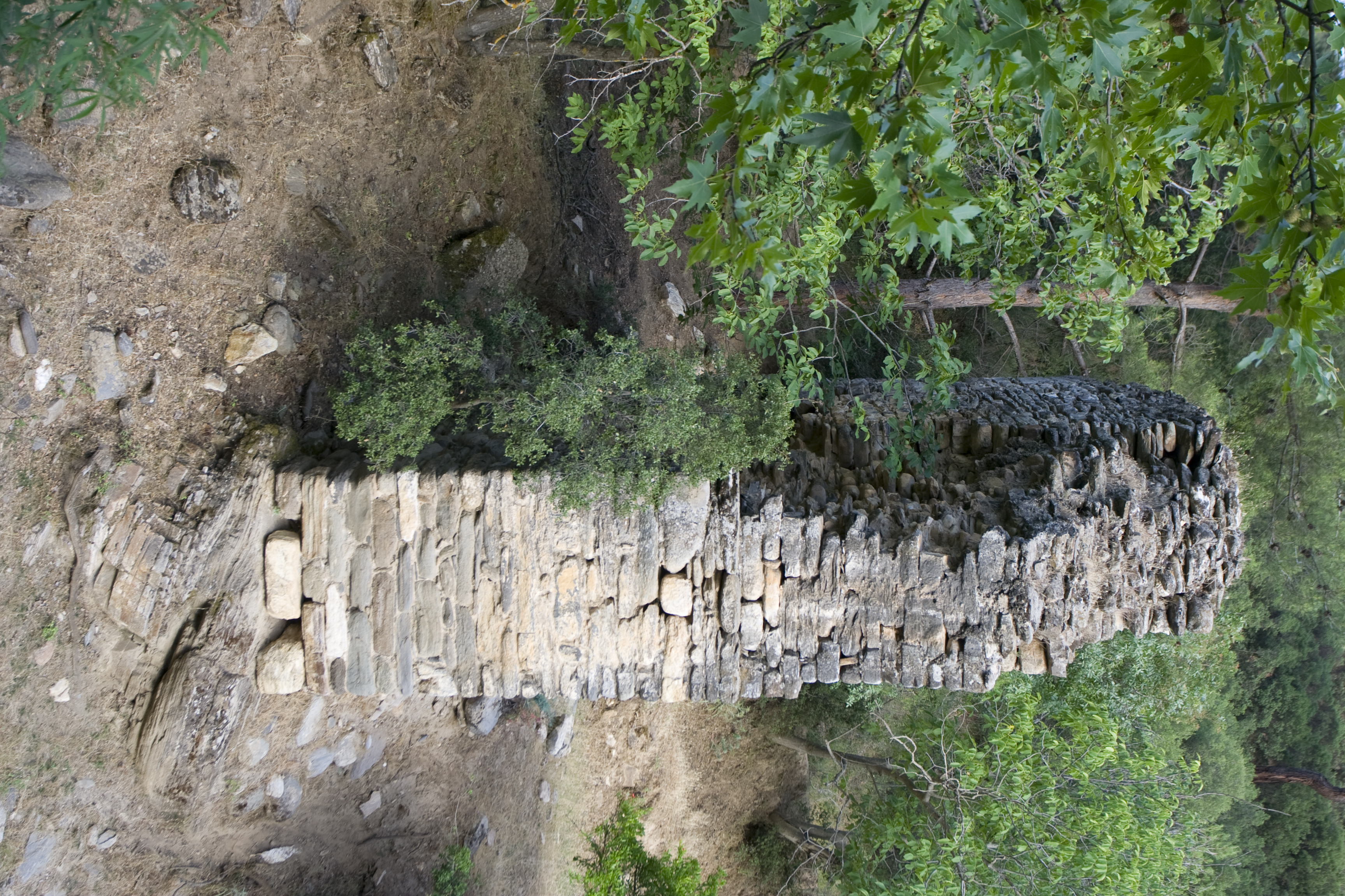
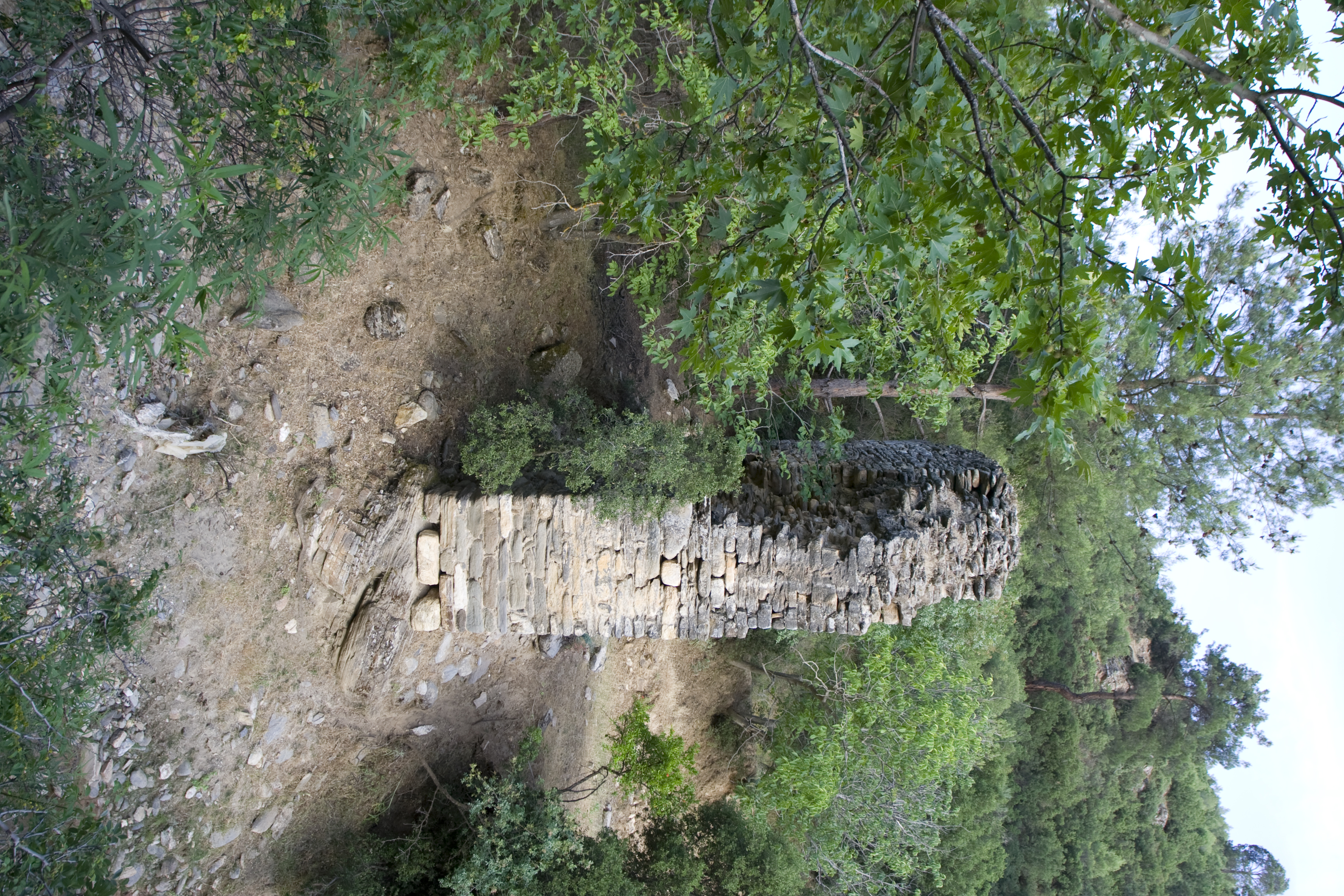
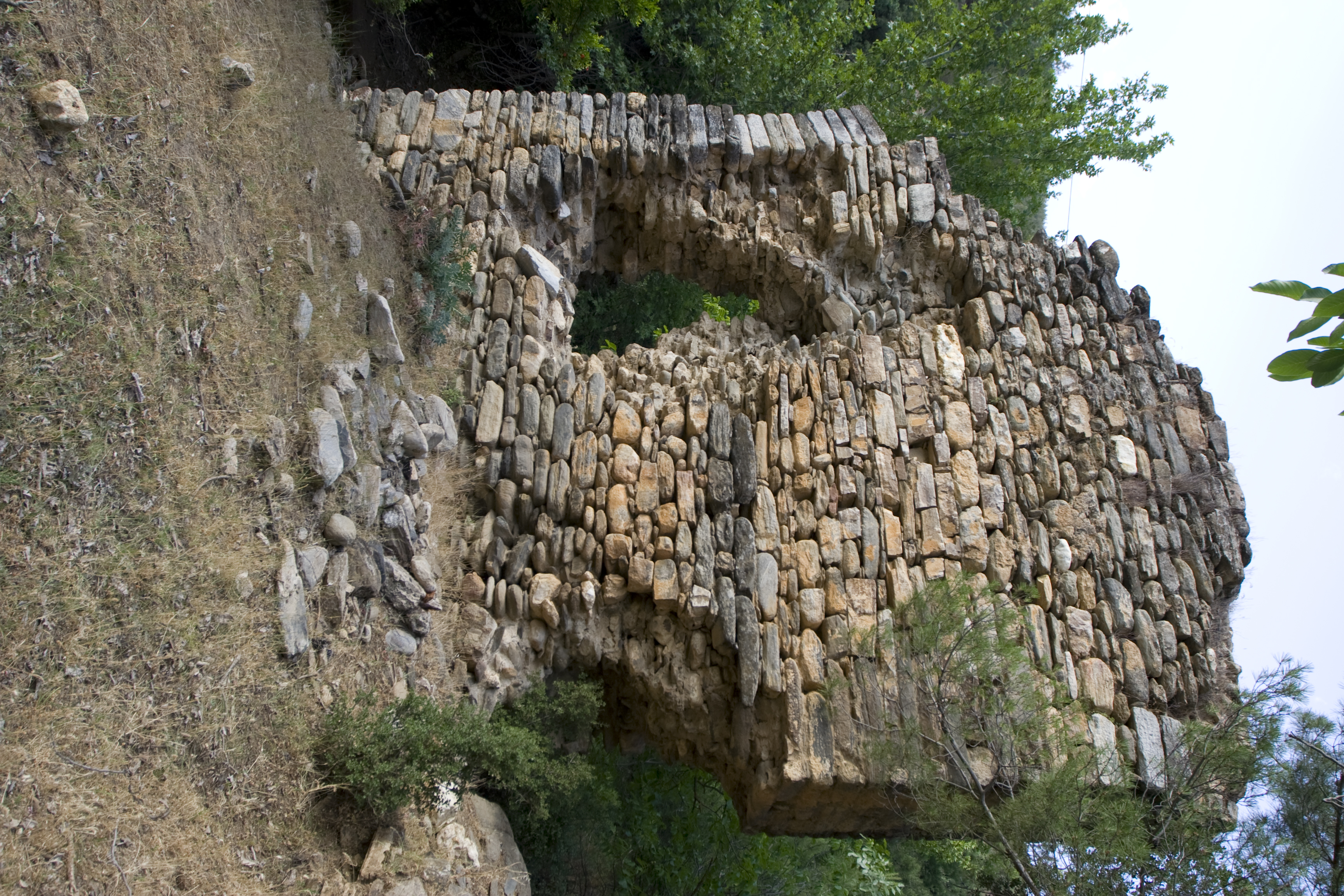
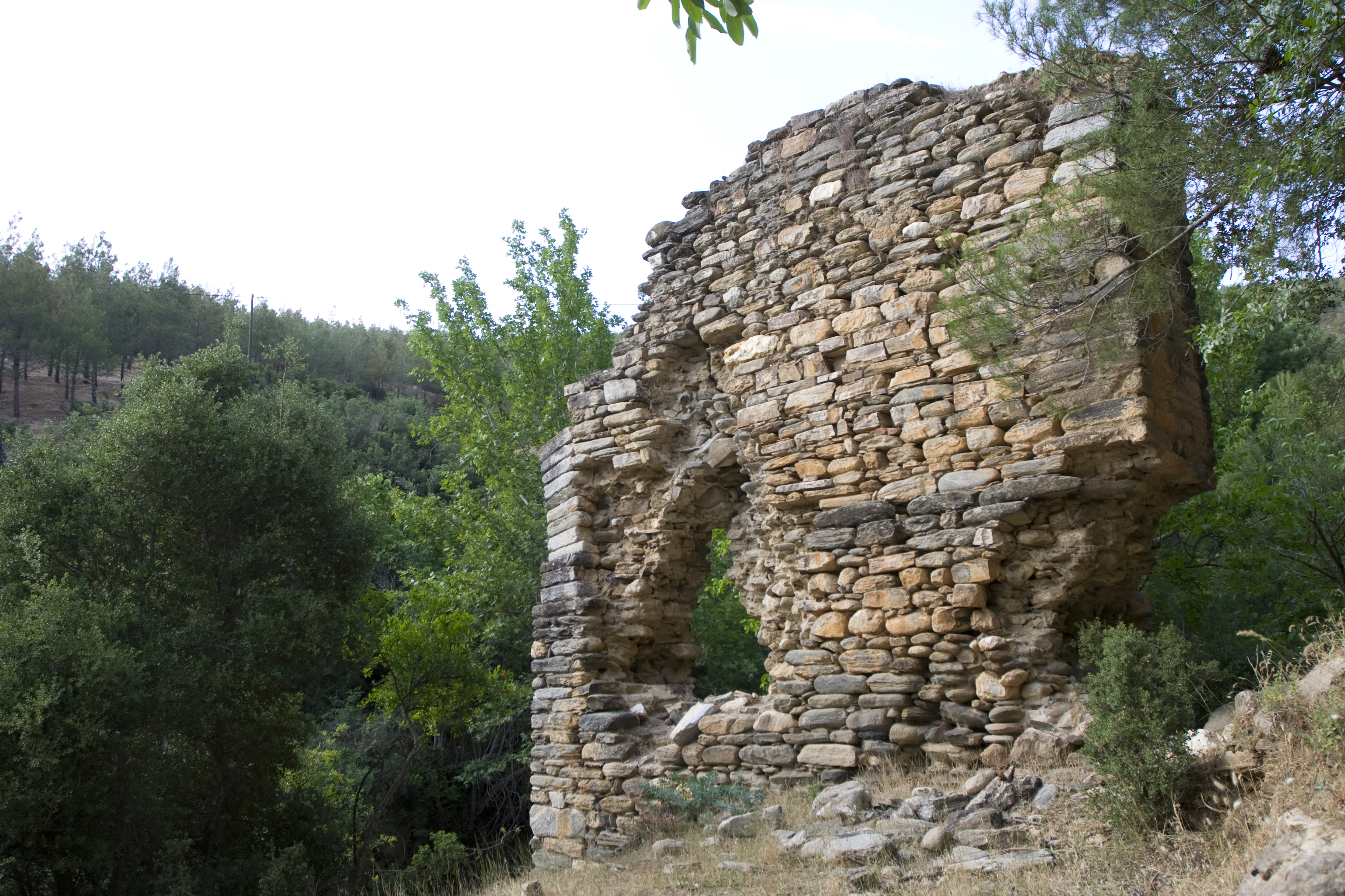
| dc.description | Description: One complete pier of the aqueduct bridge with partial remains of two springing arches stands on the south side of a small stream. Other remains of the bridge include two masses of mortared rubble, one approximately 18 m. from the standing pier on the opposite bank of the stream and another adjacent to the standing pier at a distance of (**) m. These structures may be the remains of additional pier footings. The standing pier is not preserved to the height of the channel, and no trace of the channel can be found in either bank along the stream. ** Collapse or settling of the pier has resulted in a large hole through the structure, revealing its mortared rubble core. The upstream (east) face of the structure is more heavily damaged, with greater loss of facing blocks than the downstream side. The standing pier is 6.10 m. at its maximum preserved height, 6.60 m. long, and rests on a base 1.65 m. wide. ** The bridge pier is constructed in petit appareil with blocks of roughly worked fieldstone (schist) in courses facing a mortared rubble core. The facing blocks are 0.10-.60 m. long, 0.05-0.20 high, and 0.20-.40 deep, with extensive use of chinking stones as small as 0.05 m. long and 0.01 m. high. This great variety of stone sizes is apparent in the rubble core as well, with stones ranging from 0.05-.50 in length. Courses of blocks of standard size are interchanged with courses of smaller, more irregular stones. The mortared rubble core of unworked stones in a great variety of sizes, from 0.05-,50 m. long, is densely packed and laid in rough levels. The blocks of the facing and rubble core are bonded with a pale grey/tan lime-based mortar with stone inclusions, most less than 0.01 m. long. Where the pier is closest to the stream, large blocks form a foundation resting on bedrock to obviate damage due to water-induced erosion. ** The voussoirs of the arch spanning the stream (north) are recessed from the pier face 0.15 m. at a height of 3.60 m. from the base. Three courses of voussoirs rest on this level before the arch is recessed 0.15 m. a second time, approximately 0.40 m. above the lower recess. The resulting double-stepped profile of the arch provides two ledges to support scaffolding. At the same height, the entire length of the broad sides (east and west) of the pier are recessed 0.07 m. above a course of stones larger than the average size, so that above this point the structure narrows 0.20 m. in width. This upper recess extends even to the voussoirs of the arch spanning the stream, with the result that the lowest three courses of the arch are wider than the rest. The arch on the south side of the pier has no recess to support scaffolding, but a putlog hole just above the springing of the arch fulfills the same purpose. It is noteworthy that both arches are equipped with support for scaffolding at a point that is three voussoirs above the spring point, and that two different methods are used. ** While a few of the facing voussoirs are schist, most are marble blocks that are more finely worked than the facing stones of the pier and have visible chisel marks on their worked faces. They range from 0.30-.40 m. long, 0.10-.15 m. wide at the extrados, and 0.20-.40 deep. Courses of four to five blocks span the width of the arch. The arch has a projected span of 6.60 m. The height of the projected arch bottom from the streambed is c. 10.50 m. Nothing remains of the hypothetical pier on the opposite stream bank resulting from this arch span projection. | en_US |
| dc.relation | A009, A010, A011, A012 | en_US |
| dc.subject | Waterworks | en_US |
| dc.subject | 4: Roman | en_US |
| dc.title | A008: Işıklar Aqueduct, Kavaklıdere Bridge | en_US |
| dc.type | Other | en_US |
| dc.subject.hlbsecondlevel | Archaeology | en_US |
| dc.subject.hlbtoplevel | Social Sciences | en_US |
| dc.description.bitstreamurl | http://deepblue.lib.umich.edu/bitstream/2027.42/93134/1/D2005.0053.JPG | |
| dc.description.bitstreamurl | http://deepblue.lib.umich.edu/bitstream/2027.42/93134/2/D2005.0054.JPG | |
| dc.description.bitstreamurl | http://deepblue.lib.umich.edu/bitstream/2027.42/93134/3/D2005.0055.JPG | |
| dc.description.bitstreamurl | http://deepblue.lib.umich.edu/bitstream/2027.42/93134/4/D2005.0056.JPG | |
| dc.description.bitstreamurl | http://deepblue.lib.umich.edu/bitstream/2027.42/93134/5/D2005.0057.JPG | |
| dc.description.bitstreamurl | http://deepblue.lib.umich.edu/bitstream/2027.42/93134/6/D2005.0058.JPG | |
| dc.description.bitstreamurl | http://deepblue.lib.umich.edu/bitstream/2027.42/93134/7/D2005.0059.JPG | |
| dc.description.bitstreamurl | http://deepblue.lib.umich.edu/bitstream/2027.42/93134/8/D2005.0060.JPG | |
| dc.description.bitstreamurl | http://deepblue.lib.umich.edu/bitstream/2027.42/93134/9/D2005.0061.JPG | |
| dc.description.bitstreamurl | http://deepblue.lib.umich.edu/bitstream/2027.42/93134/10/D2008.1385.JPG | |
| dc.description.bitstreamurl | http://deepblue.lib.umich.edu/bitstream/2027.42/93134/11/D2008.1386.JPG | |
| dc.description.bitstreamurl | http://deepblue.lib.umich.edu/bitstream/2027.42/93134/12/D2008.1387.JPG | |
| dc.description.bitstreamurl | http://deepblue.lib.umich.edu/bitstream/2027.42/93134/13/D2008.1388.JPG | |
| dc.description.bitstreamurl | http://deepblue.lib.umich.edu/bitstream/2027.42/93134/14/D2008.1389.JPG | |
| dc.description.bitstreamurl | http://deepblue.lib.umich.edu/bitstream/2027.42/93134/15/D2008.1390.JPG | |
| dc.description.bitstreamurl | http://deepblue.lib.umich.edu/bitstream/2027.42/93134/16/D2008.1391.JPG | |
| dc.description.bitstreamurl | http://deepblue.lib.umich.edu/bitstream/2027.42/93134/17/D2008.1392.JPG | |
| dc.description.bitstreamurl | http://deepblue.lib.umich.edu/bitstream/2027.42/93134/18/D2008.1393.JPG | |
| dc.description.bitstreamurl | http://deepblue.lib.umich.edu/bitstream/2027.42/93134/19/D2008.1394.JPG | |
| dc.description.bitstreamurl | http://deepblue.lib.umich.edu/bitstream/2027.42/93134/20/D2008.1395.JPG | |
| dc.description.bitstreamurl | http://deepblue.lib.umich.edu/bitstream/2027.42/93134/21/D2008.1396.JPG | |
| dc.description.bitstreamurl | http://deepblue.lib.umich.edu/bitstream/2027.42/93134/22/D2008.1397.JPG | |
| dc.description.bitstreamurl | http://deepblue.lib.umich.edu/bitstream/2027.42/93134/23/D2008.1398.JPG | |
| dc.description.bitstreamurl | http://deepblue.lib.umich.edu/bitstream/2027.42/93134/24/D2008.1399.JPG | |
| dc.description.bitstreamurl | http://deepblue.lib.umich.edu/bitstream/2027.42/93134/25/D2008.1400.JPG | |
| dc.description.bitstreamurl | http://deepblue.lib.umich.edu/bitstream/2027.42/93134/26/RS29.JPG | |
| dc.owningcollname | Aphrodisias Regional Survey |
Files in this item
Remediation of Harmful Language
The University of Michigan Library aims to describe library materials in a way that respects the people and communities who create, use, and are represented in our collections. Report harmful or offensive language in catalog records, finding aids, or elsewhere in our collections anonymously through our metadata feedback form. More information at Remediation of Harmful Language.
Accessibility
If you are unable to use this file in its current format, please select the Contact Us link and we can modify it to make it more accessible to you.