 Access by request
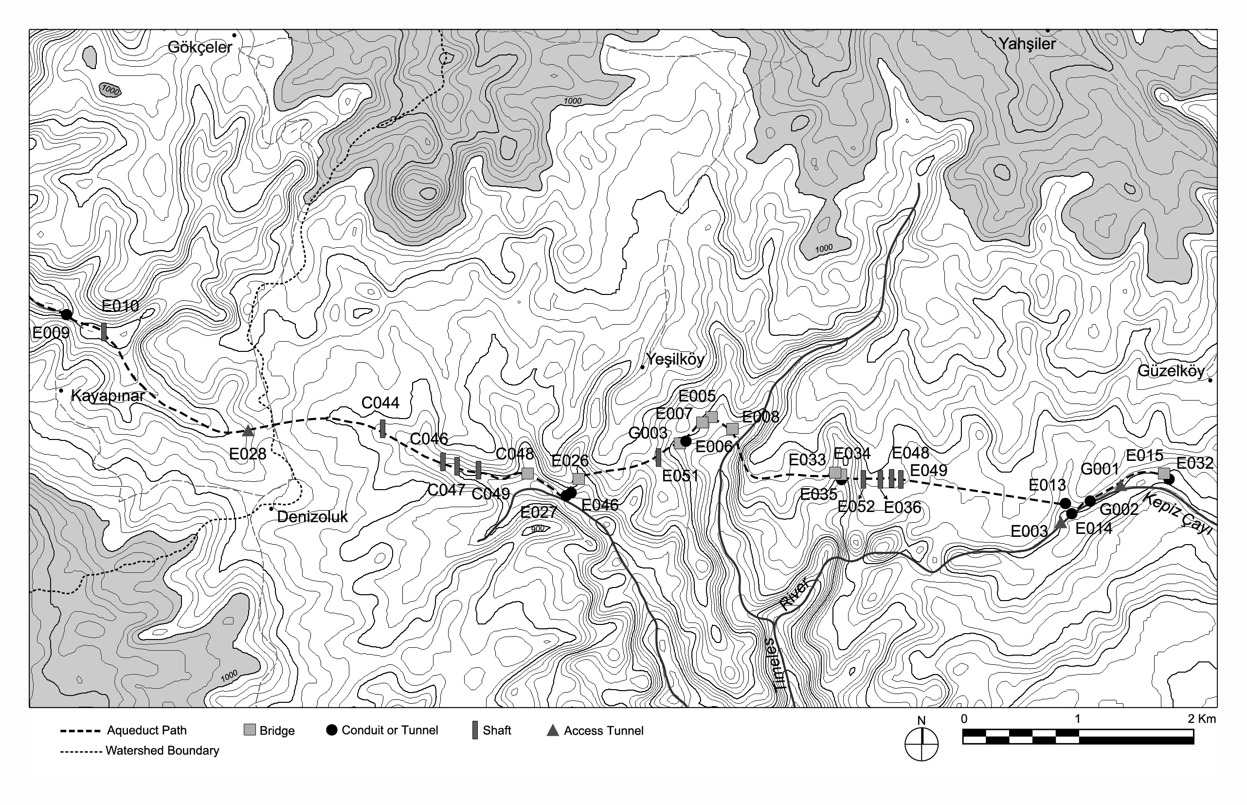
Map showing eastern (upstream) portion of the reconstructed path of the Timeles aqueduct, from Kepiz Çayı to Kayapınar, based on standing remains and least-cost analysis predictive modeling
| dc.contributor.author | Aphrodisias Regional Survey | en_US |
| dc.date.accessioned | 2012-08-27T20:56:24Z | |
| dc.date.available | 2012-08-27T20:56:24Z | |
| dc.date.issued | 2012-08-21 | en_US |
| dc.identifier.citation | Christopher Ratté and Peter D. De Staebler (eds.). Aphrodisias V. The Aphrodisias Regional Survey (Verlag Philipp von Zabern: Darmstadt/Mainz, 2012), p. 255, Figure 16. <http://hdl.handle.net/2027.42/93205> | en_US |
| dc.identifier.uri | https://hdl.handle.net/2027.42/93205 | |
| dc.description | Scale: 1:50000 | en_US |
| dc.subject | Waterworks | en_US |
| dc.title | Map showing eastern (upstream) portion of the reconstructed path of the Timeles aqueduct, from Kepiz Çayı to Kayapınar, based on standing remains and least-cost analysis predictive modeling | en_US |
| dc.type | Map | en_US |
| dc.subject.hlbsecondlevel | Archaeology | en_US |
| dc.subject.hlbtoplevel | Social Sciences | en_US |
| dc.description.bitstreamurl | http://deepblue.lib.umich.edu/bitstream/2027.42/93205/1/CommitoRojasFig16.jpg | |
| dc.owningcollname | Aphrodisias Regional Survey |
Files in this item
Remediation of Harmful Language
The University of Michigan Library aims to describe library materials in a way that respects the people and communities who create, use, and are represented in our collections. Report harmful or offensive language in catalog records, finding aids, or elsewhere in our collections anonymously through our metadata feedback form. More information at Remediation of Harmful Language.
Accessibility
If you are unable to use this file in its current format, please select the Contact Us link and we can modify it to make it more accessible to you.