|
The Ohio Railroad Guide, Illustrated; Cincinnati to Erie,
via Columbus and Cleveland. Columbus, Ohio: Ohio State Journal
Company, 1854.
 A
wonderful example of the genre, this guide describes the route of
the Cincinnati, Columbus, Cleveland, and Erie Railroad, giving detailed
descriptions of towns and points of interest. The text also contains
bits of historical information, mentioning such places as Fort Ancient,
the ancient burial mounds of Native Americans, and Willoughby, where
a Mormon community had settled temporarily. This section notes that
the Mormons had just recently moved en masse to Utah after having
been driven out of Illinois and Missouri. A
wonderful example of the genre, this guide describes the route of
the Cincinnati, Columbus, Cleveland, and Erie Railroad, giving detailed
descriptions of towns and points of interest. The text also contains
bits of historical information, mentioning such places as Fort Ancient,
the ancient burial mounds of Native Americans, and Willoughby, where
a Mormon community had settled temporarily. This section notes that
the Mormons had just recently moved en masse to Utah after having
been driven out of Illinois and Missouri.
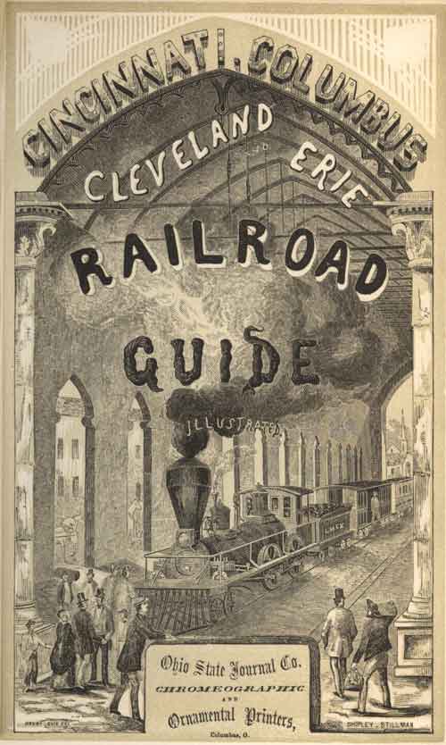
The engraved illustrations are detailed and numerous, beginning
with the fold-out “View of Station Buildings and Lake Erie,
at Cleveland.” Facing this illustration is an engraved vignette
title page depicting the interior of the passenger depot at Cincinnati,
based on a drawing by American artist Henry H. Lovie.
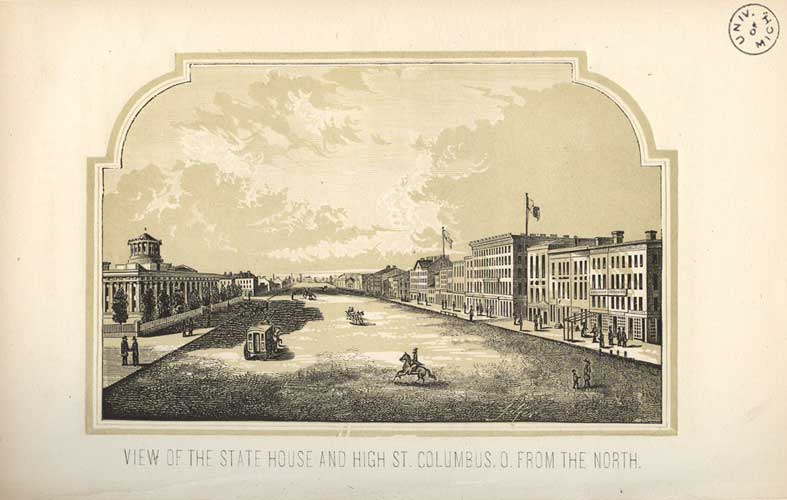
 Also
shown here is a stately engraving of the“View of the State
House and High St., Columbus, O. From the North.” In the description
of Columbus, the text documents the amazing growth of the town:
“though Columbus was laid out only forty years since in the
woods, and had no mail for many years,” the population grew
from 1,400 in 1820 to 22,000 in 1854. At the time of publication,
the State Capitol was nearing completion and the book boasts that
“it is the largest building of the kind in the country, except
the Capitol of the United States, at Washington,” and that
it is built of “Ohio marble,” a light gray limestone. Also
shown here is a stately engraving of the“View of the State
House and High St., Columbus, O. From the North.” In the description
of Columbus, the text documents the amazing growth of the town:
“though Columbus was laid out only forty years since in the
woods, and had no mail for many years,” the population grew
from 1,400 in 1820 to 22,000 in 1854. At the time of publication,
the State Capitol was nearing completion and the book boasts that
“it is the largest building of the kind in the country, except
the Capitol of the United States, at Washington,” and that
it is built of “Ohio marble,” a light gray limestone.
|