 Access by request
The Huron River Survey Maps - Original Maps - Index
Williams, Gardner Stewart
2013
Abstract
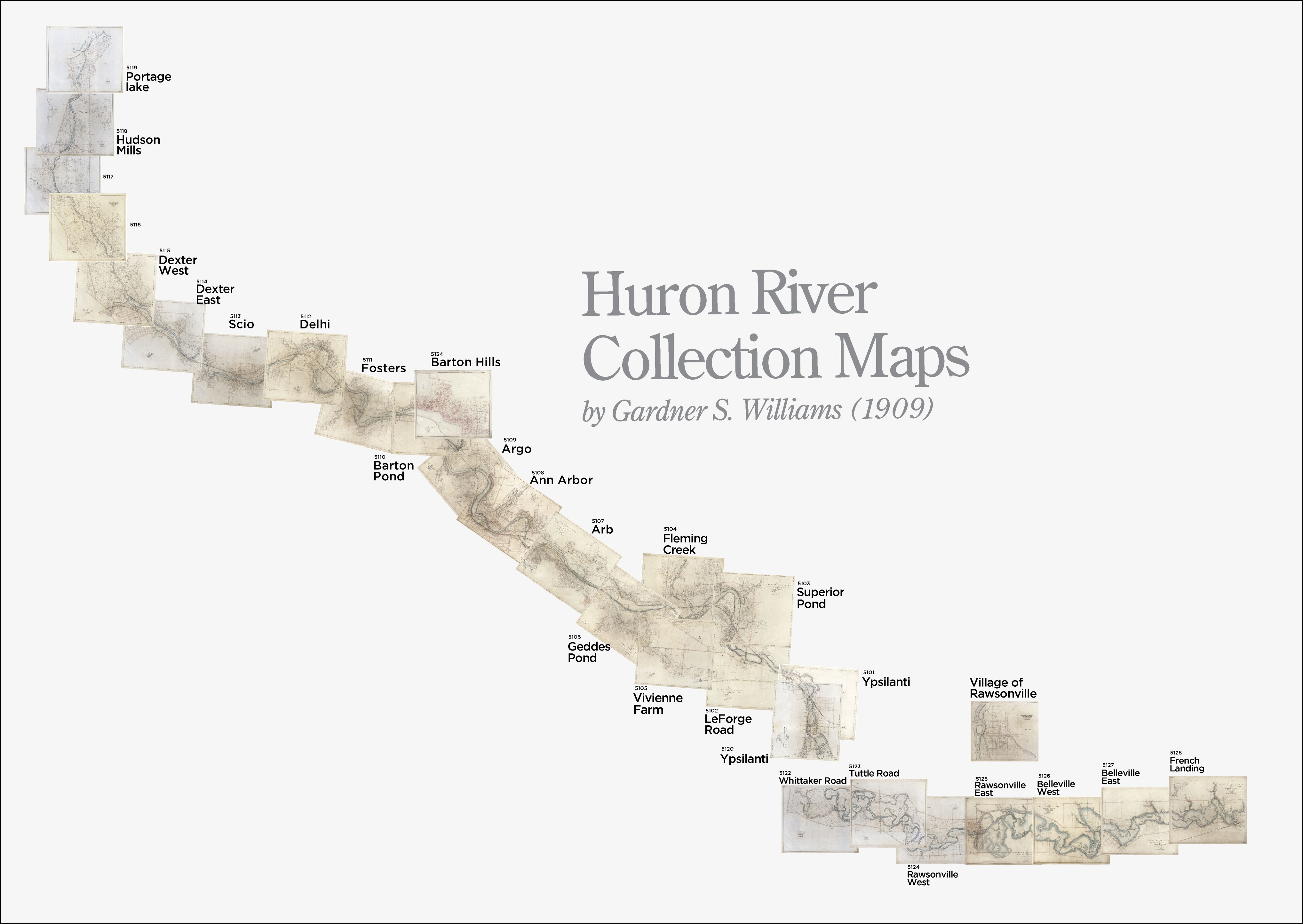
An index to the Huron River Valley survey maps created by Gardner Stewart Williams, ca. 1905-1922. This composite image shows the relative position of each survey map along the Huron River from Portage Lake to Ypsilanti and then from Whittaker Road (in Ypsilanti) through French Landing (east of Belleville, Mich.). Researchers may wish to consult this map to determine which full-size map to download from the Gardner Stewart Williams digital collection.Rights
Copyright is held by the Regents of the University of Michigan Content is open for research
Types
Image