 Access by request
Water Supply Maps for Phulsara Union, Bangladesh
| dc.contributor.author | Reddy, Raghav | |
| dc.date.accessioned | 2022-11-24T08:27:52Z | |
| dc.date.available | 2022-11-24T08:27:52Z | |
| dc.date.issued | 2022-11-24 | |
| dc.identifier.uri | https://hdl.handle.net/2027.42/175156 | en |
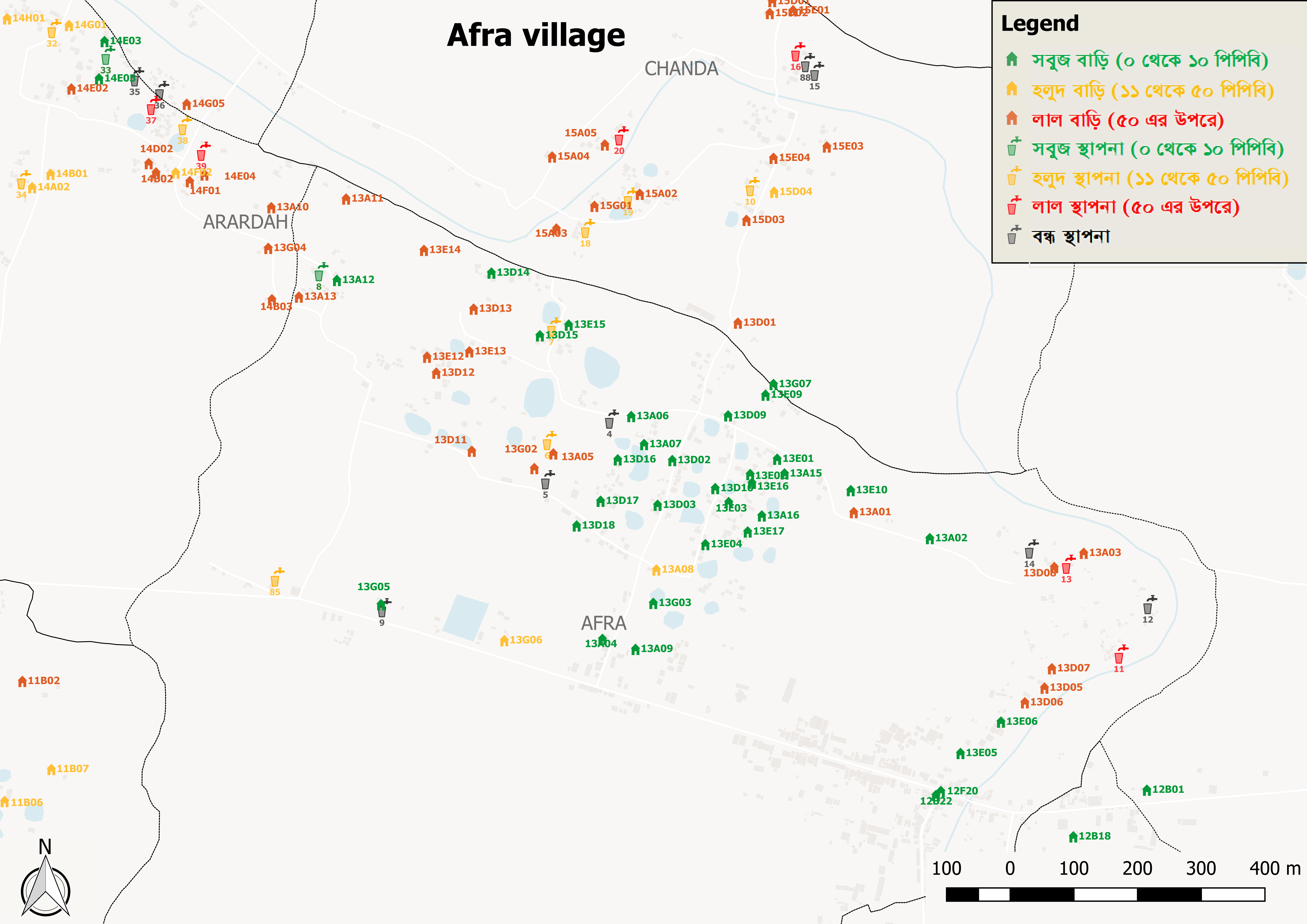
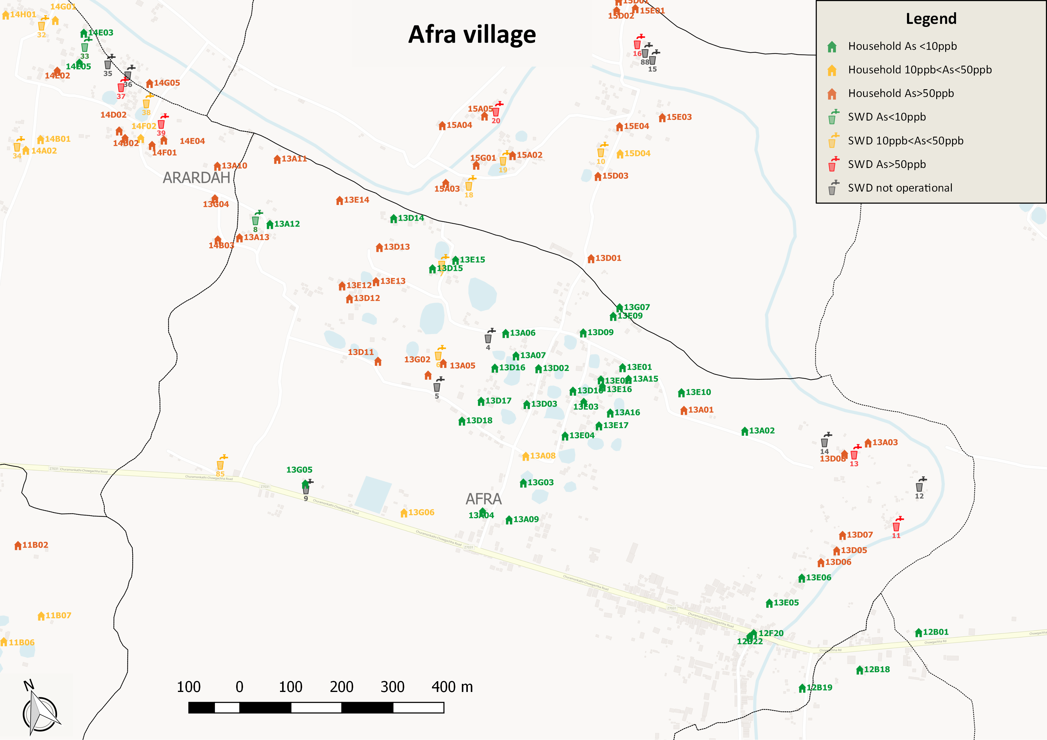
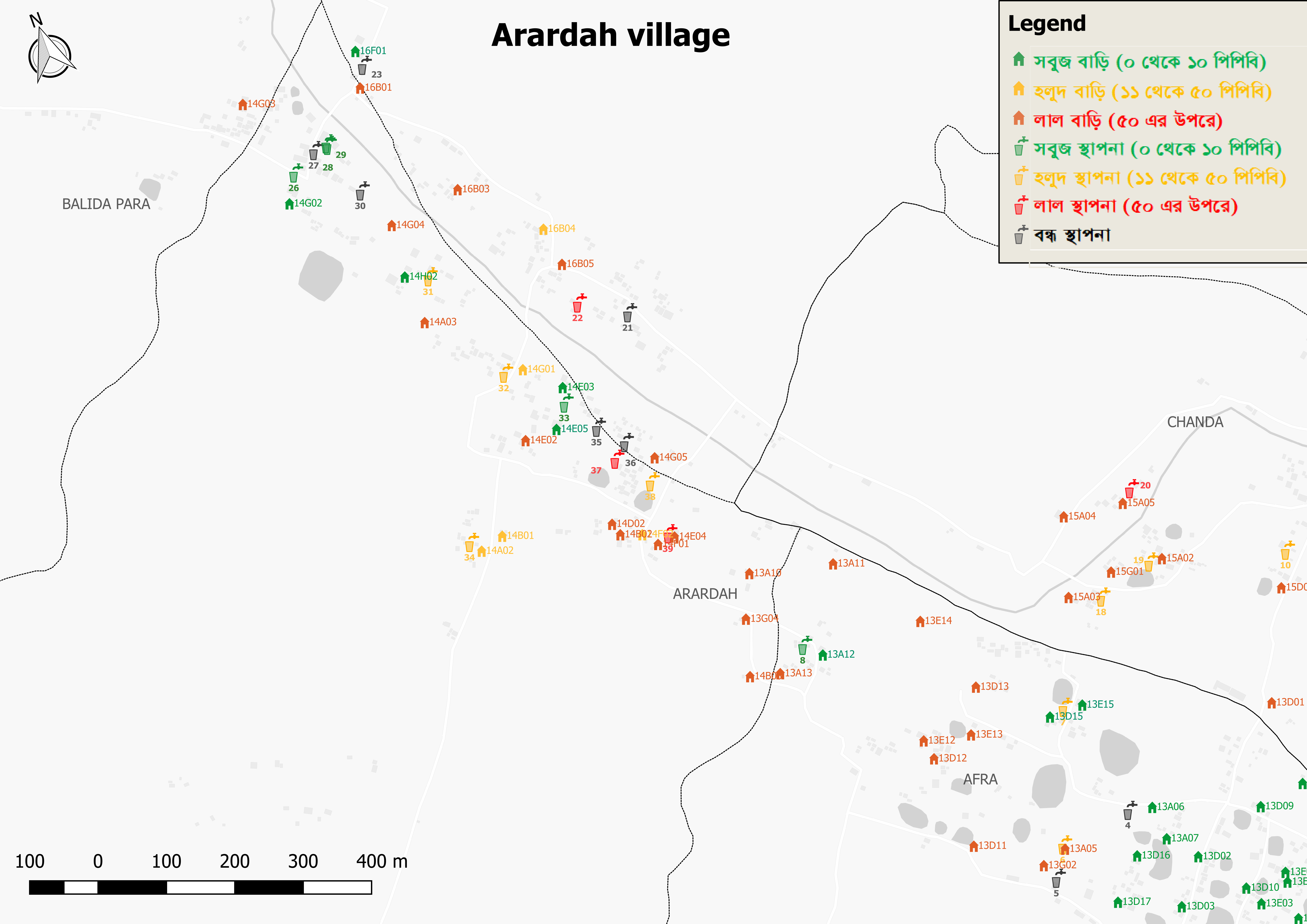
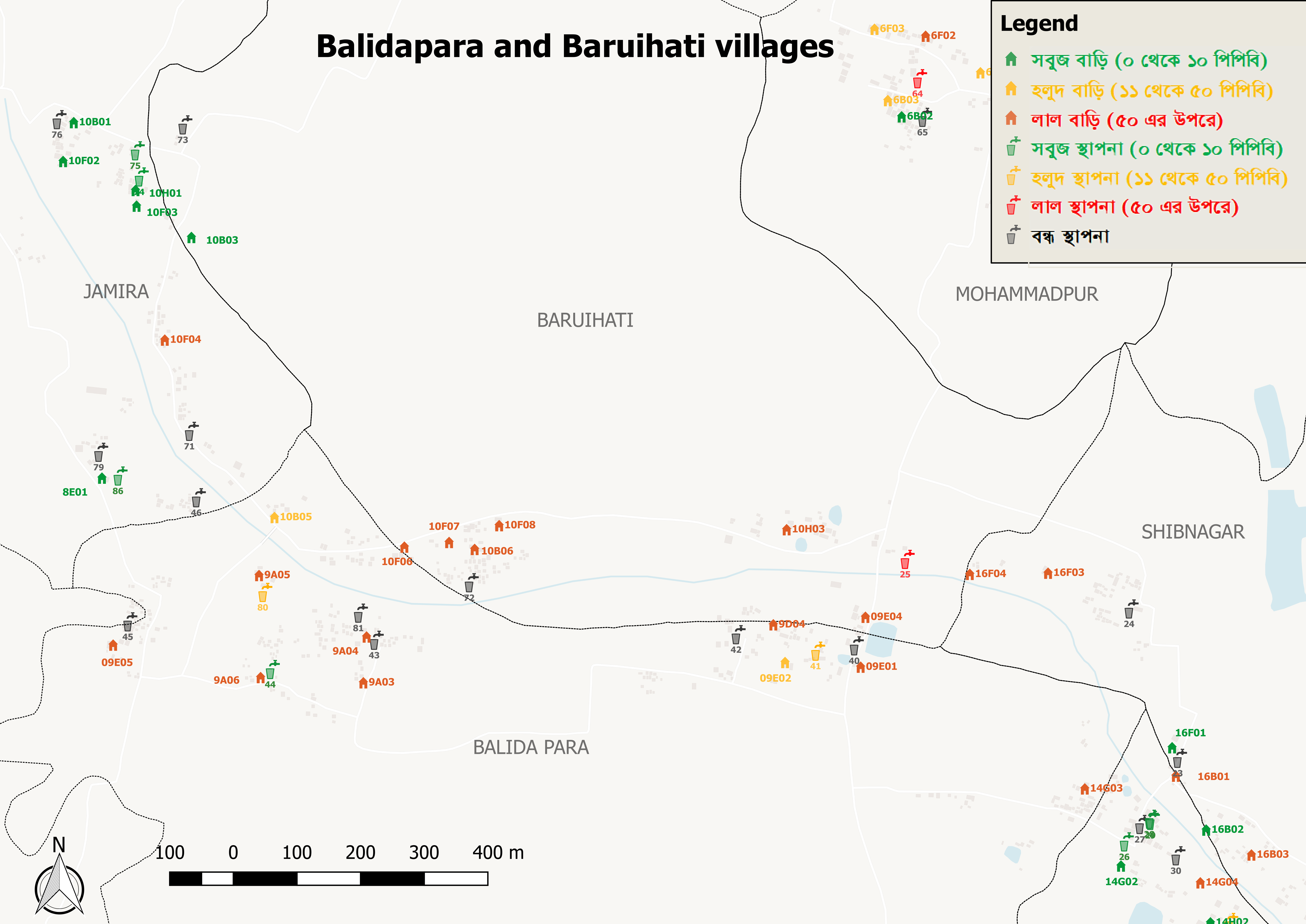
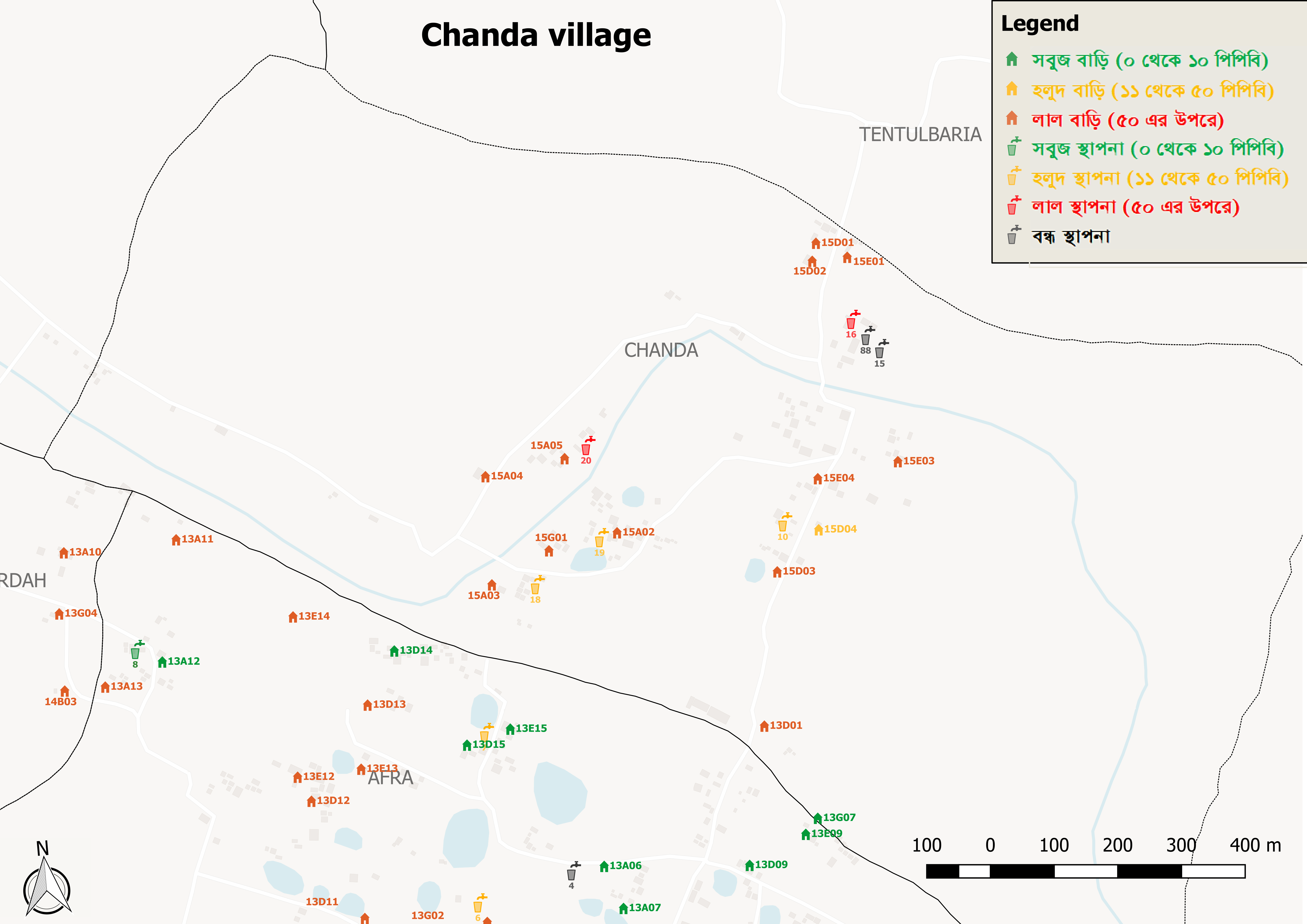
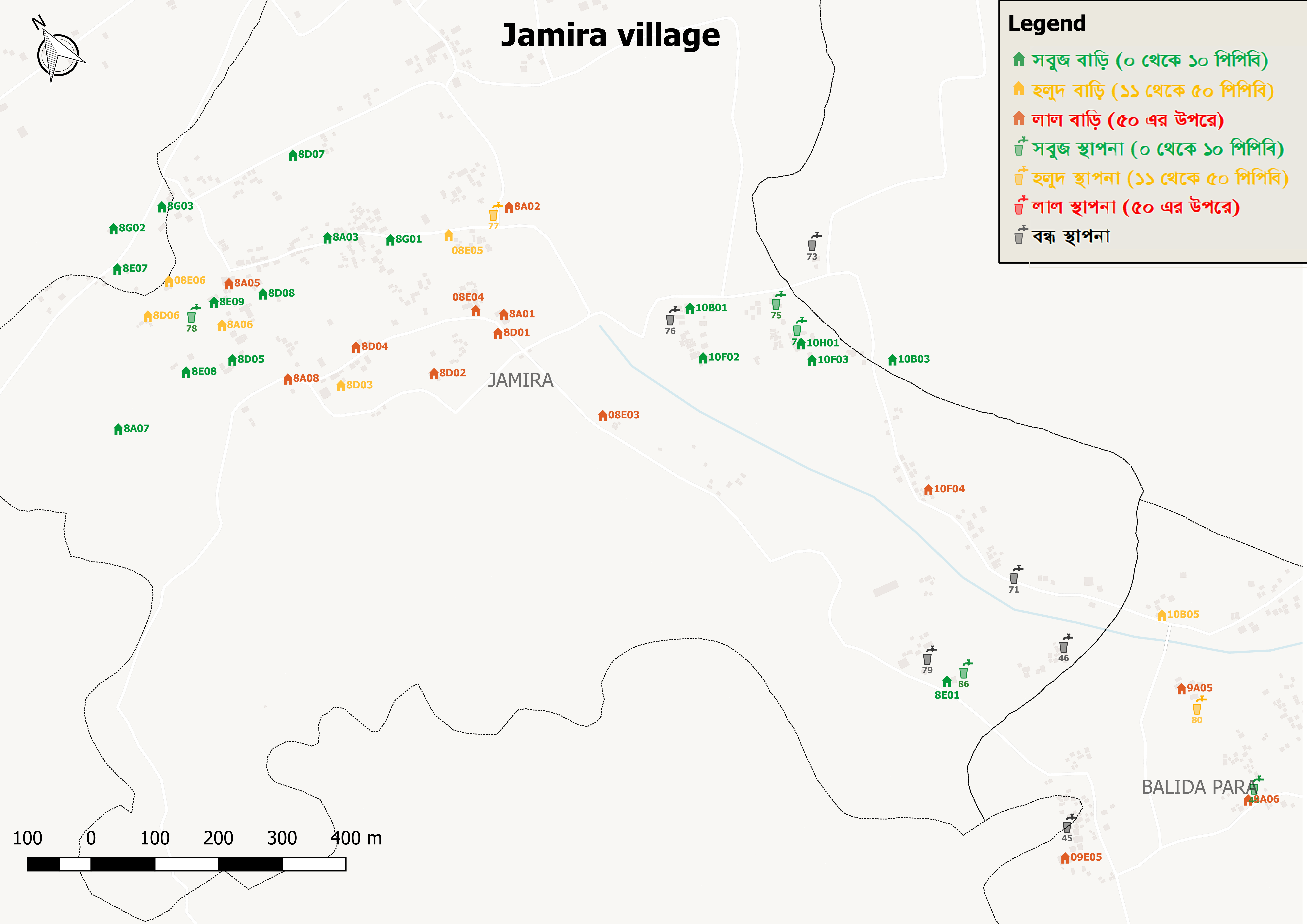
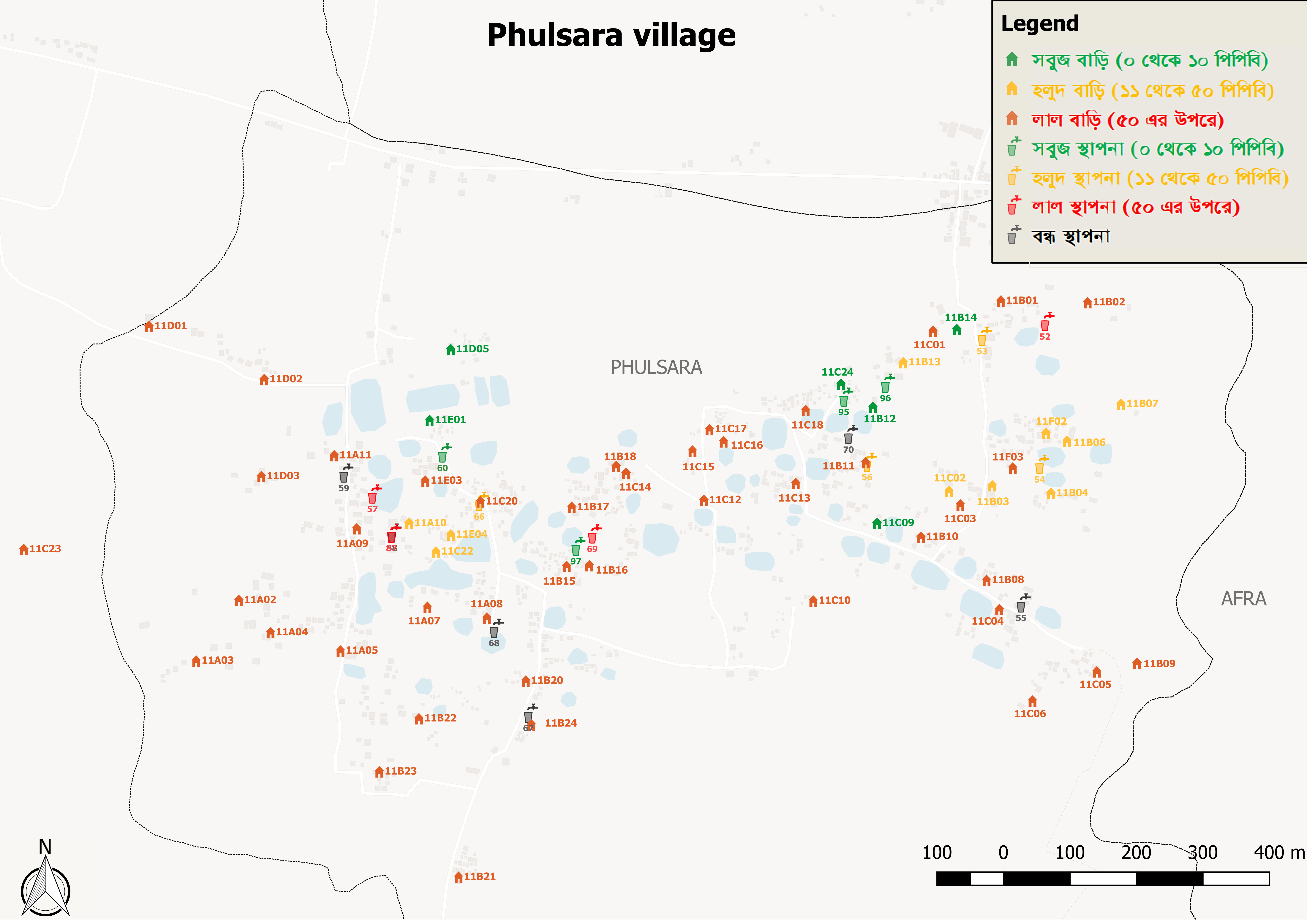
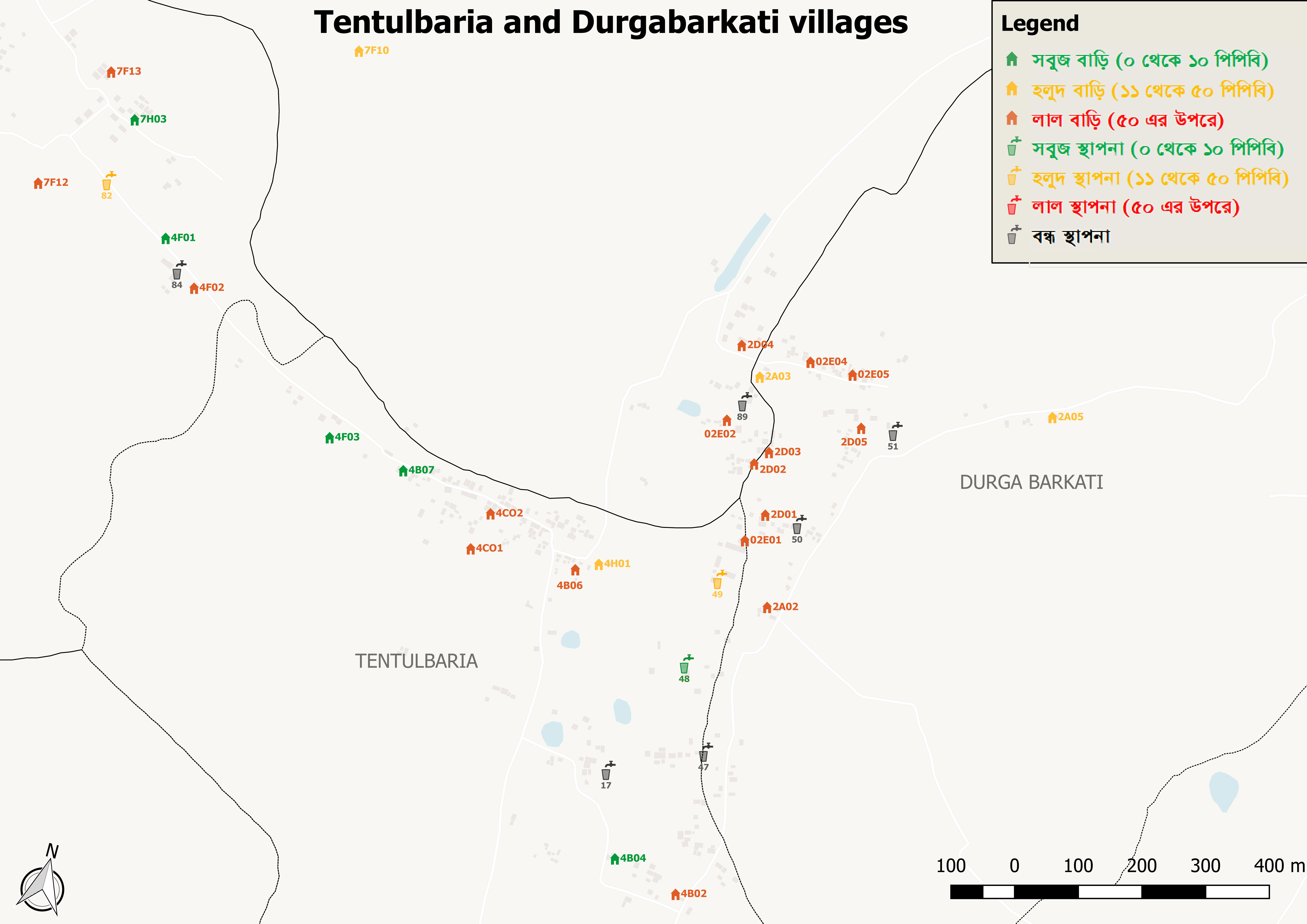
| dc.description | These maps were created during our work in Phulsara Union Bangladesh and include all 16 villages in the union. They represent spatial data for study households, private and communal water sources and also have a few local landmarks for easy identification. The water sources are color coded based on water quality. Note: The map legends are in Bangla as that was easiest for the field staff who used them during the study. For one map "Afra (english legend)" we have an english legend and this is the same legend in all other maps. | en_US |
| dc.description.abstract | These maps were created during our work in Phulsara Union Bangladesh and include all 16 villages in the union. They represent spatial data for study households, private and communal water sources and also have a few local landmarks for easy identification. The water sources are color coded based on water quality. | en_US |
| dc.description.sponsorship | University of Michigan Graham Sustainability Institute, University of Michigan MCubed | en_US |
| dc.language.iso | en_US | en_US |
| dc.rights | Attribution-NonCommercial-NoDerivatives 4.0 International | * |
| dc.rights.uri | http://creativecommons.org/licenses/by-nc-nd/4.0/ | * |
| dc.subject | Arsenic, Bangladesh, Water | en_US |
| dc.title | Water Supply Maps for Phulsara Union, Bangladesh | en_US |
| dc.type | Dataset | en_US |
| dc.type | Map | en_US |
| dc.subject.hlbsecondlevel | Civil and Environmental Engineering | |
| dc.subject.hlbtoplevel | Engineering | |
| dc.contributor.affiliationumcampus | Ann Arbor | en_US |
| dc.description.bitstreamurl | http://deepblue.lib.umich.edu/bitstream/2027.42/175156/1/Afra.png | |
| dc.description.bitstreamurl | http://deepblue.lib.umich.edu/bitstream/2027.42/175156/2/Afra (english legend).png | |
| dc.description.bitstreamurl | http://deepblue.lib.umich.edu/bitstream/2027.42/175156/3/Arardah.png | |
| dc.description.bitstreamurl | http://deepblue.lib.umich.edu/bitstream/2027.42/175156/4/Balidapara & Baruihati.png | |
| dc.description.bitstreamurl | http://deepblue.lib.umich.edu/bitstream/2027.42/175156/5/Chanda.png | |
| dc.description.bitstreamurl | http://deepblue.lib.umich.edu/bitstream/2027.42/175156/6/Charabaira, mohammadpur, Rainagar.png | |
| dc.description.bitstreamurl | http://deepblue.lib.umich.edu/bitstream/2027.42/175156/7/Jamira.png | |
| dc.description.bitstreamurl | http://deepblue.lib.umich.edu/bitstream/2027.42/175156/8/Kotalipur.png | |
| dc.description.bitstreamurl | http://deepblue.lib.umich.edu/bitstream/2027.42/175156/9/Phulsara.png | |
| dc.description.bitstreamurl | http://deepblue.lib.umich.edu/bitstream/2027.42/175156/10/Saidpur.png | |
| dc.description.bitstreamurl | http://deepblue.lib.umich.edu/bitstream/2027.42/175156/11/Shibnagar, Arardah.png | |
| dc.description.bitstreamurl | http://deepblue.lib.umich.edu/bitstream/2027.42/175156/12/Tentulbaria and Durgabarkarti.png | |
| dc.identifier.doi | https://dx.doi.org/10.7302/6616 | |
| dc.description.mapping | -1 | en_US |
| dc.description.filedescription | Description of Afra.png : Afra village | |
| dc.description.filedescription | Description of Afra (english legend).png : Afra village (english legend) | |
| dc.description.filedescription | Description of Arardah.png : Arardah village | |
| dc.description.filedescription | Description of Balidapara & Baruihati.png : Balidapara and Baruihati villages | |
| dc.description.filedescription | Description of Chanda.png : Chanda village | |
| dc.description.filedescription | Description of Charabaira, mohammadpur, Rainagar.png : Charabaria, Mohammadpur and Rainagar villages | |
| dc.description.filedescription | Description of Jamira.png : Jamira village | |
| dc.description.filedescription | Description of Kotalipur.png : Kotalipur village | |
| dc.description.filedescription | Description of Phulsara.png : Phulsara village | |
| dc.description.filedescription | Description of Saidpur.png : Saidpur village | |
| dc.description.filedescription | Description of Shibnagar, Arardah.png : Shibnagar and Arardah villages | |
| dc.description.filedescription | Description of Tentulbaria and Durgabarkarti.png : Tentulbaria and Durgabarkarti villages | |
| dc.description.depositor | SELF | en_US |
| dc.working.doi | 10.7302/6616 | en_US |
| dc.owningcollname | Civil & Environmental Engineering (CEE) |
Files in this item

Except where otherwise noted, this item's license is described as Attribution-NonCommercial-NoDerivatives 4.0 International
Remediation of Harmful Language
The University of Michigan Library aims to describe library materials in a way that respects the people and communities who create, use, and are represented in our collections. Report harmful or offensive language in catalog records, finding aids, or elsewhere in our collections anonymously through our metadata feedback form. More information at Remediation of Harmful Language.
Accessibility
If you are unable to use this file in its current format, please select the Contact Us link and we can modify it to make it more accessible to you.