 Access by request
A100: Adamharmanı Fortified Settlement
Aphrodisias Regional Survey
2005-06-16
View/


Citation
Page reference: Christopher Ratté and Peter D. De Staebler (eds.). Aphrodisias V. The Aphrodisias Regional Survey (Verlag Philipp von Zabern: Darmstadt/Mainz, 2012), 353. <http://hdl.handle.net/2027.42/92484>
Other Identifiers
A100
Subjects
Citadels and Watchtowers Settlements 4: Roman 3: Hellenistic 5: Late Roman
Description
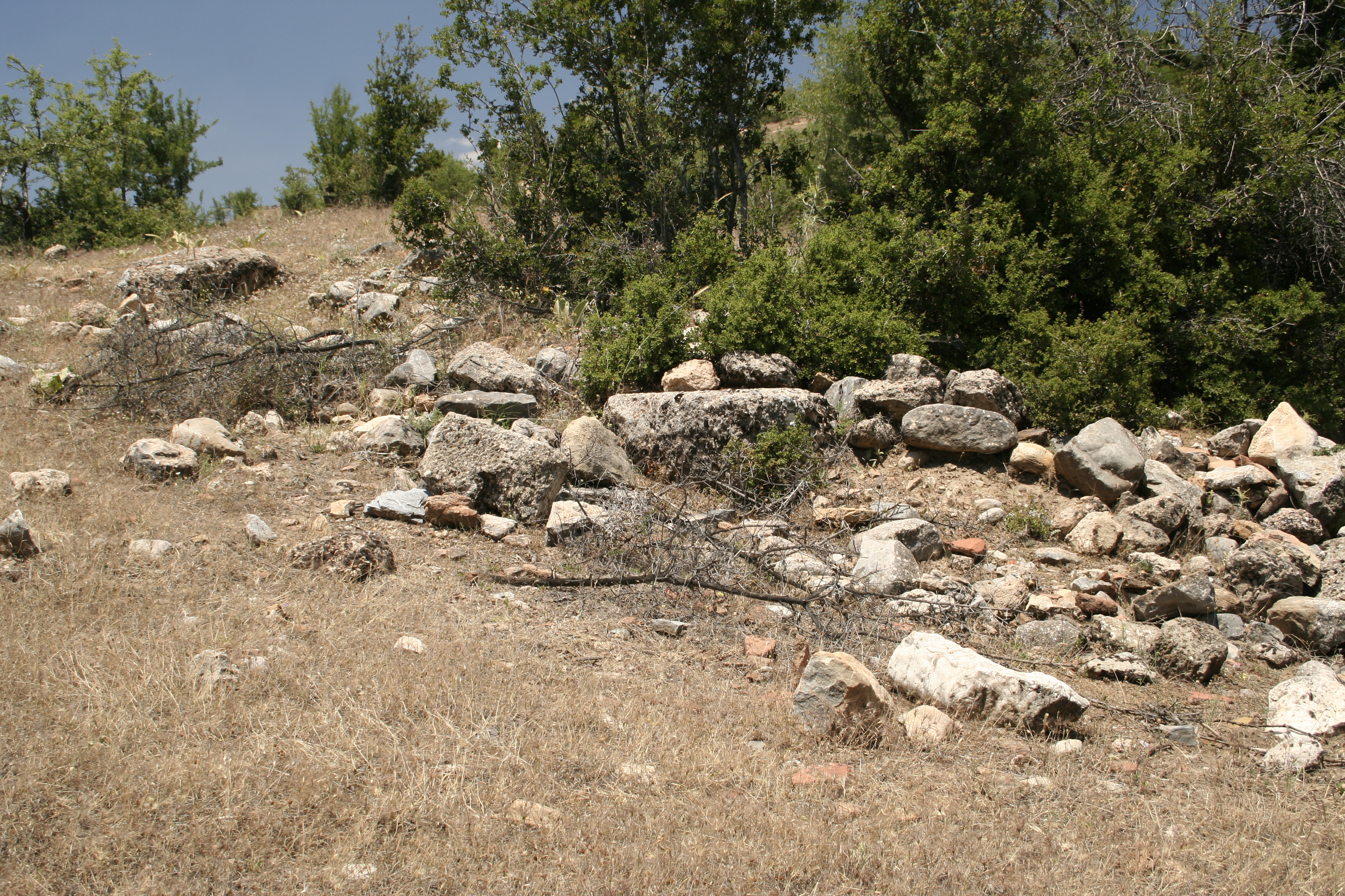
Local Name: Adamharmanı Kalesi Latitude: 37.32.36.66 Longitude: 28.46.16.26 Elevation: 903m Description: Very large fortified settlement on isolated promontory at south end of ridge, overlooking the valley of the Yenidere Çayı. Site measures approximately 260 m east-west by 220 m north-south, and slopes from north to south. Steep cliffs on all sides except for northwest. Remains of a number of walls, especially on top of hill, on north side, west side, and in south-center. The site is apparently bounded by a circuit wall: on north side, wall is 1.75m wide and approx. 150-200m long. Other architectural elements include fragments of black marble spiral-fluted columns [D2005.0847], a white marble Corinthian column capital [D2005.0849] and a marble voussoir [D2005.0852]. In addition are a fragment of a black marble basin [D2005.0861], fragments of marble revetment, many tile fragments in hill top, some of which are light-weight yellow-greenish type. There was also a cistern, now filled in, round opening, plastered interior Diam: 1.46m [D2005.0860]. ** On the south slope are more marble architectural elements (both white and black) including: a seat block (L: 1.20m, H: 0.40m, p. D: 0.50m; located at NP 320: 28.46.334/37.32.574/882m [D2005.0863]), cornices, capitals, unfluted white marble columns [D2005.0867], additional black marble spiral-fluted columns [D2005.0862]. Finds: Pottery was not collected, whether grab-bag or systematic. Architectural elements suggest an date range for occupation roughly parallel to that of the site of Aphrodisias.
Types
Other
Metadata
Show full item recordCollections
Remediation of Harmful Language
The University of Michigan Library aims to describe its collections in a way that respects the people and communities who create, use, and are represented in them. We encourage you to Contact Us anonymously if you encounter harmful or problematic language in catalog records or finding aids. More information about our policies and practices is available at Remediation of Harmful Language.
Accessibility
If you are unable to use this file in its current format, please select the Contact Us link and we can modify it to make it more accessible to you.