 Access by request
B095: Yeşilyurt Settlement
Aphrodisias Regional Survey
2006-06-09
View/


Citation
Page reference: Christopher Ratté and Peter D. De Staebler (eds.). Aphrodisias V. The Aphrodisias Regional Survey (Verlag Philipp von Zabern: Darmstadt/Mainz, 2012), 26, 71, 233. <http://hdl.handle.net/2027.42/92619>
Other Identifiers
B095
Subjects
Settlements 4: Roman 5: Late Roman
Description
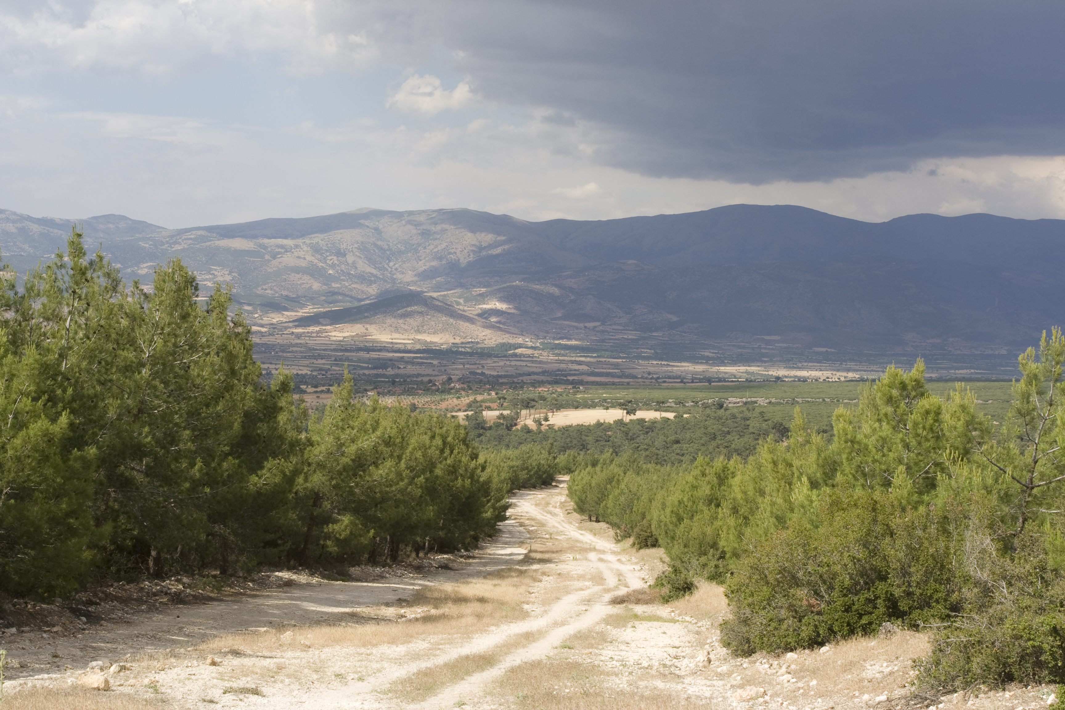
Local Name: Yeşilyurt Local Informant: Ali Gusen Latitude: 37.39.08.904 Longitude: 28.40.18.199 Elevation: 697m Dimensions: approximately 20 m by 30 m Description: This settlement is located on the south side of the valley, south of Yeşilyurt and west of Çamarası in a modern firebreak that runs between areas of recently planted pine forest. The extent of the settlement is clear, because the remains are significant enough to have impeded the planting of the young pines. It measures approximately 20 m by 30 m. Visibility is fairly high at the site, despite patches of scrub oak. The walls are built from limestone petit appareil blocks or rubble, and their course is not always clear (however one wall is preserved to 9 m long). There is also a possible cistern, or alternatively a lime quarry (abouit 5 by 5 m). There is a large amount of tile and brick at the site (Typical Brick: L: 0.32; W: 0.16m H: 0.05m) and floor tile (L: 0.28m; W: 0.27m; H: 0.04m), as well as numerous pipe and pithos fragments, many of them exposed in at least five robber's pits that were dug at the site between our first visit in 2006 and second visit in 2008. Press elements (F029) at the site are two socket uncovered in a robber's pit. Finds: Undated: The pottery collected at the site is unhelpful in providing a period of occupation. ** Systematic pottery collection conducted 8 June 2008
Types
Other
Metadata
Show full item recordCollections
Remediation of Harmful Language
The University of Michigan Library aims to describe library materials in a way that respects the people and communities who create, use, and are represented in our collections. Report harmful or offensive language in catalog records, finding aids, or elsewhere in our collections anonymously through our metadata feedback form. More information at Remediation of Harmful Language.
Accessibility
If you are unable to use this file in its current format, please select the Contact Us link and we can modify it to make it more accessible to you.