 Access by request
A032: Kavaklıdere Villa / Farmstead
Aphrodisias Regional Survey
2005-06-04
View/


Citation
Page reference: Christopher Ratté and Peter D. De Staebler (eds.). Aphrodisias V. The Aphrodisias Regional Survey (Verlag Philipp von Zabern: Darmstadt/Mainz, 2012), 2, 8, 71, 85. <http://hdl.handle.net/2027.42/92734>
Other Identifiers
A032
Subjects
Farmsteads Tombs 4: Roman
Description
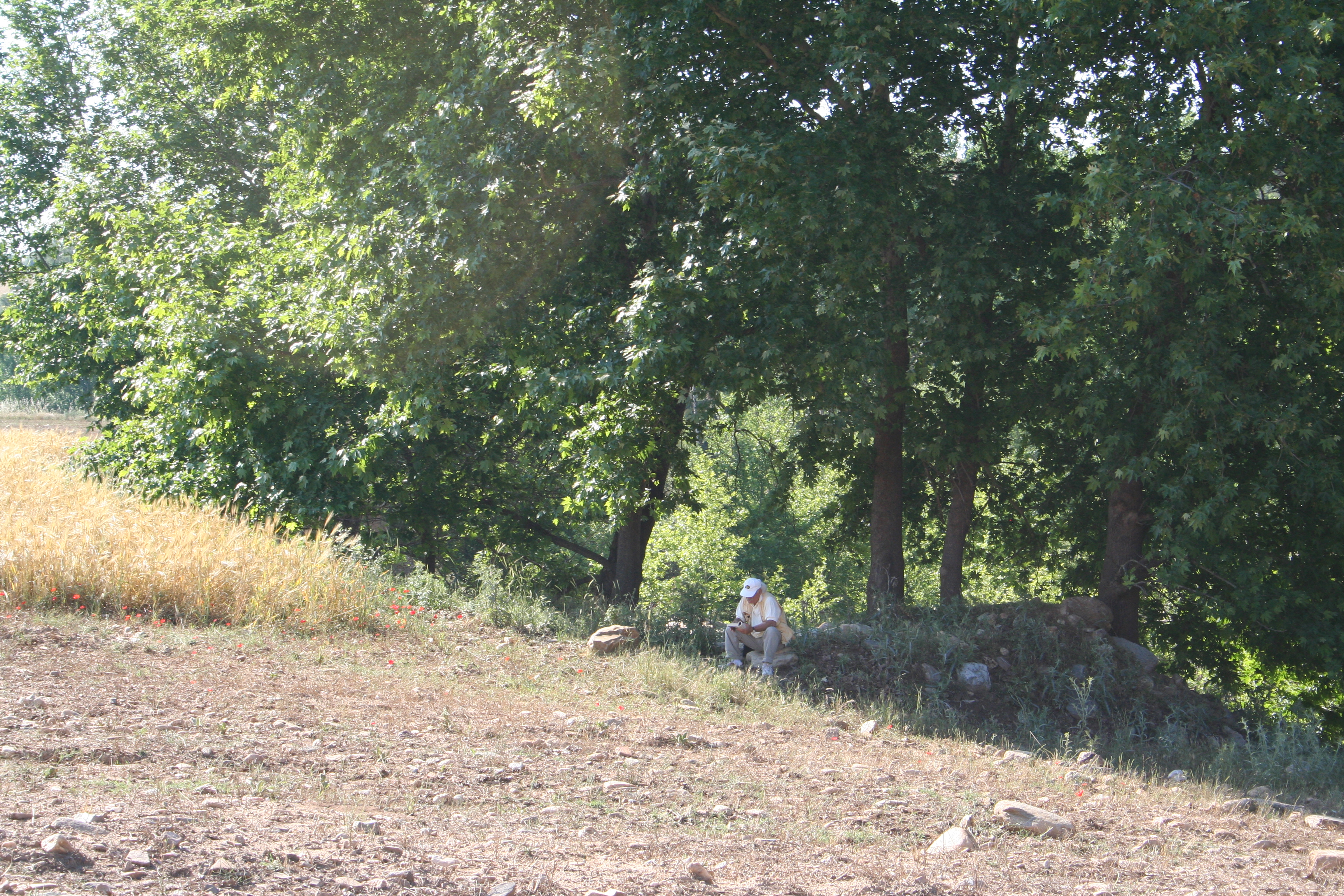
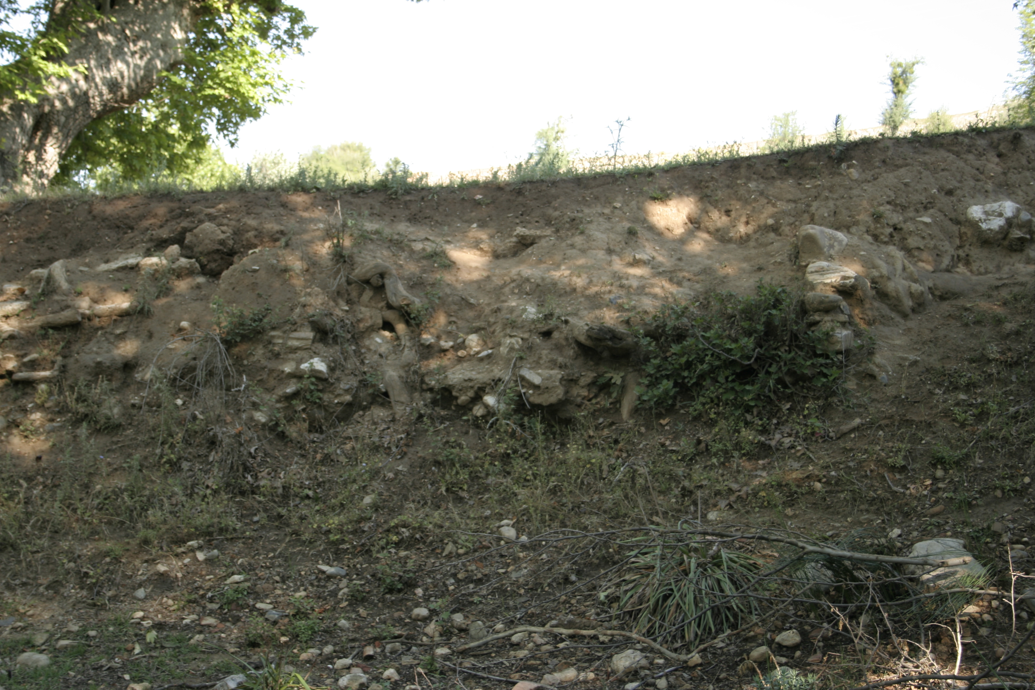
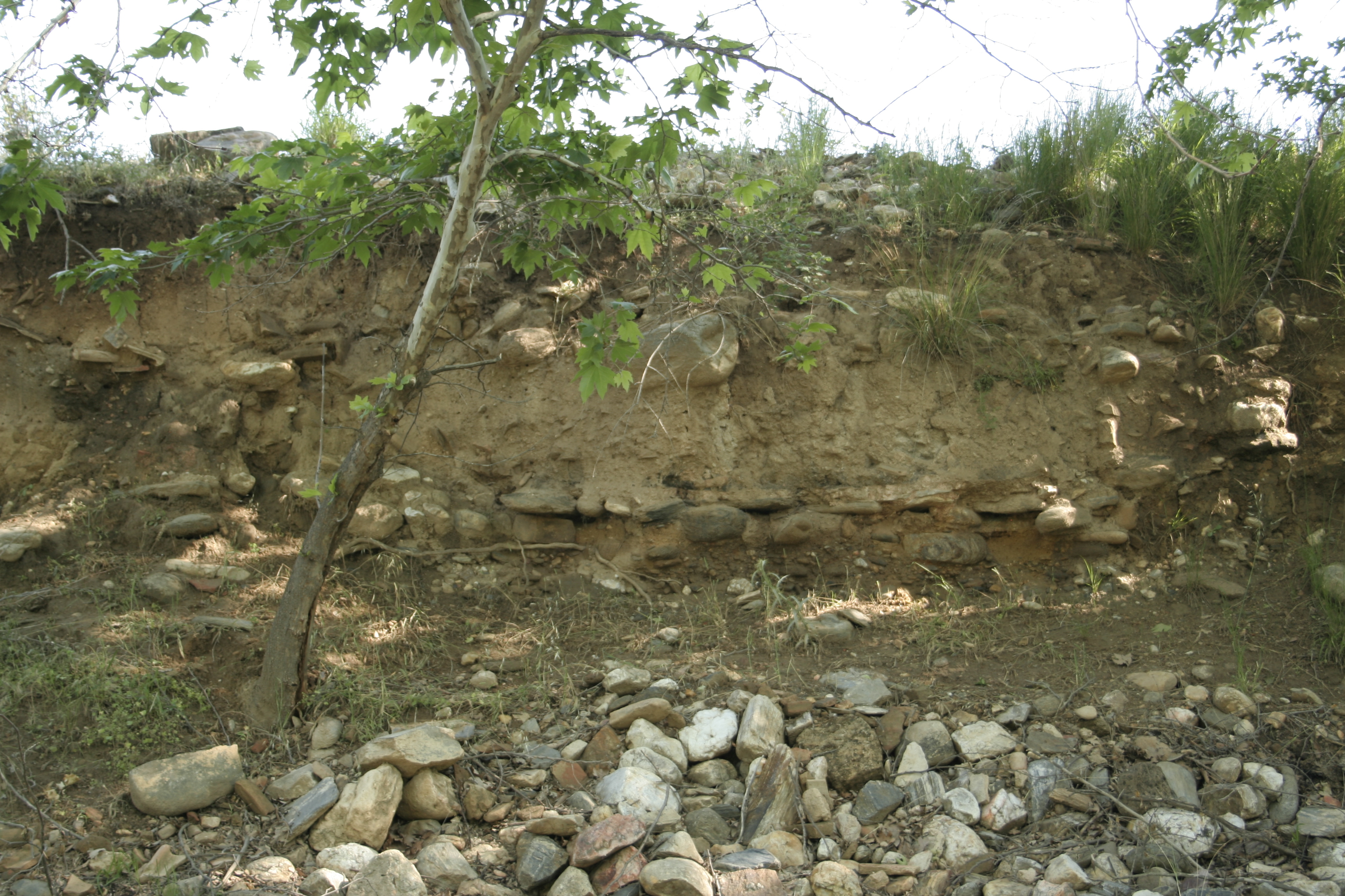
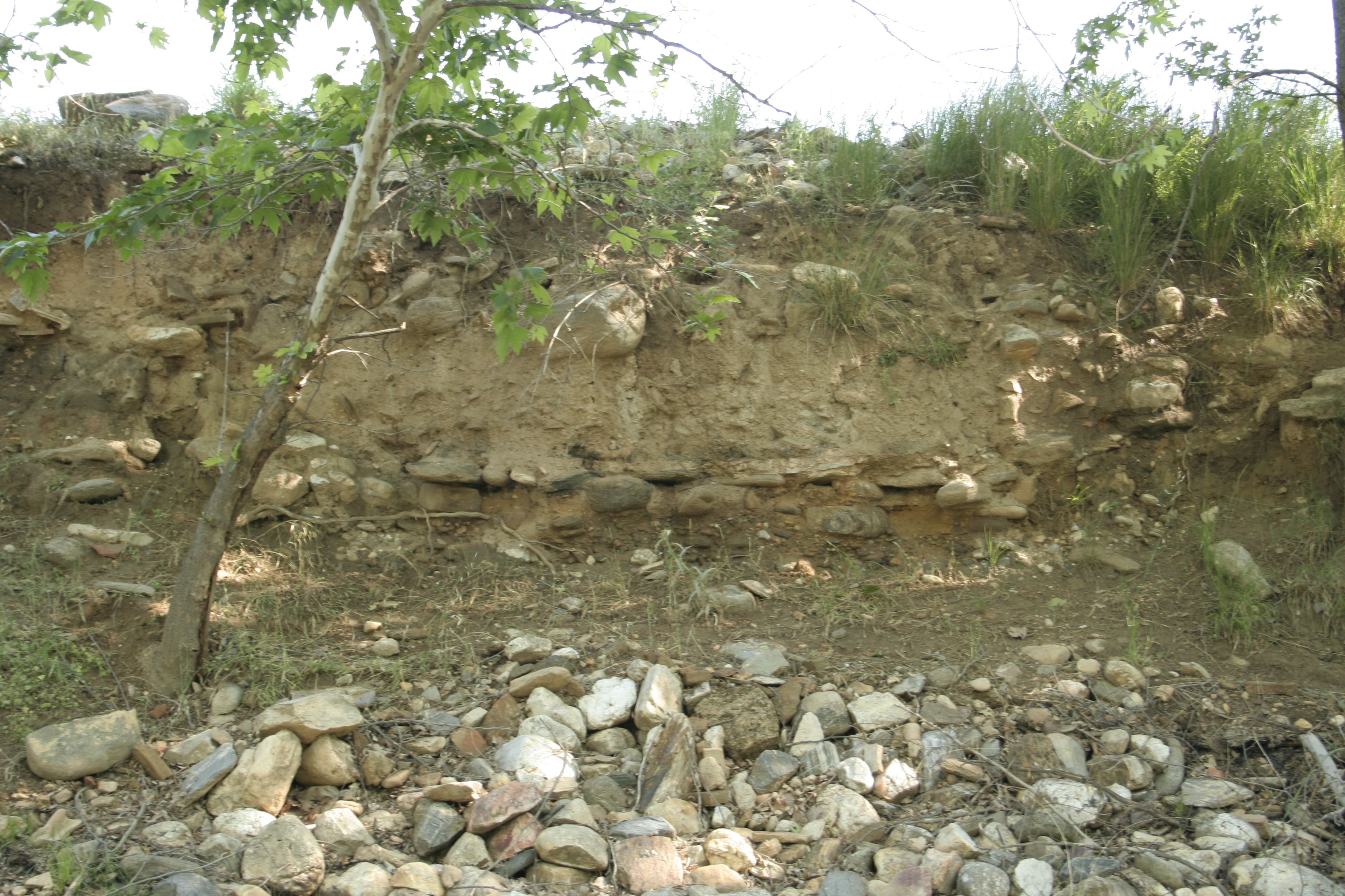
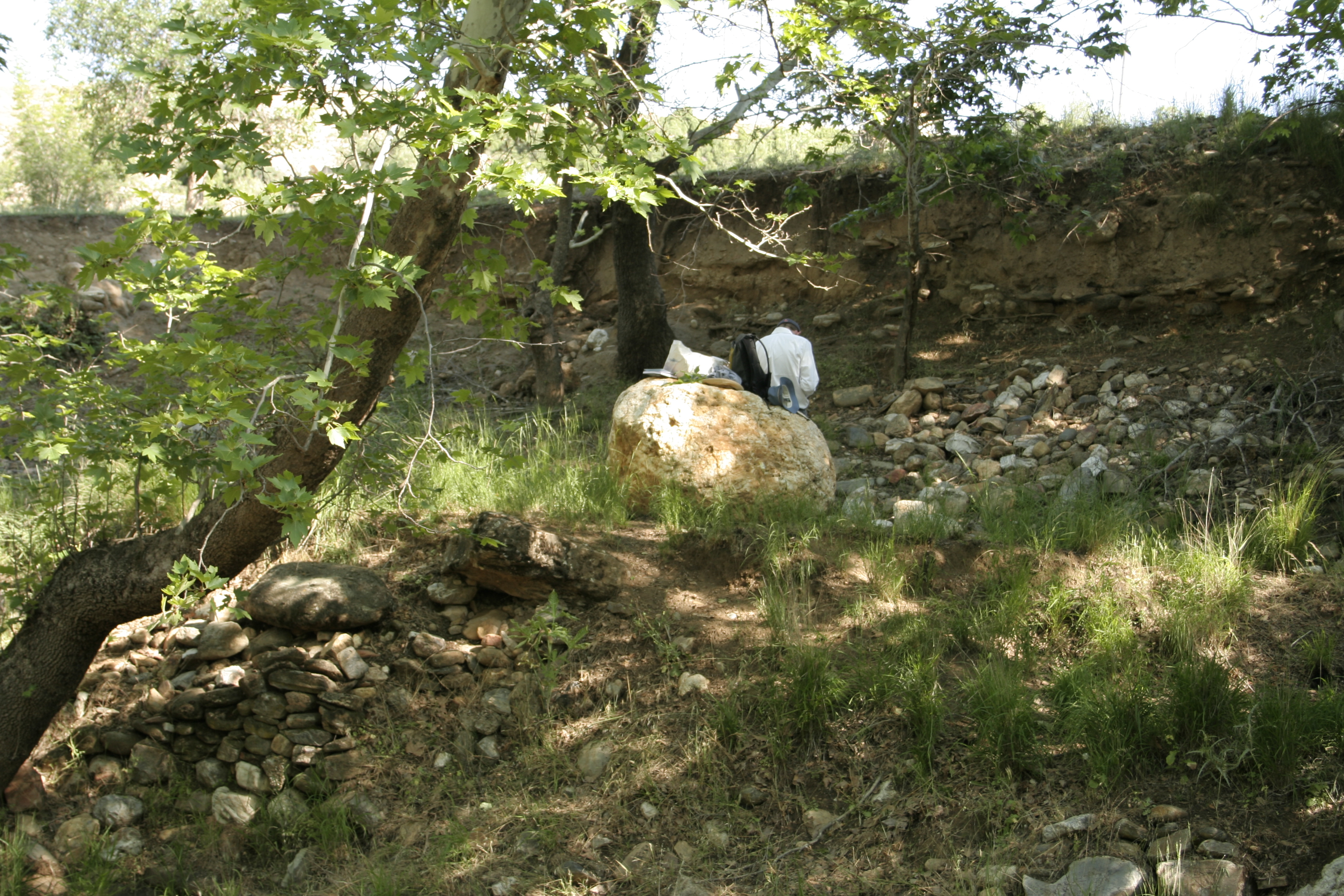
Local Name: Kavaklıdere Local Information: on west bank of the Kavaklı Dere, near where it joins the river Latitude: 37.42.46.08 Longitude: 28.39.45.12 Elevation: 407m Description: Remains of a structure are seen in the west bank of the Kavaklı stream. Two wall flank a floor layer of packed rubble and mortar (W: 3.06, Th: 0.07m). A layer of ash and tile debris is preserved above, perhaps floor level for a courtyard. Limestone blocks (0.70m x 0.45m x 0.35m) are visible in the area. Further up the slope are a number of marble architectural fragments perhaps from monumental tomb (A126), perhaps connected with the villa. ** These blocks include a pedestal with unfinished exterior, a column base, a curving cyma block, 2 column fragments, a threshold block with door pivot hole and visible scratch marks from the door, 2 column capitals and a base molded block. the blocks are in the area around GPS Point 44: Long: 28.39.756, Lat: 37.42.792, elev: 414m Finds: Systematic pottery collection on 6/14/2008
Types
Other
Metadata
Show full item recordCollections
Remediation of Harmful Language
The University of Michigan Library aims to describe library materials in a way that respects the people and communities who create, use, and are represented in our collections. Report harmful or offensive language in catalog records, finding aids, or elsewhere in our collections anonymously through our metadata feedback form. More information at Remediation of Harmful Language.
Accessibility
If you are unable to use this file in its current format, please select the Contact Us link and we can modify it to make it more accessible to you.