 Access by request
E005: Timeles Aqueduct, Kırkım Deresi Bridge
Aphrodisias Regional Survey
2007-05-24
View/


Citation
Page reference: Christopher Ratté and Peter D. De Staebler (eds.). Aphrodisias V. The Aphrodisias Regional Survey (Verlag Philipp von Zabern: Darmstadt/Mainz, 2012), 266, 283, 301 - Book catalogue no.: Aqueducts cat. 6. <http://hdl.handle.net/2027.42/92935>
Other Identifiers
E005
Subjects
Waterworks 4: Roman
Description
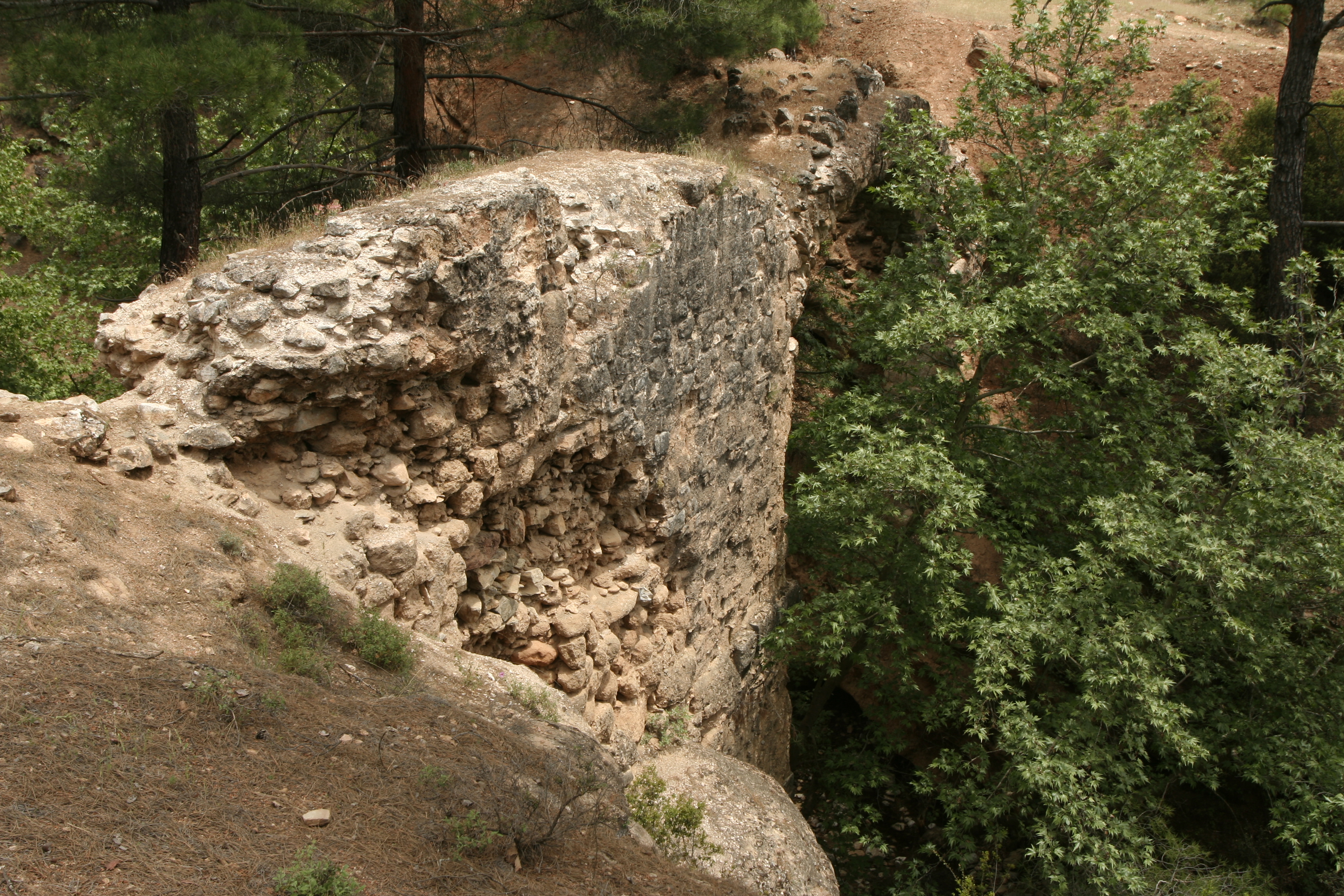
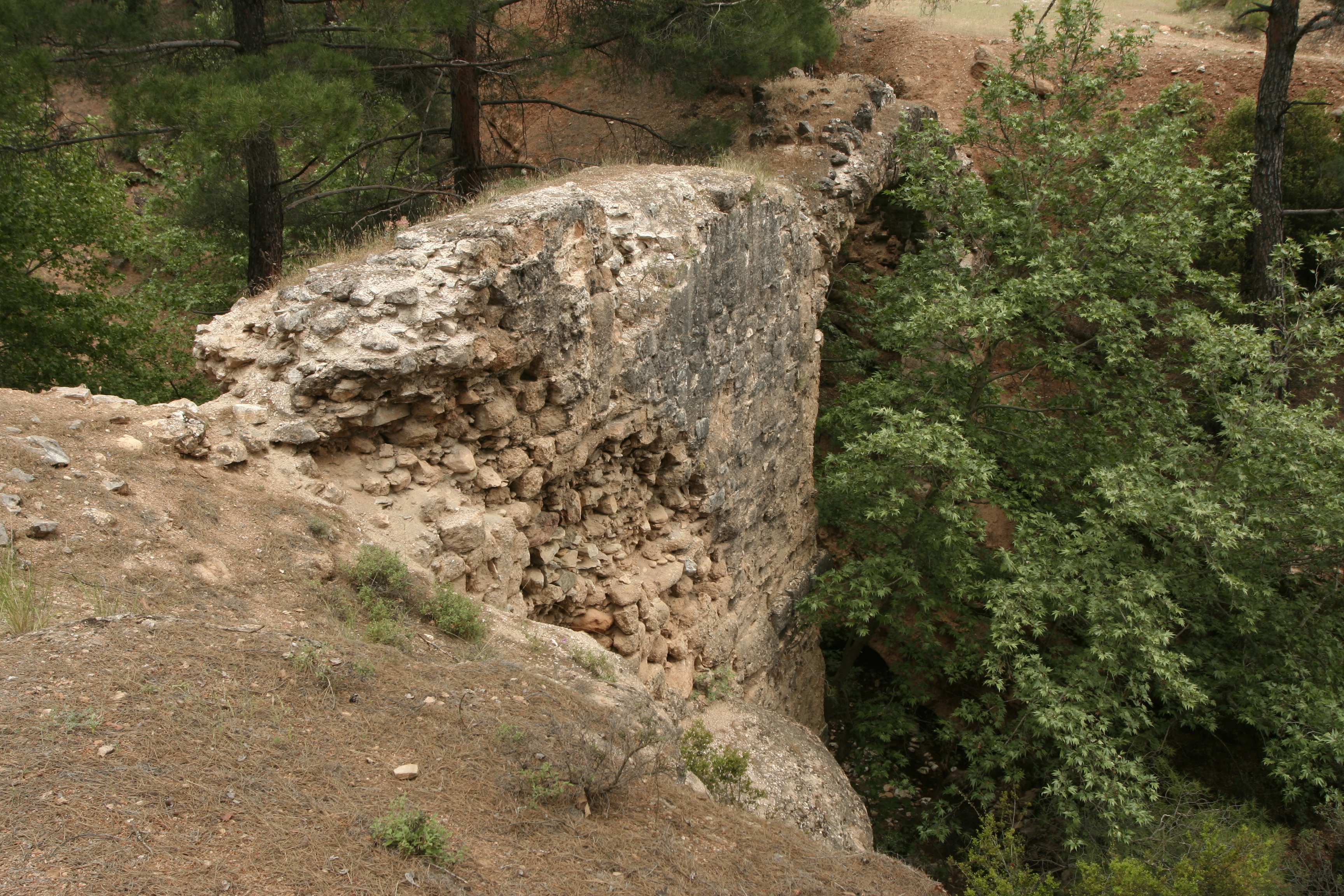
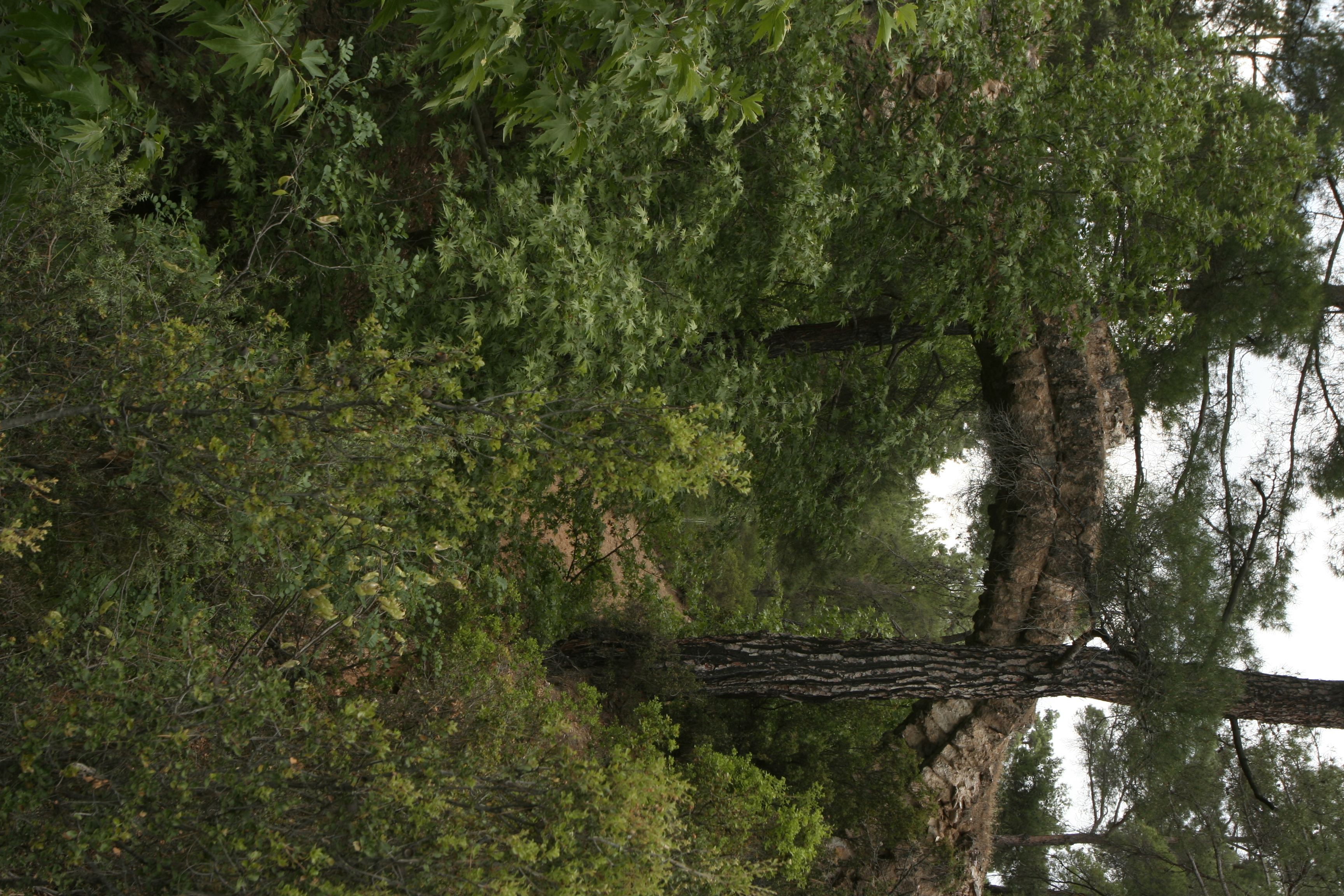
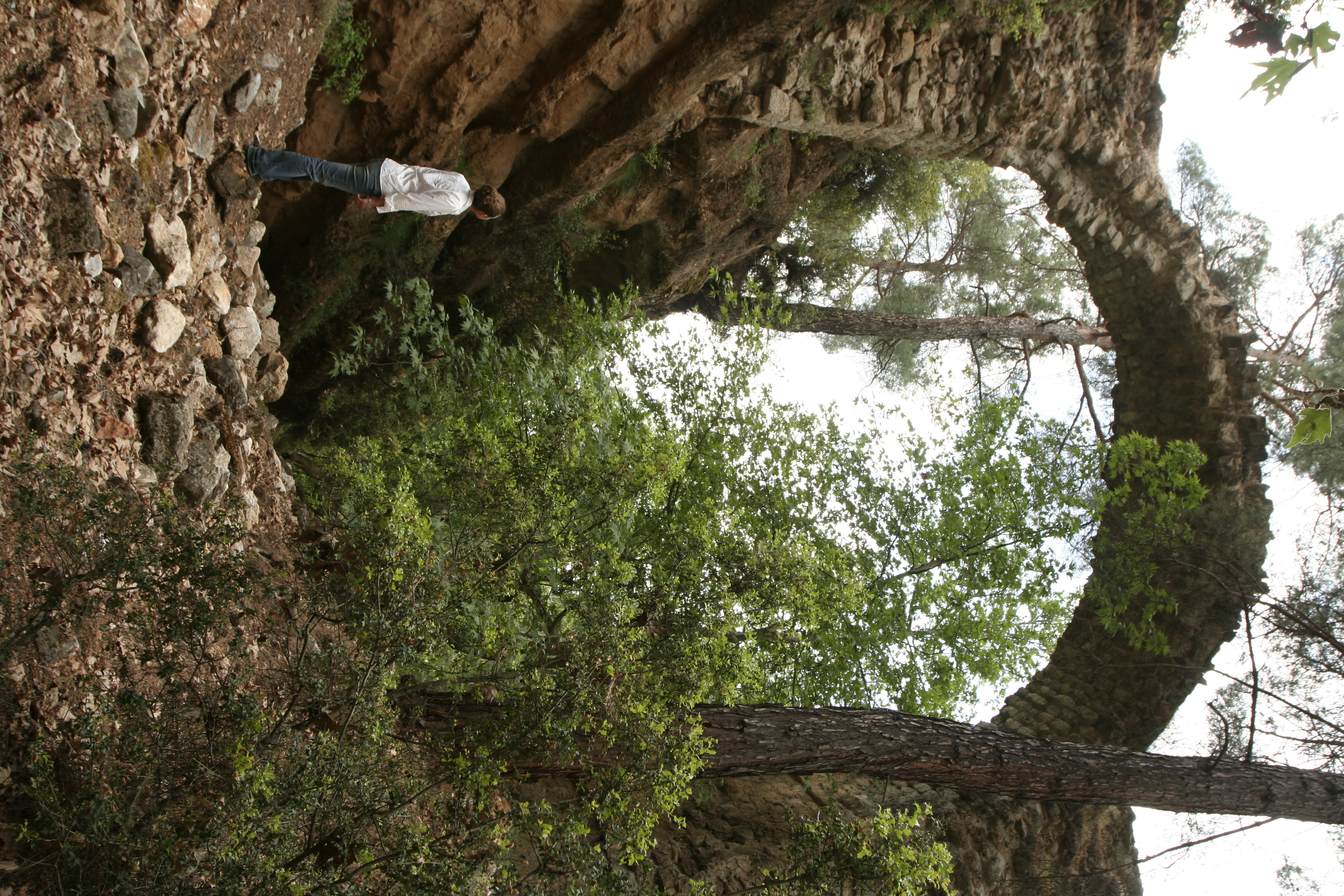
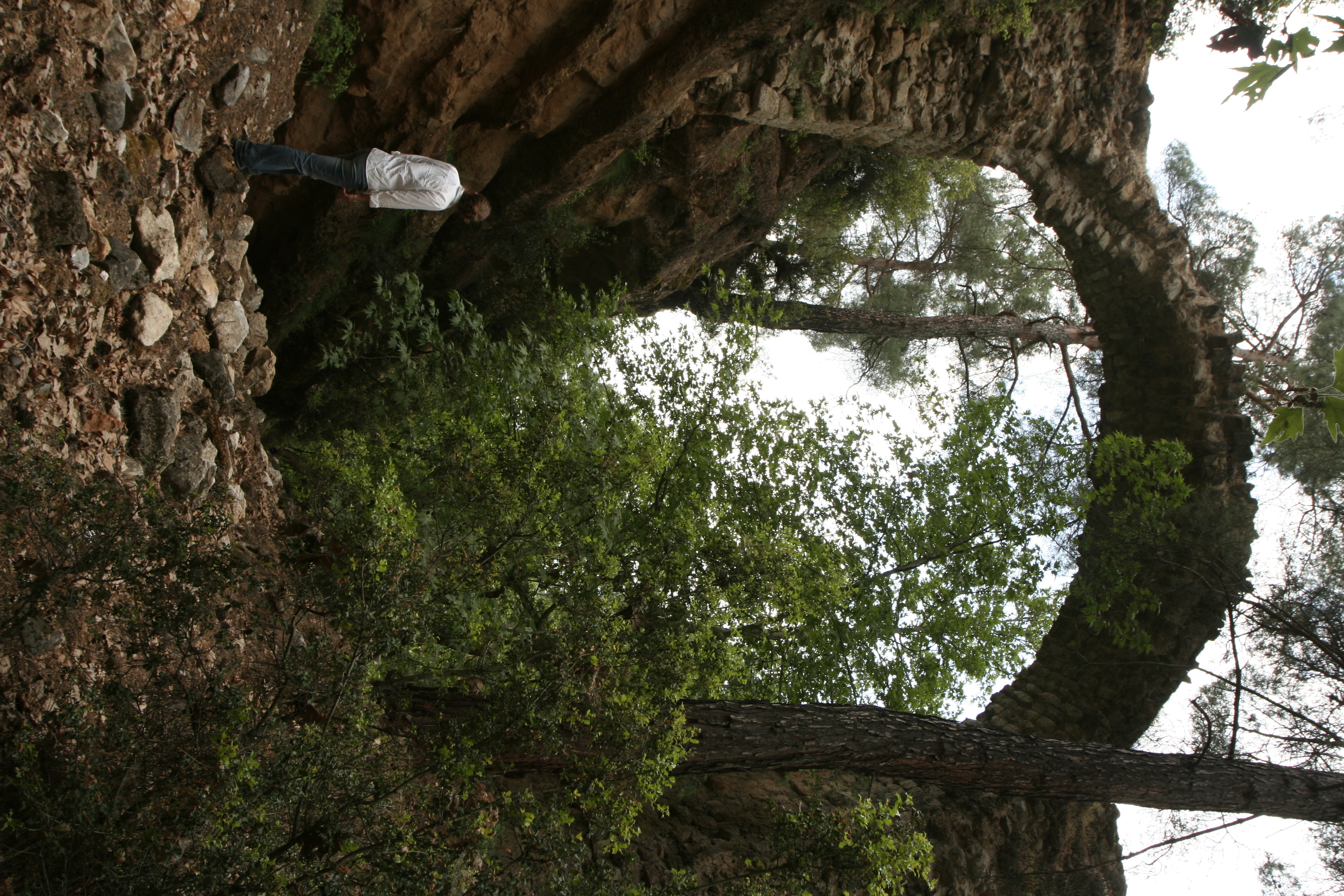
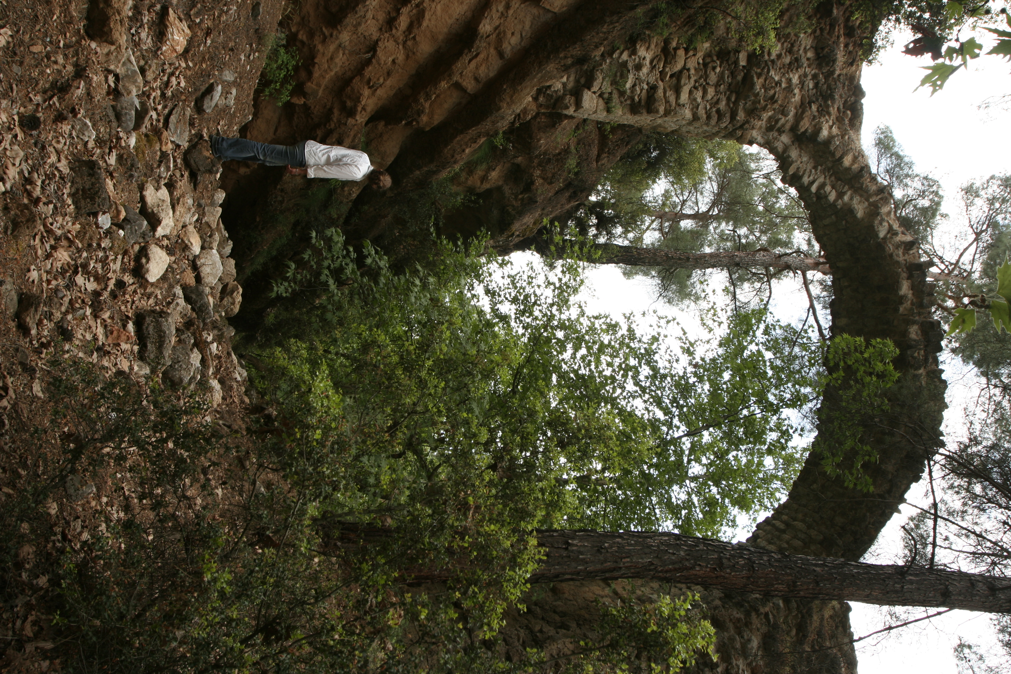
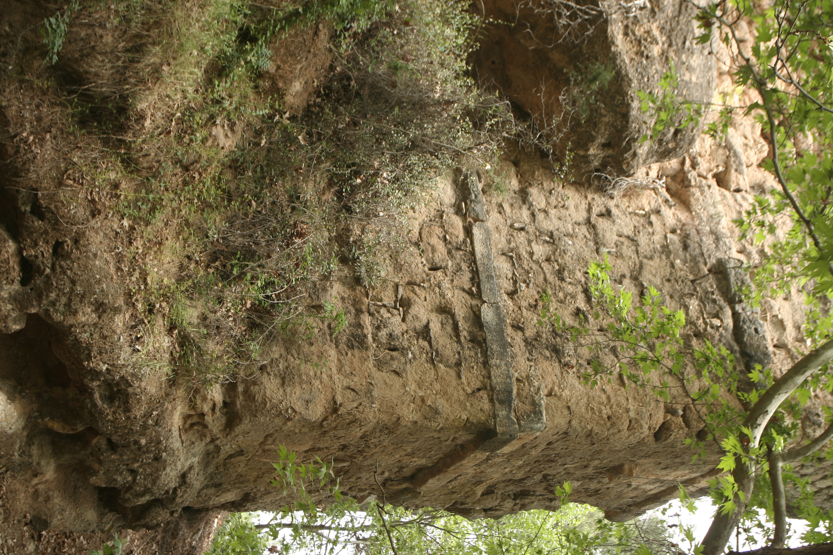
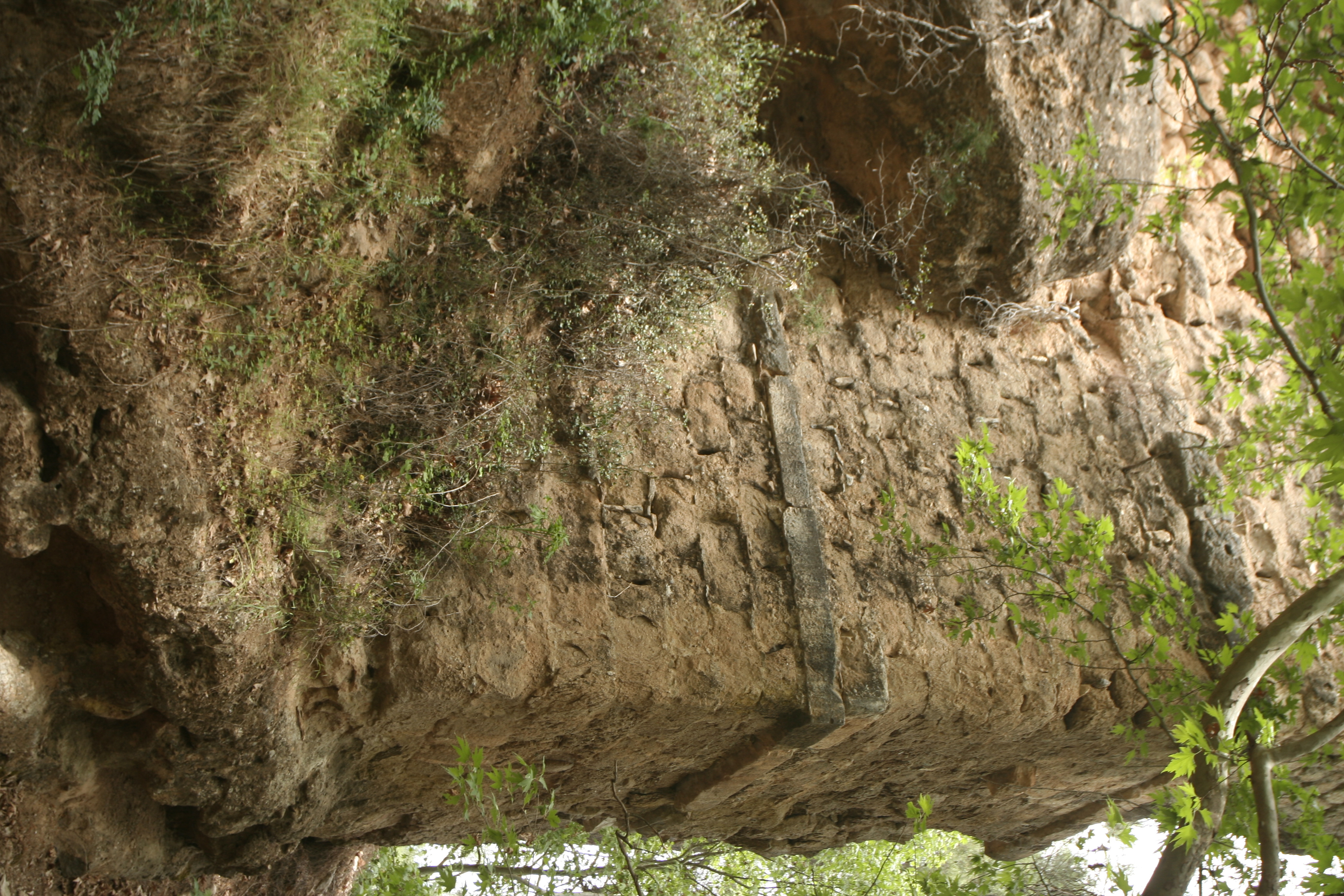
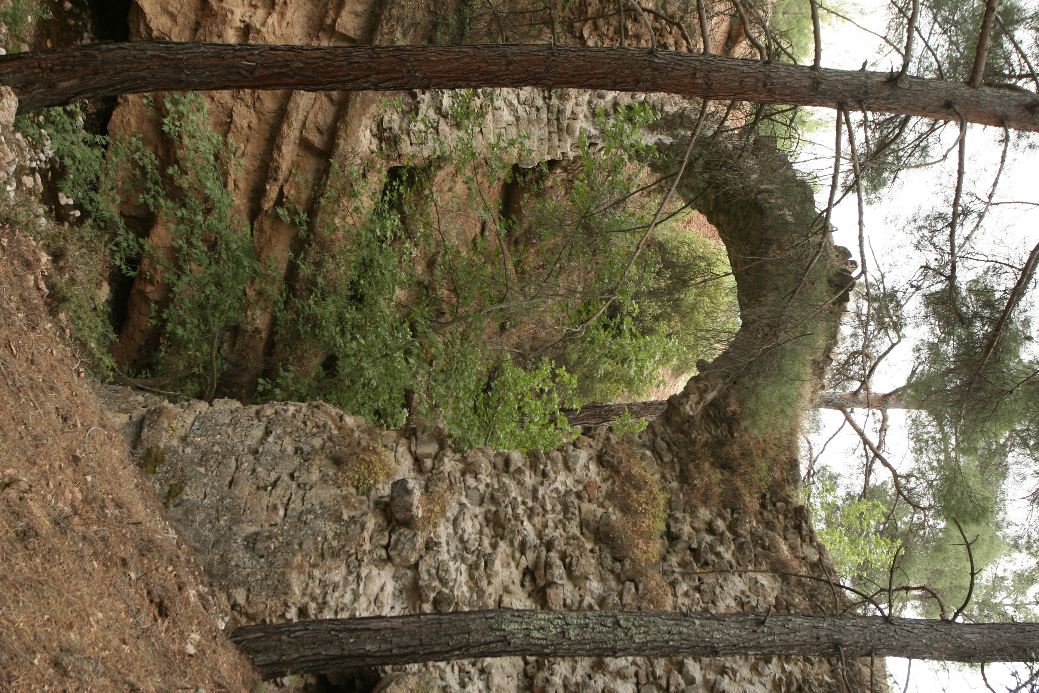
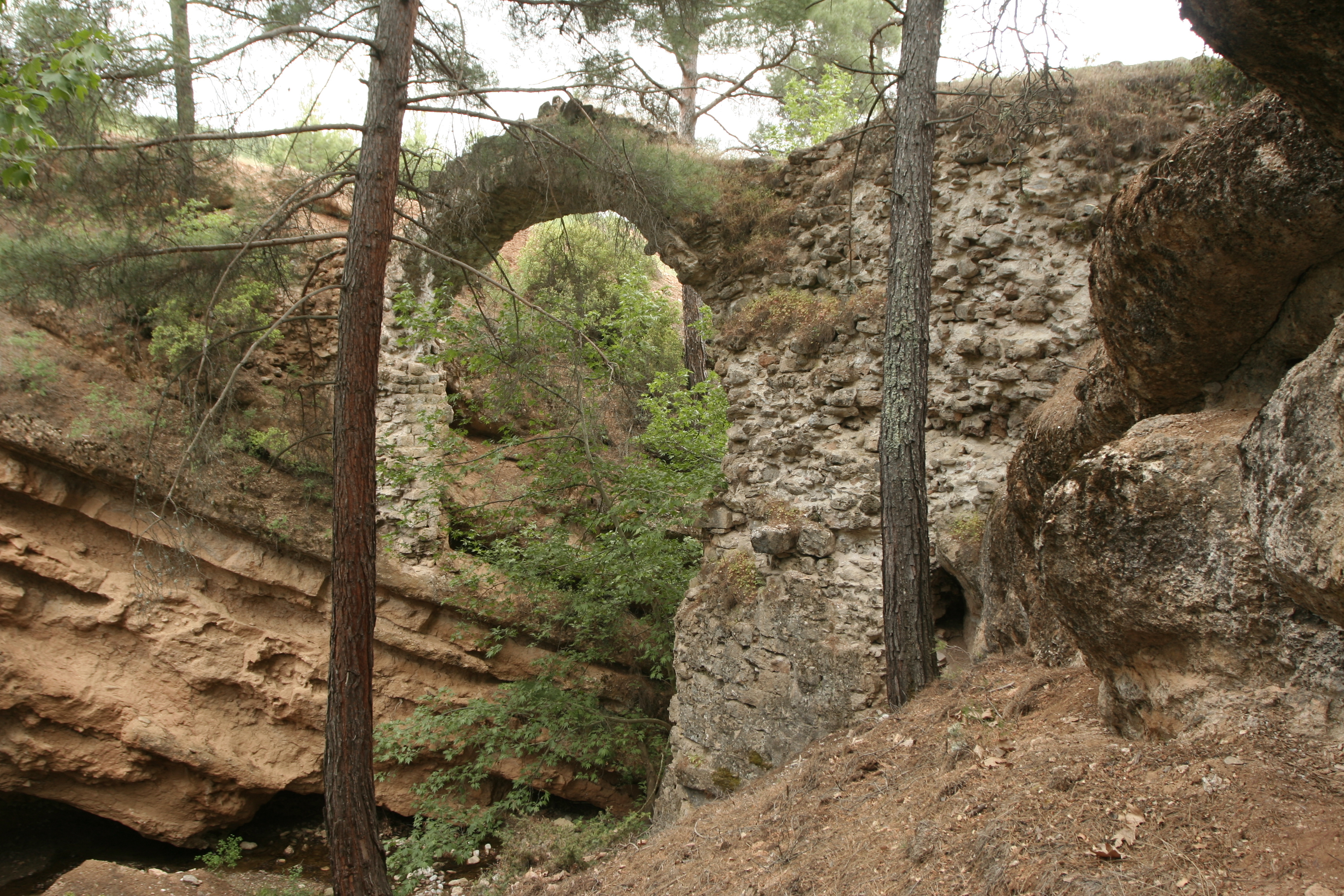
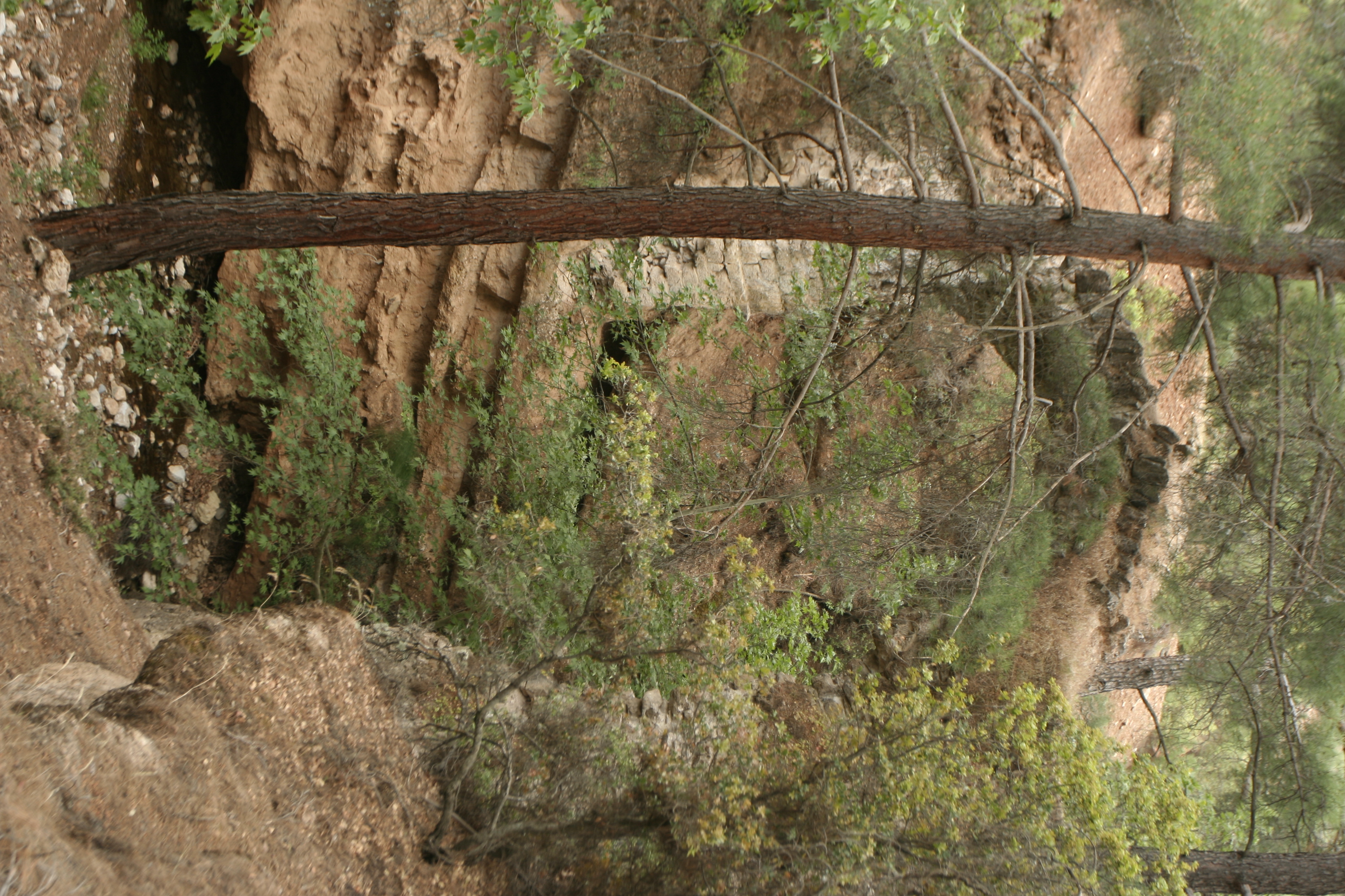
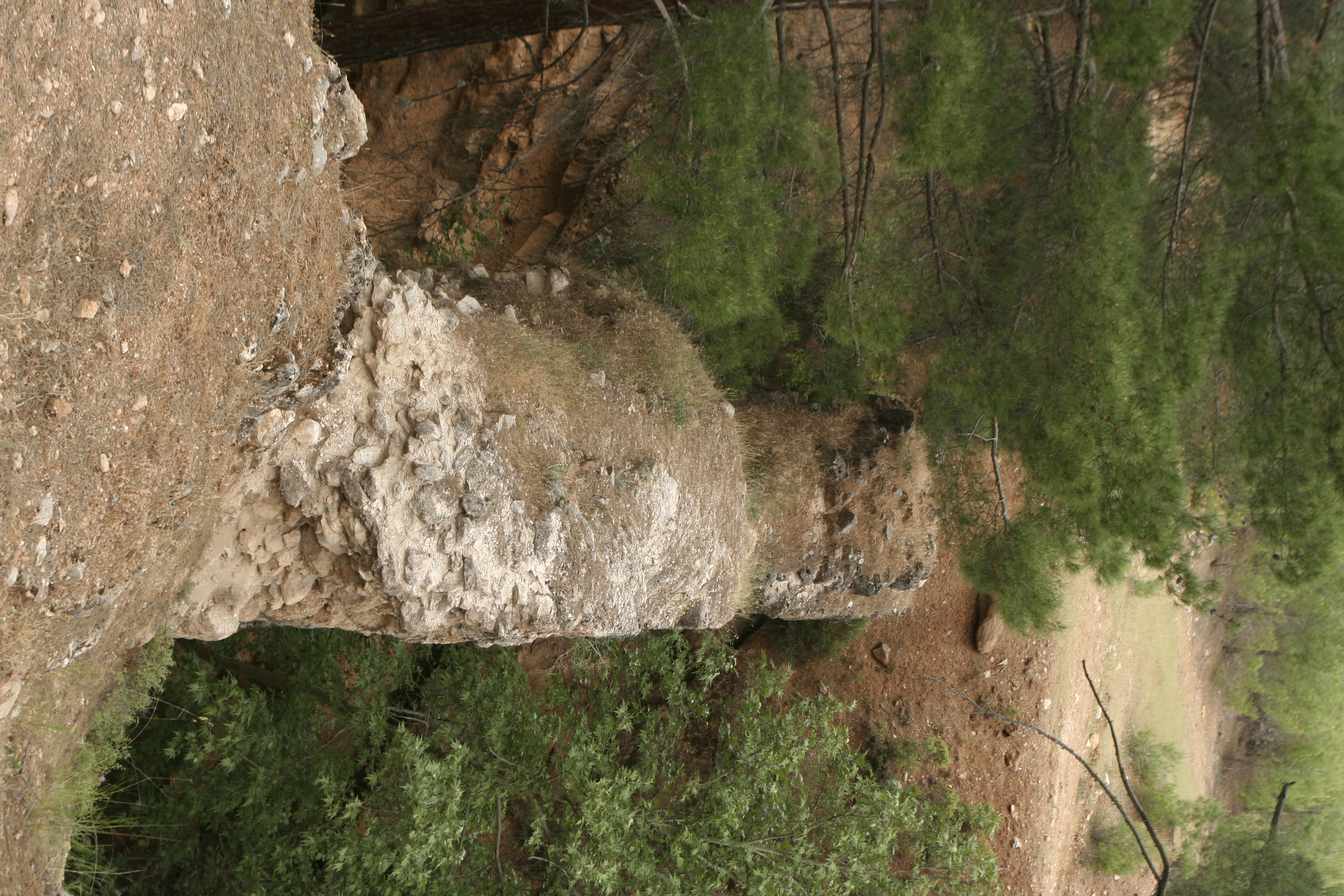
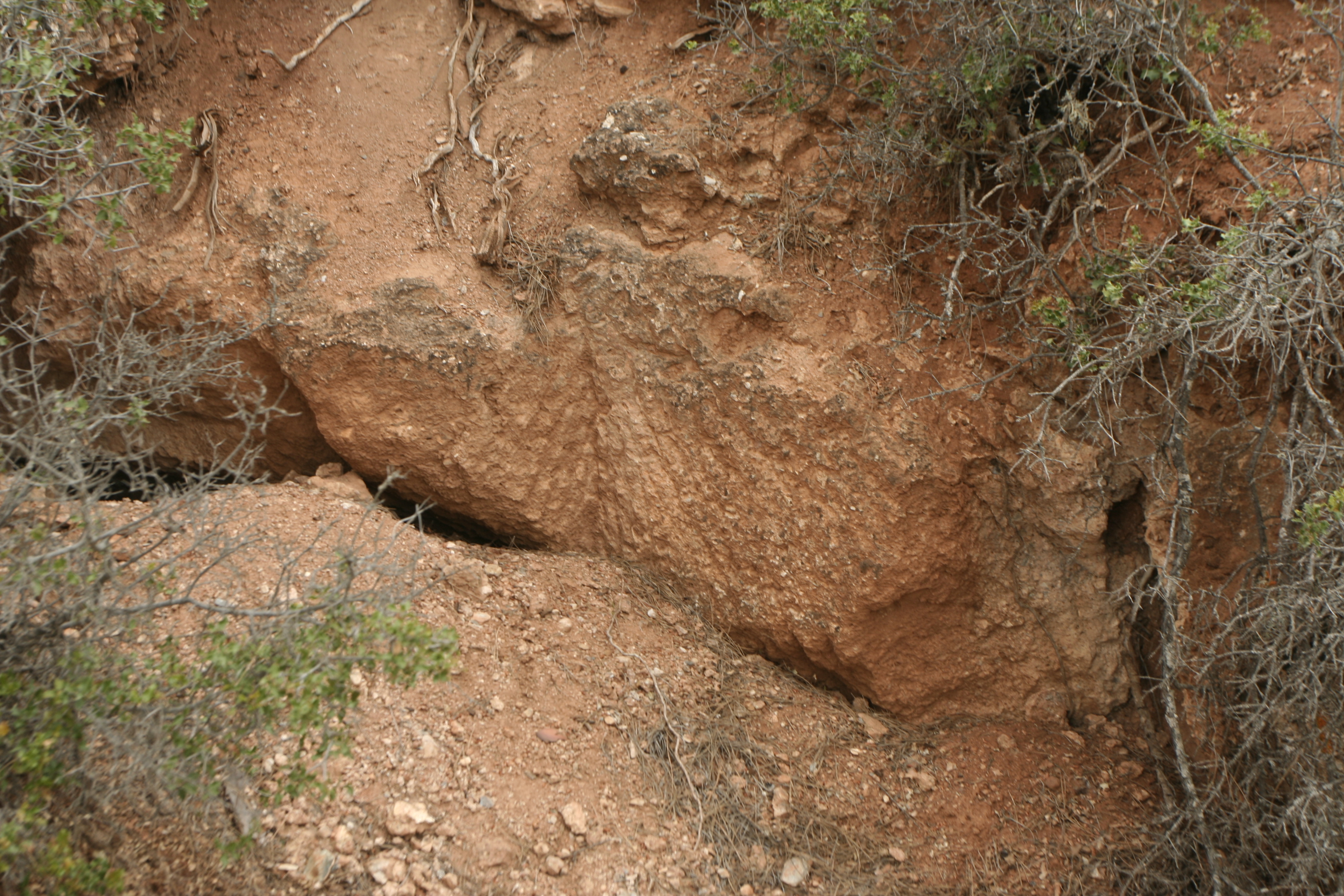
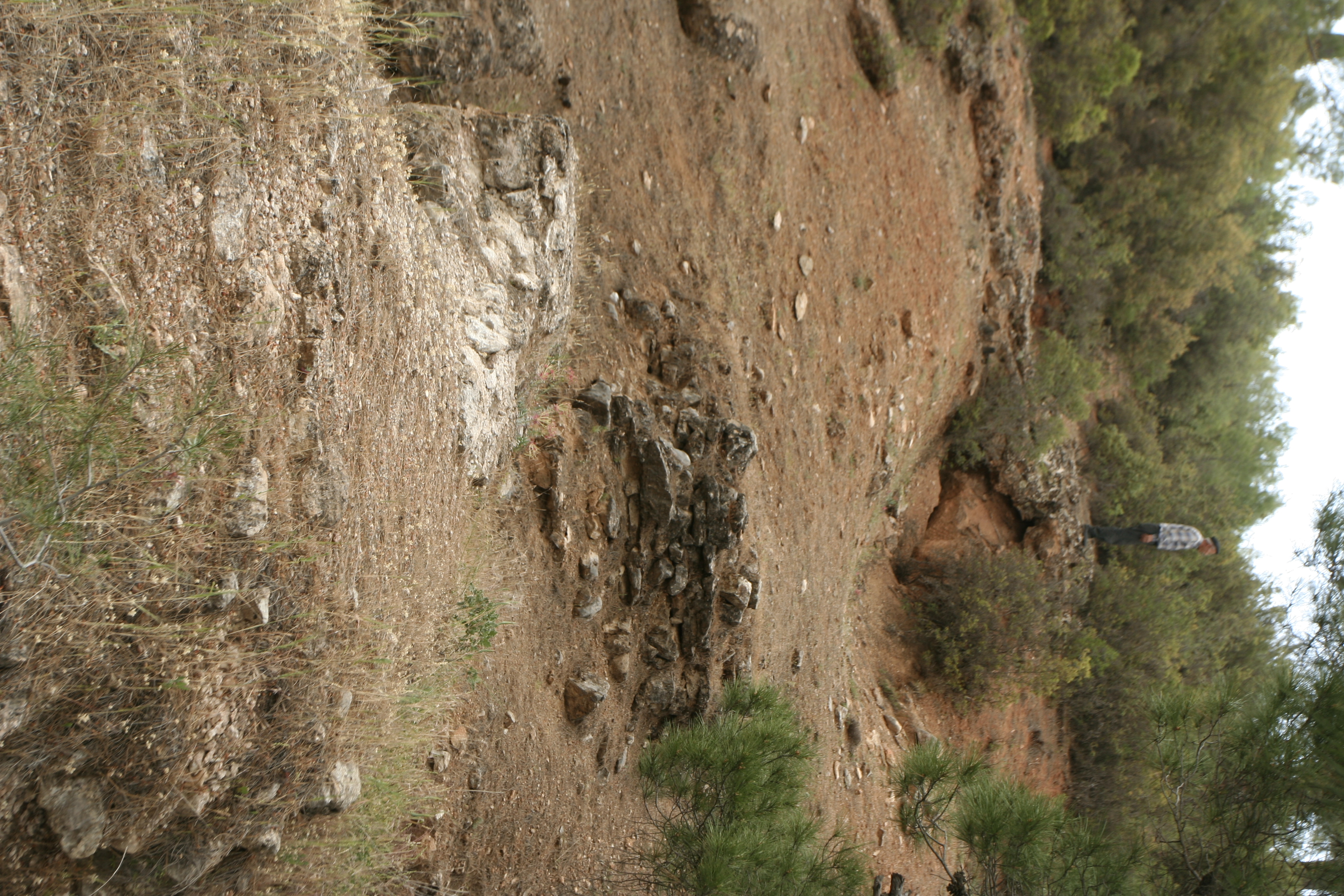
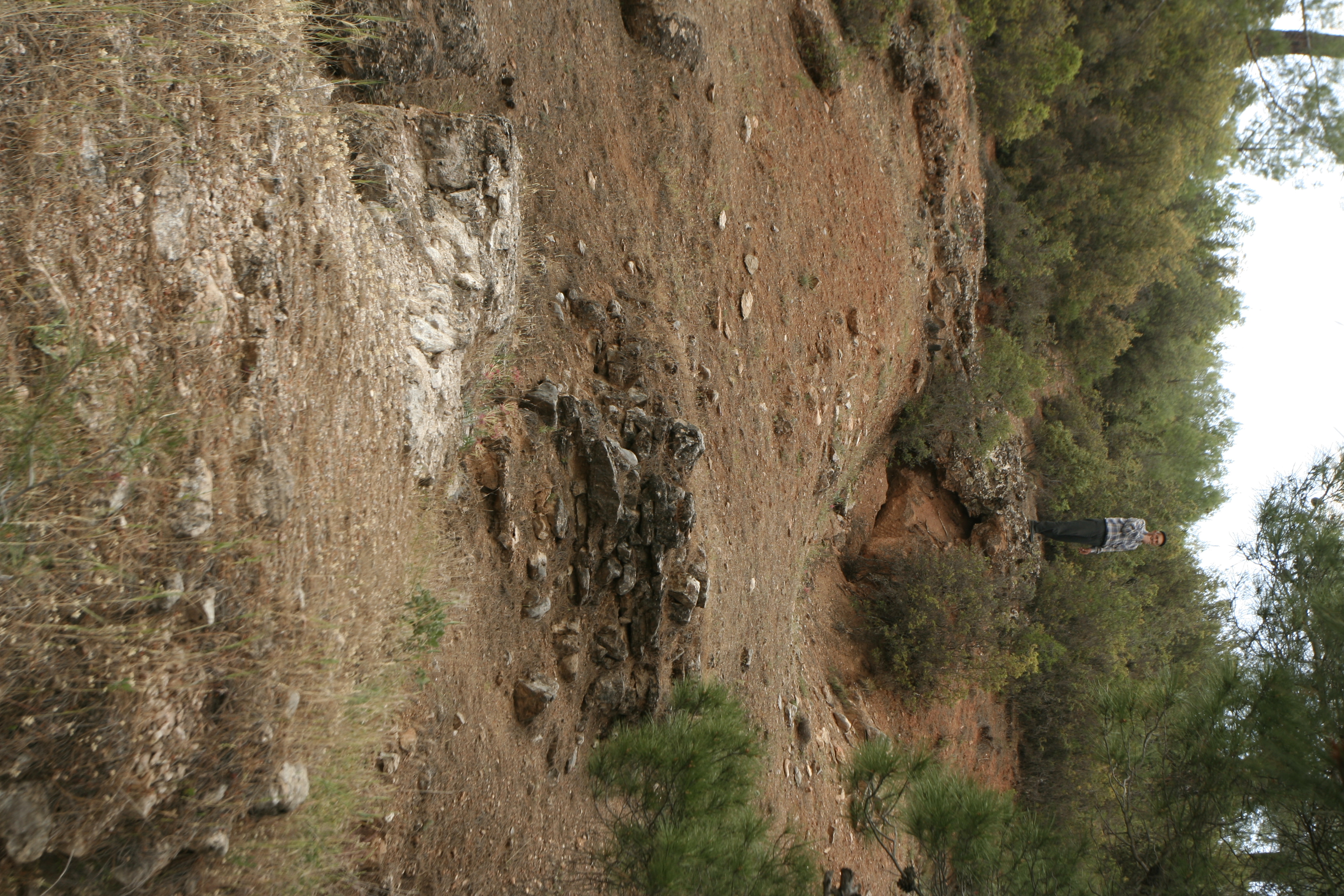
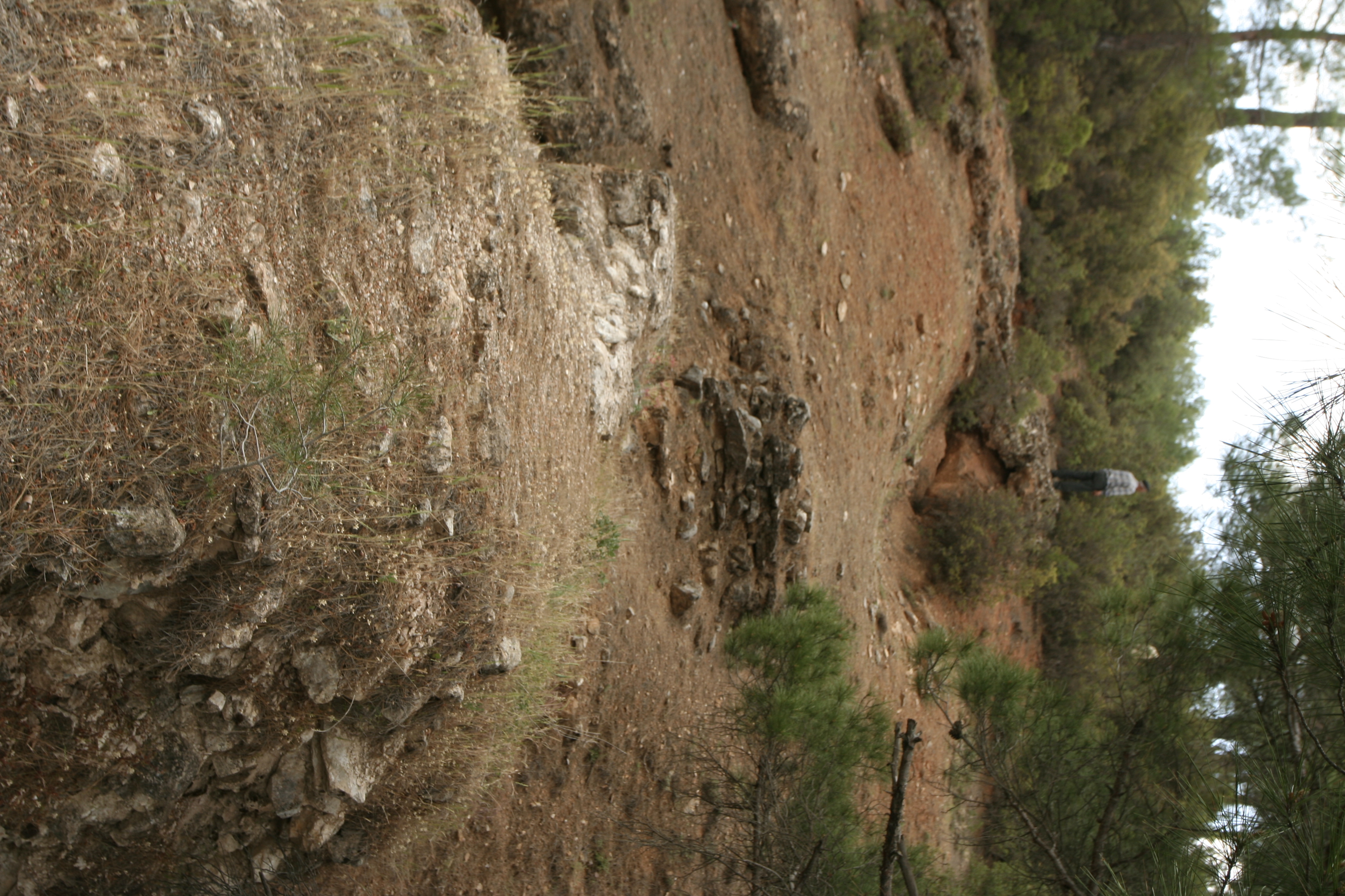
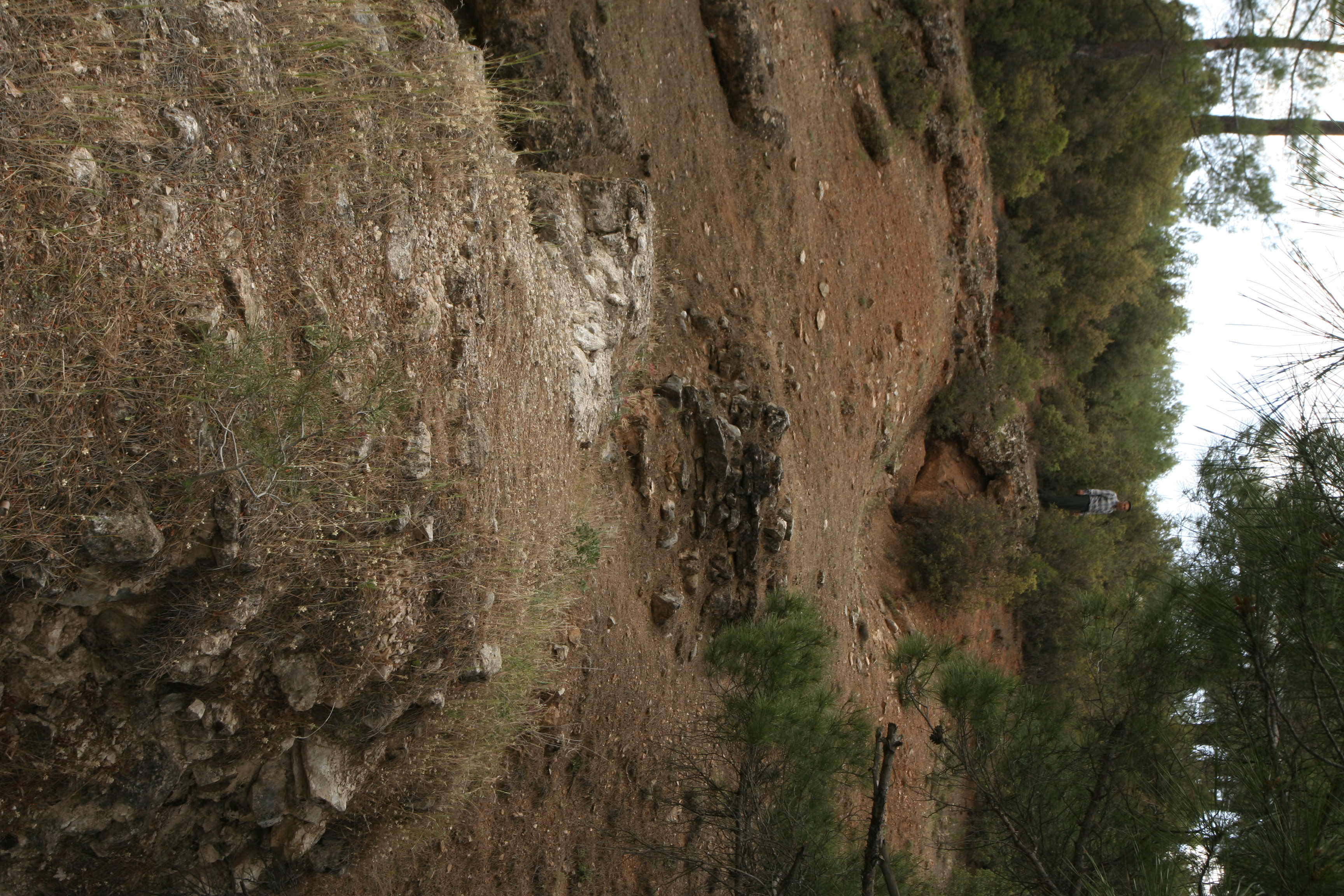
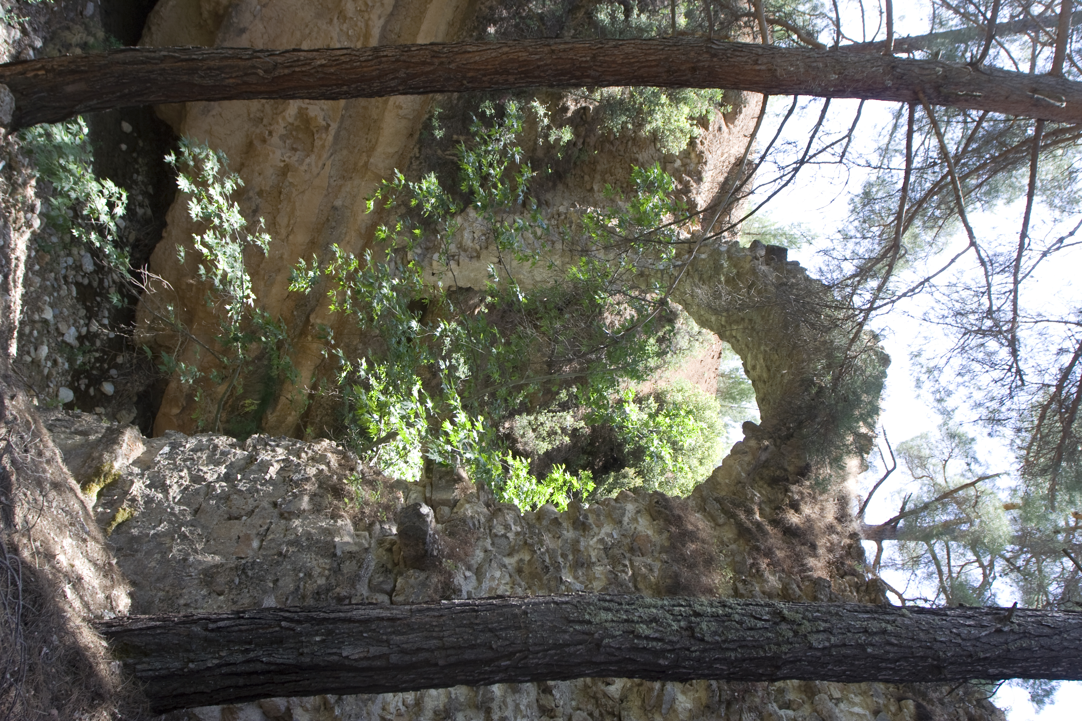
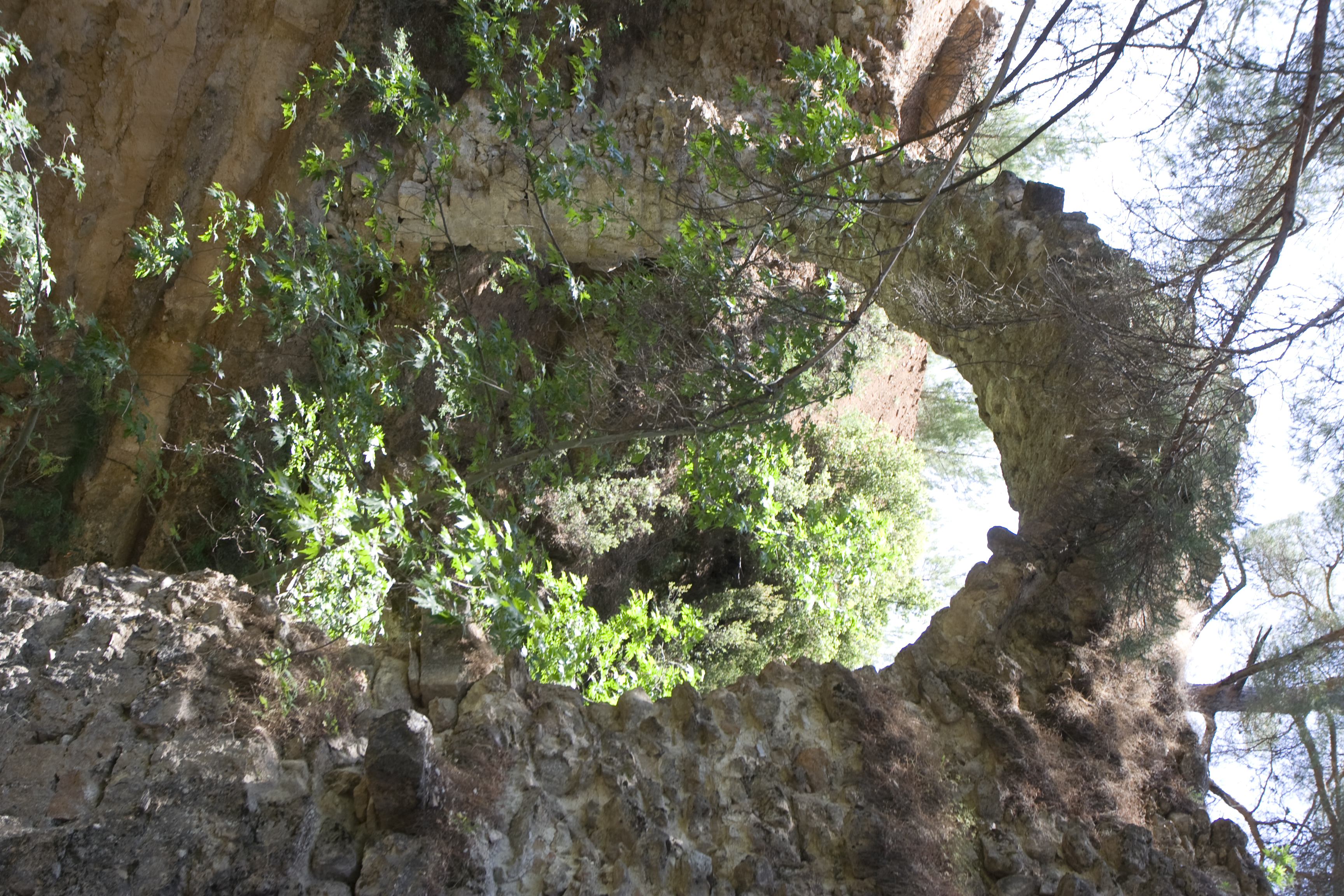
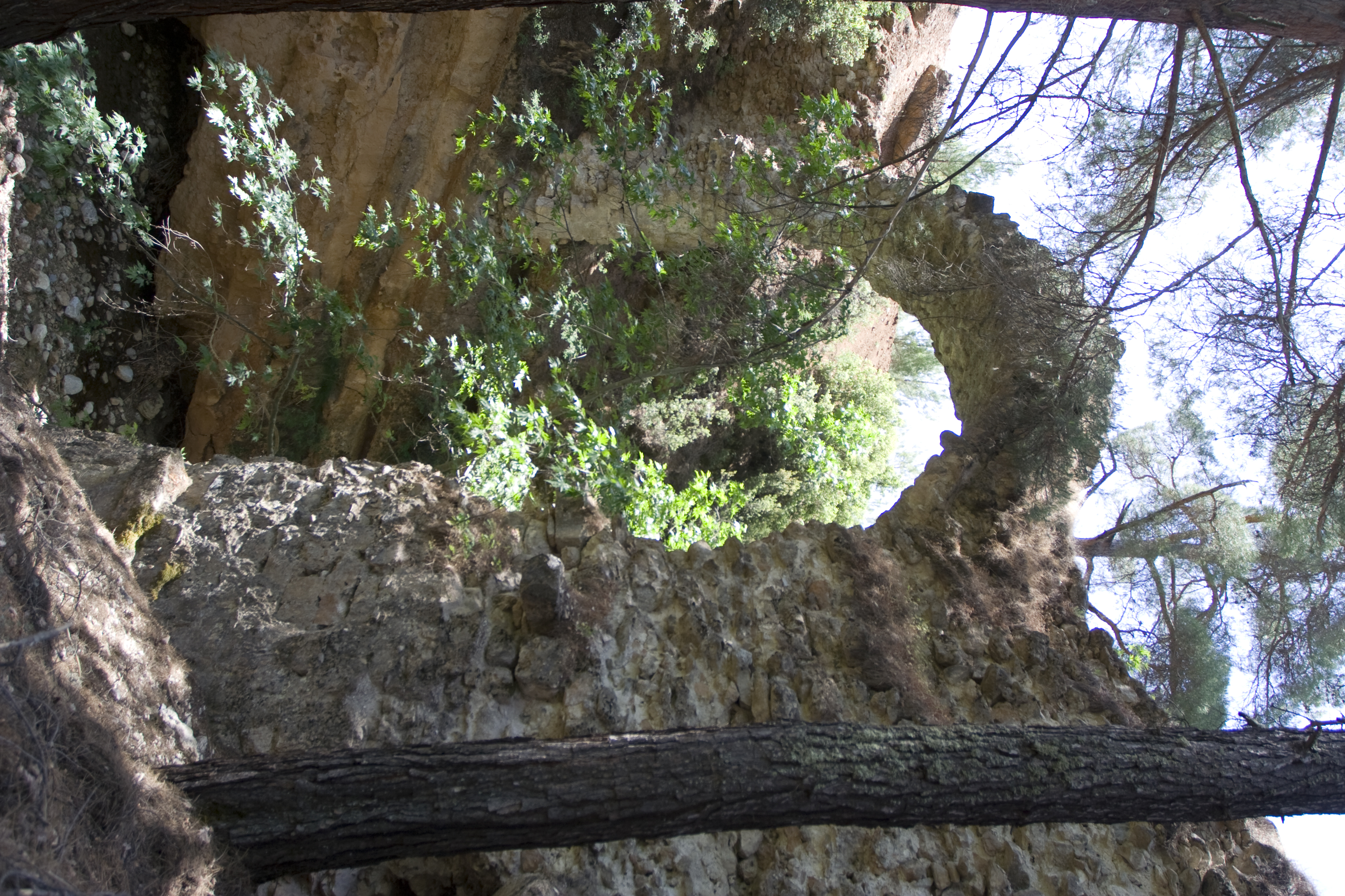
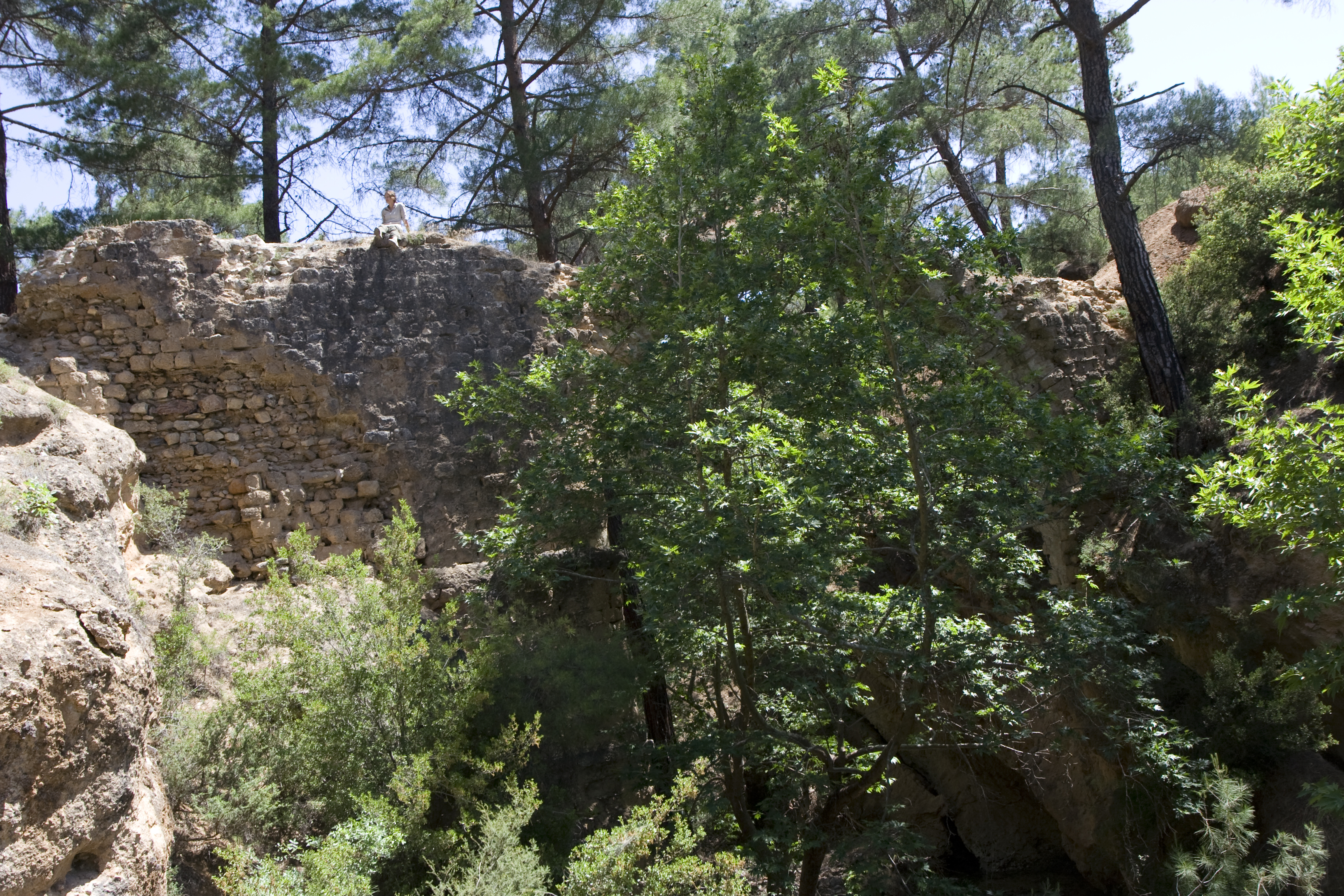
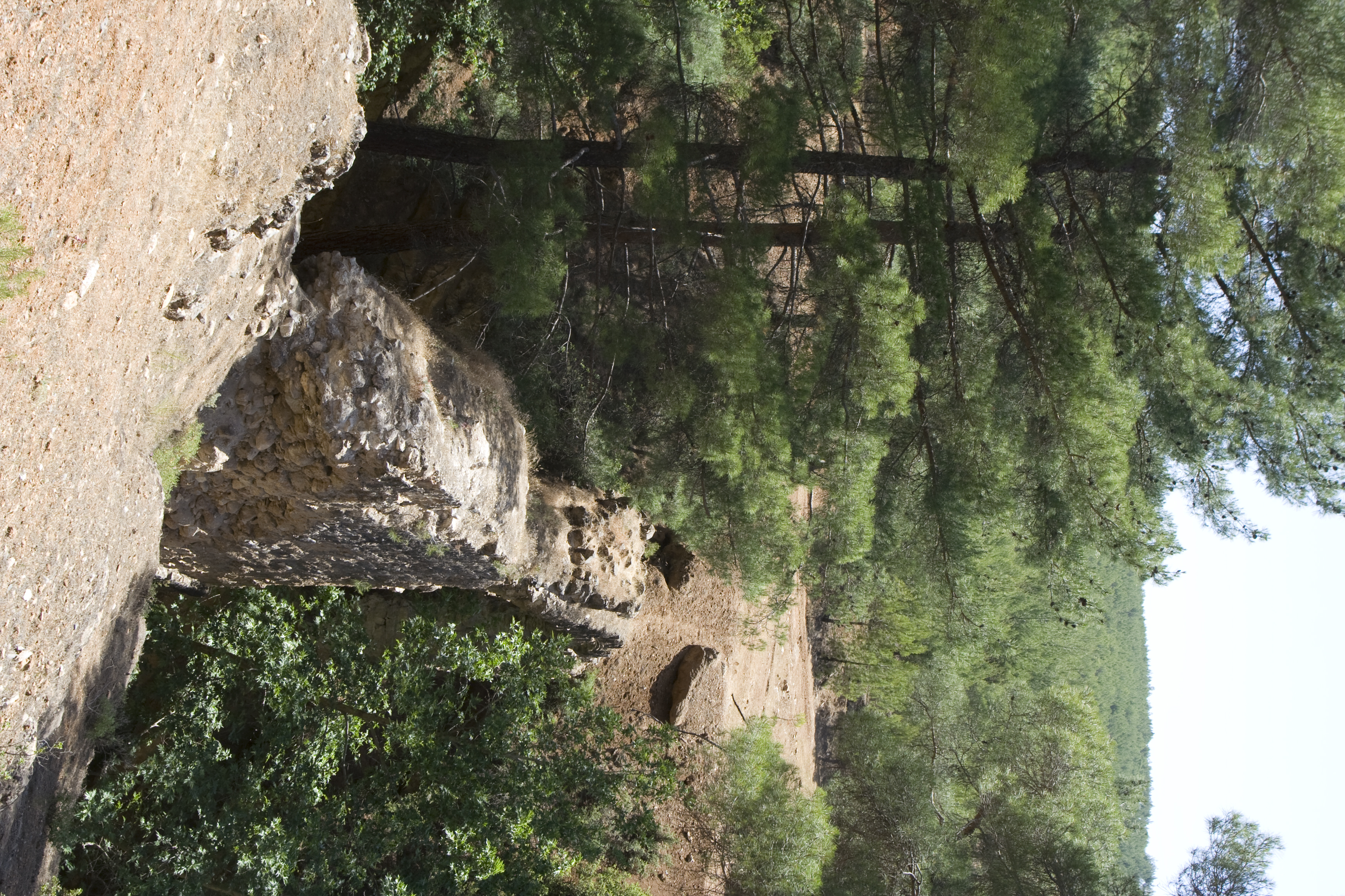
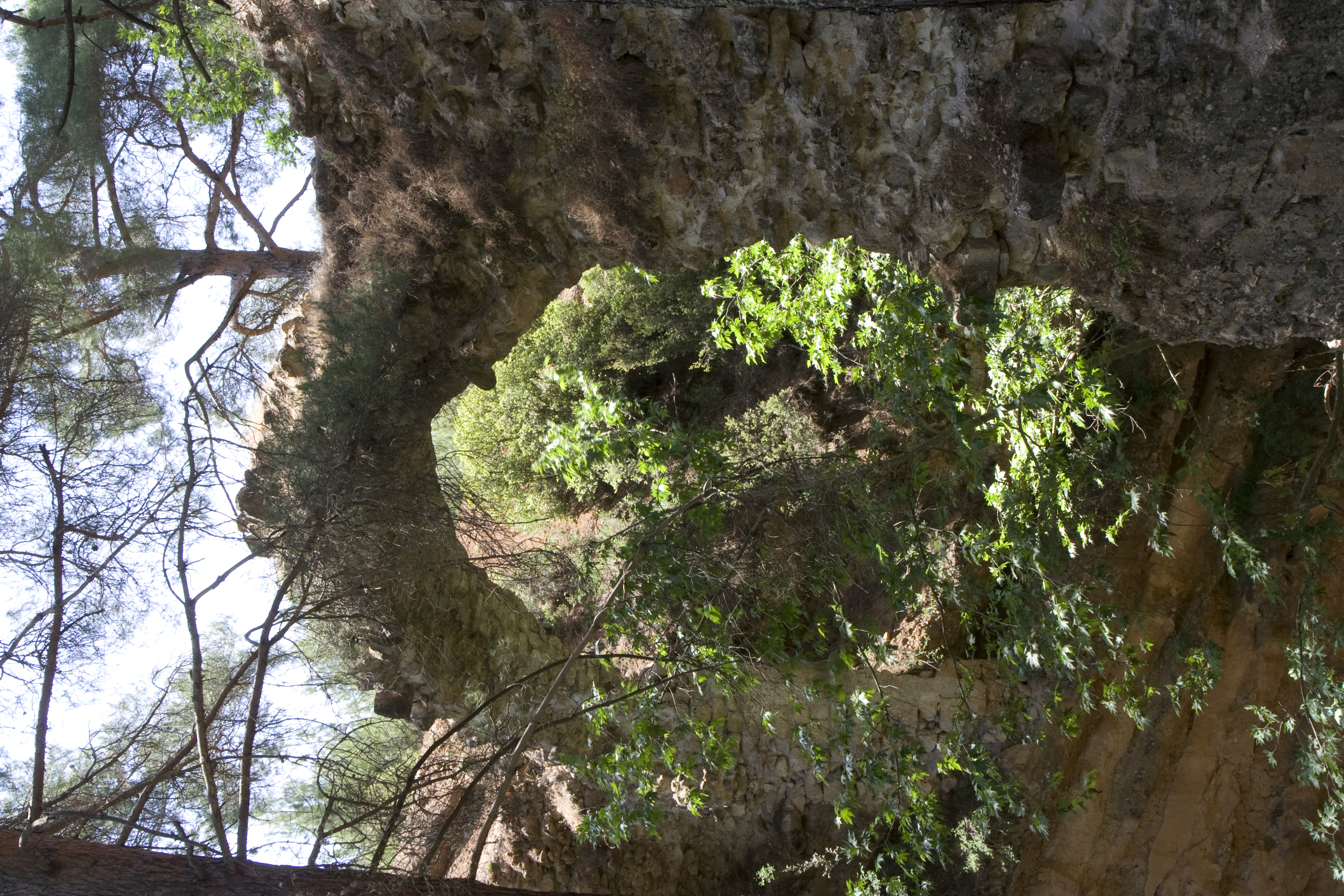
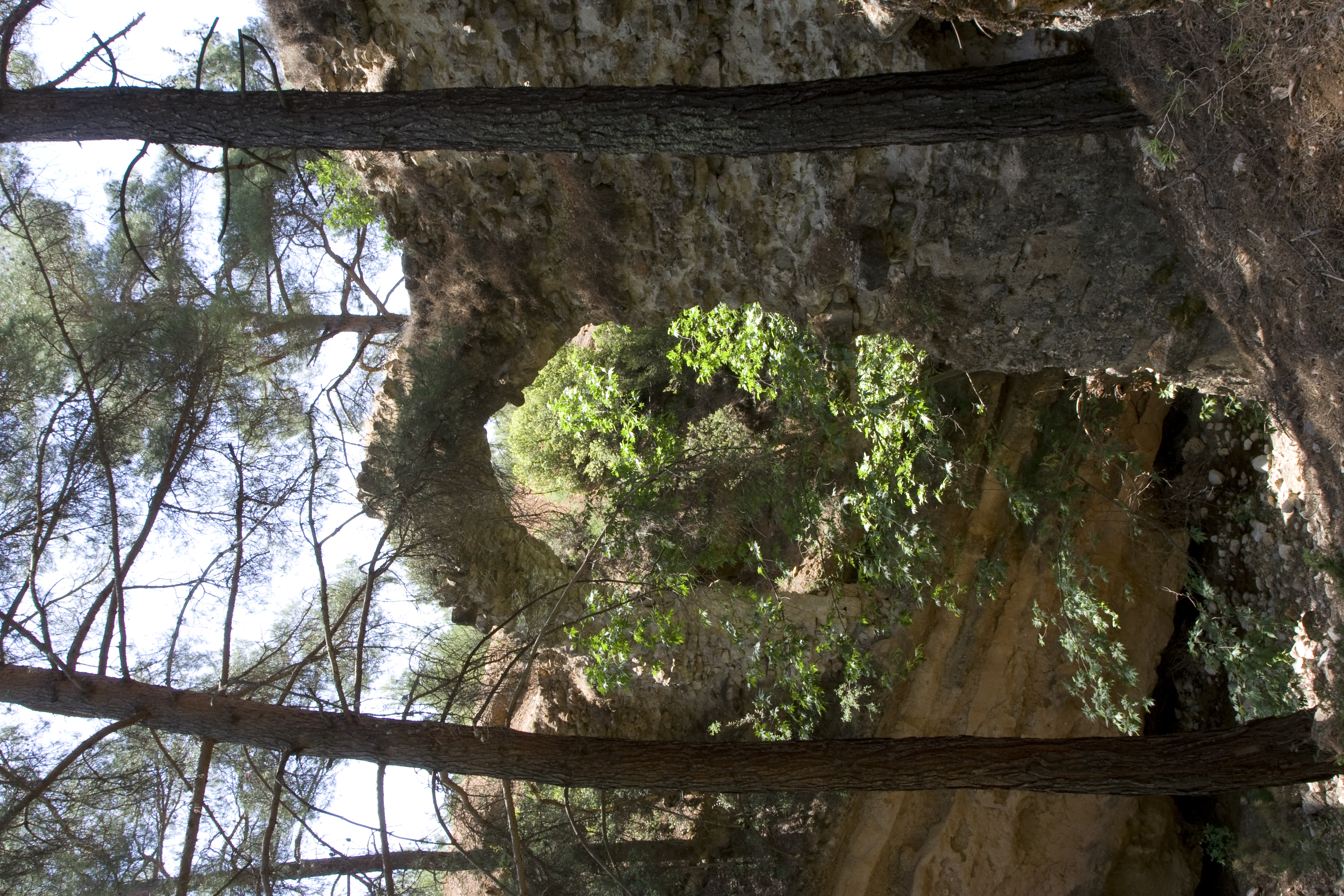
Local Name: Yeşilköy Local Information: The bridge is located on the Kırkım Deresi, one of the many small tributaries of the Yenidere Çayı. The remains are located 0.7 km southeast of the modern village of Yeşilköy and 15.2 km southeast of Aphrodisias. Latitude: 37.36.49.862 Longitude: 28.50.55.298 Elevation: 845.8m Axis: 110 Dimensions: p. H: 13.3 m ** W (west pier): 4.3 m ** p. L: 36 m ** Projected original H: 19 m ** Projected original L: 42 m ** Projected original H (conduit above streambed): 16.7 m ** p. arch span: 9.8 m ** p. W (conduit): 1.2 m ** H (arch bottom from streambed): 14.8 m Description: Preservation: The arch of the bridge is preserved intact and can still be crossed on foot. Facing blocks and voussoirs remain in place on the downstream (south) side of the bridge, which is much better preserved than the upstream side. A section of the vaulted conduit and tunnel, in which pickmarks are visible, is preserved in the west (right) bank. ** Construction: The bridge is constructed of mortared rubble faced with petit appareil masonry. The facing blocks, carved from sandy conglomerate rock, are 0.30–0.50 m long, 0.20 m high, 0.30–0.40 m deep, and are laid out in courses interchanged with courses of small stones that help to level each course. The lime mortar is a white with small stone inclusions, most no larger than 0.05 m. The lower projecting course of the west pier is constructed of worked marble blocks 1 m long, 0.20 m high, and at least 0.4 deep. The worked marble blocks of the upper projecting course of the west pier are taller (about 0.5 m) but not as long (about 0.5 m), and are not of uniform size or shape as are those of the lower course. The lower voussoirs include blocks 0.30–0.50 m long and approximately 0.20 m wide at the extrados. The upper voussoirs are larger, 0.40–0.70 m long and about 0.30 m wide at the extrados. ** Description: The bridge is preserved to a height of 13.3 m, a width of 4.3 m, and a length of 36 m. Both piers are founded on rock outcrops, and the base of the east pier sits 3.7 m above the base of the west pier, which is constructed of marble blocks several times larger than the other facing blocks. Two projecting courses run through the west pier, while the one projecting course of the east pier sits about 0.15 m lower in elevation than the upper projecting course on the west pier. These courses project approximately 0.10–0.15 m from all faces of the pier. The lower projecting course of the west pier sits 2.6 m above the base of the structure, and the upper sits 3.2 m above the bottom of the lower course. The arch is constructed of two layers of voussoirs and spans 9.8 m.
Types
Other
Metadata
Show full item recordCollections
Remediation of Harmful Language
The University of Michigan Library aims to describe library materials in a way that respects the people and communities who create, use, and are represented in our collections. Report harmful or offensive language in catalog records, finding aids, or elsewhere in our collections anonymously through our metadata feedback form. More information at Remediation of Harmful Language.
Accessibility
If you are unable to use this file in its current format, please select the Contact Us link and we can modify it to make it more accessible to you.