 Access by request
E007: Timeles Aqueduct, Kırkrım Deresi Feeder Bridge
Aphrodisias Regional Survey
2007-05-26
View/


Citation
Page reference: Christopher Ratté and Peter D. De Staebler (eds.). Aphrodisias V. The Aphrodisias Regional Survey (Verlag Philipp von Zabern: Darmstadt/Mainz, 2012), 267, 301 - Book catalogue no.: Aqueducts cat. 6. <http://hdl.handle.net/2027.42/92937>
Other Identifiers
E007
Subjects
Waterworks 4: Roman
Description
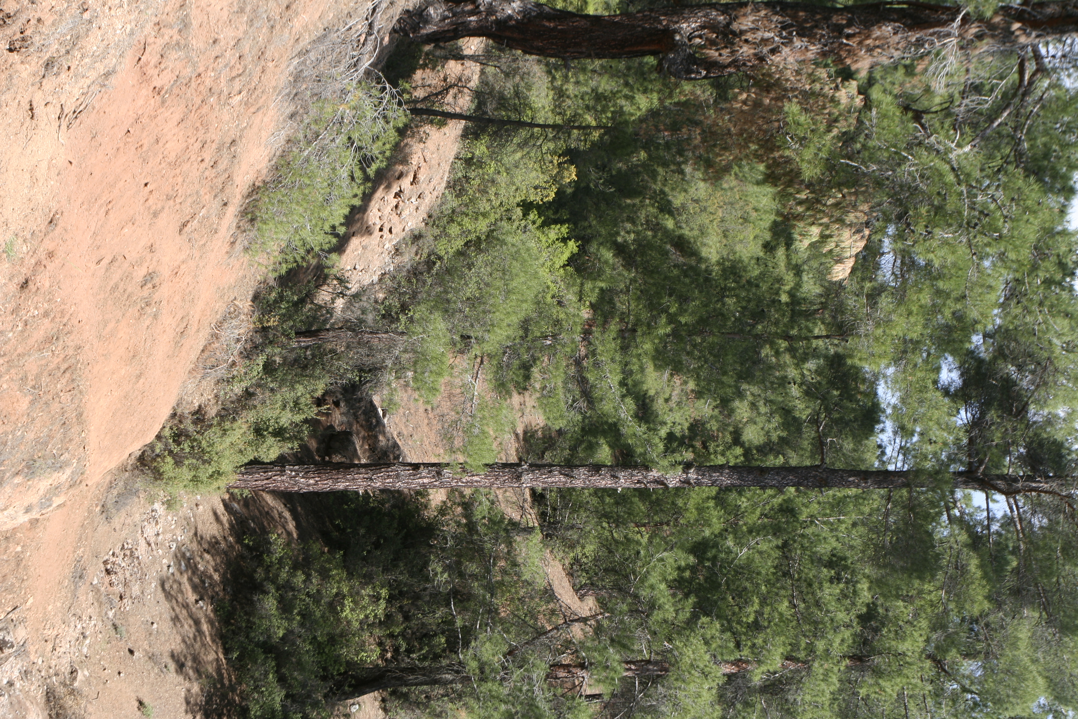
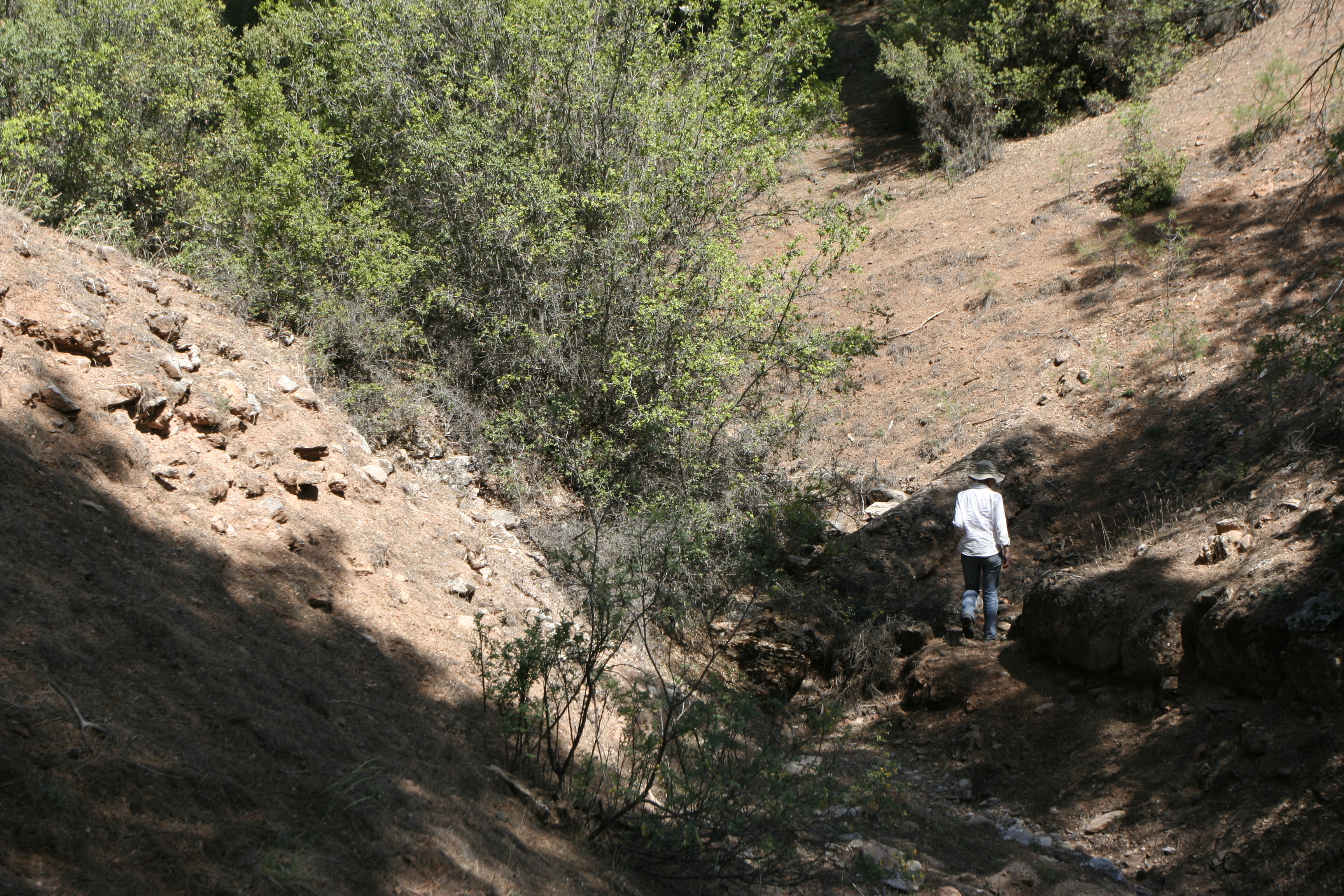
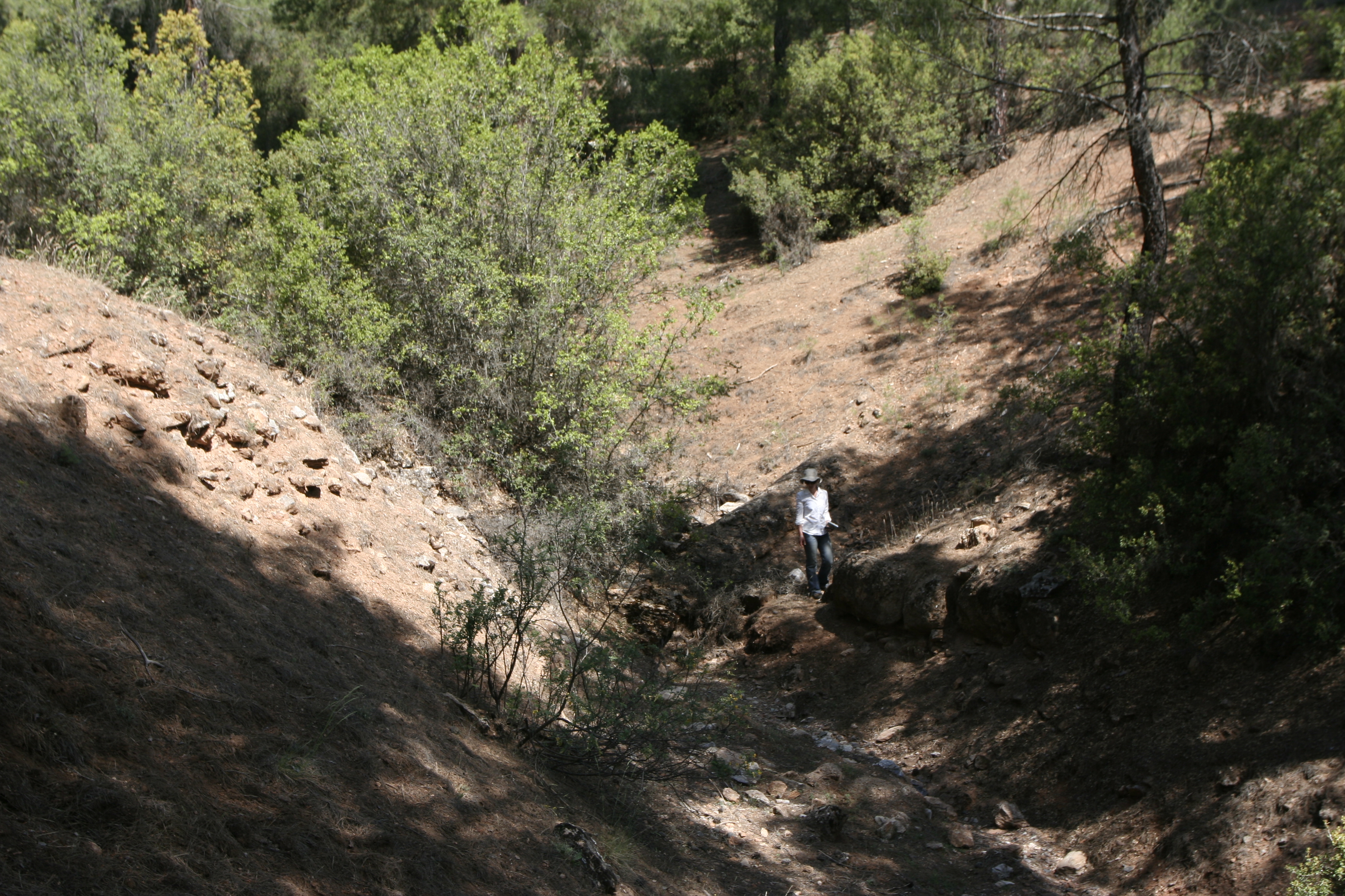
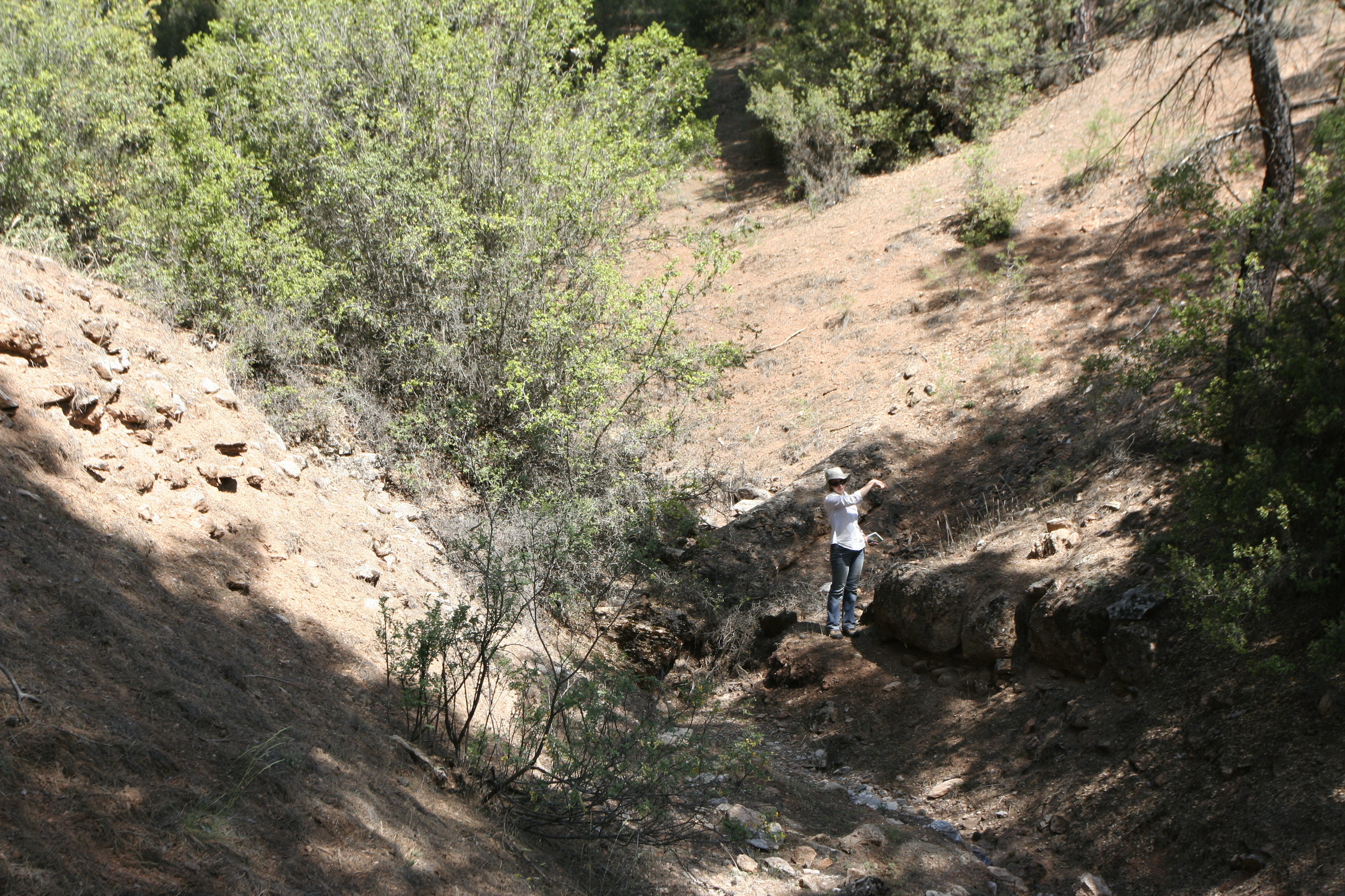
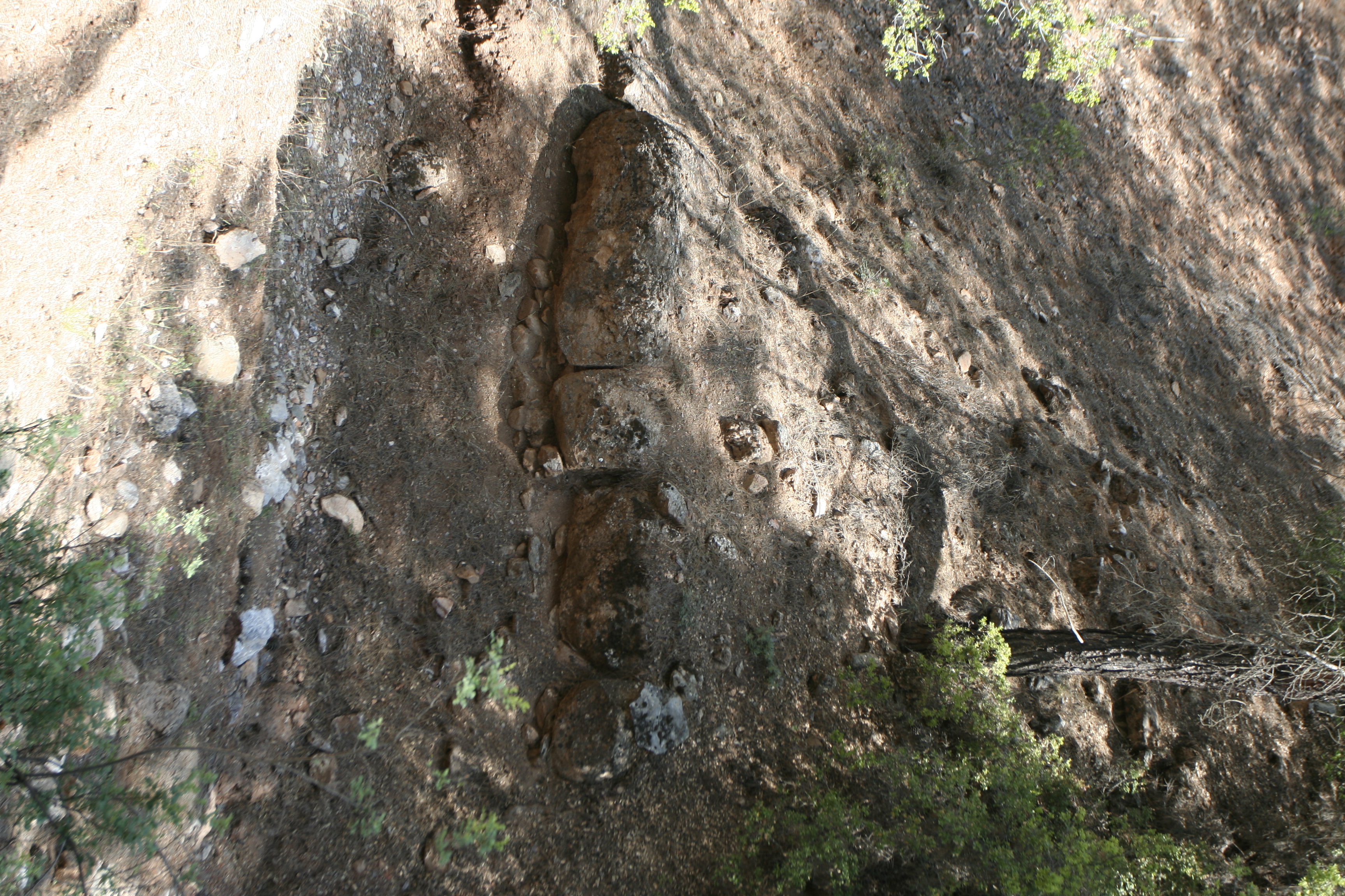
Local Name: Yeşilköy Local Informant: Osman Yusmak Local Information: The bridge is located on a shallow dere feeding into the Kırkım Deresi from the west, one of the many small tributaries of the Yenidere Çayı. The remains are located 0.7 km southeast of the modern village of Yeşilköy and 15.2 km southeast of Aphrodisias. Latitude: 37.36.48.402 Longitude: 28.50.51.975 Elevation: 831m Dimensions: p. H (approximate): 6 m ** W (east pier): 4.4 m ** p. L (approximate): 15 m ** Projected original H (approximate): 8 m ** Projected original L (approximate): 15 m ** Projected original H (conduit above streambed) (approximate): 6 m Description: Preservation: Only the large footing blocks and weathered mortared rubble core remain of the bridge. Traces of the conduit are visible as depressions in the earth on both sides of the bridge. ** Construction: The bridge is constructed of mortared rubble faced with petit appareil masonry. The facing blocks are carved from sandy conglomerate rock, as are the footing blocks, which range in size from 0.60 to 2.03 m long and 0.60–0.70 m high. The masonry is bonded with white lime mortar with stone inclusions, most smaller than 0.05 m. ** Description: The east pier of the bridge is 4.4 m wide with a maximum preserved height of 6 m. The approximate width of the conduit is 1.5 m, though no clear side walls are visible to provide an accurate measurement.
Types
Other
Metadata
Show full item recordCollections
Remediation of Harmful Language
The University of Michigan Library aims to describe library materials in a way that respects the people and communities who create, use, and are represented in our collections. Report harmful or offensive language in catalog records, finding aids, or elsewhere in our collections anonymously through our metadata feedback form. More information at Remediation of Harmful Language.
Accessibility
If you are unable to use this file in its current format, please select the Contact Us link and we can modify it to make it more accessible to you.