 Access by request
E033: Timeles Aqueduct, Ciğlek Deresi Bridge
Aphrodisias Regional Survey
2007-06-17
View/


Citation
Page reference: Christopher Ratté and Peter D. De Staebler (eds.). Aphrodisias V. The Aphrodisias Regional Survey (Verlag Philipp von Zabern: Darmstadt/Mainz, 2012), 258, 261, 265, 283, 300 - Book catalogue no.: Aqueducts cat. 6. <http://hdl.handle.net/2027.42/92965>
Other Identifiers
E033
Subjects
Waterworks 4: Roman
Description
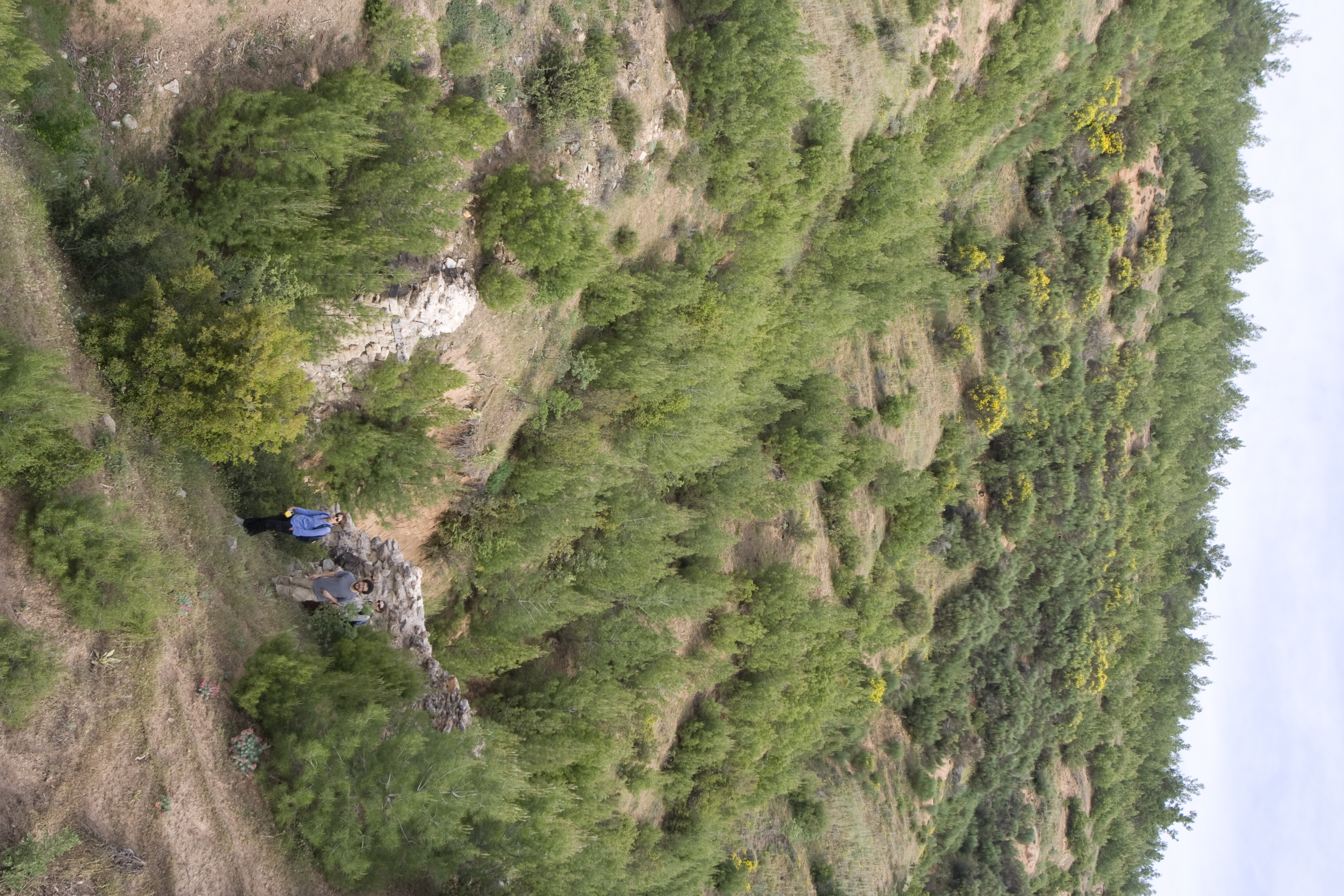
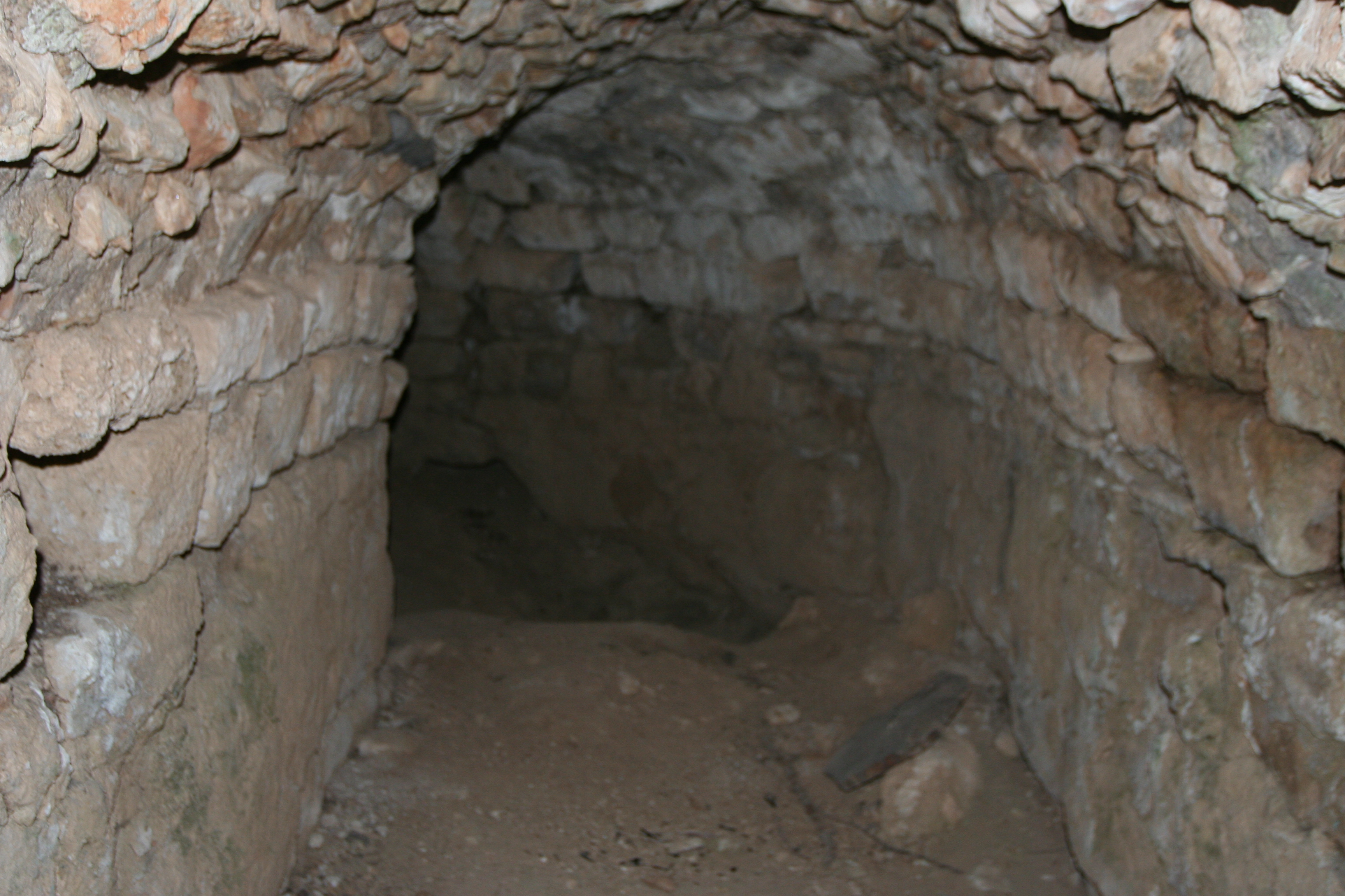
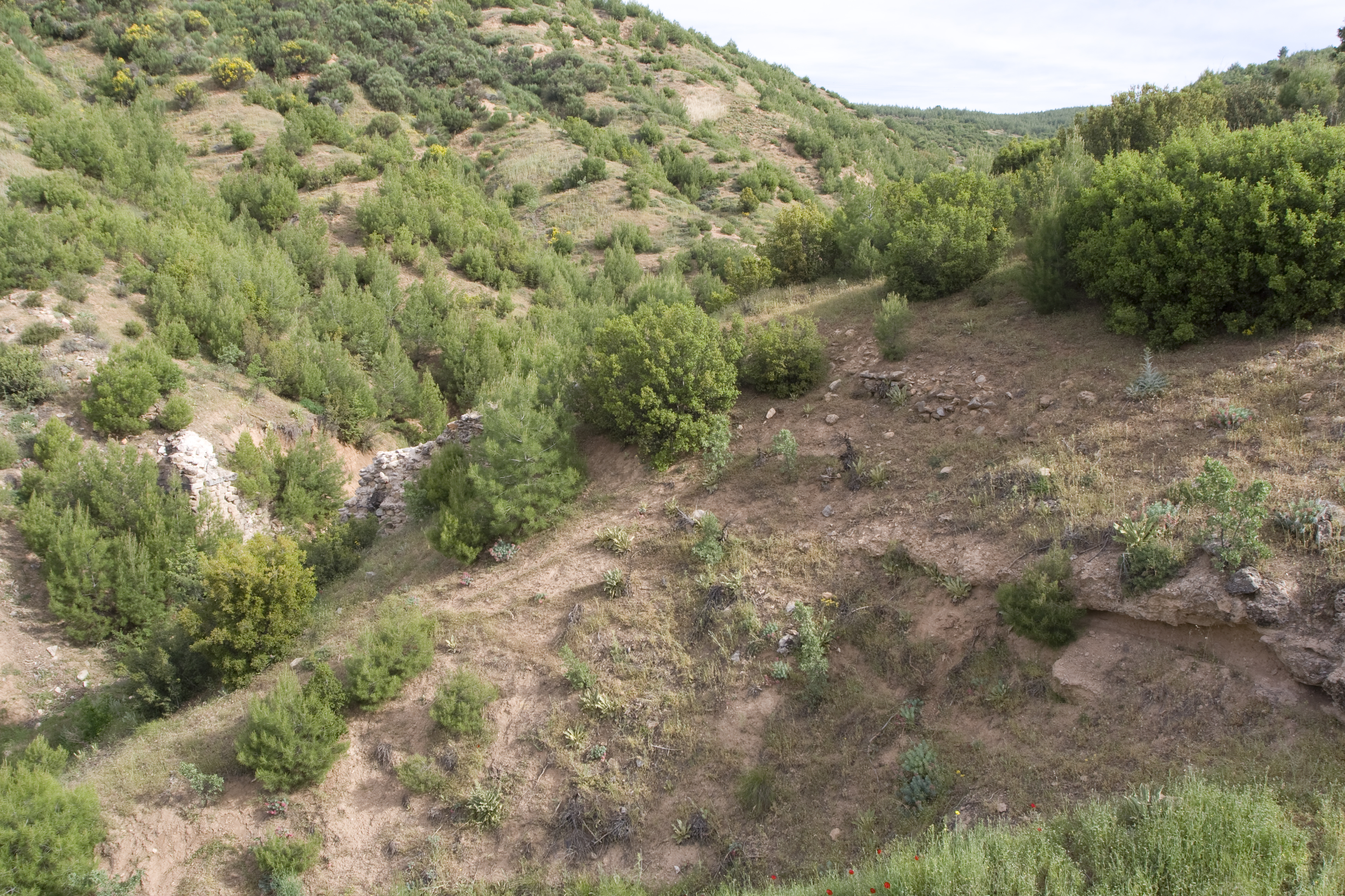
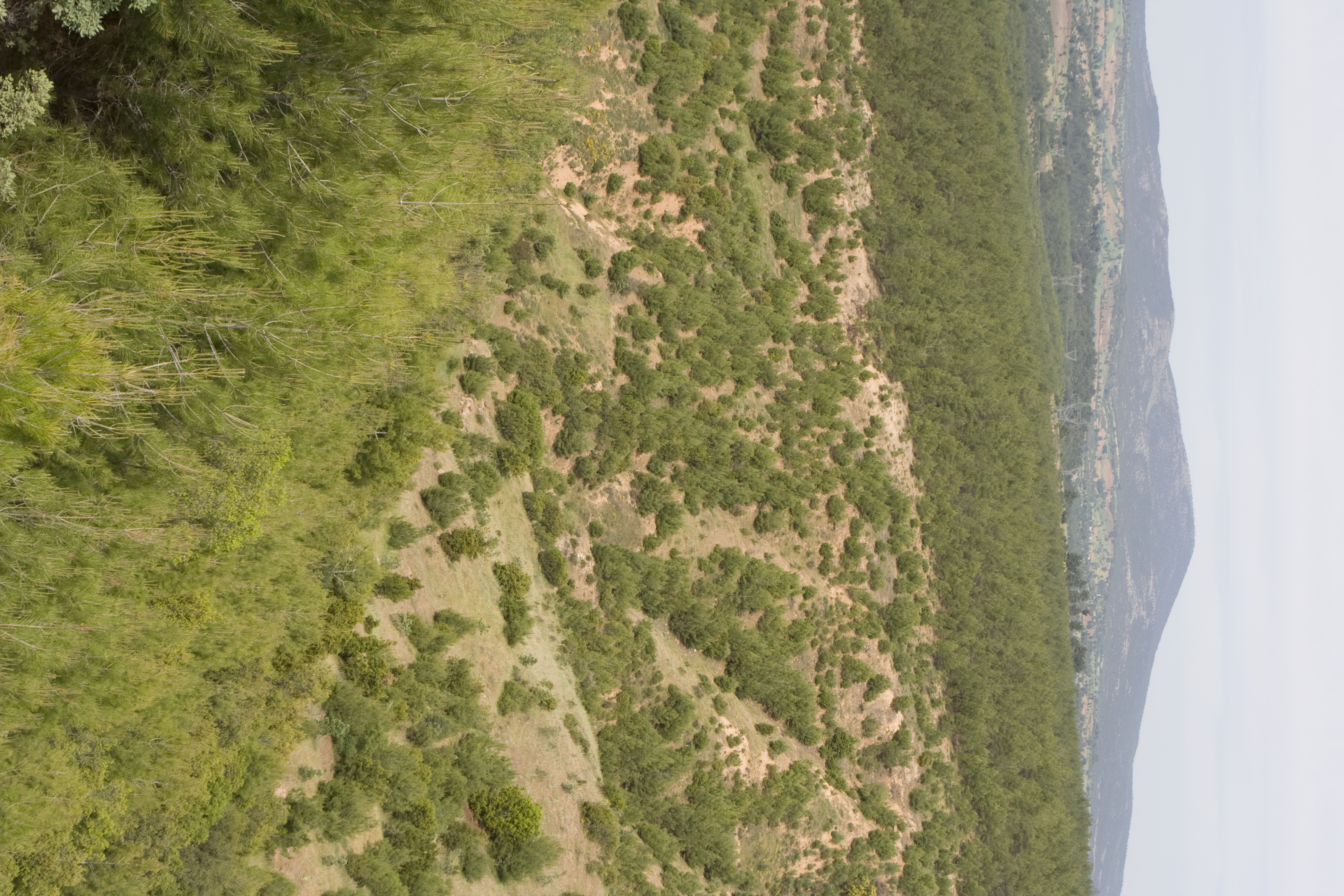
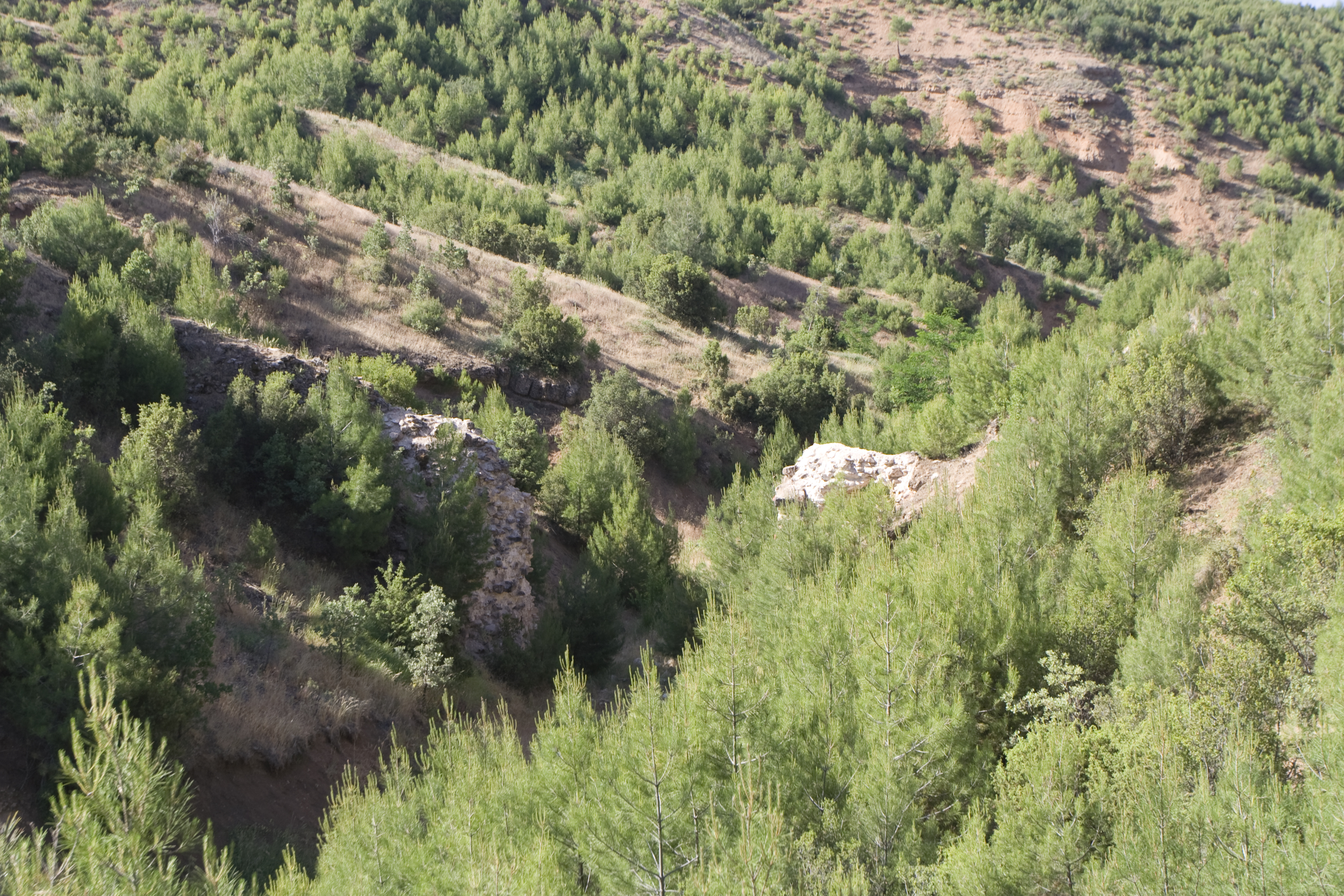
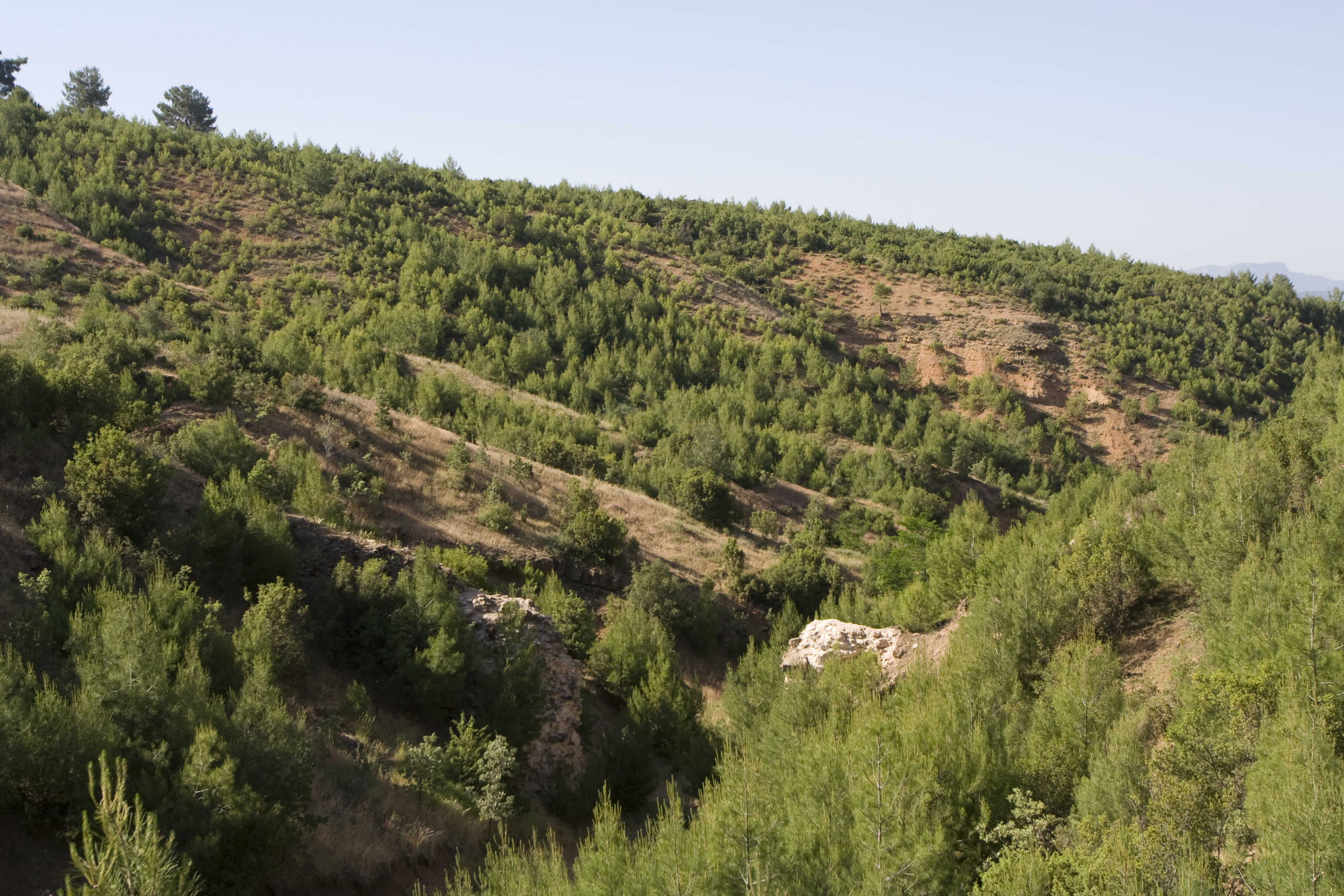
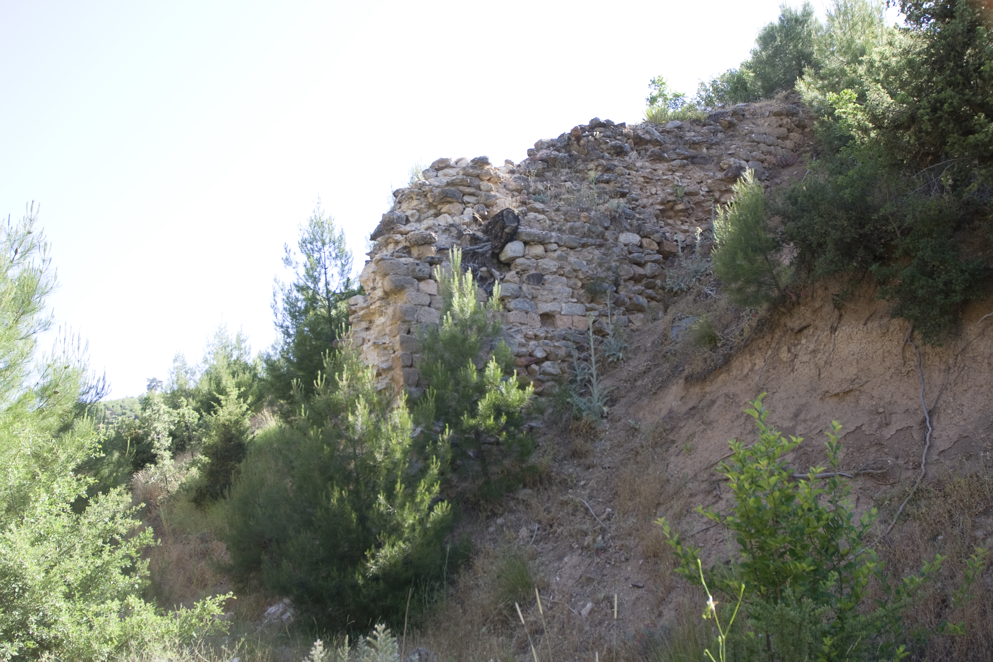
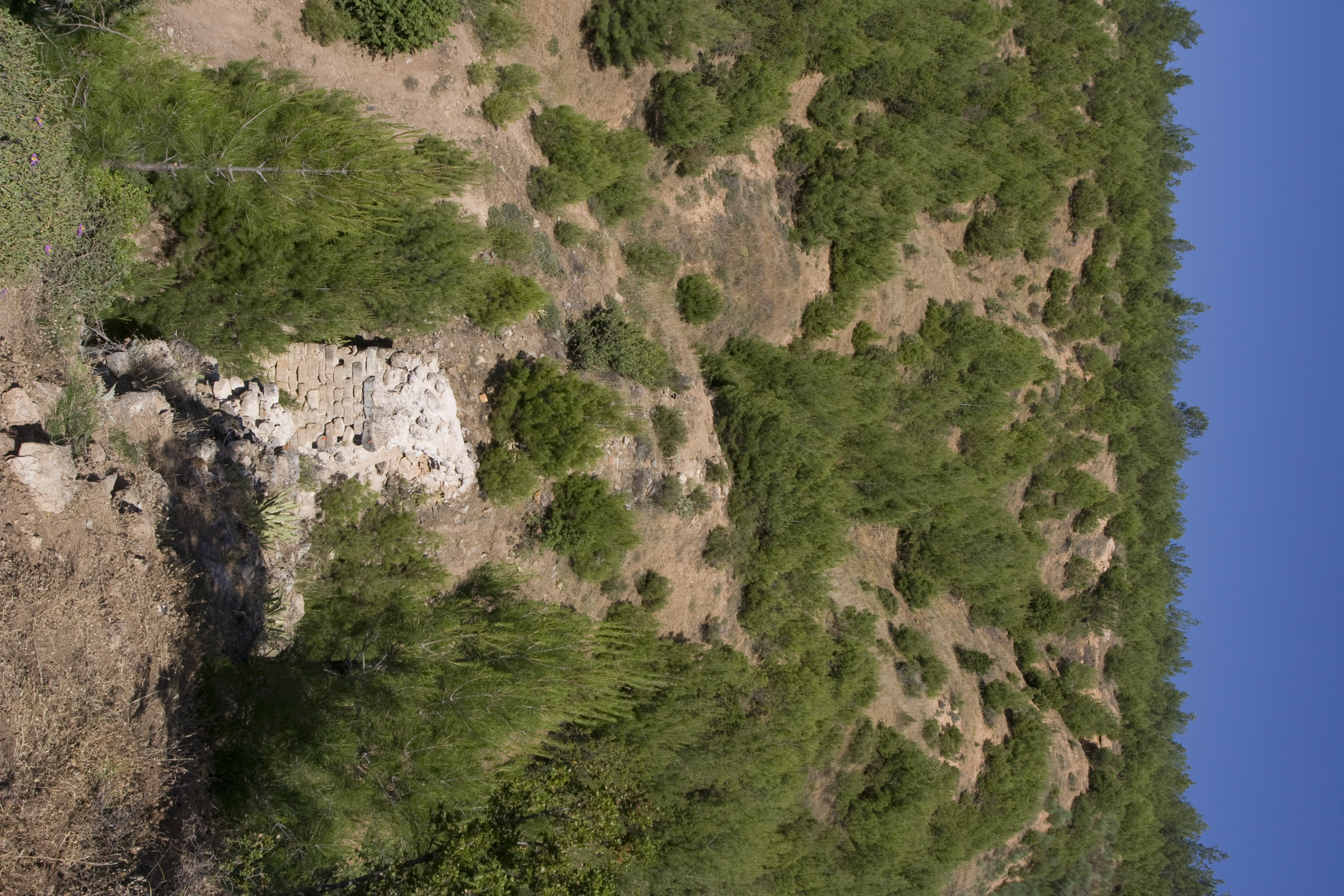
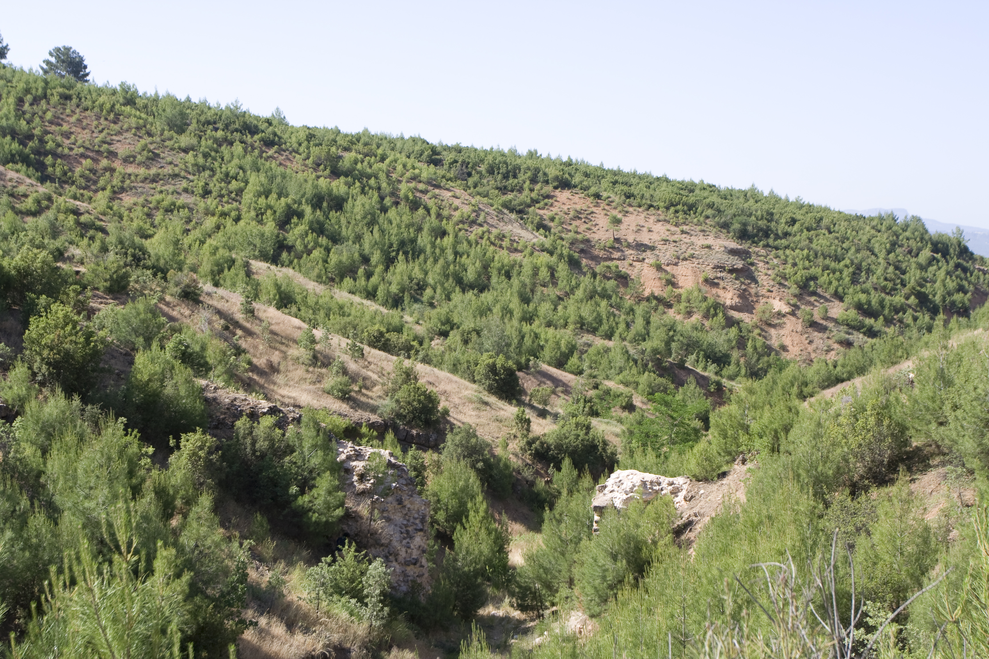
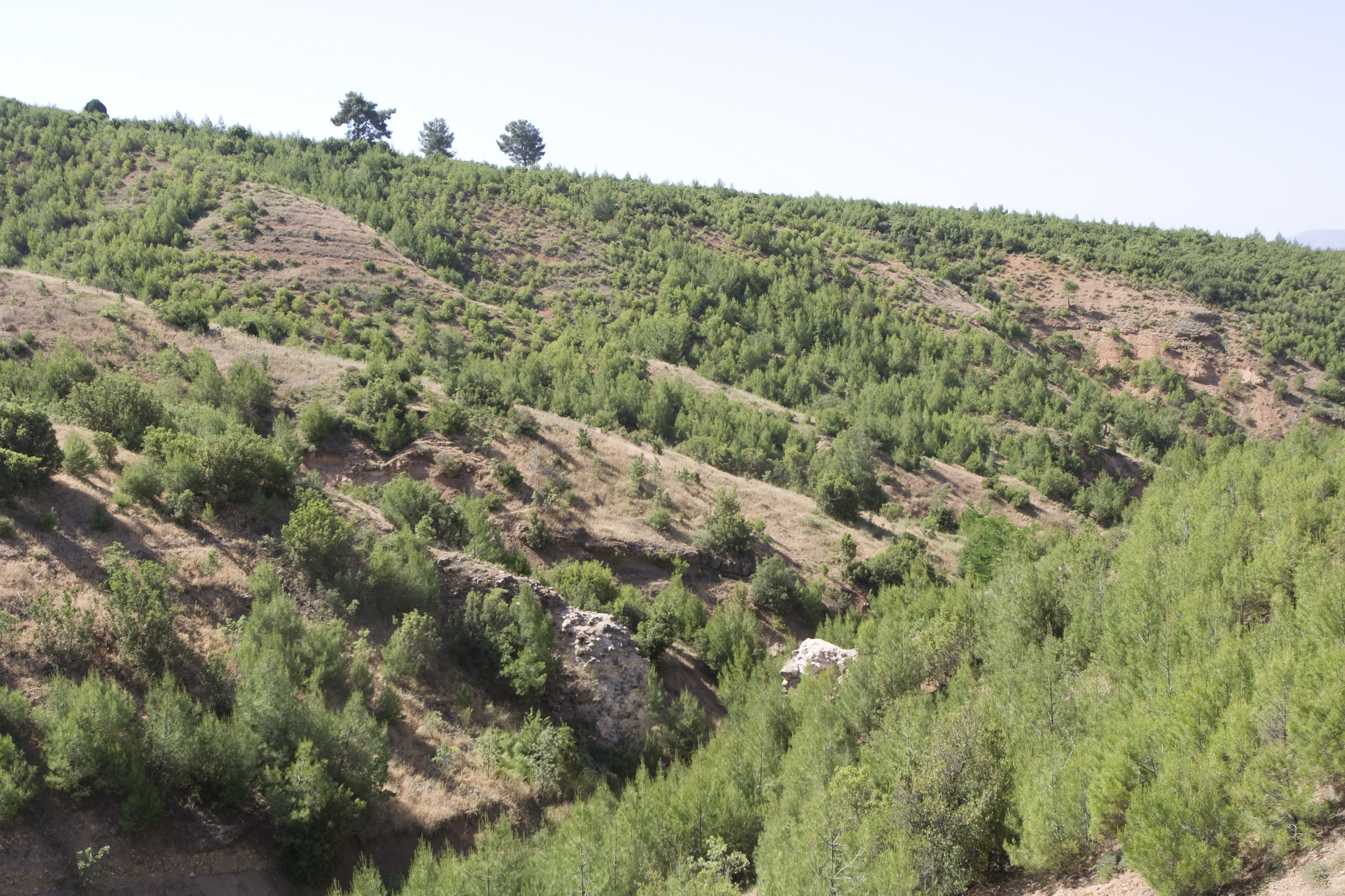
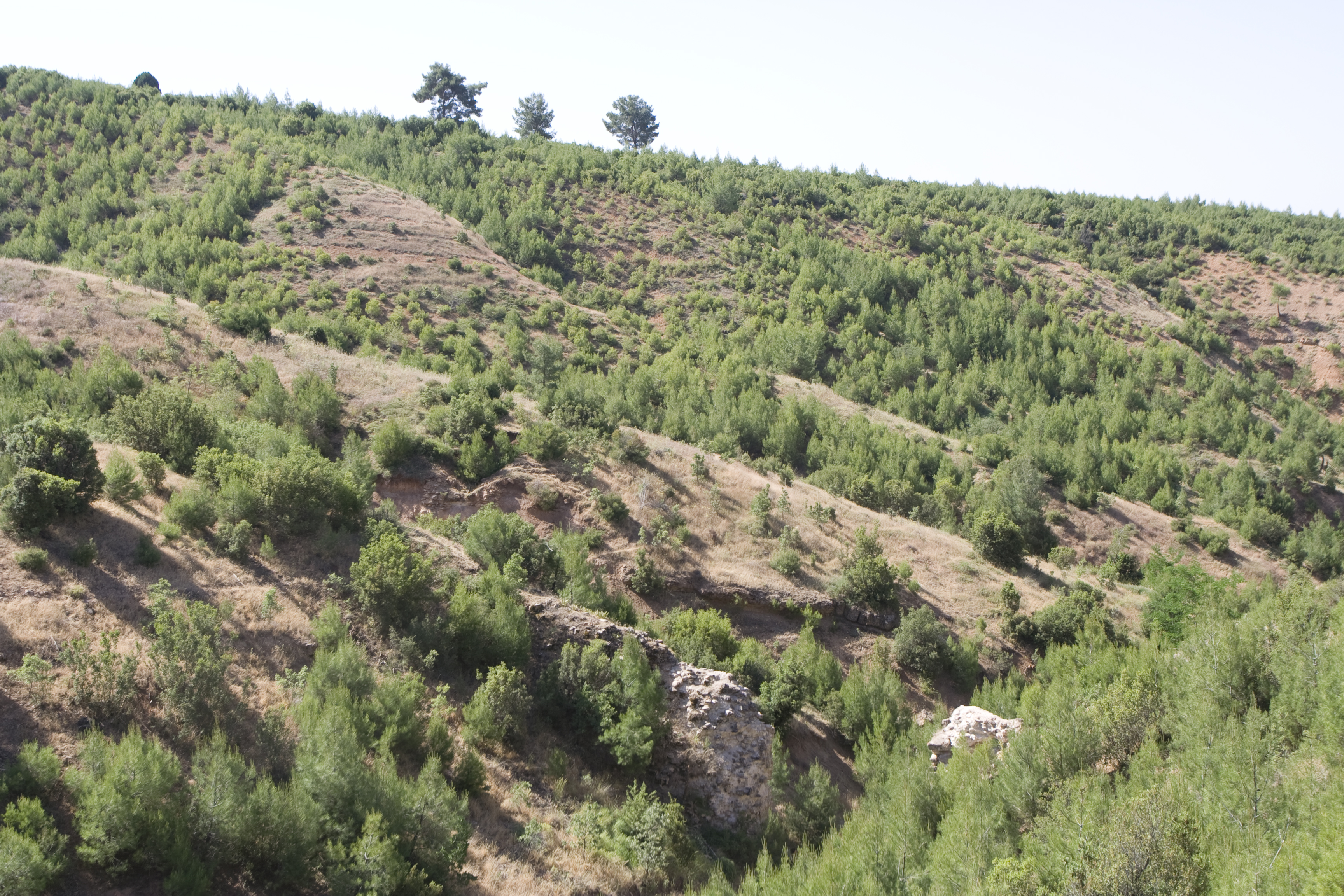
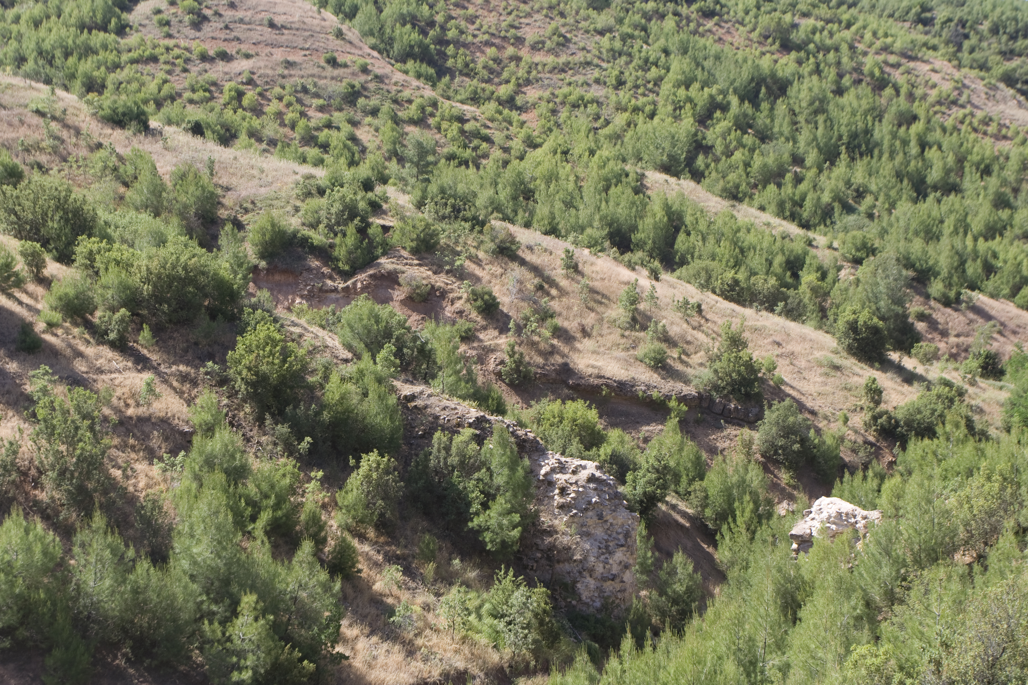
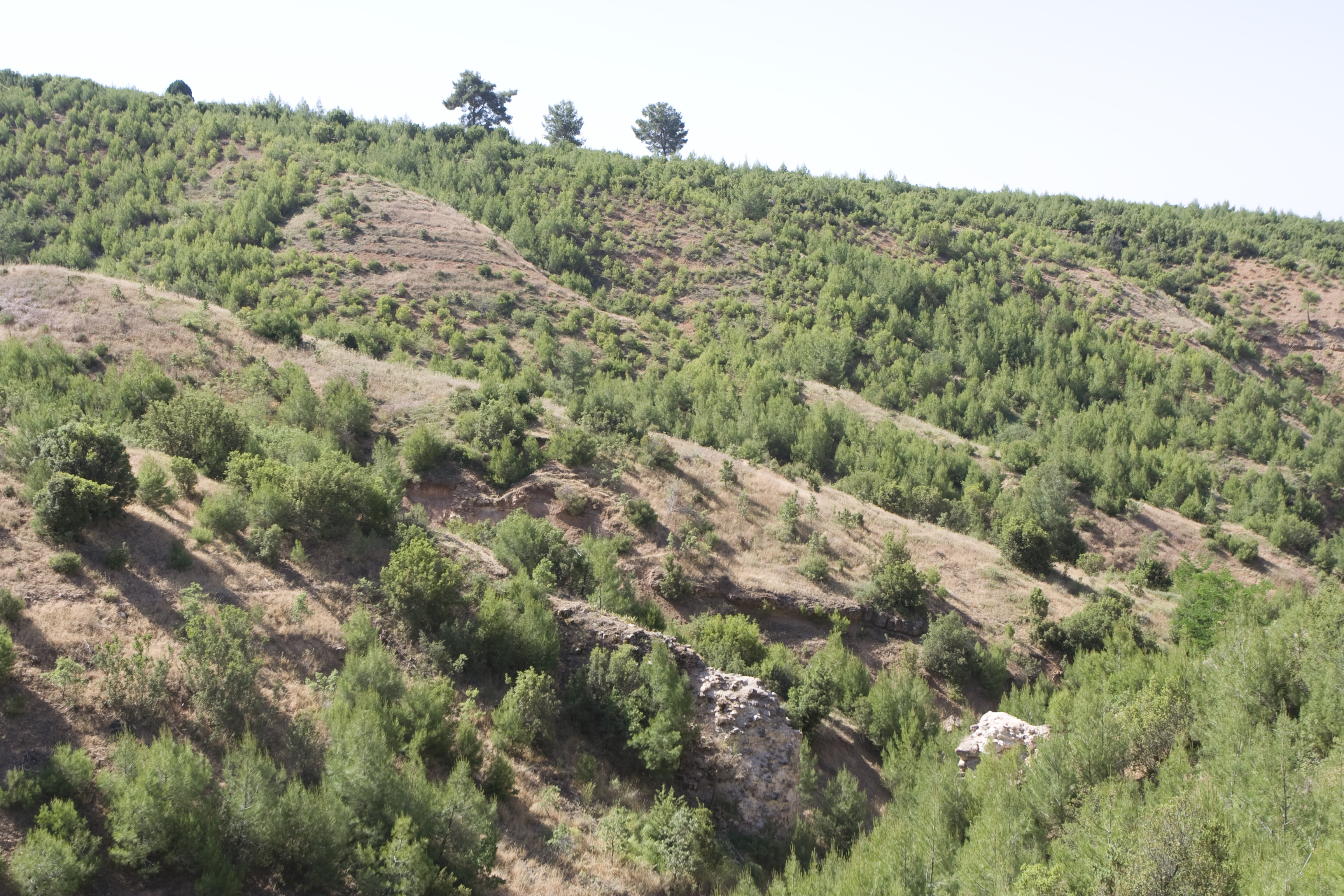
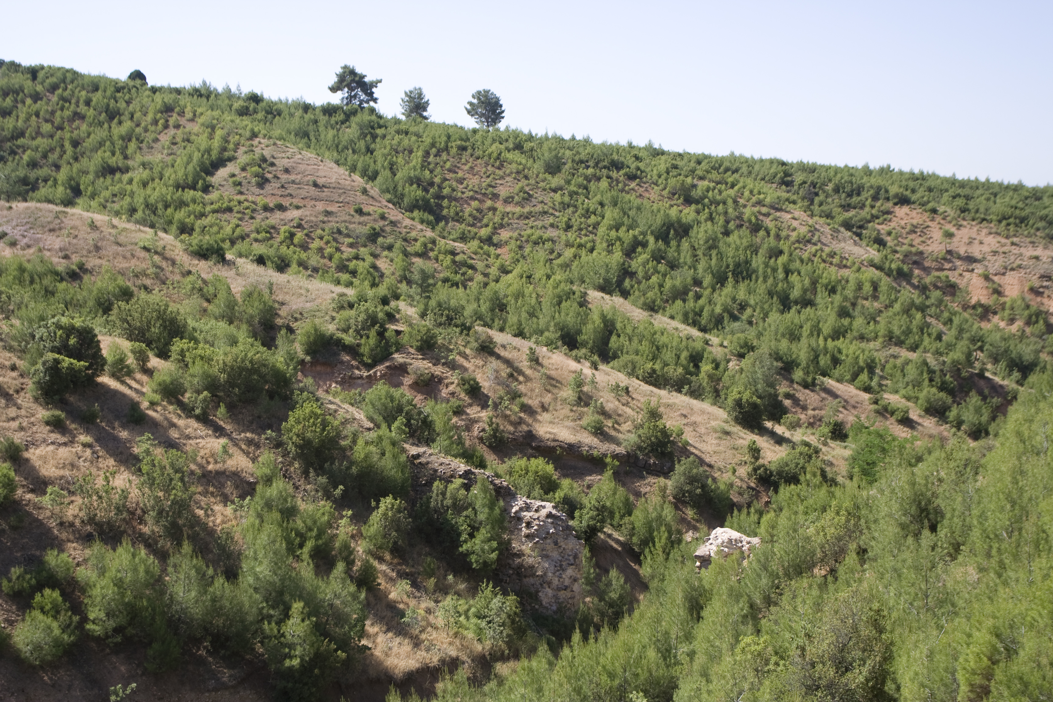
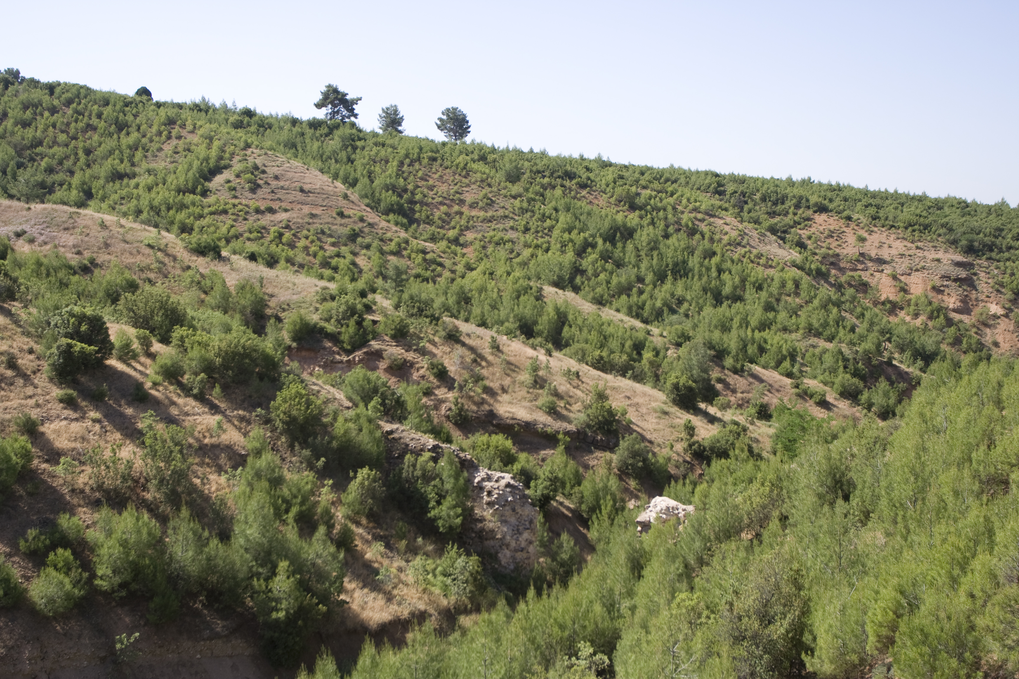
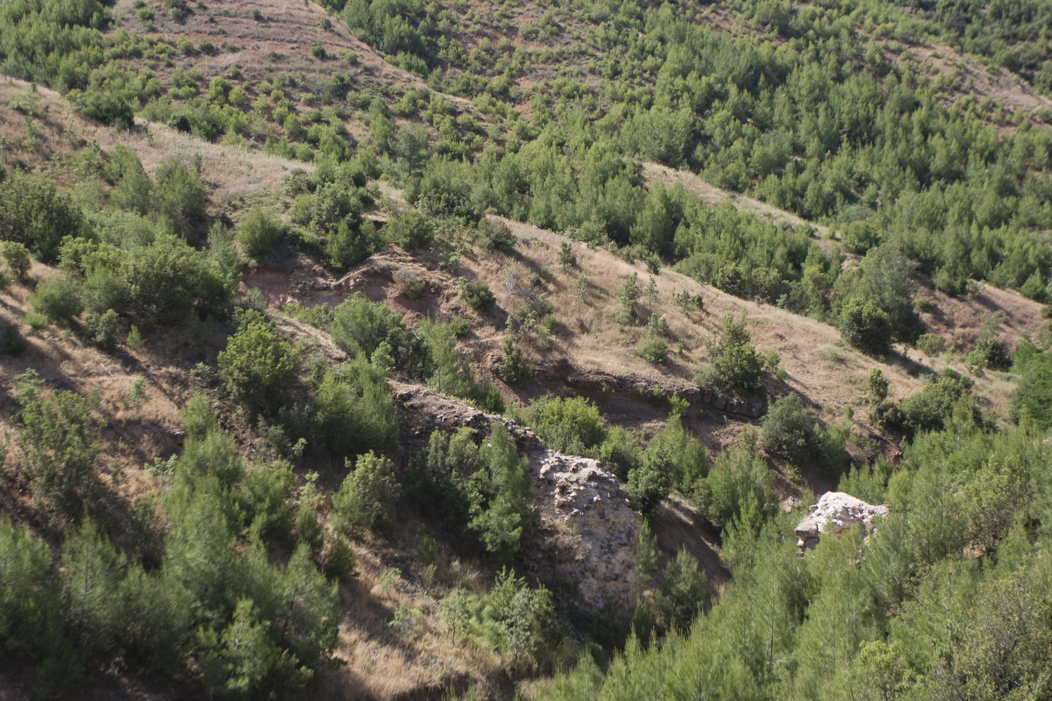
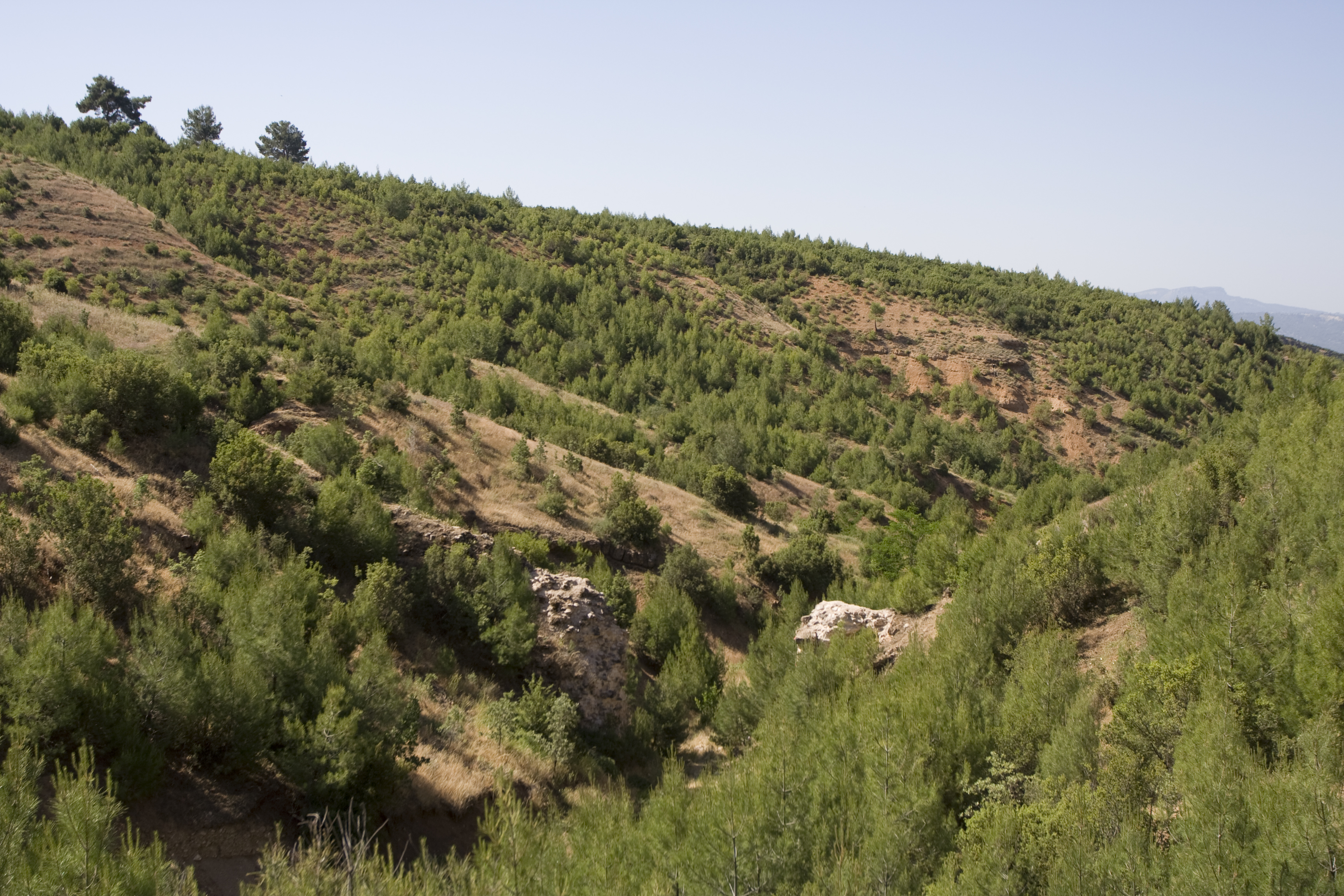
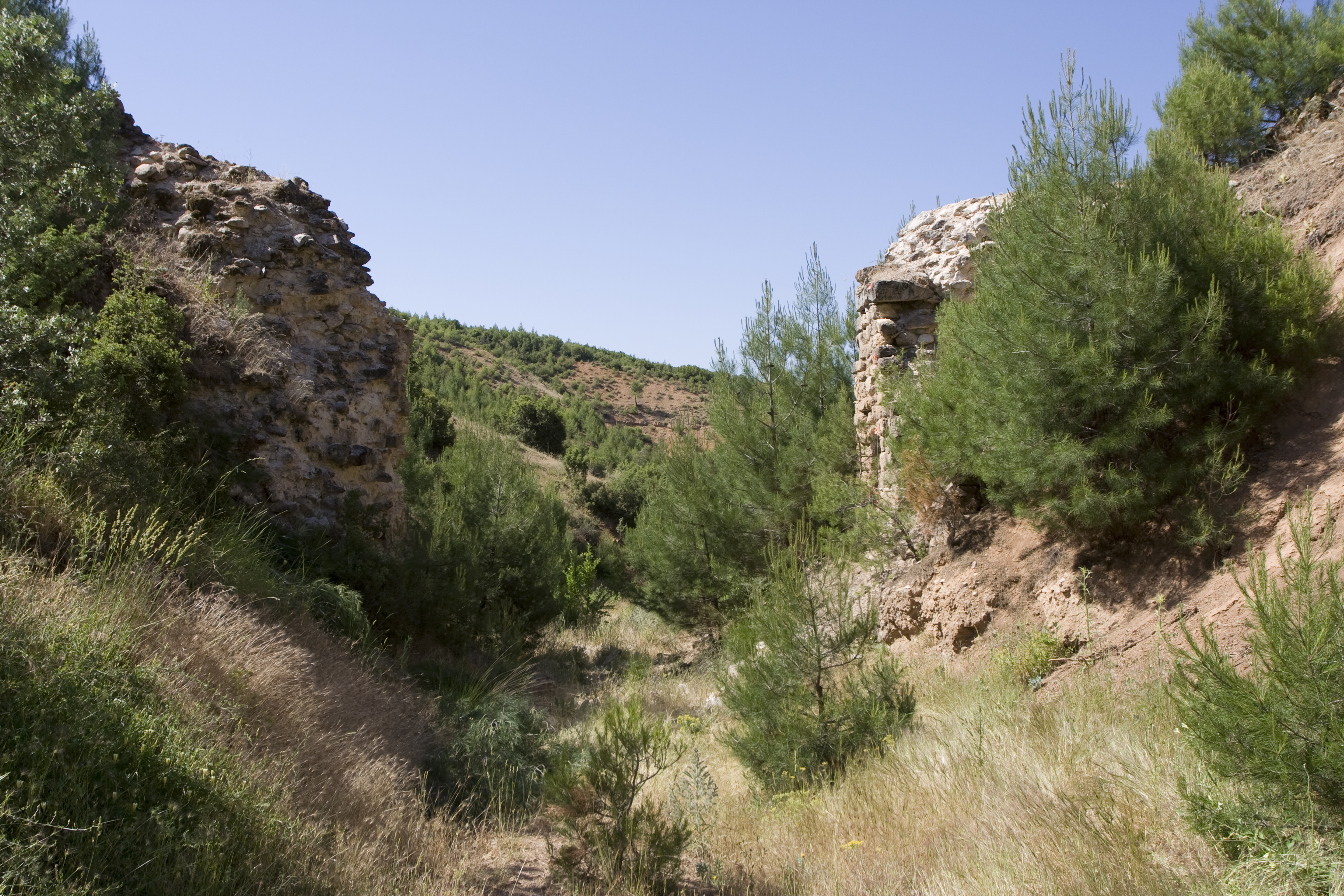
Local Name: Ciğlek Deresi Local Information: The remains of the bridge are located on both sides of the Ciğlek Deresi, a dry dere that runs north–south and connects to the Kepiz Çayı to the south. The Ciğlek Deresi forms the western limit of the Yahşiler plateau. The remains are located 4 km southwest of the modern village of Yahşiler, 2 km southeast of the modern village of Yes¸ilköy, and 16 km southeast of Aphrodisias. Latitude: 37.36.33.276 Longitude: 28.51.38.755 Elevation: 848.1m Axis: 105 Dimensions: p. H: 9 m; W (west pier): 5.2 m; p. L: 42 m ** Projected original H: 13.7 m ** Projected original H (conduit above streambed): 11.5 m ** Projected arch span: 6.2 m ** H (west pier base to bottom of leveling course): 3.6 m Description: Preservation: The arch of the bridge has collapsed, leaving two piers standing on either side of the Cig˘lek Deresi. The upper portions of the bridge have fallen as well, and the upstream (north) side of the piers is more heavily damaged than the downstream side, leaving a scatter of mortared rubble on the ground below. The west pier is better preserved than the east, which has preserved facing blocks mostly on the south side and only a few facing blocks in situ on its west and north faces. No clear trace of conduit remains, but its elevation can be reconstructed using the conduit section exposed nearby (E034, E035). ** Construction: The bridge is constructed of mortared rubble faced with petit appareil masonry. The facing blocks are carved from sandy conglomerate rock, fieldstones of quartz, and low-grade, gray-blue marble, all leveled with small chinking stones. The facing blocks are 0.15–0.60 m long and 0.15–0.30 m high. The blocks and rubble core are bonded with pink-beige lime mortar with stone inclusions smaller than 0.01 m. The blocks of the leveling course are 0.60–0.80 m long and 0.25–0.30 m high and are carved exclusively of low-grade, gray-blue marble. ** Description: The Roman bridge is preserved to a height of 9 m, a width of 5.2 m, and a length of 42 m. The base of the west pier is 5.2 m wide and is founded on an outcrop of sandy conglomerate rock. Approximately 18 courses up (3.6 m) from the base of the west pier is a leveling course. The arch originally spanned approximately 6.2 m to cross the dere.
Types
Other
Metadata
Show full item recordCollections
Remediation of Harmful Language
The University of Michigan Library aims to describe library materials in a way that respects the people and communities who create, use, and are represented in our collections. Report harmful or offensive language in catalog records, finding aids, or elsewhere in our collections anonymously through our metadata feedback form. More information at Remediation of Harmful Language.
Accessibility
If you are unable to use this file in its current format, please select the Contact Us link and we can modify it to make it more accessible to you.