 Access by request
E058: Timeles Aqueduct, Gümüş (Korkor) Dere Bridge
Aphrodisias Regional Survey
2008-06-15
View/


Citation
Page reference: Christopher Ratté and Peter D. De Staebler (eds.). Aphrodisias V. The Aphrodisias Regional Survey (Verlag Philipp von Zabern: Darmstadt/Mainz, 2012), 253, 274, 277, 284, 304 - Book catalogue no.: Aqueducts cat. 6. <http://hdl.handle.net/2027.42/92992>
Other Identifiers
E058
Subjects
Waterworks 4: Roman
Description
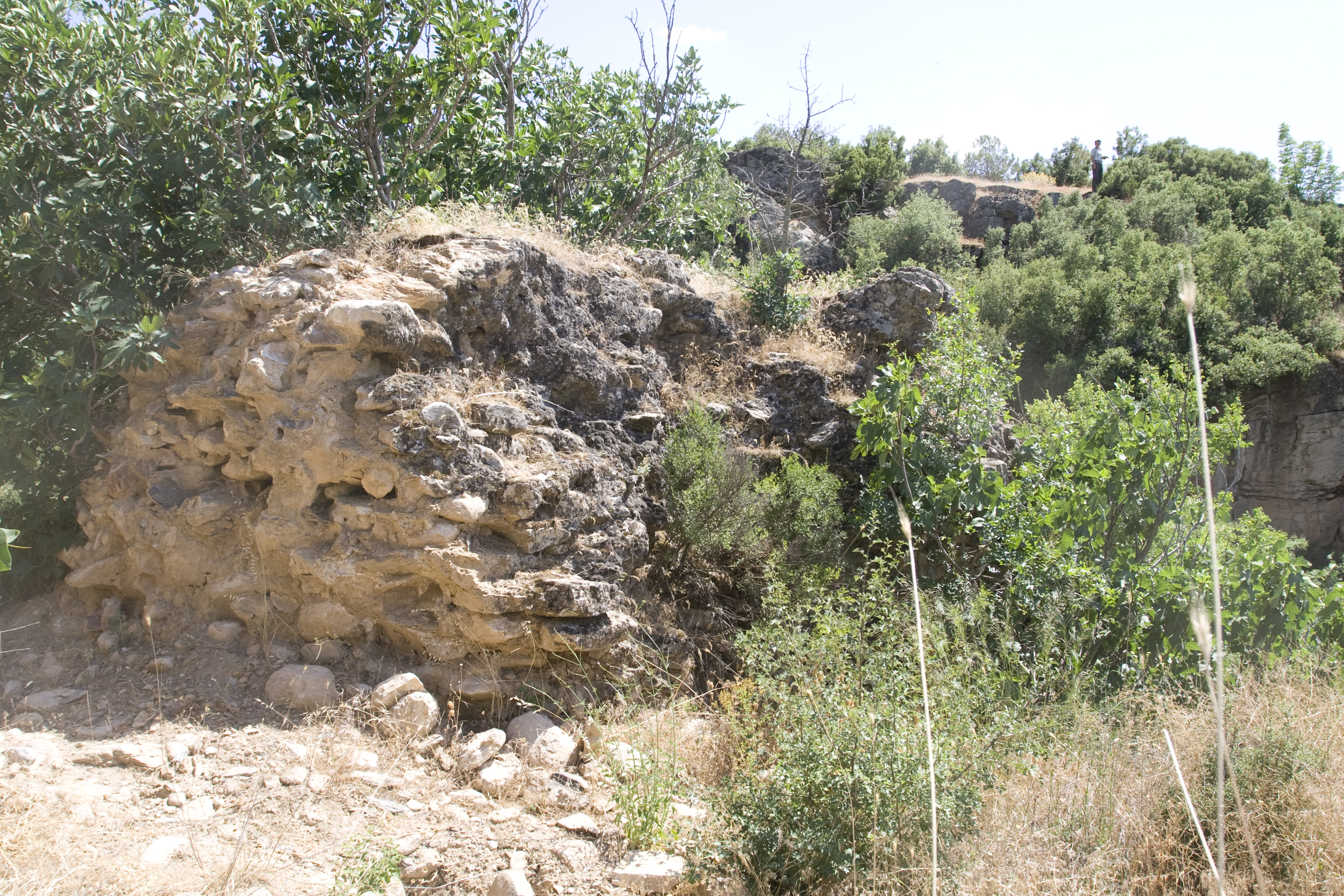
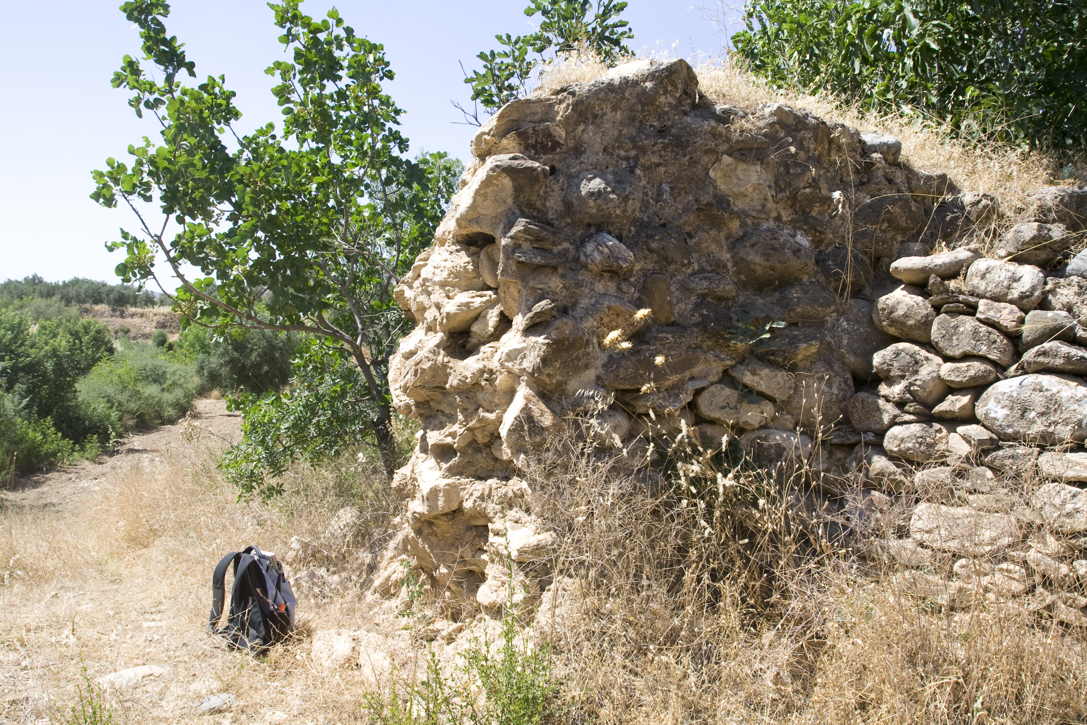
Local Name: Gümüş Deresi Local Informant: Osman Güzel Local Information: The remains of the bridge are located on the north bank of Gümüş (Korkor) Deresi, a tributary of the Morsynus river. The bridge is located 2 km southwest of the modern village of Seki, 2.8 km southeast of the modern town of Ataeymir, and 6.3 km southeast of Aphrodisias. Latitude: 37.41.13.3 Longitude: 28.47.27.1 Elevation: 626 Dimensions: p. H (north pier): 4.8 m ** p. W (north pier): 3.5 m ** p. L (north pier): 12 m Description: Preservation: Only one pier of the bridge remains standing, located on the north bank of the dere. In contrast to the other bridges, this one is better preserved on its upstream (east) side. The length of the pier has been cut in two to accommodate a dirt road parallel with the stream. Nothing remains of the conduit. ** Construction: The bridge is constructed of mortared rubble faced with petit appareil masonry. The rounded fieldstones that comprise the structure are not as internally consistent in shape and size as those of the other bridges along the aqueduct, and many of the facing blocks are larger than those of the other bridges. One large facing block preserved on the south side of the pier facing the dere is 0.60 m long, 0.25 m high, and 0.50 m deep. The lime mortar is gray with densely ** packed stone inclusions smaller than 0.02 m. ** Description: The pier is preserved to a height of 4.8 m, a width of 3.5 m, and a length of 12 m. The pier rests on a rock outcrop forming the bank of the dere. The pier extends to the north into agricultural fields, where it is no longer traceable.
Types
Other
Metadata
Show full item recordCollections
Remediation of Harmful Language
The University of Michigan Library aims to describe library materials in a way that respects the people and communities who create, use, and are represented in our collections. Report harmful or offensive language in catalog records, finding aids, or elsewhere in our collections anonymously through our metadata feedback form. More information at Remediation of Harmful Language.
Accessibility
If you are unable to use this file in its current format, please select the Contact Us link and we can modify it to make it more accessible to you.