 Access by request
E059: Timeles Aqueduct, Seki Deresi Bridge
| dc.contributor.author | Aphrodisias Regional Survey | en_US |
| dc.date.accessioned | 2012-08-24T18:57:30Z | |
| dc.date.available | 2012-08-24T18:57:30Z | |
| dc.date.issued | 2008-06-15 | en_US |
| dc.identifier.citation | Page reference: Christopher Ratté and Peter D. De Staebler (eds.). Aphrodisias V. The Aphrodisias Regional Survey (Verlag Philipp von Zabern: Darmstadt/Mainz, 2012), 274, 275, 280, 304 - Book catalogue no.: Aqueducts cat. 6. <http://hdl.handle.net/2027.42/92993> | en_US |
| dc.identifier.other | E059 | en_US |
| dc.identifier.uri | https://hdl.handle.net/2027.42/92993 | |
| dc.description | Local Name: Seki Deresi | en_US |
| dc.description | Local Informant: Osman Güzel | en_US |
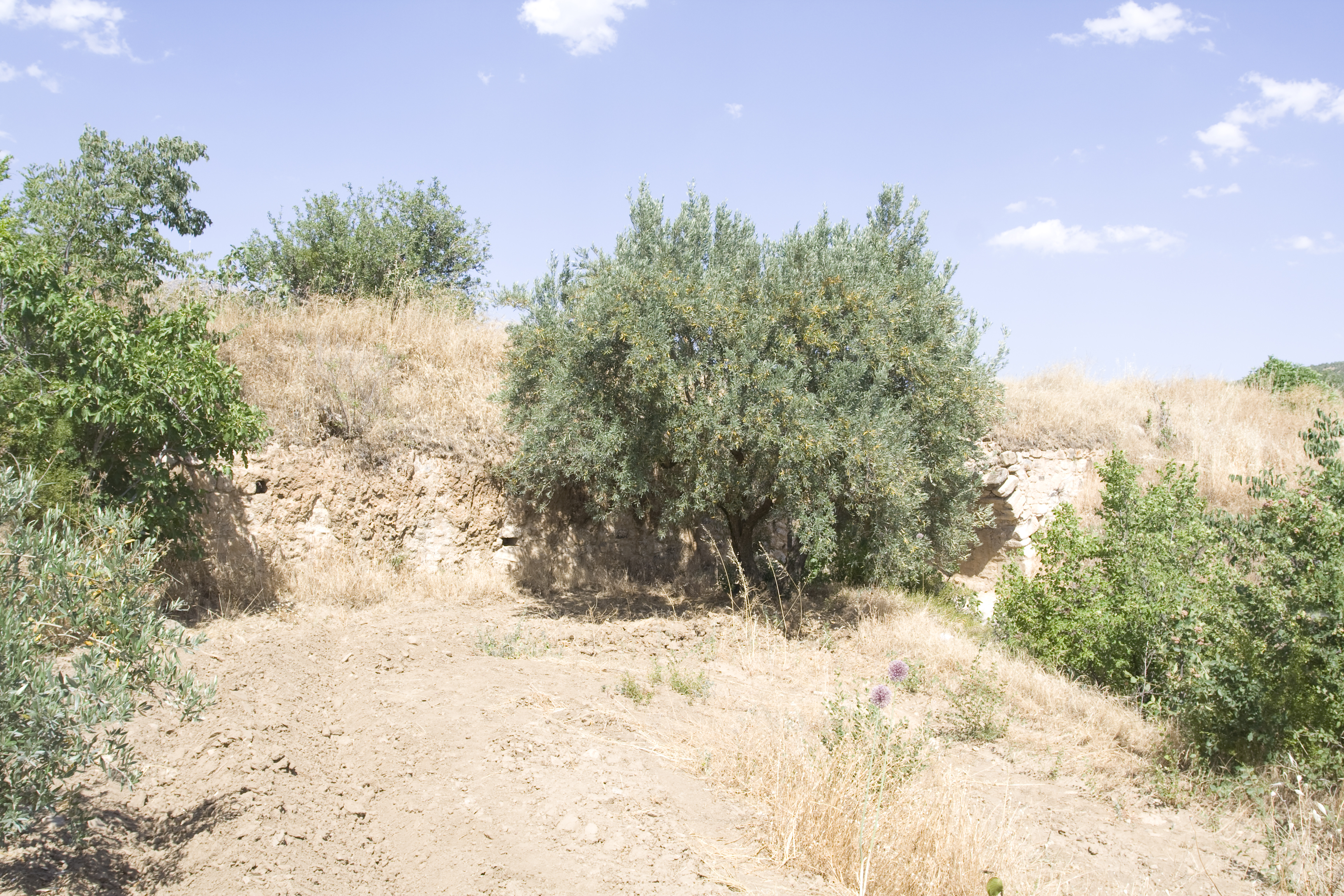
| dc.description | Local Information: The remains of the bridge are located on the north bank of Seki Deresi, a tributary of the Morsynus river. The bridge is located 2.1 km southwest of the modern village of Seki, 2.5 km southeast of the modern town of Ataeymir, and 6 km southeast of Aphrodisias. | en_US |
| dc.description | Latitude: 37.41.19.4 | en_US |
| dc.description | Longitude: 28.47.14.1 | en_US |
| dc.description | Elevation: 617 (streambed) | en_US |
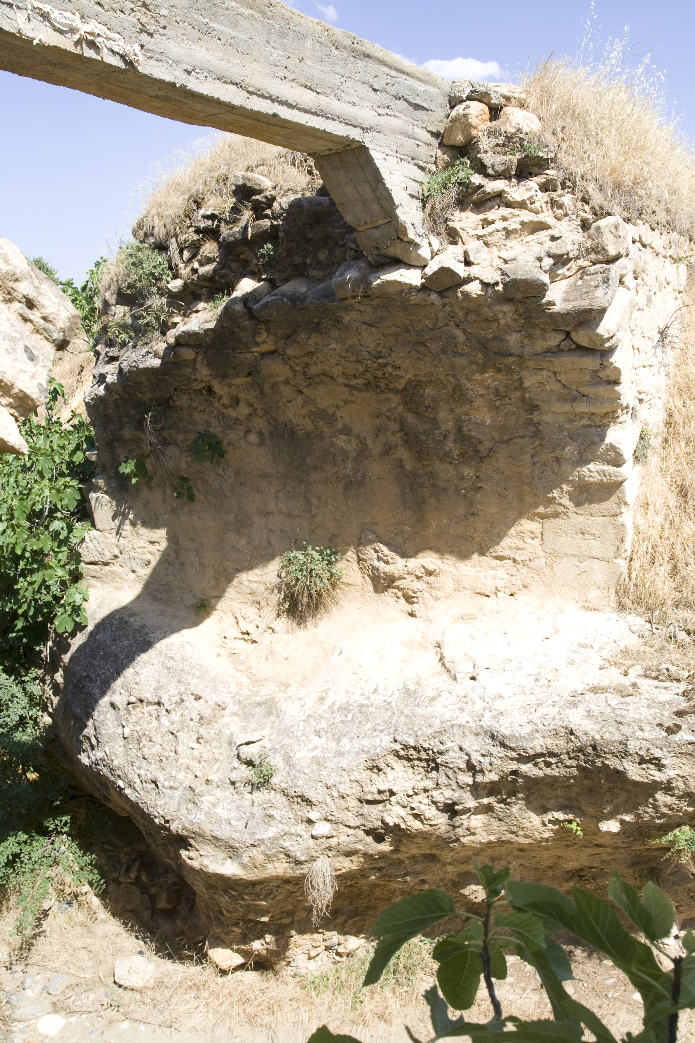
| dc.description | Dimensions: p. H (east pier): 3.5 m ** W: 5.2 m ** p. L: 50 m ** Projected original H: 11 m ** Projected original L: more than 50 m ** Projected original H (conduit above streambed): 9 m ** p. arch span: 5.8 m | en_US |
| dc.description | Description: Preservation: The lower courses of both sides of the arch are well preserved, but the upper portions of the arch and both piers have been cut down to serve as a substructure to support a modern concrete irrigation channel. The upstream (north) side has suffered more damage than the downstream side. Nothing remains of the conduit. ** Construction: The bridge is constructed of mortared rubble faced with petit appareil masonry. The facing blocks are 0.15–0.60 m long and 0.15–0.30 m high, and most are worked from locally available materials such as sandstone, quartz, and, occasionally, marble. The voussoirs include both fieldstones and marble blocks, which range in size from 0.30 to 0.60 m long, 0.10 to 0.25 m wide, and 0.20 to 0.60 m deep. ** Description: The bridge is preserved to a height of 3.5 m, a width of 5.2 m, and a length of 50 m. Both piers are founded on the bedrock forming the banks of the dere. At its east and west extremities, the structure is buried under agricultural fields. The west pier alone extends 34 m from the stream bed before disappearing into the ground. At about 10 m from the stream bed, the west pier is pierced by a drainage conduit included as part of the original structure. The arch, which has only a single layer of voussoirs, spans 5.8 m. Three levels of voussoirs up from the bottom of the arch, putlog holes punctuate the south face of each pier, about 0.20 m back from the curved sides of the arch facing each other across the stream. Two stacked levels of putlog holes spaced erratically are visible along the entire south face of the west pier. | en_US |
| dc.subject | Waterworks | en_US |
| dc.subject | 4: Roman | en_US |
| dc.subject | 8: Modern | en_US |
| dc.title | E059: Timeles Aqueduct, Seki Deresi Bridge | en_US |
| dc.type | Other | en_US |
| dc.subject.hlbsecondlevel | Archaeology | en_US |
| dc.subject.hlbtoplevel | Social Sciences | en_US |
| dc.description.bitstreamurl | http://deepblue.lib.umich.edu/bitstream/2027.42/92993/1/D2008.1775.JPG | |
| dc.description.bitstreamurl | http://deepblue.lib.umich.edu/bitstream/2027.42/92993/2/D2008.1776.JPG | |
| dc.description.bitstreamurl | http://deepblue.lib.umich.edu/bitstream/2027.42/92993/3/D2008.1777.JPG | |
| dc.description.bitstreamurl | http://deepblue.lib.umich.edu/bitstream/2027.42/92993/4/D2008.1778.JPG | |
| dc.description.bitstreamurl | http://deepblue.lib.umich.edu/bitstream/2027.42/92993/5/D2008.1779.JPG | |
| dc.description.bitstreamurl | http://deepblue.lib.umich.edu/bitstream/2027.42/92993/6/D2008.1780.JPG | |
| dc.description.bitstreamurl | http://deepblue.lib.umich.edu/bitstream/2027.42/92993/7/D2008.1781.JPG | |
| dc.description.bitstreamurl | http://deepblue.lib.umich.edu/bitstream/2027.42/92993/8/D2008.1782.JPG | |
| dc.description.bitstreamurl | http://deepblue.lib.umich.edu/bitstream/2027.42/92993/9/D2008.1783.JPG | |
| dc.description.bitstreamurl | http://deepblue.lib.umich.edu/bitstream/2027.42/92993/10/D2008.1784.JPG | |
| dc.description.bitstreamurl | http://deepblue.lib.umich.edu/bitstream/2027.42/92993/11/RS39.JPG | |
| dc.owningcollname | Aphrodisias Regional Survey |
Files in this item
Remediation of Harmful Language
The University of Michigan Library aims to describe library materials in a way that respects the people and communities who create, use, and are represented in our collections. Report harmful or offensive language in catalog records, finding aids, or elsewhere in our collections anonymously through our metadata feedback form. More information at Remediation of Harmful Language.
Accessibility
If you are unable to use this file in its current format, please select the Contact Us link and we can modify it to make it more accessible to you.