 Access by request
F073: Çamova Tepe Quarries
Aphrodisias Regional Survey
2008-06-15
View/


Citation
Page reference: Christopher Ratté and Peter D. De Staebler (eds.). Aphrodisias V. The Aphrodisias Regional Survey (Verlag Philipp von Zabern: Darmstadt/Mainz, 2012), 201 - Book catalogue no.: Quarries cat. 8. <http://hdl.handle.net/2027.42/93074>
Other Identifiers
F073
Subjects
Quarries 4: Roman
Description
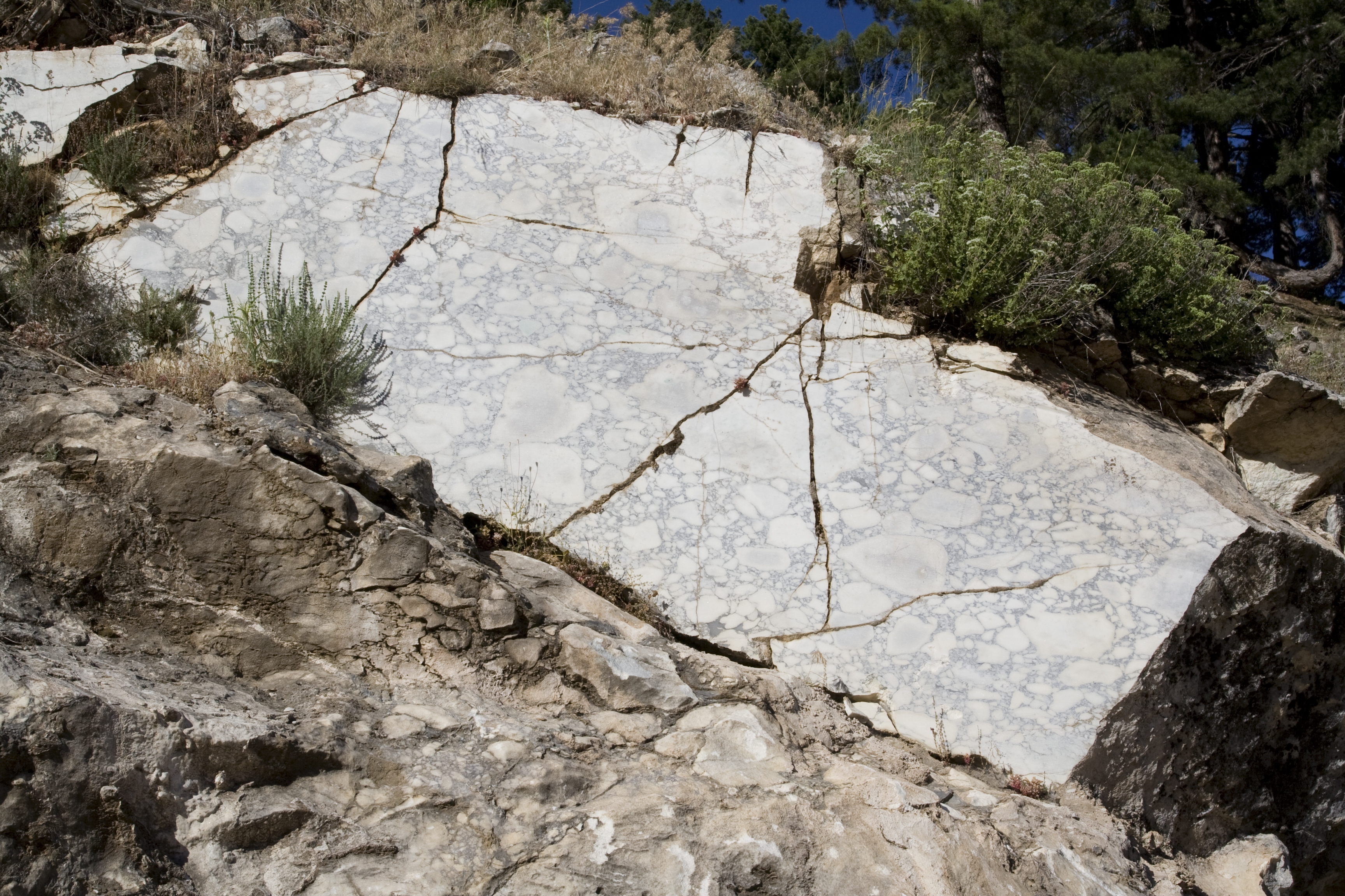
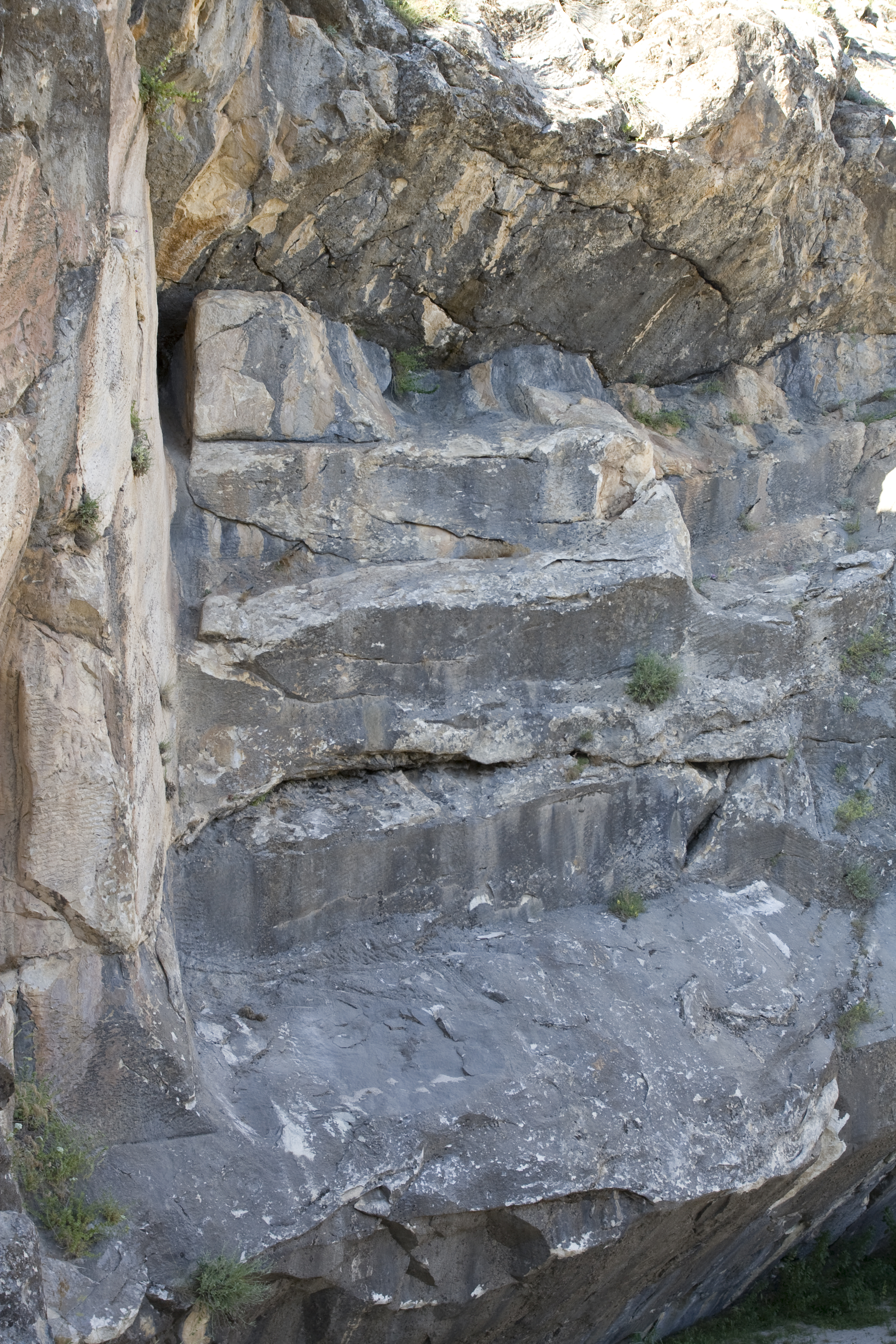
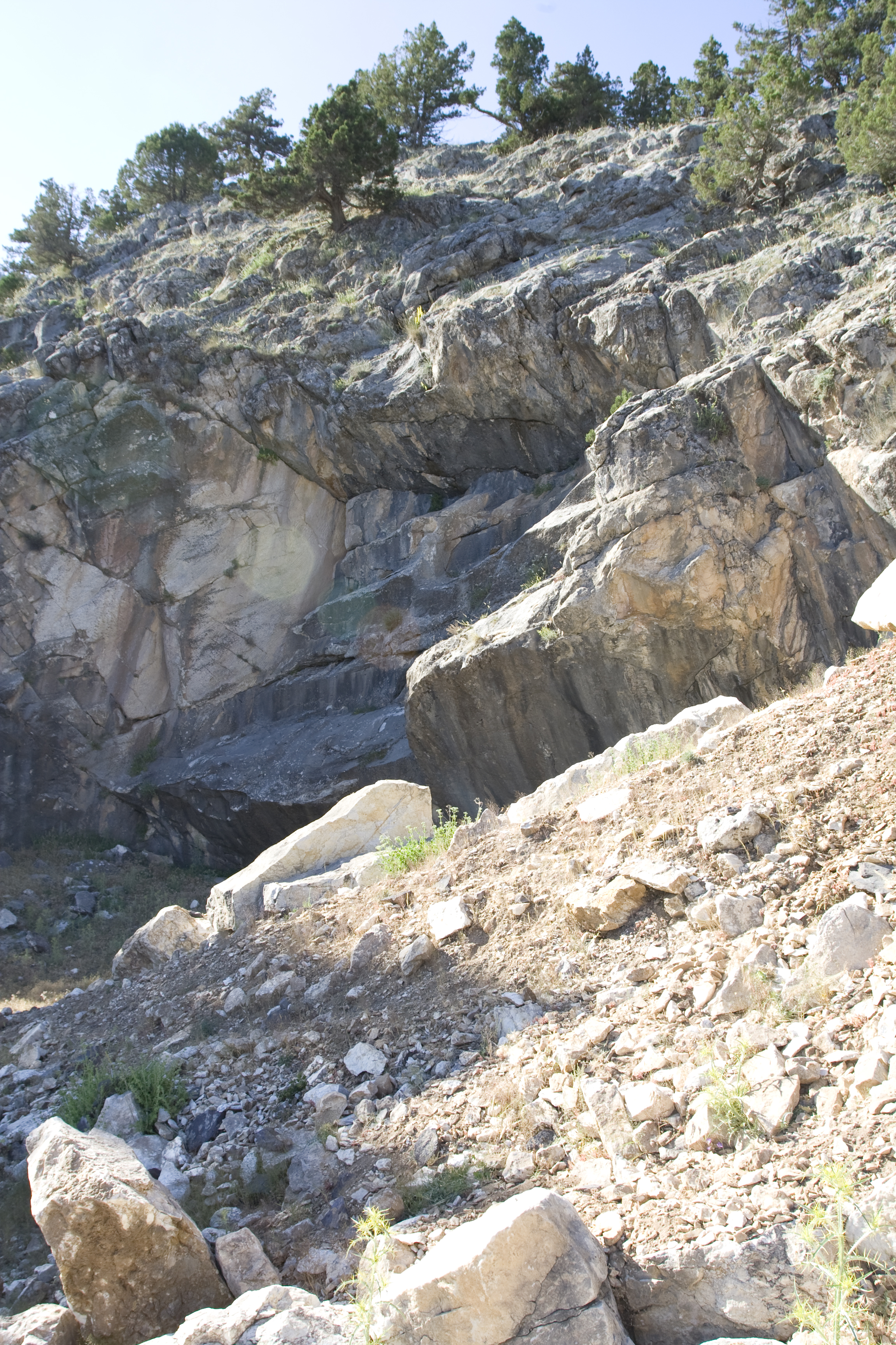
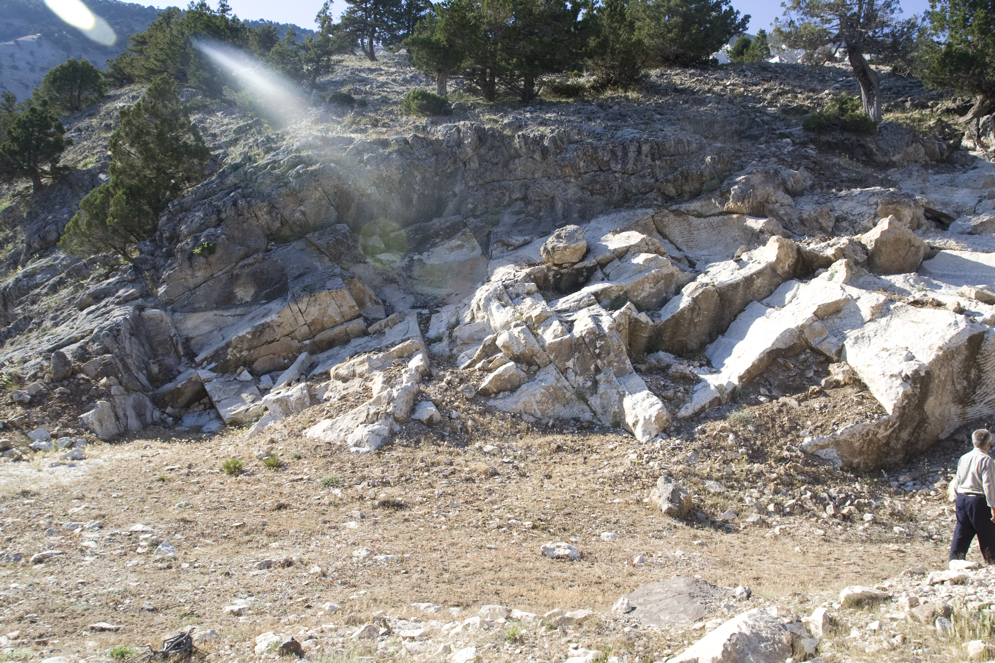
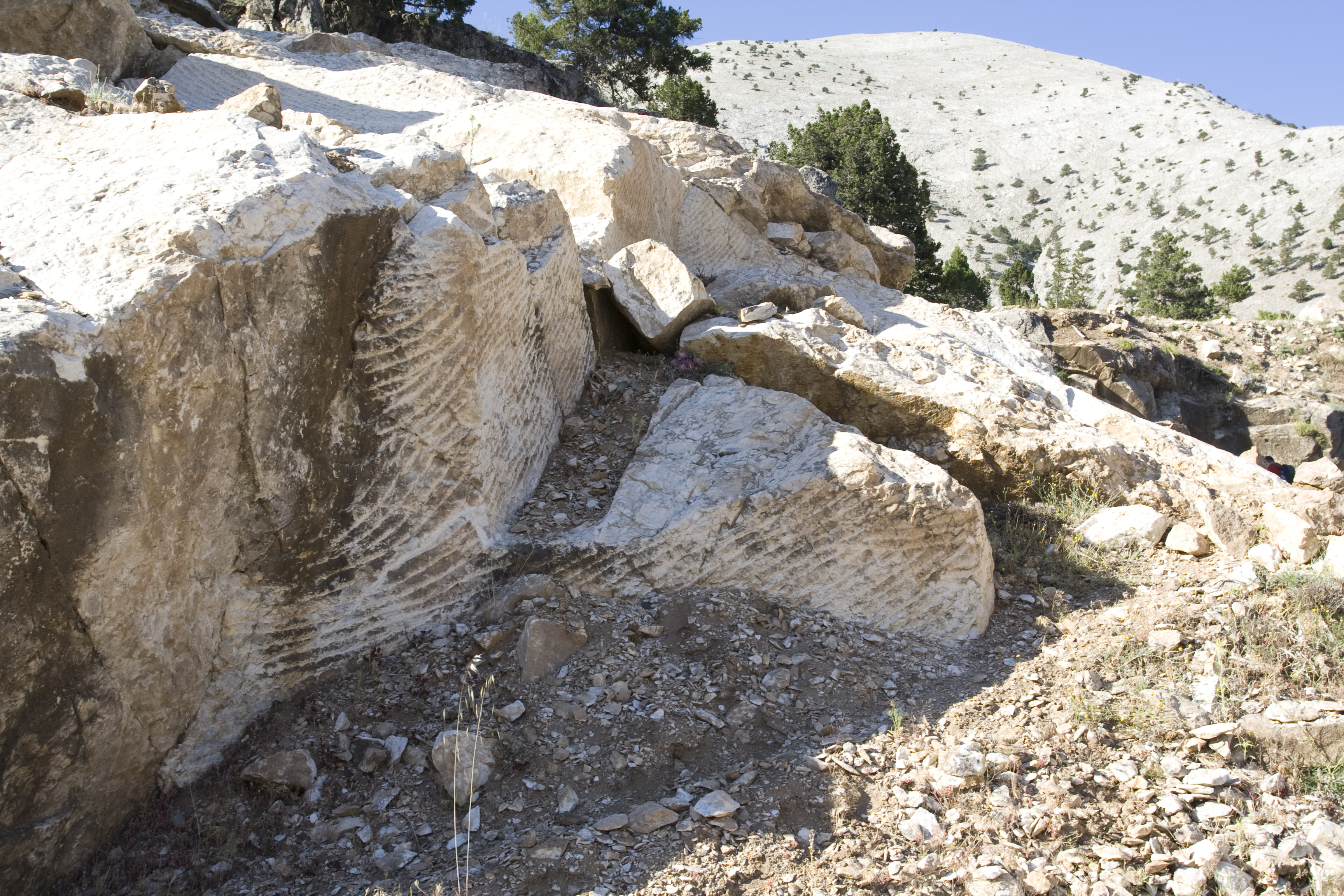
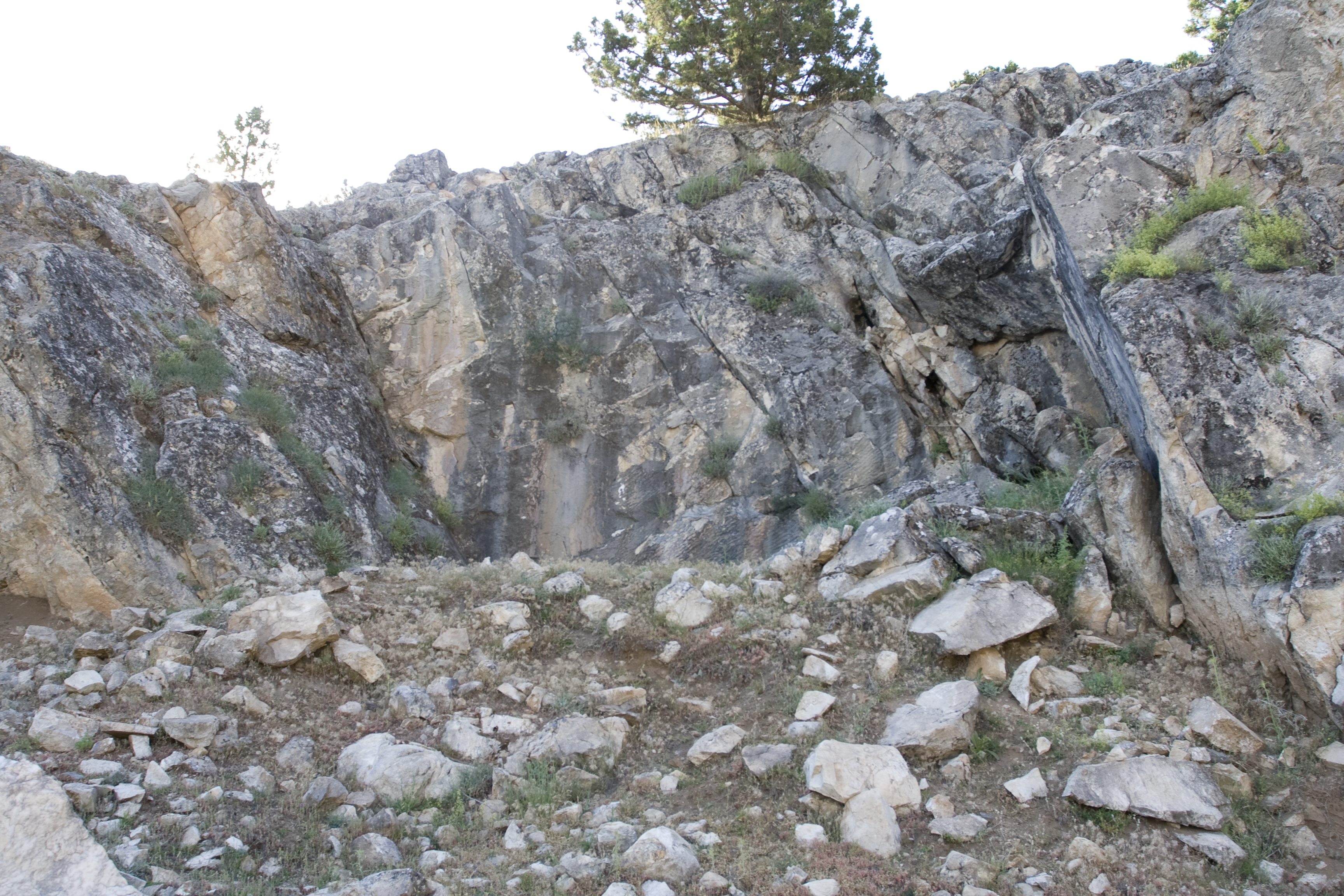
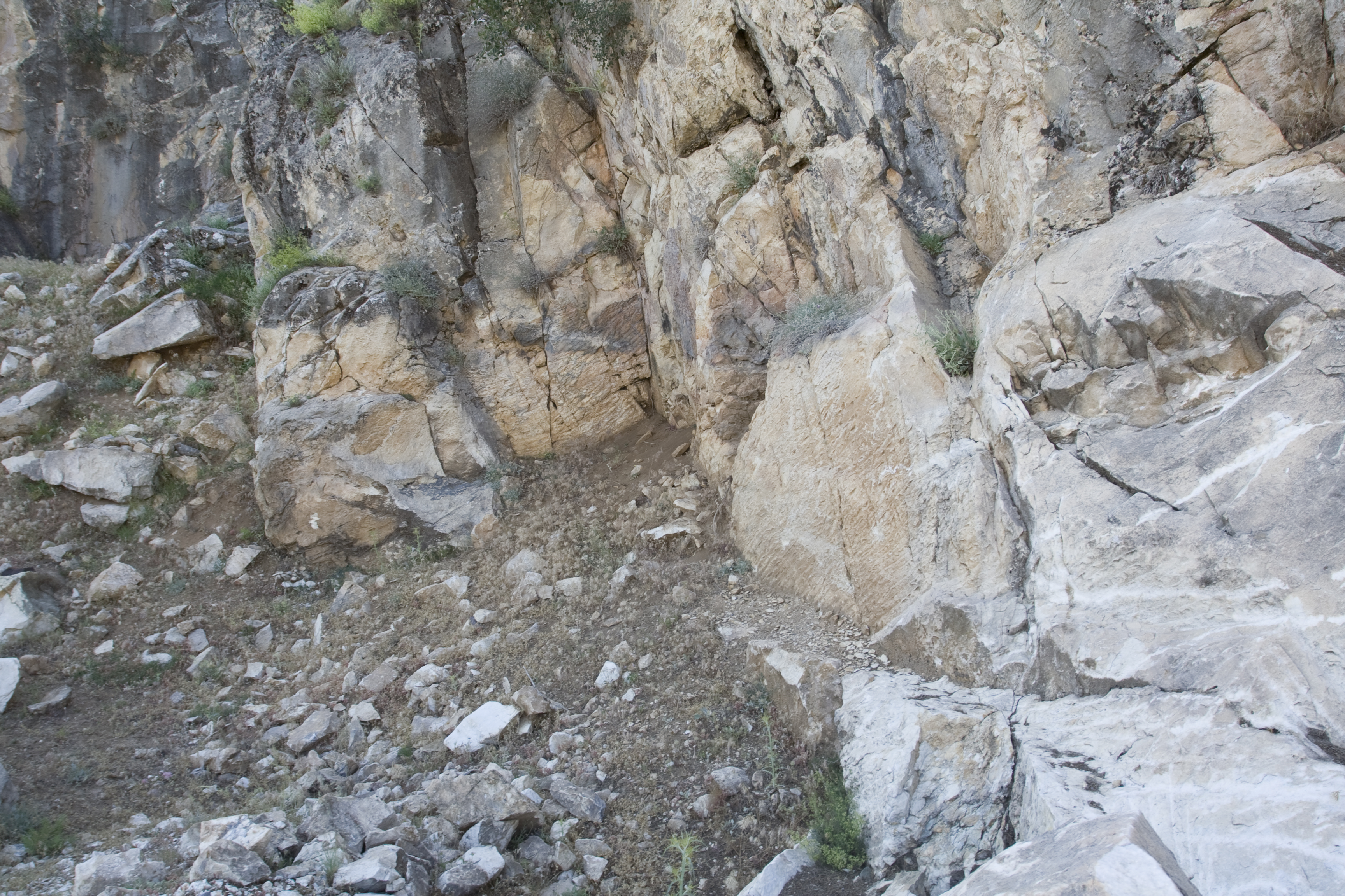
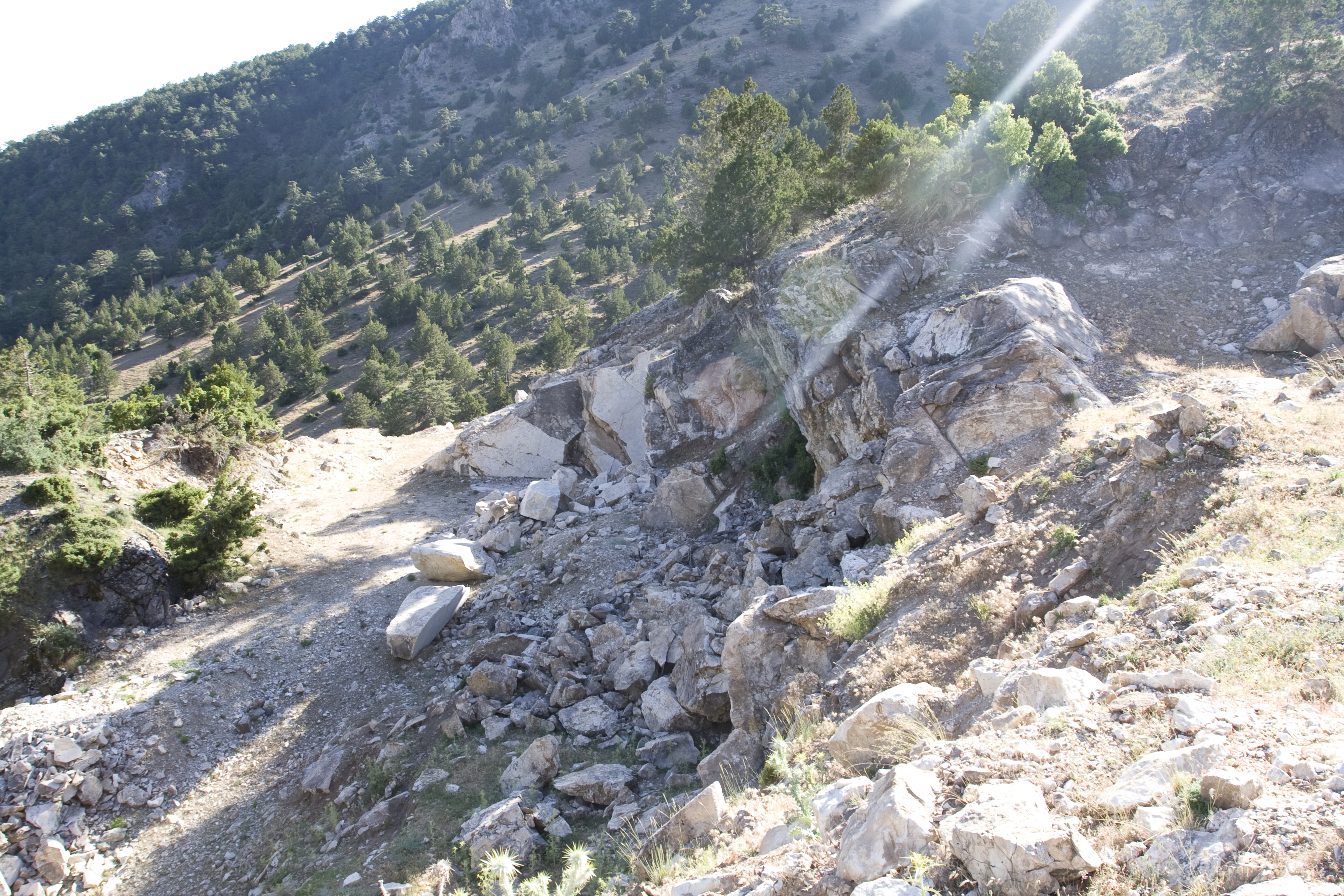
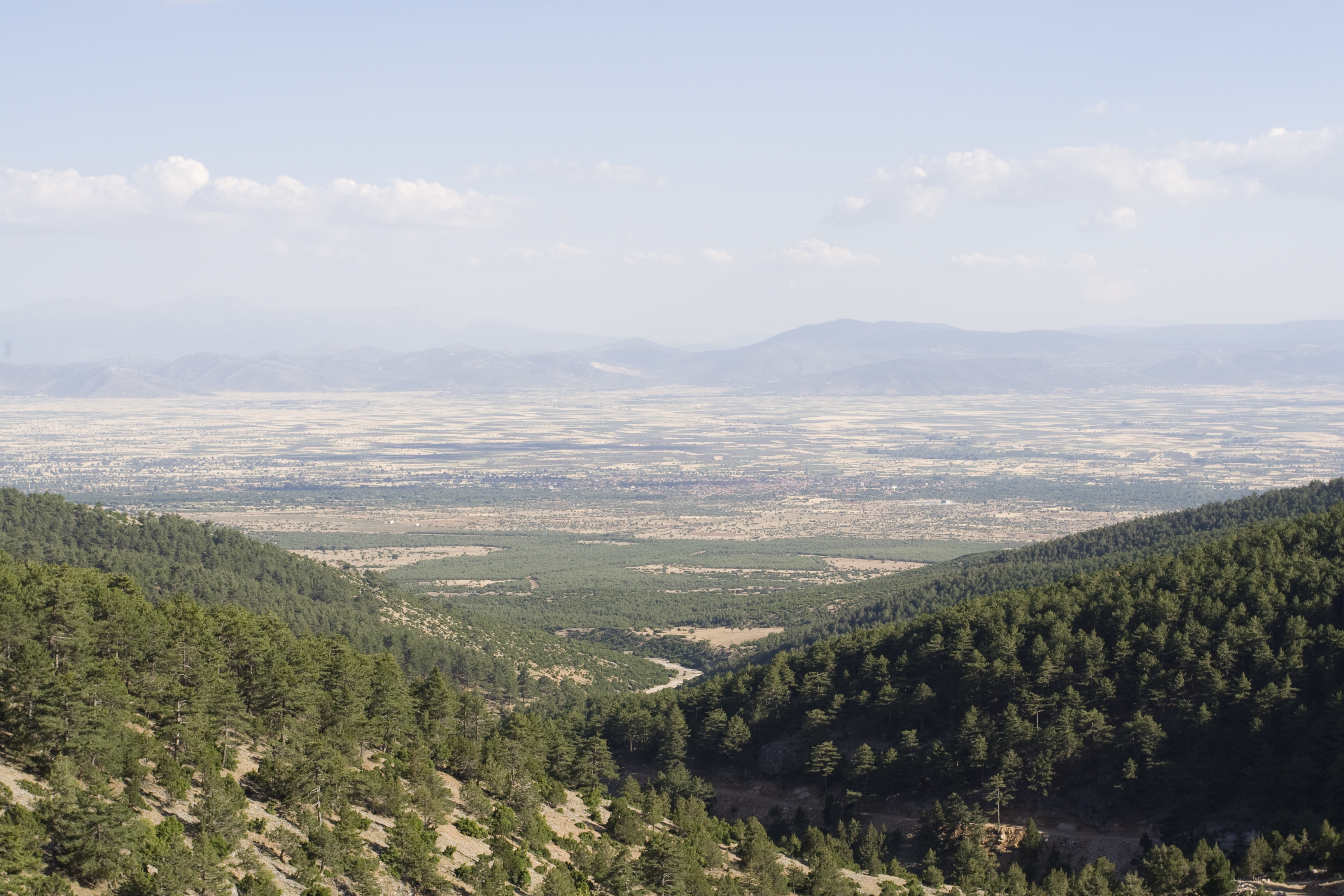
Local Name: Çamova Tepe Local Informant: Hasan Çomek Local Information: On Çamova Tepe between Kara Baba Dağı and Ak Baba Dağı ** Hasan Çomek said that Afyon Marble company is currently quarrying there. Latitude: 37.41.13.46 Longitude: 28.56.51.86 Elevation: 1471.71m Dimensions: Quarry 1: H: 10 m, W: 20 m, D: 10 m, Vol: 2,000 m3 ** Quarry 2: H: 3.0 m, W: 12 m, D: 8.0 m, Vol: 288 m3 ** Quarry 3: H: 5.0 m, W: 15 m, D: 10 m, Vol: 750 m3 ** Capacity: ca. 3,050 m3; eighth largest quarry complex. Description: Location: On the southeast portion of the Kara Baba Dağı ridge along the tree line, due north of the village of Karahisar; 22 km from Aphrodisias. Elevation ca. 1,475 masl. Road running northeast from Yahşiler leads directly to the quarry, snaking dramatically through the lower spurs of Baba Dağı. Quarry opens to the south/southeast, and site offers panoramic view of the plain of Tabae. Largest quarry visible from access road, others obscured by hills. ** Number and dimensions of quarries: Three small quarries in a single district situated on the west side of the hill. ** Geological age, grain size, and color: Mesozoic. Fine to medium grained. Bright white and grayish purple breccia, very similar in appearance to lower grade pavonazzetto from Dokimeion. ** Modern quarrying: Burdur Mermer of Afyon and Koca Ökuz Mermer are currently engaged in extraction of white marble above ancient quarries. ** Joints and quality of marble: Subhorizontal / subvertical joints, from 0.5 to 1 m wide. Medium quality. ** Quarry organization and evidence for extraction: The quarries are strung along the ridge of hill running northeast to southwest. ** Quarry 1, the largest, is a steep-sided semicircular bowl, with a series of worked steps undercut from the quarry face; the steps measure up to 7 m long and are lined with horizontal pickmarks. Directly below these, a subvertical joint was followed at 60° angle down to the quarry floor. Pickmarks and vertical separating channels line the sides of the quarry. The floor is filled with marble scree and small stones. Blocks were moved out of the back of the quarry along level slipway that bypasses Quarries 2 and 3. ** Quarry 2 lies directly east of Quarry 1 and is a shallow bowl-shaped quarry. Preserved evidence of ancient quarrying includes pickmarks, separating channels, and in one place a regular line of fine-point chisel marks, as also seen in Ören Quarry 7. In one area, separating trenches define a large block (H: 1 m, W: 2.95 m, and D: 2.6 m). ** Quarry 3 lies behind and north of Quarry 2 and is a medium-sized square quarry. Ancient pickmarks preserved on the quarry face. The numerous joints make the marble quality lower than at the other two quarries. The floor is filled with marble scree. ** Blocks: Four abandoned rectangular blocks in Quarries 2 and 3.
Types
Other
Metadata
Show full item recordCollections
Remediation of Harmful Language
The University of Michigan Library aims to describe library materials in a way that respects the people and communities who create, use, and are represented in our collections. Report harmful or offensive language in catalog records, finding aids, or elsewhere in our collections anonymously through our metadata feedback form. More information at Remediation of Harmful Language.
Accessibility
If you are unable to use this file in its current format, please select the Contact Us link and we can modify it to make it more accessible to you.