 Access by request
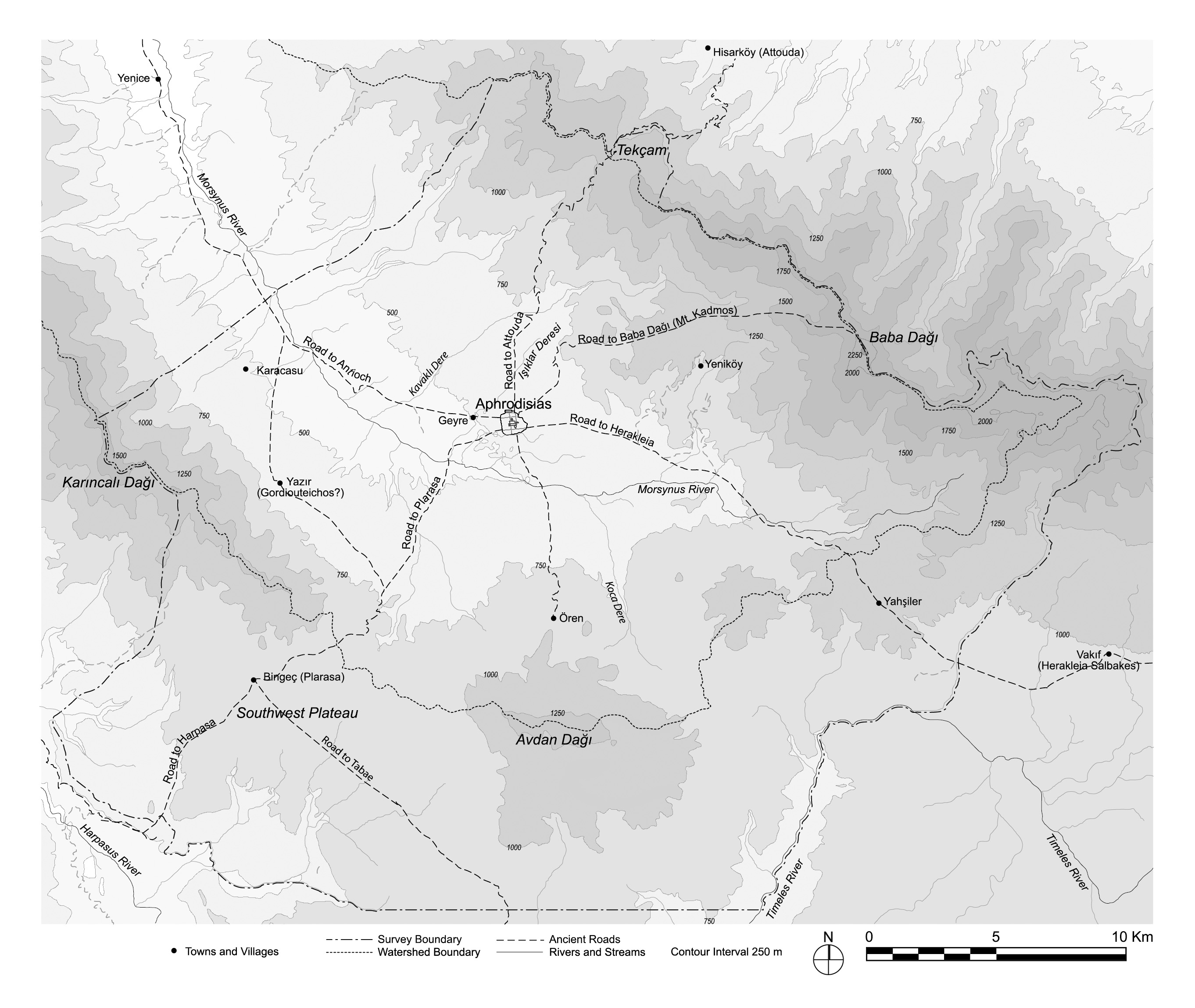
Map of Aphrodisias survey region, showing restored locations of territorial boundaries and roads
| dc.contributor.author | Aphrodisias Regional Survey | en_US |
| dc.date.accessioned | 2012-08-27T20:57:10Z | |
| dc.date.available | 2012-08-27T20:57:10Z | |
| dc.date.issued | 2012-08-21 | en_US |
| dc.identifier.citation | Christopher Ratté and Peter D. De Staebler (eds.). Aphrodisias V. The Aphrodisias Regional Survey (Verlag Philipp von Zabern: Darmstadt/Mainz, 2012), p. 33, Figure 23. <http://hdl.handle.net/2027.42/93215> | en_US |
| dc.identifier.uri | https://hdl.handle.net/2027.42/93215 | |
| dc.description | Scale: 1:200000 | en_US |
| dc.subject | Ancient Roads | en_US |
| dc.title | Map of Aphrodisias survey region, showing restored locations of territorial boundaries and roads | en_US |
| dc.type | Map | en_US |
| dc.subject.hlbsecondlevel | Archaeology | en_US |
| dc.subject.hlbtoplevel | Social Sciences | en_US |
| dc.description.bitstreamurl | http://deepblue.lib.umich.edu/bitstream/2027.42/93215/1/RatteIntroFig23.jpg | |
| dc.owningcollname | Aphrodisias Regional Survey |
Files in this item
Remediation of Harmful Language
The University of Michigan Library aims to describe its collections in a way that respects the people and communities who create, use, and are represented in them. We encourage you to Contact Us anonymously if you encounter harmful or problematic language in catalog records or finding aids. More information about our policies and practices is available at Remediation of Harmful Language.
Accessibility
If you are unable to use this file in its current format, please select the Contact Us link and we can modify it to make it more accessible to you.