|
 |
   |
 |


 |
|

|
 |
|
 |
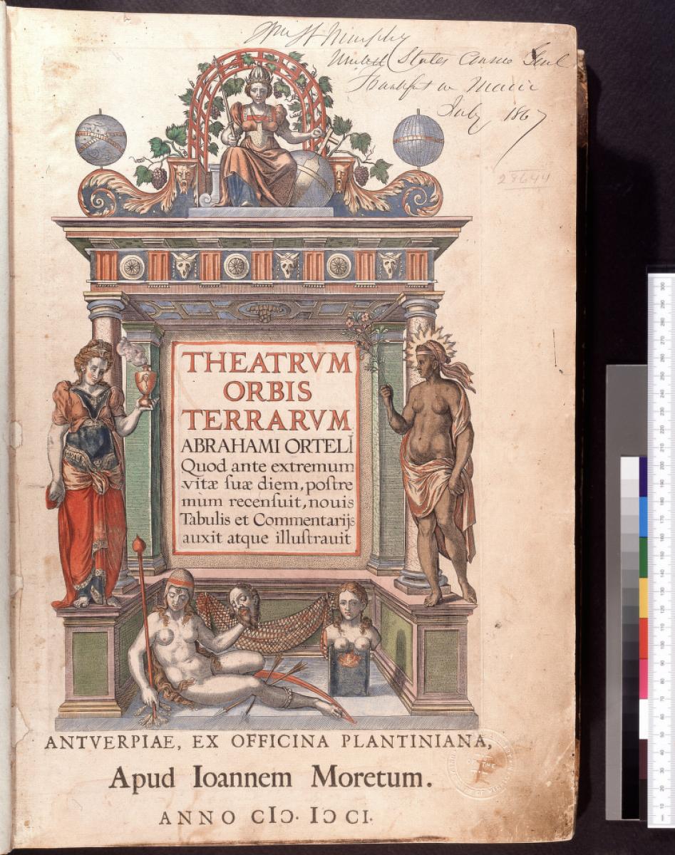
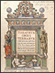
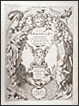
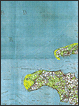
Abraham Ortelius (1527-1598). Theatrum orbis terrarum. Antwerp: ex officina Plantiniana, apud Ioannem Moretum, 1601.
Next to his contemporary Mercator, Ortelius is the greatest of the 16th-century Flemish geographers. His chief work was this atlas of the world, the first edition of which appeared in 1570 and which was enlarged and improved with each subsequent edition.
Bequeathed, 1921, to the University of Michigan by W. W. Murphy, U.S. Consul General, Frankfurt am Main (his autograph on title page with date July 1867).
|
 |
 |
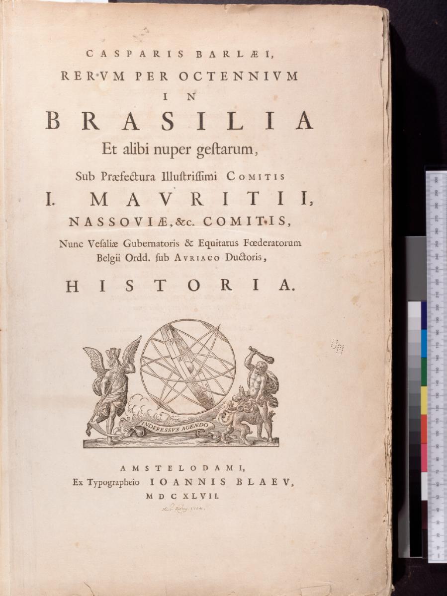
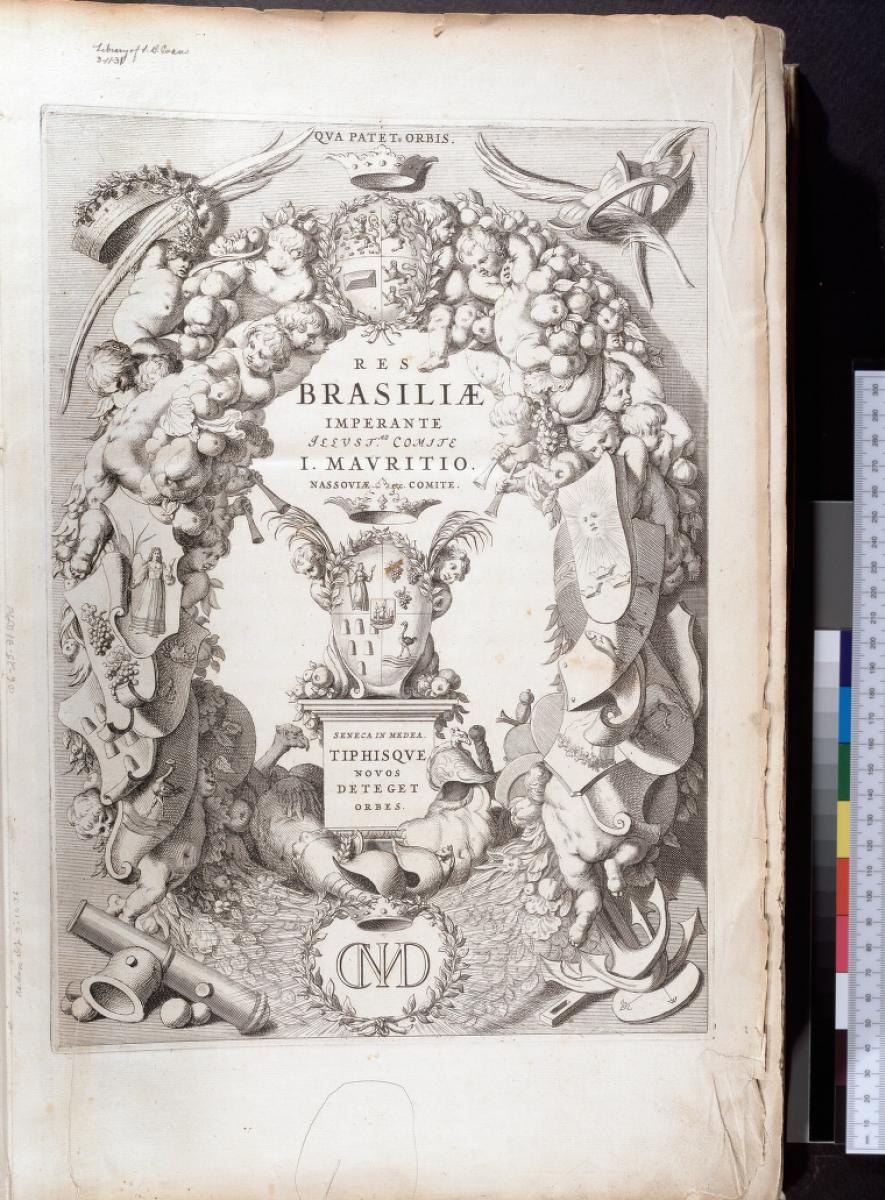
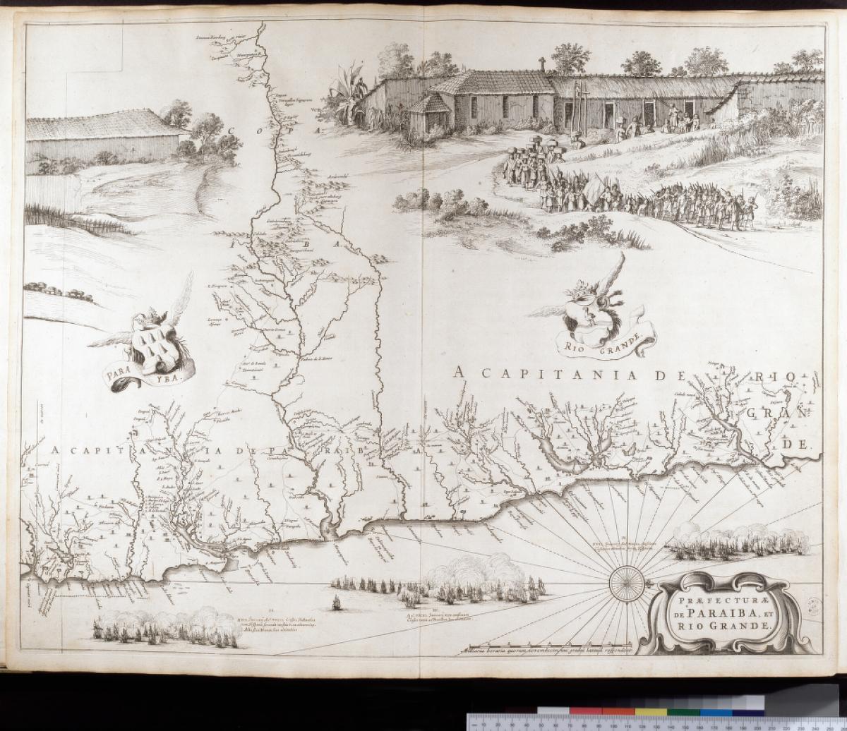
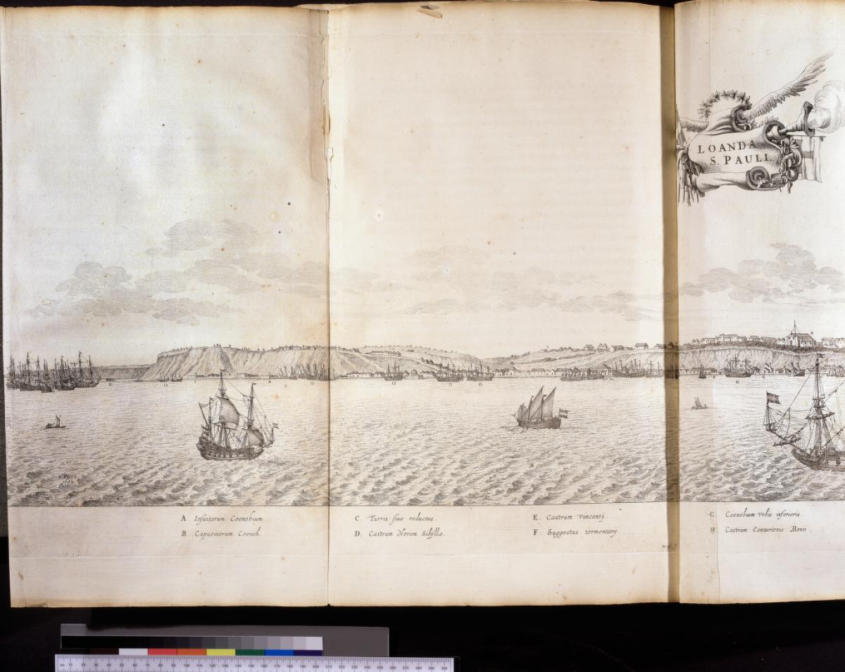
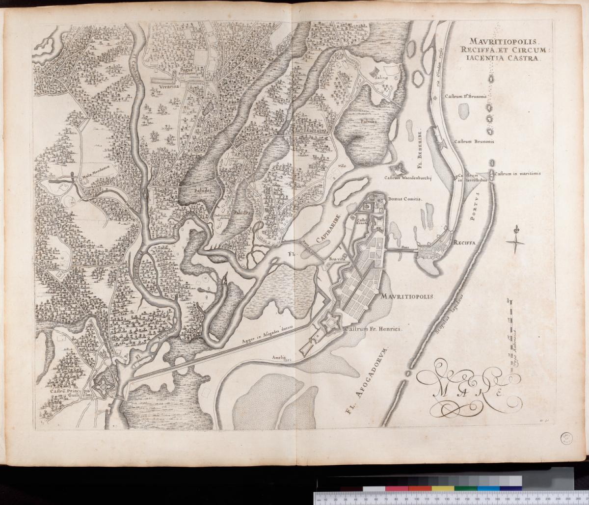
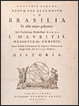
Kaspar van Baerle (1584-1648). Rerum per octennium in Brasilia et alibi nuper gestarum, sub praefectura Illustrissimi Comitis I. Mauritii, Nassoviae … historia.
Amsterdam: I. Blaeu, 1647.
This work describing the flora and fauna, climate, inhabitants, religion, and languages of the coastal provinces
of Brazil, was produced as a result of the Dutch conquest of Brazil (1624-1654). It was one of many works on
geography, topography, cartography, and accounts of voyages which were published in the 17th century to satisfy
a curiosity about newly discovered countries. The firm of Blaeu in Amsterdam produced many of these works.
Sabin reports that this edition is rare, "most of the copies having been consumed by a fire, which destroyed the warehouses of Blaeu, the publisher."
Gift in 1931 of Grace L. and Abby L. Sargent, from the Library of Lawrence B. Evans, UM class of 1894.
|
|
 |
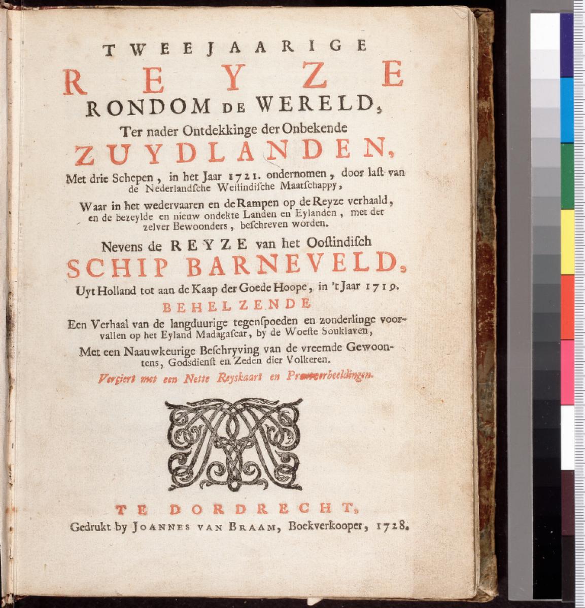
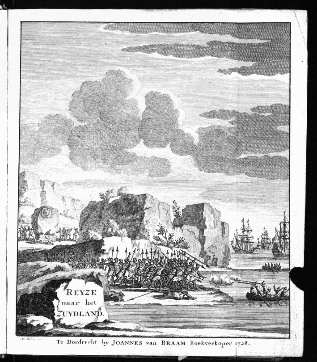
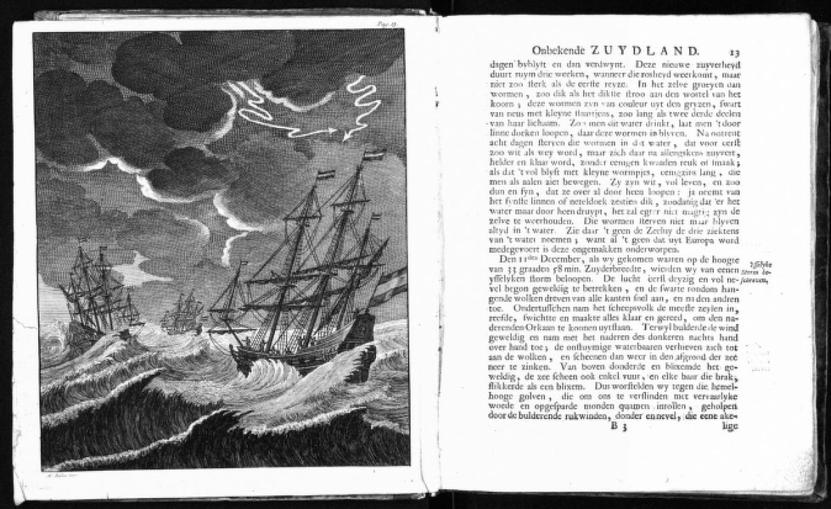
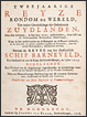
Tweejaarige reyze rondom de wereld, ter nader ontdekkinge der onbekende zuydlanden, met drie schepen, in het jaar 1721, door last van de Nederlandsche Westindische Maatschappy. Dordrecht: J. van Braam, 1728.
An anonymous account of Commodore Jacob Roggeveen's 1721-1723 circumnavigation of the world under the direction of the
Dutch West India Company. The voyage was to be a project for discovering something of the supposed, vast, southern continent,
a mystery which was not solved until Cook's voyages of the late 18th century. Also included in this volume is an account of
the voyage of the Dutch East India ship Barneveld to the Cape of Good Hope in 1719, with a stop at Madagascar.
Gift in 1964 of Mrs. Alina R. Crummey.
|
|
 |
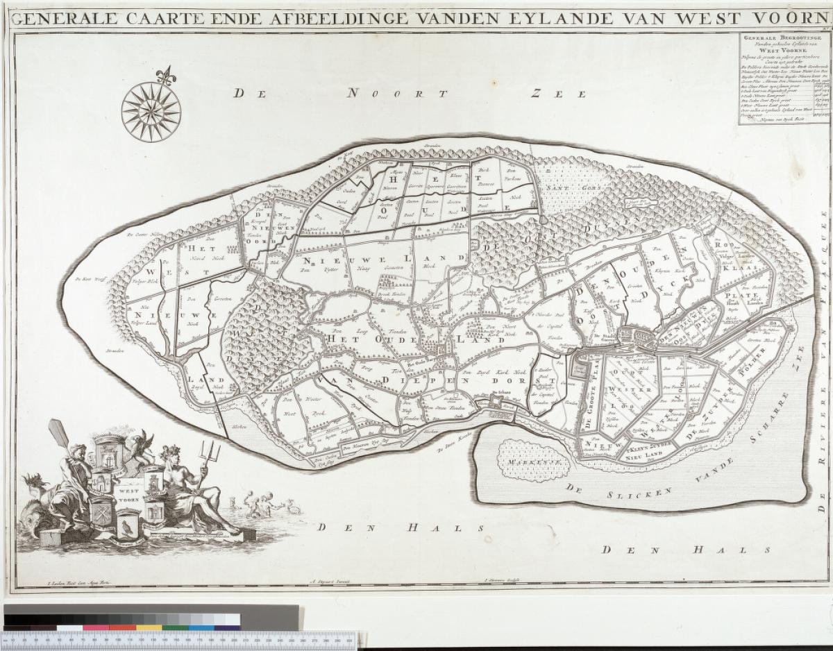
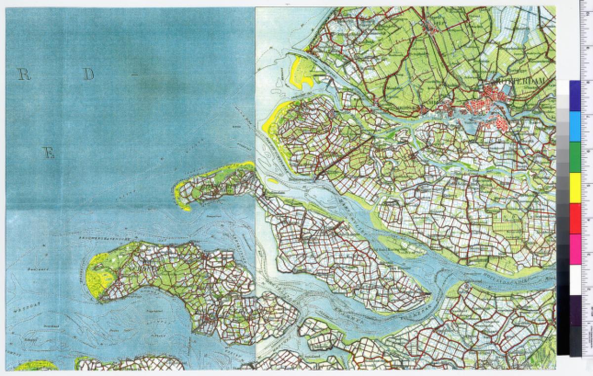
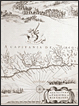
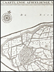
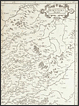
Heyman van der Dyck. "Generale caarte ende afbeeldinge vanden eylande van West Voorn" from Kaartboek van Voorne, Goeree en Overflakkee. Leiden: Pieter van der Aa, 1701:
This map shows reclaimed land on what was then called the island of Westvoorne. It is now Goeree, province South Holland. Note that in the modern map (1936), still more land has been reclaimed in the intervening centuries so that Goeree is now connected to Overflakkee.
The set of maps from which this is selected is notable for its beautiful engraved decorations. The cartouches are by Jan Luiken (1649-1712). The publisher, Van der Aa, was a prolific issuer of printed matter, including many maps and atlases.
Gift in 1948 of Professor J. A. vanden Broeck (Engineering Mechanics).
From the University of Michigan Map Library.
|
|
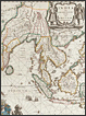 |
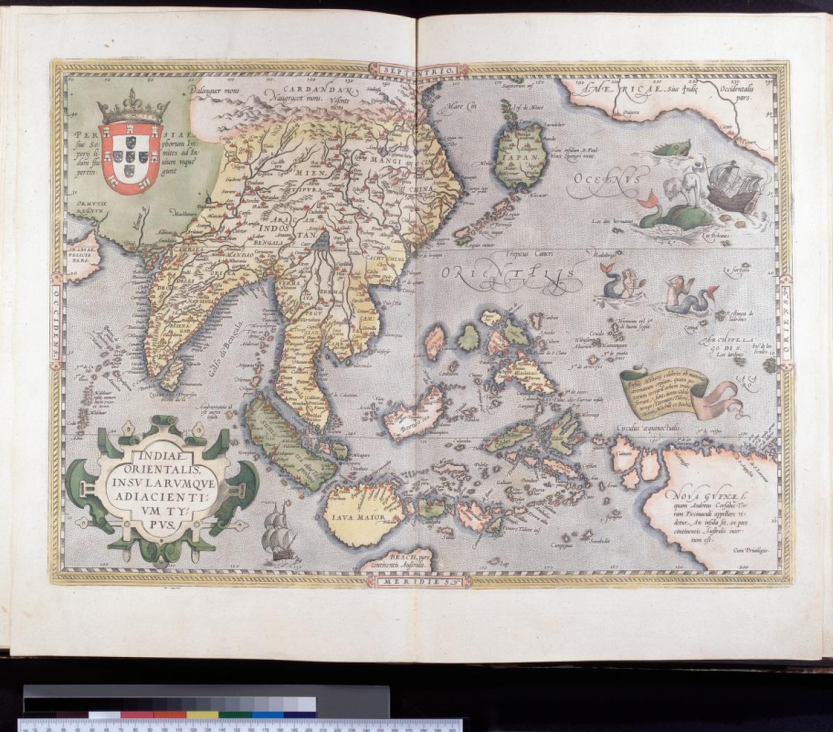
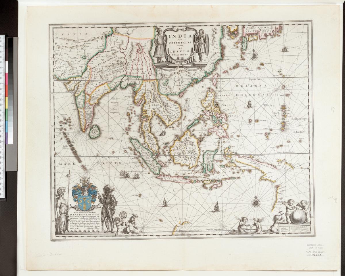
Willem Janszoon Blaeu (1571-1638). India quae orientalis dicitur, et insulae adiacentes.
Amsterdam: apud G. et I. Blaeu, 1640.
Blaeu ranks with Mercator and Ortelius among the foremost cartographers of the 17th century. His map-publishing business, founded in Amsterdam and continued by his sons Joan and Cornelius, produced great numbers of all kinds of maps and atlases. The firm flourished for more than 40 years until a fire in 1672 destroyed their premises, with a loss of virtually all equipment and stock and most of the printing plates.
This map of East Asia is especially attractive. It shows some of the Dutch discoveries in Australia in the lower right corner. The map continued to be issued up to the atlas of 1662, well after some of its information was superseded (for example, by the discoveries of Abel Janszoon Tasman in his voyages of 1642-1644). In effect, this map became an historical record of Dutch discoveries in the archipelago between 1606 and 1623.
Purchased from the estate of American expatriate Henry Vignaud, after the latter's death in Paris in 1922. The University of Michigan representative negotiating the purchase was Librarian William Warner Bishop.
From the University of Michigan Map Library.
|
|
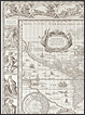 |
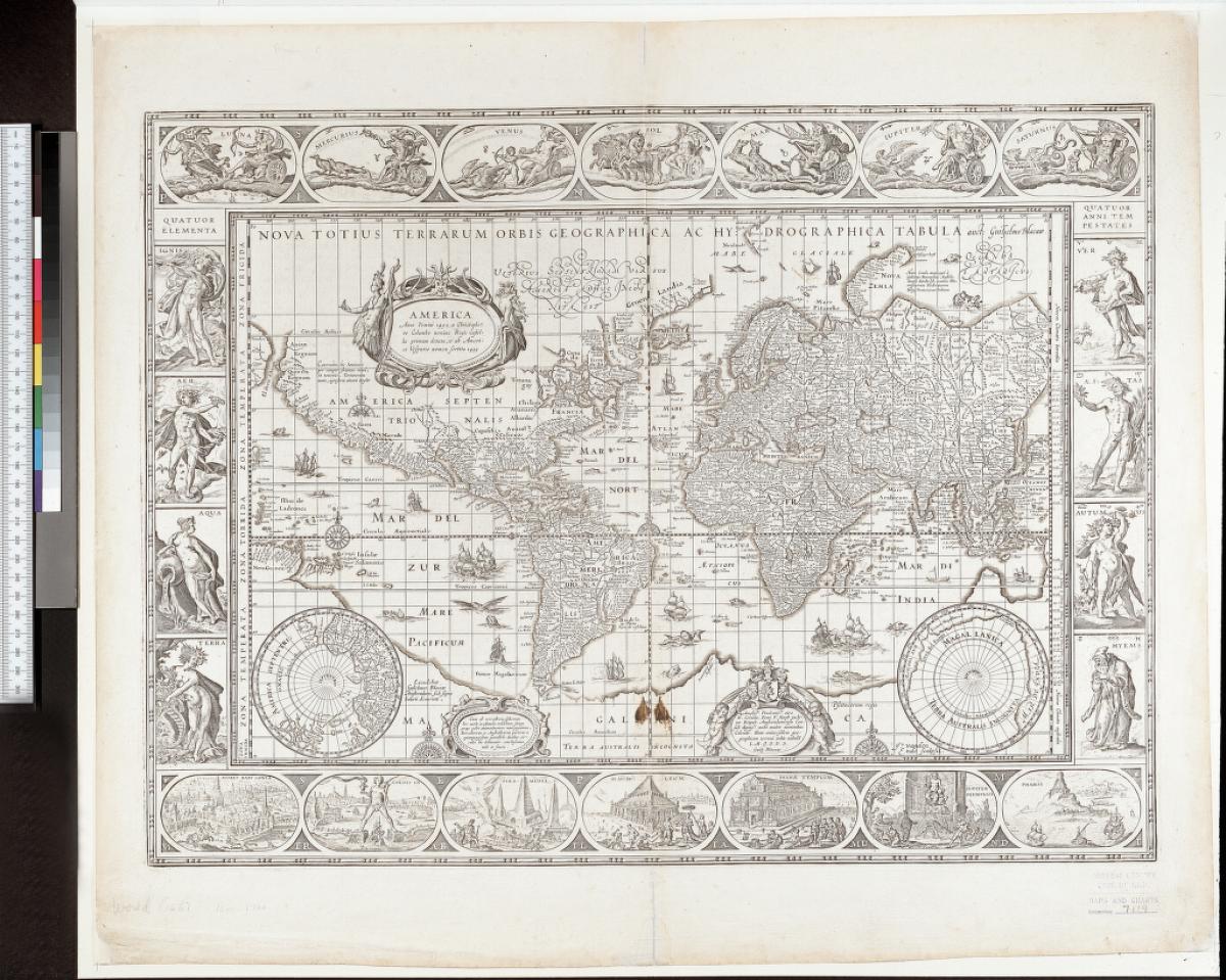
Willem Janszoon Blaeu (1571-1638). Nova totius terrarum orbis geographica ac hydrographica tabula.
Amsterdam: Blaeu, 1635.
"This world map prefaced atlases published by the Blaeu establishment from 1630 until it was superseded by a twin-hemispherical design in 1662 … it is celebrated as one of the supreme examples of the mapmaker's art." [John Goss, Blaeu's The Grand Atlas of the 17th-Century World, N.Y., Rizzoli, 1991]
Gift of University of Michigan Regent Lucius L. Hubbard in 1923.
From the University of Michigan Map Library.
|
|
 |
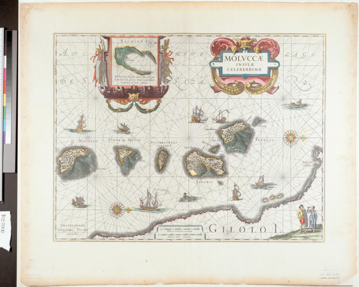
Willem Janszoon Blaeu (1571-1638). Moluccae insulae celeberrimae.
Amsterdam: Guiljelmus Blaeuw, 1643.
The discoveries in the East Indies made by 16th-century circumnavigators Sir Francis Drake in 1577-1580 and Thomas Cavendish in 1587, plus those by Dutch expeditions, led to the establishment of the Dutch East India Company in 1602. Within ten years the Dutch dominated trade with the Spice Islands of the Moluccas, earlier a Portuguese domain. Gradually, Dutch influence and control extended to a large part of the East Indian archipelago.
Among the most important of the Spice Islands were Ternate, Tidoro, and Gilolo, all three for the abundance of cloves. Note that this map is oriented with north to the right.
Purchased from the estate of Henry Vignaud in 1922.
From the University of Michigan Map Library.
|
|
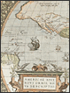 |
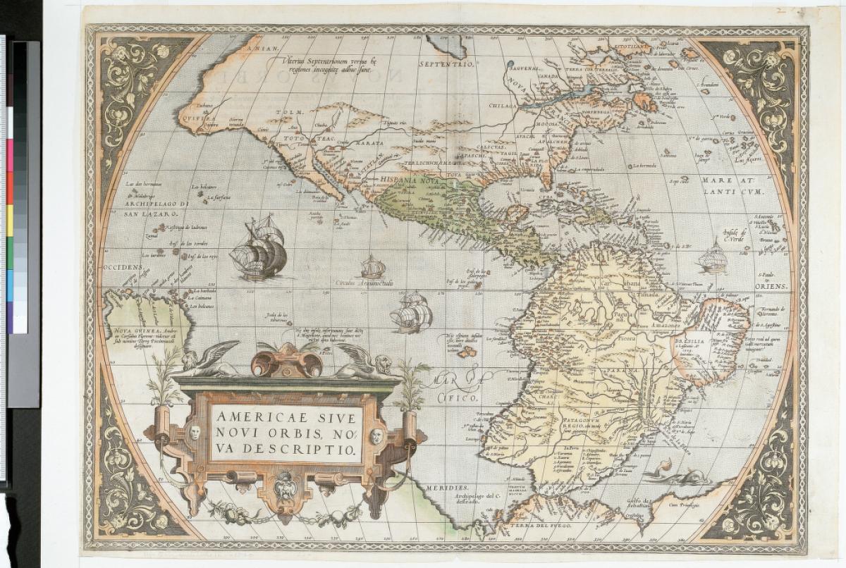
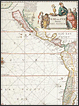
Abraham Ortelius (1527-1598). Americae sive novi orbis, nova descriptio.
Antwerp: printed by Aegid. Coppenium Diesth, 1570 or later.
A publisher and retailer of maps, Ortelius first produced his famous atlas, Theatrum orbis terrarum, in 1570. This uniform collection of modern maps had a great impact on the spread of geographical knowledge, with copies bought by commercial firms, scholars, kings, and poets. It went through some 24 editions in Ortelius's lifetime and another 10 after his death.
New data were incorporated into the maps over the years. The bulge in the south-western coast of South America, as shown in the map here, was removed in the 1587 edition.
Gift of University of Michigan Regent Lucius L. Hubbard in 1923.
From the University of Michigan Map Library.
|
|
 |
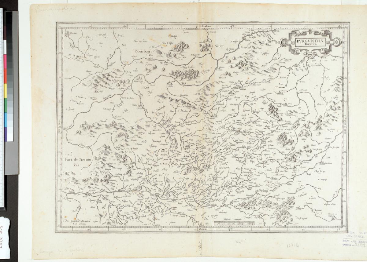
Gerhard Mercator (1512-1594). Burgundia ducatus.
Amsterdam: Mercator, 1585.
The most famous cartographer after Ptolemy, Mercator studied philosophy and then mathematics at the
University of Leuven under Gemma Frisius (see the latter's Arithmetic in this exhibition).
He became an expert on making mathematical instruments, first as a land surveyor and, after 1537, as a cartographer
and maker of globes. He also qualified as a copper-engraver.
Mercator's maps are original, based on contemporary knowledge of the earth's topography and drawn to his own conception. Ortelius's best-selling atlas, first issued in 1570 (see the 1601 edition in this exhibition), was by contrast a generalization of existing maps.
The map shown here is from part one of Mercator's book of modern maps (France, Germany, and the Netherlands) from 1585. Part two came out in 1589, and part three in 1595, completed by Mercator's son, Rumold. When the plates for the maps were sold to Jodocus Hondius of Amsterdam after Rumold's death in 1599, the full Mercator Atlas achieved a much greater distribution and fame.
From the estate of Henry Vignaud, an American who spent most of his life in Paris. He was a scholar of the early explorers of the New World, and his impressive library of Americana was acquired by the University of Michigan in 1922.
Gift in 1923 of University of Michigan Regent L.L. Hubbard. Some 140 titles in Hubbard's collection of imaginary voyages are Dutch-language editions.
From the University of Michigan Map Library.
|
|
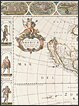 |
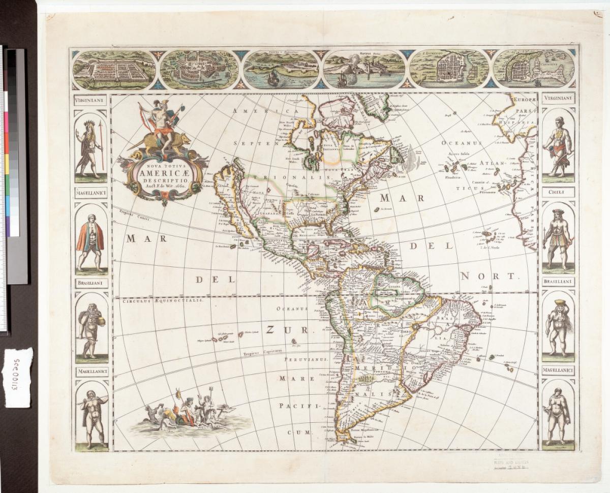
Frederik de Wit. Nova totius Americae descriptio.
Amsterdam: s.n., 1660.
A respected Amsterdam map-maker, De Wit's first map of America, shown here, was not part of a specific atlas and is a blend of many different sources. The title cartouche shows a Native American riding an armadillo.
Gift of University of Michigan Regent Lucius L. Hubbard in 1923.
From the University of Michigan Map Library.
|
|
 |
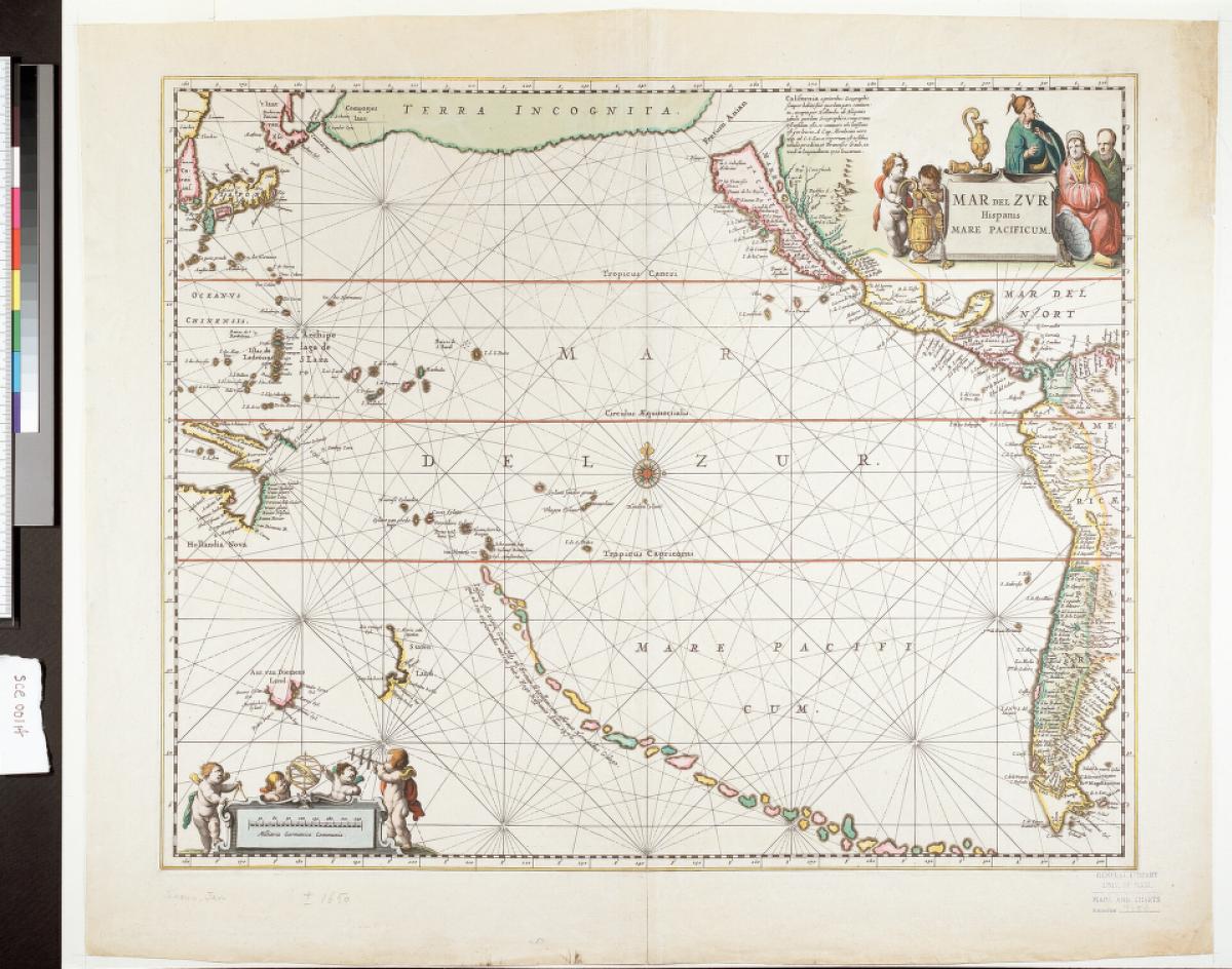
Jan Jansson (1588-1664). Mar del Zur Hispania Mare Pacificum.
Amsterdam: apud Joannem Janssonium, 1685?
Jansson joined the map-publishing business of Jodocus Hondius upon his marriage to the latter's daughter in 1612. This chart was the first to show the whole of the Pacific Ocean. It was part of Jansson's sea atlas, which was the fifth volume of his Atlas Novus, 1650. The chain of islands shown extending across the southern Pacific are here identified as being discovered by one Hernando Galego in 1576, sent by the King of Spain. The present example is the second state of this chart, incorporating Tasman's discoveries in New Zealand and Tasmania, plus the coast lines of southern New Guinea and Cape York, Australia from the earlier state (1650).
Gift of University of Michigan Regent Lucius L. Hubbard in 1923.
From the University of Michigan Map Library.
|
|
|
|
|
|
|
|
|