“THE PICTURE OF THE MIND”
Tintern & Vicinity through Images
Works on Display:
- The View of Tintern Abbey on the River Wye
- Tintern, Monmouthshire
- Tintern Abbey, Monmouthshire
- Map of the County of Gloucester
- Map of the County of Monmouth
- Ordnance Survey “Old Series”, Sheet XXXV
- Ordnance Survey “Old Series”, Sheet XLIII
- Tintern Abbey from the Priory
- South Front, Tintern Abbey
- The Wyndcliff
- Chepstow Castle and Bridge
- Tintern Abbey

|
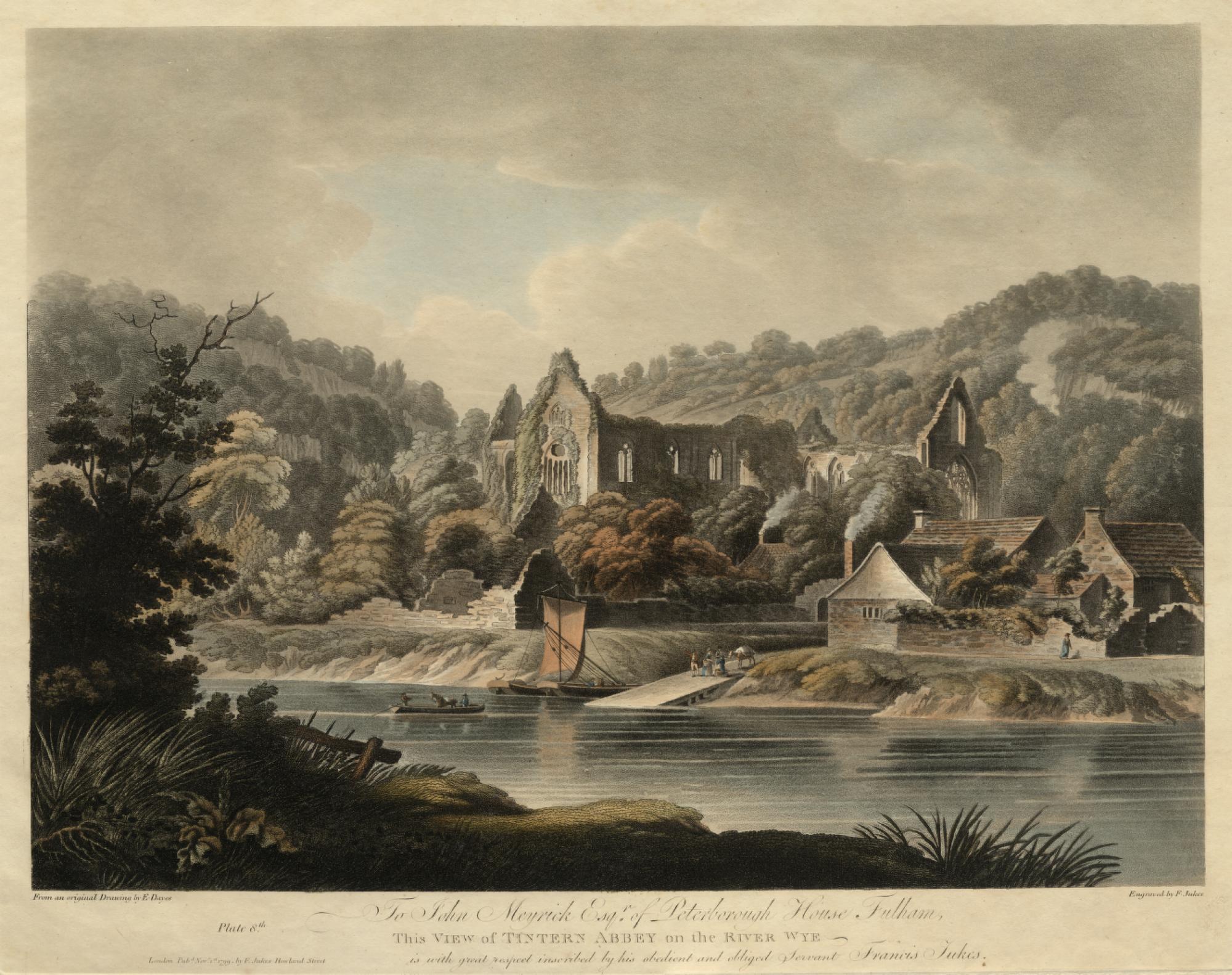
Edward Dayes, artist; Francis Jukes, engraver The View of Tintern Abbey on the River Wye Nov.1, 1799 London: F. Jukes, 1799 Aquatint Loaned from a private collection This plate is one of sixteen large aquatints drawn by Dayes and engraved and published by Francis Jukes for a series called Views on the River Wye. The original watercolor drawing, dated 1794, is in the Whitworth Art Gallery, Manchester. Dayes’s vantage point is on the Gloucestershire or English side of the River Wye, near the ferry passage and landing jetty where tourist boats decanted in the period. He dwells upon the wildness and isolation of this border setting, evoking the drama of a traveller about to cross over into an unfamiliar land. Dayes’s choice of view may also be intended to communicate something of his reverence for the monument. In an account of another ruin, Fountains Abbey in Yorkshire, Dayes abjures his readers: “Retire to a respectful distance, ye dull and phlegmatic worldings; this spot is sacred to the arts, prophane [sic] it not with unhallowed feet...Here is ample scope for the moralist: let him behold here the perishable labours of man”.1 Perhaps the far side of the Wye is the “respectful distance” that will allow the tourist to turn moralist. Dayes catalogues the features and qualities that made Tintern Abbey such a popular destination, and therefore popular subject for art in the era. The scenic landscape is punctuated by the melancholy beauty of the Abbey ruins, so overgrown that the works of nature and the work of man are becoming indistinguishable. Here is that “pleasing intermixture of wildness and culture”, that contemporary travelers found so compelling.2 Dayes seems to allow the elements themselves to dictate the composition of the scene. The calm water of the River Wye in the foreground, the slopes and steeps of the earthy middle ground, and airy drama of a very characteristic sky, divide the view roughly into thirds, wholly in accordance with contemporary theories of the picturesque. Human occupation on the opposite shore is reduced to a few graceful figures; all signs of poverty are expunged, and the local industrial sites are concentrated into a plume of smoke at the upper right, barely visible against the limestone rocks behind. The original watercolor drawing contains a tall smokestack that is camouflaged in the final print. Tintern Abbey rises, as Dayes says of another ruin, “in solemn majesty...with the stately port of a giant”.3 |

|
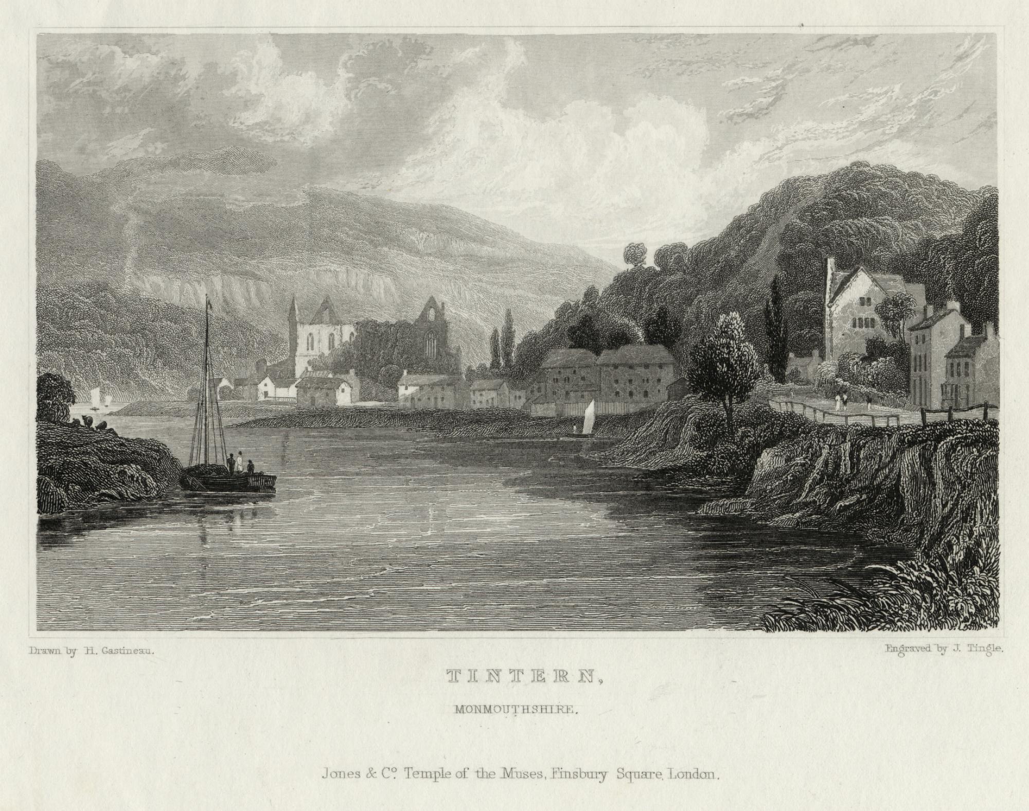
Henry Gastineau, artist; J. Tingle, engraver Tintern, Monmouthshire London, Jones & Co.: Temple of the Muses, Finsbury Square, [c. 1830] Steel engraving Loaned from a private collection |

|
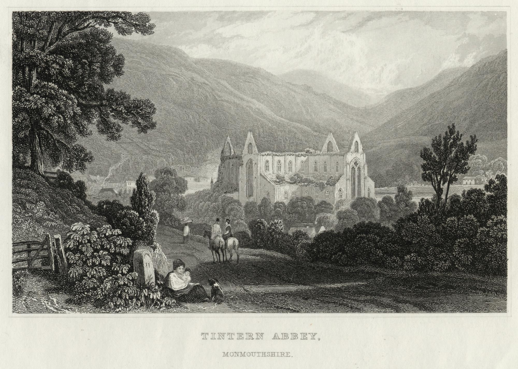
Henry Gastineau, artist; J. Tingle, engraver Tintern Abbey, Monmouthshire London, Jones & Co.: Temple of the Muses, Finsbury Square, [c. 1830] Steel engraving Loaned from a private collection These delicate steel engravings are from an ambitious topographical work by the English landscape artist and drawing master Henry Gastineau. They belong to Wales Illustrated in a Series of Views: comprising the picturesque scenery, towns, castles, seats of the nobility & gentry, antiquities, &c., a two-part work containing over 150 plates. Tintern, Monmouthshire depicts the approach by water from the direction of Monmouth, approximately ten miles north. Gastineau has represented the River Wye at full tide. Anchored just outside of the straggling precincts of the village of Tintern, this is the distant view of the Abbey that would grow on a tourist’s sight as the boat neared its destination. Many visitors in the period complained that the cluster of humble buildings round the base of the Abbey spoiled the perspective. Tintern Abbey, Monmouthshire, the lower print, shows the southerly approach by road from Chepstow, approximately 5 miles distant. Tourists complained bitterly and routinely about the state of this road before the construction of a new turnpike in 1822. Joseph Cottle, whom we will meet again later in the company of Coleridge, describes an ill-considered evening walk from Chepstow to Tintern in 1795 in which he “floundered over stones, embedded, as they appeared, in their everlasting sockets, from the days of Noah”.4 Another commentator called such unimproved roads “alpine gutters”.5 Gastineau gives us both pedestrians and a couple traveling by horseback on this post-1822 road. The gentleman and his lady are halted at a point where, as today on the A466, the view opens up beautifully to reveal the Abbey while the road prepares itself for a last descent into the valley. It’s important to bear in mind that one’s first impression of the Abbey would be dramatically different if one approached from the north rather than the south, by water or by land. The woman and child resting by a milestone could represent the sturdy “independency of spirit” which Gastineau says in his introduction has distinguished the nation from its earliest days. |

|
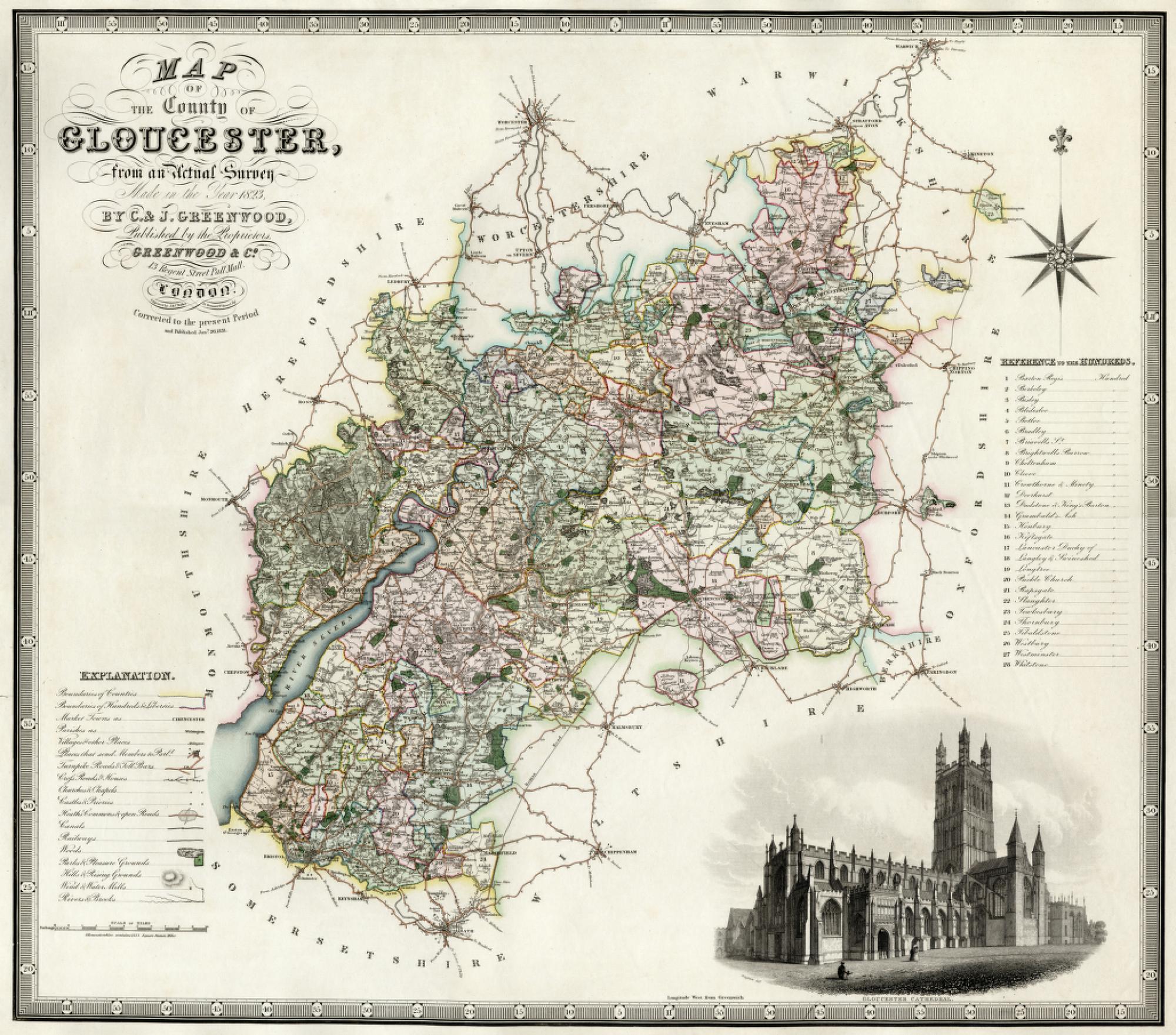
C. and J. Greenwood Map of the County of Gloucester, from an Actual Survey Made in the Year 1823 London: Greenwood and Co., 1831 Engraved by J. S. C. Walker Loaned from the University of Michigan Map Library |

|
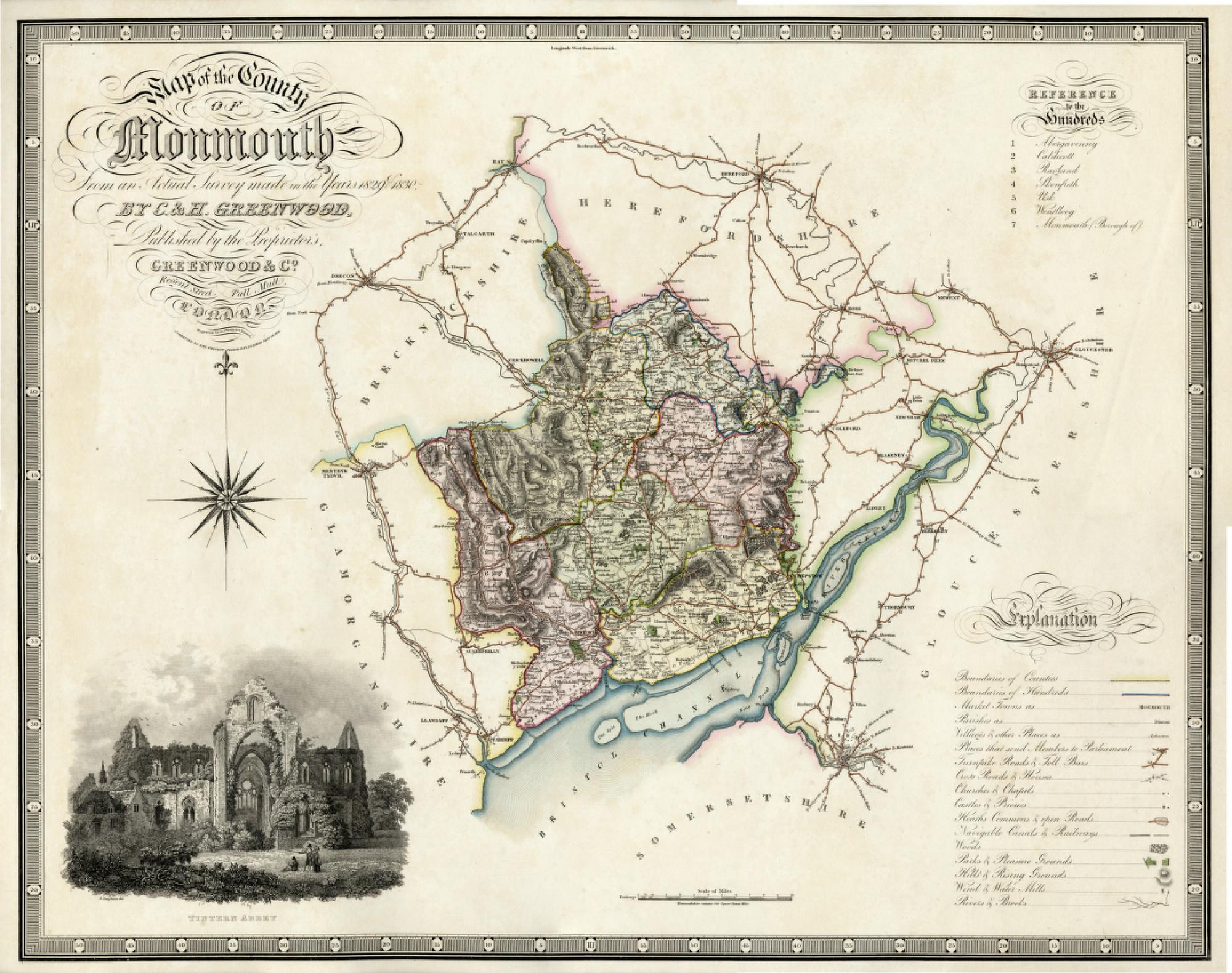
C. and J. Greenwood Map of the County of Monmouth, from an Actual Survey Made in the Years 1829 & 1830 London: Greenwood and Co., 1831 Engraved by J. Neele Loaned from the University of Michigan Map Library The Greenwoods produced large-scale maps of the counties between 1817 and 1830 to rival the publications of the Ordnance Survey office (see below).27 Like the OS maps, the scale of this map is one inch per mile. Some historians feel that the Greenwood maps are superior to the OS maps in more clearly distinguishing county, hundred and parish boundaries.28 Additionally, each map is embellished by a beautiful vignette of an important county monument or landmark: Hereford Cathedral for Gloucester and Tintern Abbey for Monmouth. Both vignettes are engraved by R. Creighton. Hereford Cathedral, home of the Mappa Mundi, must be high on the list of treasures for any cartographer.
|

|
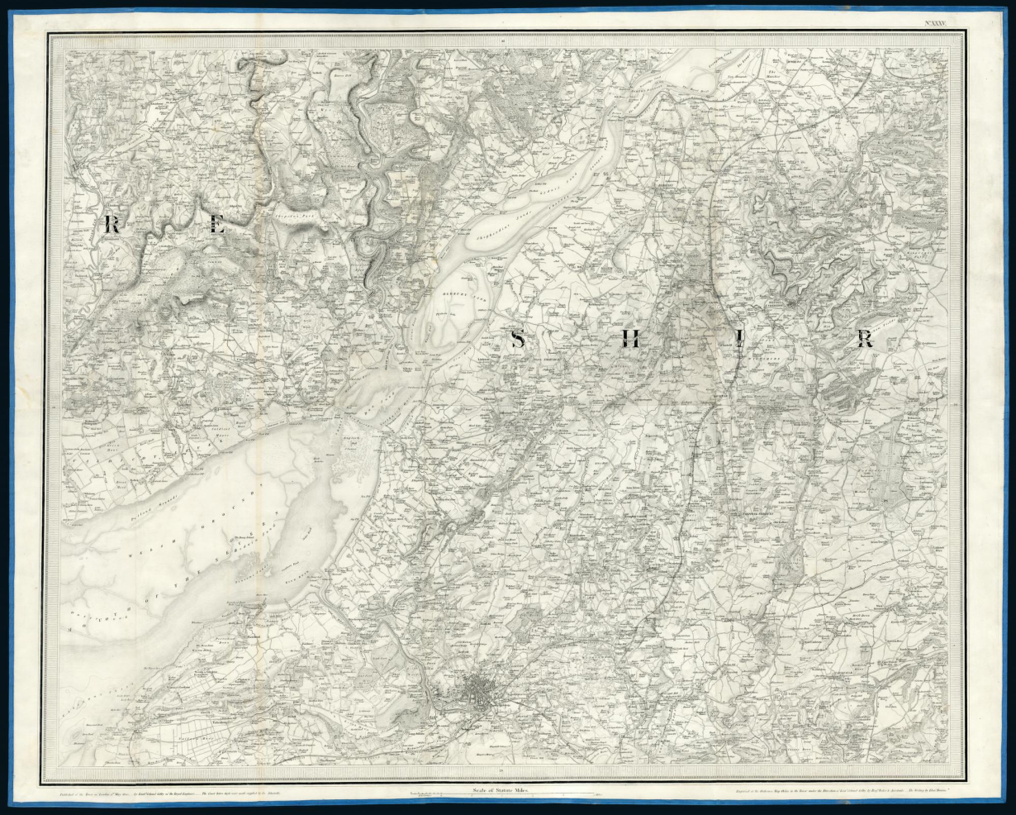
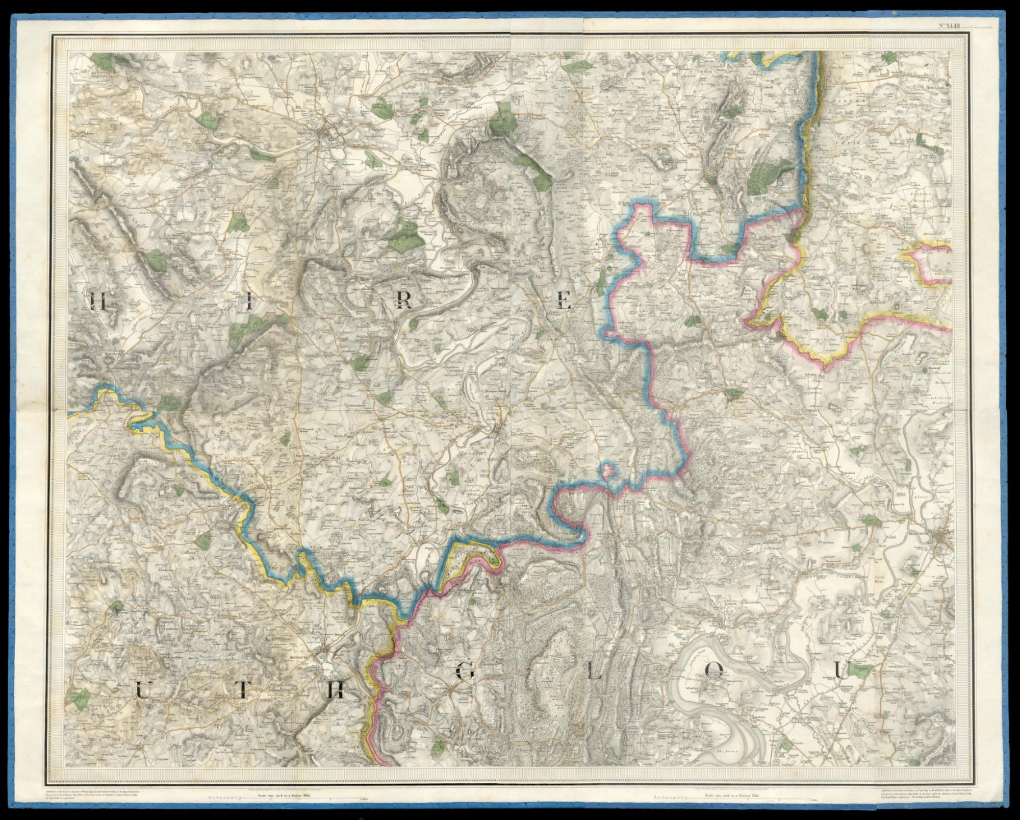
Ordnance Survey “Old Series”, Sheet XXXV Published at the Tower of London the 1st of May, 1830 by Lieut. Col. Colby of the Royal Engineers Engraved by Benjamin Baker et.al. London: 1830 Loaned from the University of Michigan Map Library |

|
Ordnance Survey “Old Series”, Sheet XLIII Published at the Tower of London the 29th of Sept., 1831 by Lieut. Col. Colby of the Royal Engineers Engraved by Benjamin Baker et.al. London: 1831 Loaned from the University of Michigan Map Library This map of the border area between the counties of Monmouthshire and Gloucestershire, along with its companion, is one of the “Old Series” Ordnance Survey maps at a scale of one inch per mile. They are based on a survey that began c.1784 and concluded in 1869. Sheet XXXV includes the city of Bristol, twenty-three miles from Tintern, and two ferry routes, the Old Passage and the New Passage, across the mouth of the Severn River. The River Wye joins the Severn at Chepstow and is tidal as far as Brockweir, just above Tintern. The Ordnance Survey maps offer highly detailed information about the topography, elevations, and features of each region. Their impact on travel in the period was considerable. In the 1830s, a few years after their publication, Thomas Roscoe describes exploring the upper reaches of the River Wye with the relevant maps in hand: My sole guides were those right faithful ones the maps of the Ordnance Survey, and occasionally ‘forgathering’ with a wayside gossip, and making enquiries or remarks on the neighborhood, the utter astonishment manifested by my honest friends at my accurate knowledge of each locality, although now traversing the district for the first time, was highly amusing. They seemed in good truth, to imagine I was ‘no canny,’ as the Scotch say — and once, on my rightly naming a hill we were about to pass, my then companion, looking at me with a most comical mixture of fear and puzzlement in his face, exclaimed ‘Then the tevil himself told ye’ — nor was a sight of my magical map any argument in favour of my innocence of forbidden knowledge — I must certainly be either a conjuror, or the ‘tevil huself,’ to know the names of places I had never seen before.39 |

|
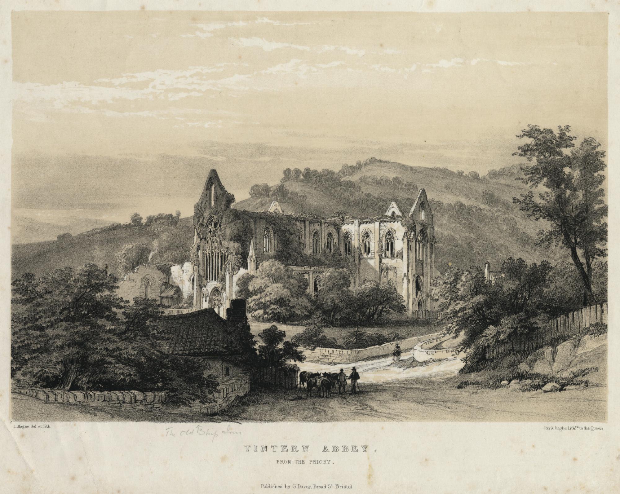
L. Haghe, artist and lithographer Tintern Abbey from the Priory Day & Haghe Lithographers to the Queen Bristol: G. Davey, [c. 1840] Tinted lithograph Loaned from a private collection |

|
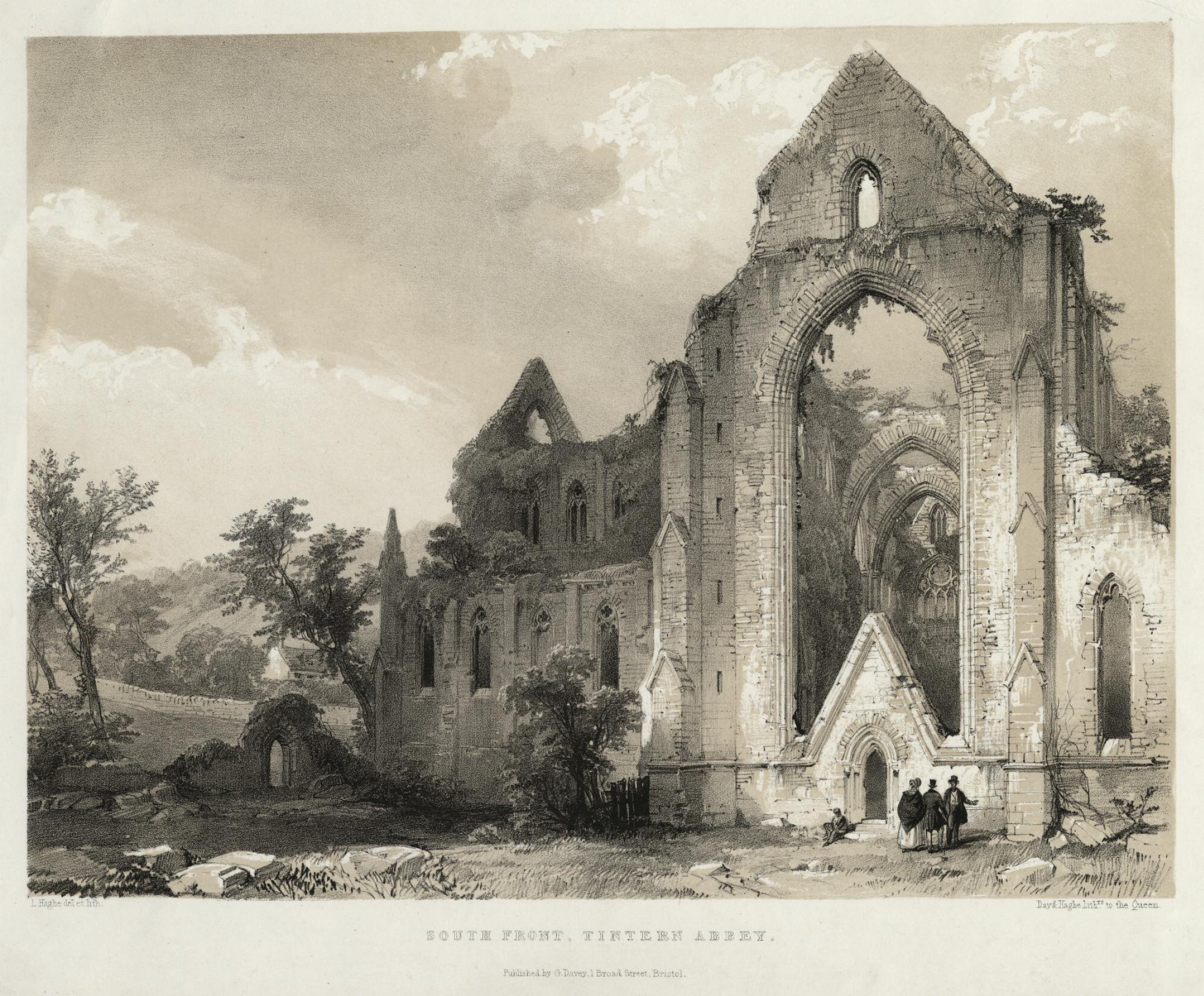
L. Haghe, artist and lithographer South Front, Tintern Abbey Day & Haghe Lithographers to the Queen Bristol: G. Davey, [c. 1840] Tinted lithograph Loaned from a private collection |

|
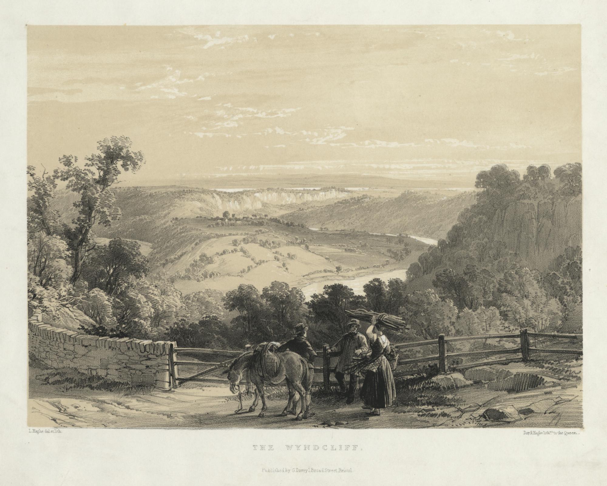
L. Haghe, artist and lithographer The Wyndcliff Day & Haghe Lithographers to the Queen Bristol: G. Davey, [c. 1840] Tinted lithograph Loaned from a private collection |

|
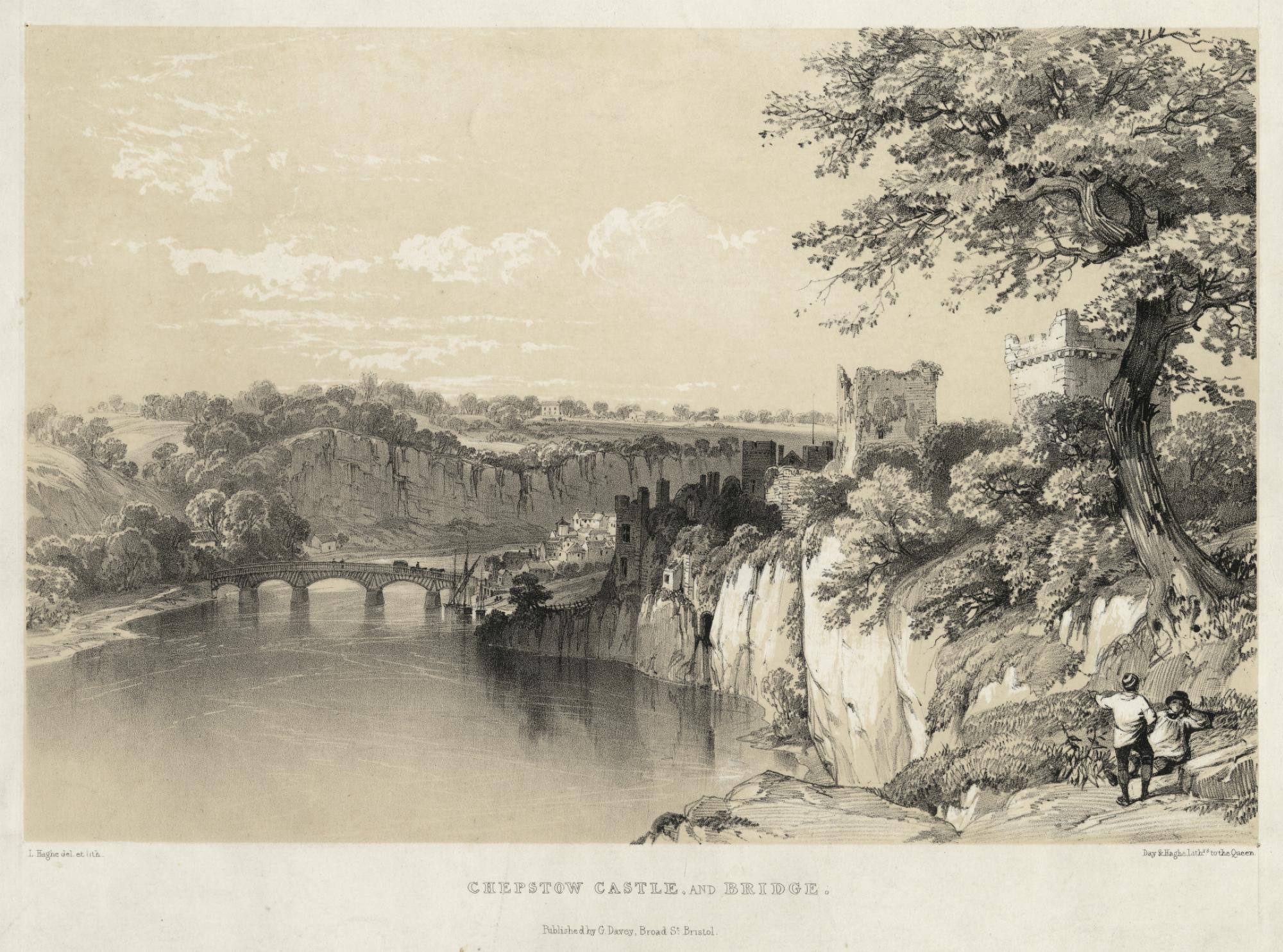
L. Haghe, artist and lithographer Chepstow Castle and Bridge Day & Haghe Lithographers to the Queen Bristol: G. Davey, [c. 1840] Tinted lithograph Loaned from a private collection These two views of Tintern Abbey by Haghe and the companion views of Chepstow Castle and the Wyndcliff are part of a set of 8 lithographs depicting Wye Valley scenery. The luminosity of the images is the result of a layered printing process designed to mimic the effects of a watercolour drawing. |

|
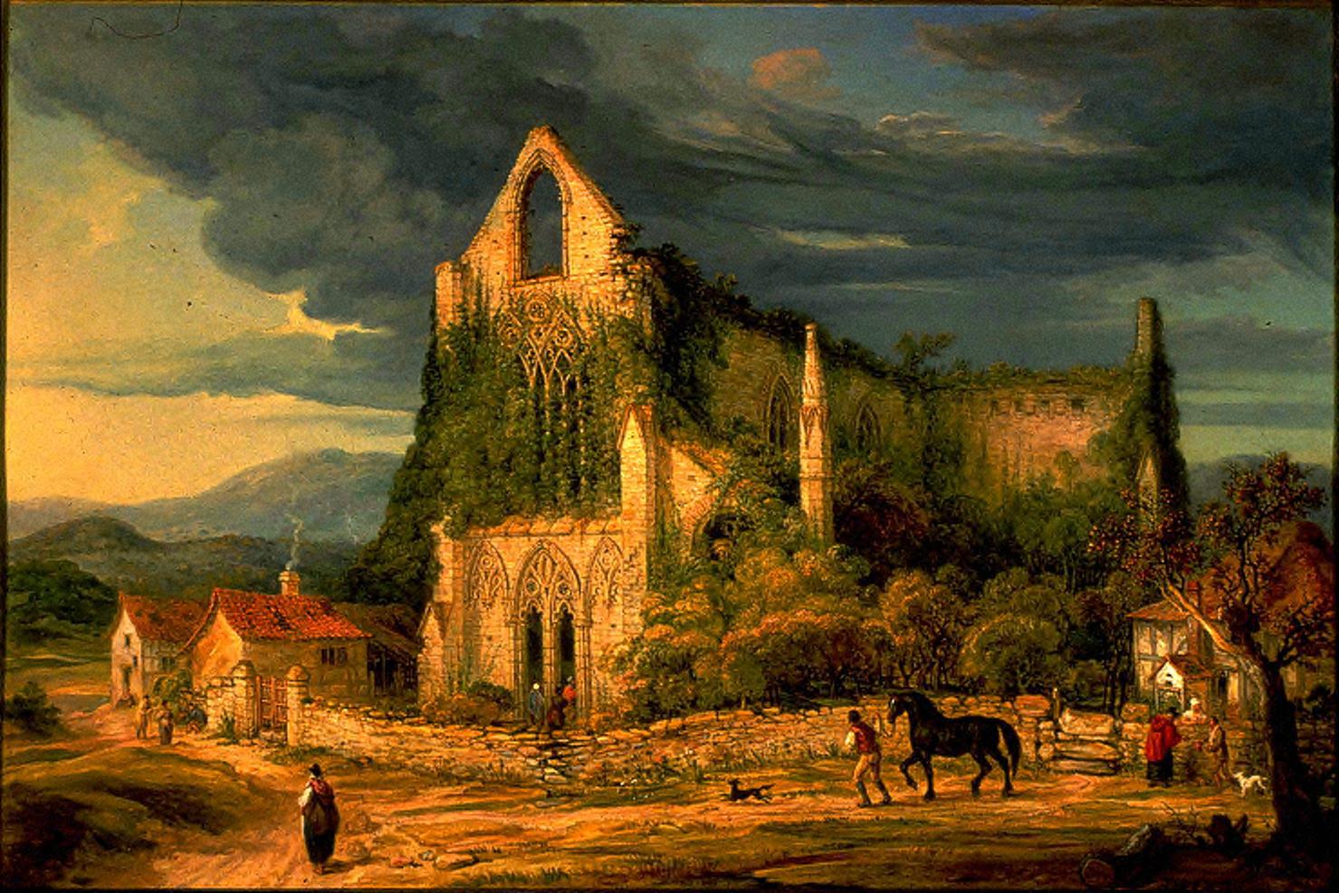
James Ward Tintern Abbey Oil on canvas [Reproduction] From original in University of Michigan Museum of Art. Original size: 61.4cm x 92.1cm. James Ward, R.A., is a painter and engraver known primarily for his depictions of animals, rustic genre scenes and landscapes, although he made some notable excursions into history painting as well. Ward first visited Wales in 1802 through a commission from the Board of Agriculture to paint portraits of livestock. A watercolour view of the Abbey dated 1807 may belong to this preliminary tour.63 Tintern Abbey, exhibited in 1838 at the British Institution with its pair The Wire Mill at Tintern, brings together several characteristic elements of his practice.64 Ward depicts the Abbey’s west entrance and window bathed in the light of sunset. (Compare his treatment to the photograph in the digital slideshow.) The last segment of the day provides an evocative counterpart to the antiquity of the structure. Sunset at Tintern Parva, situated in a mountain valley and on along a northerly latitude of 51 degrees, does not happen with tropical abruptness but rather gradually and lingeringly. Ward muses on different senses of duration here. The tone of the painting is elegiac, shading into the sublime as the eye travels towards the hidden recesses of the ruin and the sweep of approaching night. Ward balances the solemn grandeur of the Abbey with a more natural tendency to record details of the everyday — the traditional red cloaks worn by Welsh women, the little conversations brought on by evening, a giddy dog racing a fine, stable-bound horse. A viewer raised on representations of Tintern Abbey would find enough melancholy and monumentality here to satisfy their expectations. But what Ward really celebrates are the little eddies of local, humble life that swirl about the base of the brooding structure. Charles Heath would cheer. |