“VAGRANT DWELLERS”
Tours & Excursions
“In such a county as this... every foot of which is rendered interesting by History, the time allotted by Writers of Travels for its investigation, can only excite the smile of the native. What can be expected from the information obtained in a pleasure boat, or the casual stopping at an inn, without any acquaintance in the place whose history they presume to illustrate? ”
— Charles Heath
“Vagrant Dwellers” presents a selection of journeys undertaken between the 1770s and early 1830s. These tourists, predominantly English, travel to Tintern by horseback, carriage, on foot or by boat. Rail travel is not an option in the region until the 1870s. Sometimes they alternate between different modes of travel. George Manby walked from Monmouth to Tintern, but gladly accepted a seat afterwards in a boat chartered by a party of female tourists. Gladly that is, until he realized that while flirting he missed key sights going down-river to Chepstow.
The priorities and experiences of travelers change greatly over the course of six decades. The earliest Romantic tourists, such as Gray and Gilpin (“Thoughts of More Deep Seclusion”: The Wye Tour), Grose and Whateley (“Memory Be as a Dwelling Place”: Romanticism & Ruins), were guided by antiquarian itineraries, indeed often following in the footsteps of seventeenth century historians like William Camden and William Dugdale. Before tours of the region became fashionable, early travelers needed to be resilient and adaptable, especially where practical things like lodgings or meals were concerned. The rise of picturesque tourism in the 1780s increased summer traffic in the region exponentially, and the organization of a “service industry” increased in turn. Individual resourcefulness in a traveler seemed a little less necessary when his moves were anticipated or needs scripted in advance.
Just as the Wye Valley tour becomes more structured and self-contained, travel narratives of the region become increasingly self-referential. Earlier accounts seem to contain more of the information or knowledge required to navigate the region, while later accounts emphasize sensation and experience. Some tourists, such as Simond or Sinclair, have the unhappy moment of seeing themselves replicated in other visitors. Post-1800 tours give a greater sense of being written within an existing and familiar narrative. Their business is amendment and refinement, rather than discovery and invention.
Works on Display:
- A Tour through Monmouthshire and Wales
- A Pedestrian Tour of North Wales
- An Historical Tour in Monmouthshire
- An Historic and Picturesque Guide from Clifton through the counties of Monmouth
- Journal of a Tour and Residence in Great Britain
- Wanderings and Excursions in South Wales
- Hill and Valley, or Hours in England and Wales
- “London to Chepstow”
- “Cross Roads, Bath to Chepstow”
- Ordnance Survey “Old Series”, Sheet XXXV
- Ordnance Survey “Old Series” Sheet No. XLIII
- Tintern Abbey from the Priory
- South Front, Tintern Abbey
- “Useful Information to Travellers”
- The Wyndcliff
- Chepstow Castle and Bridge

view related images |
Henry Penruddocke Wyndham A Tour through Monmouthshire and Wales, Made in the Months of June, and July, 1774, and in the Months of June, July, and August, 1777 Salisbury: printed and sold by E. Easton, 1781 Henry Penruddocke Wyndham, Member of Parliament and topographer, took his first Welsh tour in the summer of 1774. Although he visited the region four years after Thomas Gray and William Gilpin initially ventured there, his account was published eight years earlier than Gilpin’s Observations on the River Wye. Wyndham’s narrative first appeared, anonymously, in 1775 under the title A Gentleman’s Tour through Monmouthshire and Wales. A second edition followed in 1781, and in 1797 a little duodecimo issue with the imprint “printed, by assignment of T. Evans ... for J. Nunn”.Wyndham’s 1774 experiences were supplemented by a three-month excursion in the summer of 1777 with the Swiss artist Samuel Hieronymous Grimm.29 The two tours were published together, this time under Wyndham’s name, as A Tour through Monmouthshire and Wales. One wonders what made the author forget he was a gentleman this time around. The volume displayed here declares itself a "second edition" and contains illustrations “drawn on the spot” by Grimm. A Tour was first published, Wyndham says in the preface to his 1775 volume, to induce his countrymen to visit Wales. He observes that “while English roads are crowded with traveling parties of pleasure, the Welsh are so rarely visited, that the author did not meet with a single party during his six weeks journey through Wales”. This would change dramatically in the next decade. Wyndham grumbles that his original excursion in 1774 had been hampered by the “little intelligence”on the region he could glean from existing publications, and the little assistance he met with enroute. Consequently his volume balances practical advice on travel (go by water: the roads are “very indifferent”) with descriptions of significant features like antiquarian sites, although he warns that he will avoid “minute historical detail”. Of Tintern Abbey he says ”no monastical ruin in Great Britain presents a more beautiful perspective than the inside of the abbey church” and notes the provisions, then considered extraordinary, taken for its preservation: “the fallen ornaments of the once vaulted roof, and the broken monuments of ancient abbots and benefactors, are so disposed in moderate piles, that all their sculpture, which is remarkably sharp, and well executed, may be inspected with the utmost facility”.30 It is a measure of the rise in Welsh tourism between 1775 and 1781 that by the “second edition” of his Tour through Monmouthshire, Wyndham has to justify his itinerary. In particular, he answers objections that there is no engraving of Tintern Abbey nor of Chepstow: “it is because they have been frequently published, and are too well known to be again repeated, those only are here ...which have either never been engraven, or which have not been made familiar to the world by the late numerous publications”.31 |

view related images |
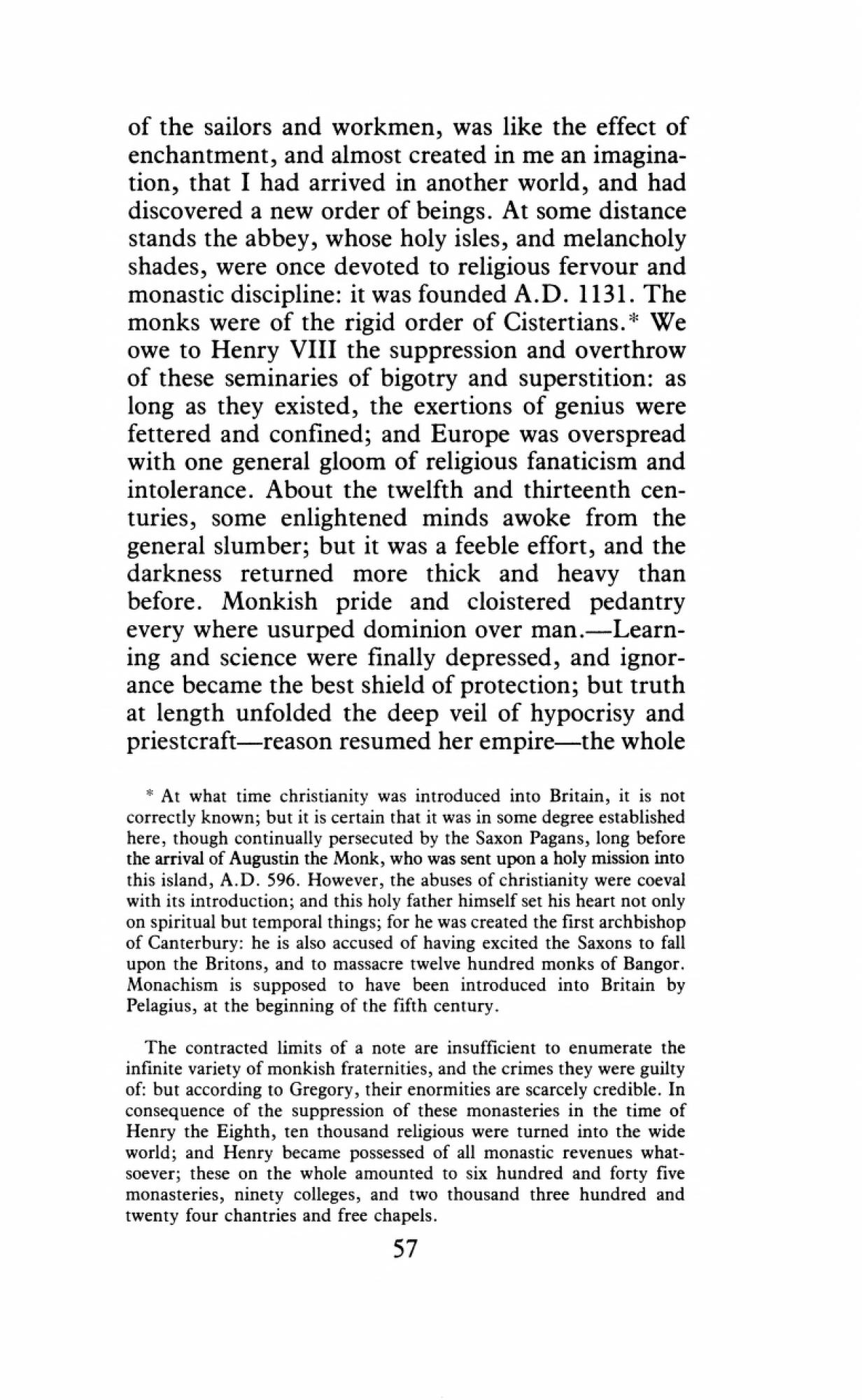
Joseph Hucks A Pedestrian Tour of North Wales, in a Series of Letters by J. Hucks, B.A. (1795). Ed. A.R. Jones and W. Tydeman Cardiff: University of Wales Press, 1979 Joseph Hucks, advocate and poet before his untimely death at age 28, toured Wales in the summer of 1794 with his undergraduate Cambridge friend Samuel Taylor Coleridge. Coleridge describes Hucks rather slightingly in a letter as “a Man of cultivated, tho’ not vigorous, understanding - his feelings are all on the side of Humanity”.32 Between July 5th and August 4th, 1794, the pair walked over 600 miles - a significant achievement given that the vogue for pedestrian tours was just beginning, and voluntary walking from place to place was not considered very respectable. Hucks relates that in this period of national alarm they were taken for recruits - or Frenchmen. Hucks reached Tintern at the tail-end of the excursion and recorded his response in a letter dated August 2nd. Coleridge’s parallel letters about their tour to friends Robert Southey and Robert Martin challenge or revise some aspects of Hucks’s narrative, but cease altogether after July 22nd. The Pedestrian Tour was likely published by Hucks himself and was advertised in May of 1795.33 Hucks’s approach to Tintern Abbey in this account is mediated by the lively commercial scene of the river: “boats in full sail...others landing their cargo, with the busy and cheerful cries of the sailors and workmen”, all of which worked on him “like an enchantment, and almost created in me an imagination, that I had arrived in another world.” Hucks observes that the Abbey stands at some distance from the pleasing economy of the river. Perhaps it is his perception of the Abbey’s detachment that provokes the anti-clericalism of the passage displayed here, although the sentiments are consistent with someone in Coleridge’s radical circle. |

view related images |
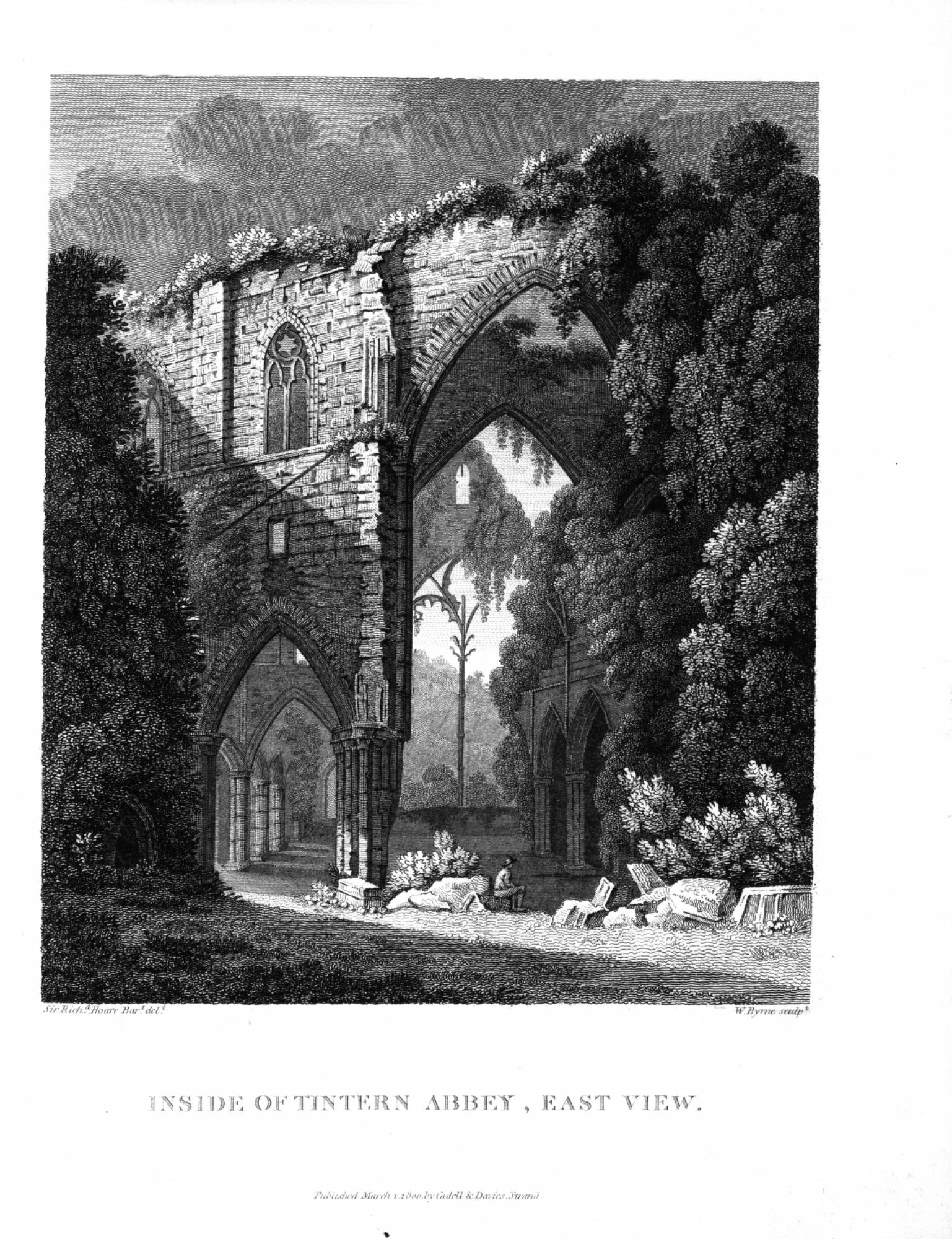
William Coxe An Historical Tour in Monmouthshire; illustrated with views by Sir R. C. Hoare, bart. London: printed for T. Cadell Jun and W. Davies, 1801 Opened to:“Inside of Tintern Abbey, East View.” March 1, 1800. (Richard Hoare, artist; W. Byrne, engraver). Vol.2 William Coxe, historian, clergyman, and member of the Society of Antiquaries, first travelled to Wales in summer of 1798 with his friend and patron Sir Richard Colt Hoare. Hoare, owner of the magnificent Stourhead estate in Wiltshire, was an antiquary and prolific amateur artist. Their initial, impromtu tour of Monmouthshire was so agreeable that it sparked plans for a history of the county. Two further tours followed smartly in 1799.34 Coxe dedicated the resulting two-volume work to Hoare, noting that it was “commenced in your Company, written at your suggestion and embellished by your pencil”.35 Coxe admits his first sight of Tintern Abbey from a distance was disappointing. He notices that some remains of the Abbey have been recycled into humble dwellings and cottages, or “interspersed among iron foundries and habitations”. Importunate beggars impede his progress to the west door, as they did Gilpin’s entrance decades earlier. His “instantaneous burst of admiration” once inside is surely heightened by relief. Within the Abbey’s walls he is free to contemplate, with unalloyed delight, “gothic architecture in its greatest purity.” Hoare is present in the text through his numerous illustrations. He also figures in the narrative as an acute observer and transcriber of landscape and antiquities. His gaze supplements and modifies that of the author. Readers are usually aware of Hoare’s activities and degree of proximity as well as Coxe’s position. At Tintern, for instance, Coxe completes his examination of the Abbey’s interior and leaves Hoare sketching the northwest facade, while he crosses the ferry and walks down river to gain a different perspective. In his drawing of the east view of the interior of Tintern Abbey, engraved by William Byrne, Hoare is carrying forward the lessons of his Continental tours and intensive study of classical ruins. As the text explains, “ the general form of the east window is entire, but the frame is much dilapidated; it occupies the whole breadth of the choir, and is divided into two large and equal compartments, by a slender shaft not less than fifty feet in height, which has an appearance of singular lightness, and in particular points of view seems suspended in the air.” To this “Nature has added her ornaments to the decorations of art; some of the windows are wholly obscured, others partially shaded by tufts of ivy or edged with lighter foliage. The tendrils creep along the walls, wind round the pillars, wreath the capitals, or hanging down in clusters obscure the space beneath”. |

view related images |
George W. Manby An Historic and Picturesque Guide from Clifton through the counties of Monmouth, Glamorgan, and Brecknock, with Representations of Ruins, Interesting Antiquities &c. Bristol: Printed by Fenley & Baylis, 1802 Capt. George William Manby, inventor and author, wrote several modest works dealing with the antiquities and scenery of the Bristol region and southern Wales between 1801 and 1802. They are illustrated with small aquatint plates after his own amateurish drawings. His real ingenuity seems to have found expression in a number of life-saving inventions, including a device for firing a rope to a sinking ship, a forerunner of the emergency flare, and a proto-fire extinguisher. One likes to imagine that as a traveller he was not easily ruffled.36 Manby’s Historic and Picturesque Guide offers “a circuit by no means expensive” that takes in the requisite number of “venerable piles,” “scenery in beautiful forms,” and “manufactories.” His work digests the narratives of Wyndham, Coxe and Warner, and quietly lifts phrases from Gilpin. Clearly by 1802 the expectations as well as discourse surrounding the tour are well-defined. Manby himself travels mostly by horseback, with the occasional stint of walking for pleasure, as he does here between Monmouth and Tintern Abbey. Although he loses his way near Brockweir, and nearly pitches into the River Wye (perhaps stopping to play the flute under a tree made him giddy), he is suitably elevated by his experience of the Abbey. A pleasant detail in the midst of a conventionally admiring (and not very grammatical) description is that he can hear an “indistinct echo” of the river from inside of the ruins. Manby also records that those guiding visitors round the site would produce a brief written account of the Abbey’s foundation for their clients to read. This conjunction of orality and literacy in the communication of the abbey’s history marks a significant cultural moment. |

view related images |
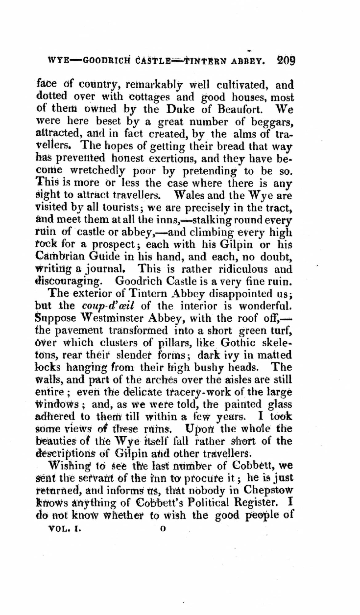
Louis Simond Journal of a Tour and Residence in Great Britain, During the Years 1810 and 1811 by a French traveller : with Remarks of the Country, its Arts, Literature, and Politics, and on the Manners and Customs of its Inhabitants Edinburgh : Printed by G. Ramsay, for A. Constable, 1815 Simond’s account of the Welsh segment of his British tour shows how highly organized tourism in the Wye Valley had become by 1810. He claims that conveniences now available for travelers made thought or foresight virtually unnecessary -- assuming one’s purse was well-supplied. At Ross-on-Wye, for instance, his party was instantly pegged as “people of taste in search of picturesque beauties” and a boat organized by the landlord of their inn. The cost for a 45 mile, 2-day trip from Ross to Chepstow: £4. 10s, plus provisions for the boatmen. Packaged travel usually comes at the expense of individuality or singularity. On this page of the text, the traveller Simond complains of being caught up in the Wye “tract” of castles, abbeys, and rocks with tourists, “each with his Gilpin or his Cambrian Guide in his hand, and each no doubt writing a journal.” Perhaps it is this discouragement which leaves Simond rather unmoved by Tintern Abbey. Although he describes the ruin vividly as “Westminster Abbey with the roof off” he admits that the whole falls short of his expectations. |

view related images |
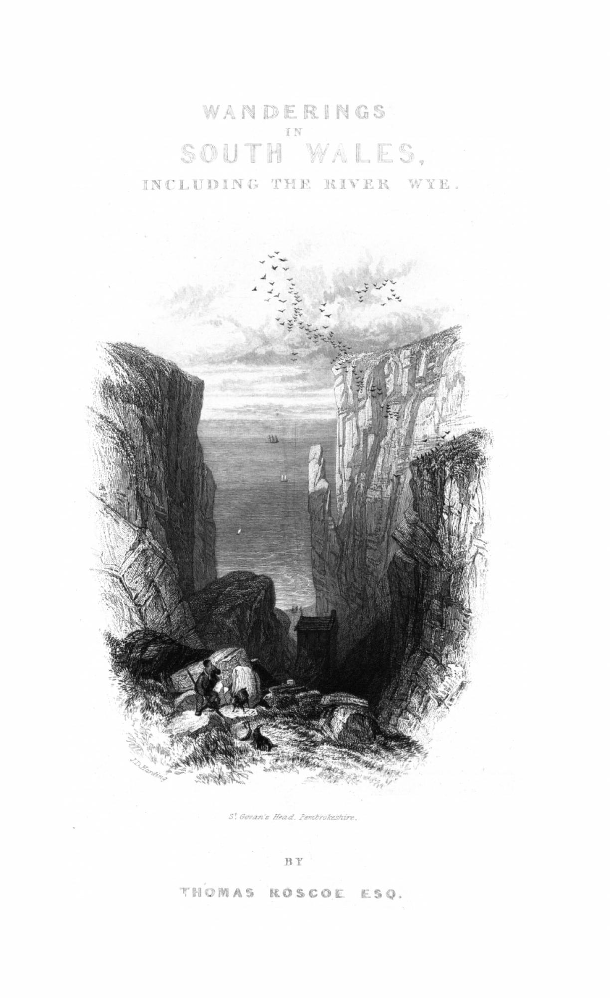
Thomas Roscoe Wanderings and Excursions in South Wales, including the Scenery of the River Wye London: C. Tilt, and Simkin and Co [&etc], 1837 Thomas Roscoe was an author, translator and traveler in Britain and continental Europe. Wanderings and Excursions in South Wales is the sequel to his popular tour of North Wales published the previous year. It was partly written by Louisa Twamley, afterwards Mrs. Charles Meredith, a poet and artist who would later emigrate to New South Wales to became an important botanical painter and recorder of colonial life. As befits the authors’ combined powers of observation and reference, South Wales is a sophisticated, self-conscious work. Even the distinction between"Wanderings" and "Excursions" in the title suggests a new mentality of travel grafted on to an "old style" of tourism. South Wales, full of nice engravings after the work of David Cox, Copley Fielding and others, is like a diploma work of sentimental tourism. It is conscious of the past, but points to the evolving expectations and needs of visitors. Some of these changes were reflected in fabric of the Abbey itself. From Roscoe and Twamley we learn that in the late 1830s, “by means of steps, rails, and planks, all travelers, even elderly ladies, may safely traverse the walls of Tintern from summit to floor, a circumstance greatly extolled by many wanders in search of the picturesque.” |

view related images |
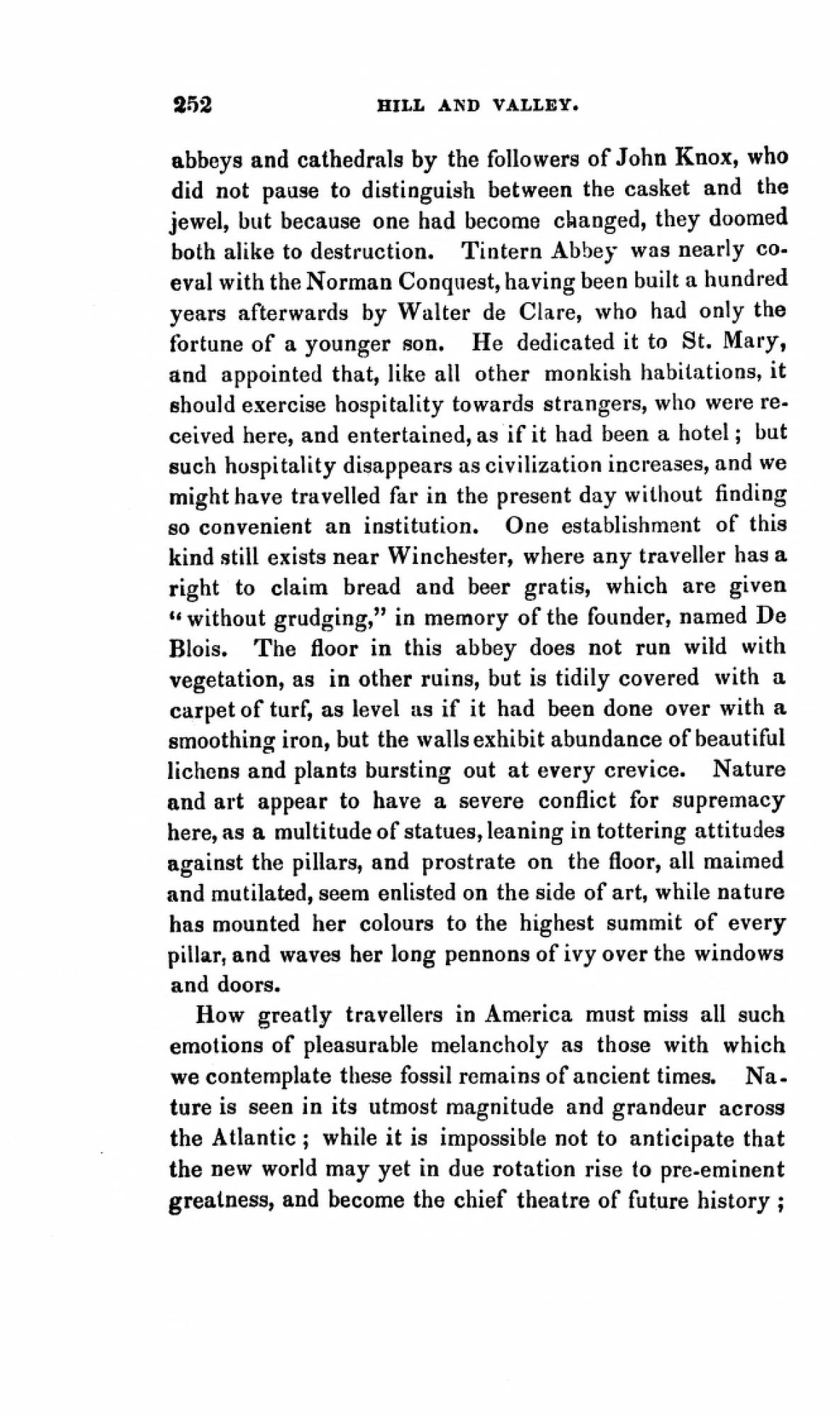
Catherine Sinclair Hill and Valley, or Hours in England and Wales New York: R. Carter, 1838 Born in Edinburgh, Catherine Sinclair wrote romantic novels (titles such as Modern Accomplishments and Modern Society tell all), children’s books and travel guides. The overlap between these genres is evident in Hill and Valley, which is by turns narrative, historical and avuncular. Sinclair’s account acknowledges the canonical place of Tintern Abbey by the early 1830s. So familiar has text, image and conversation made the Abbey that one seems “to have been haunting the venerable ruin all their lives; I scarcely felt as if a spot could be unknown to memory there, even when thus approaching it for the first time.” |

view related images |
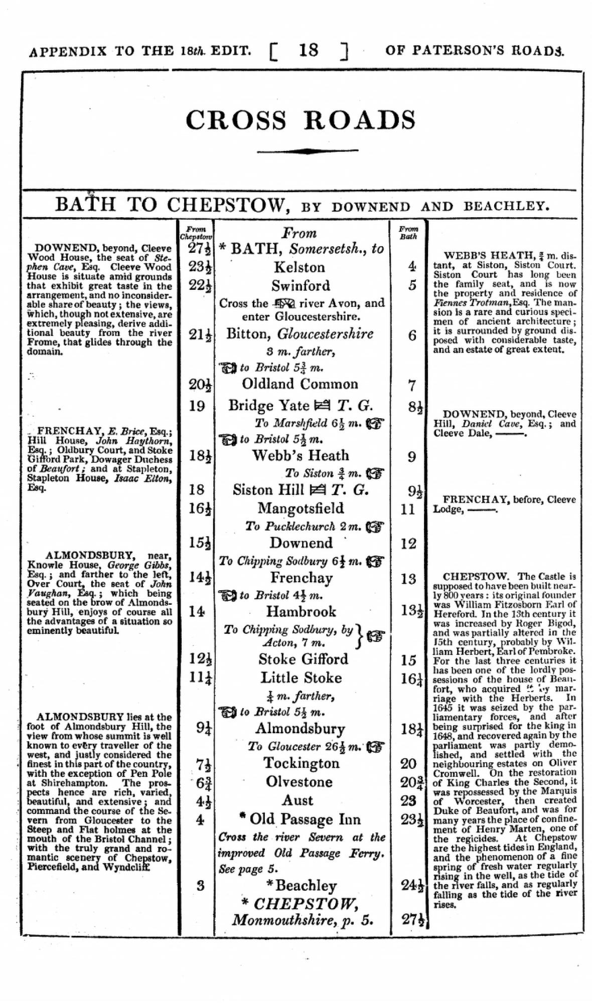
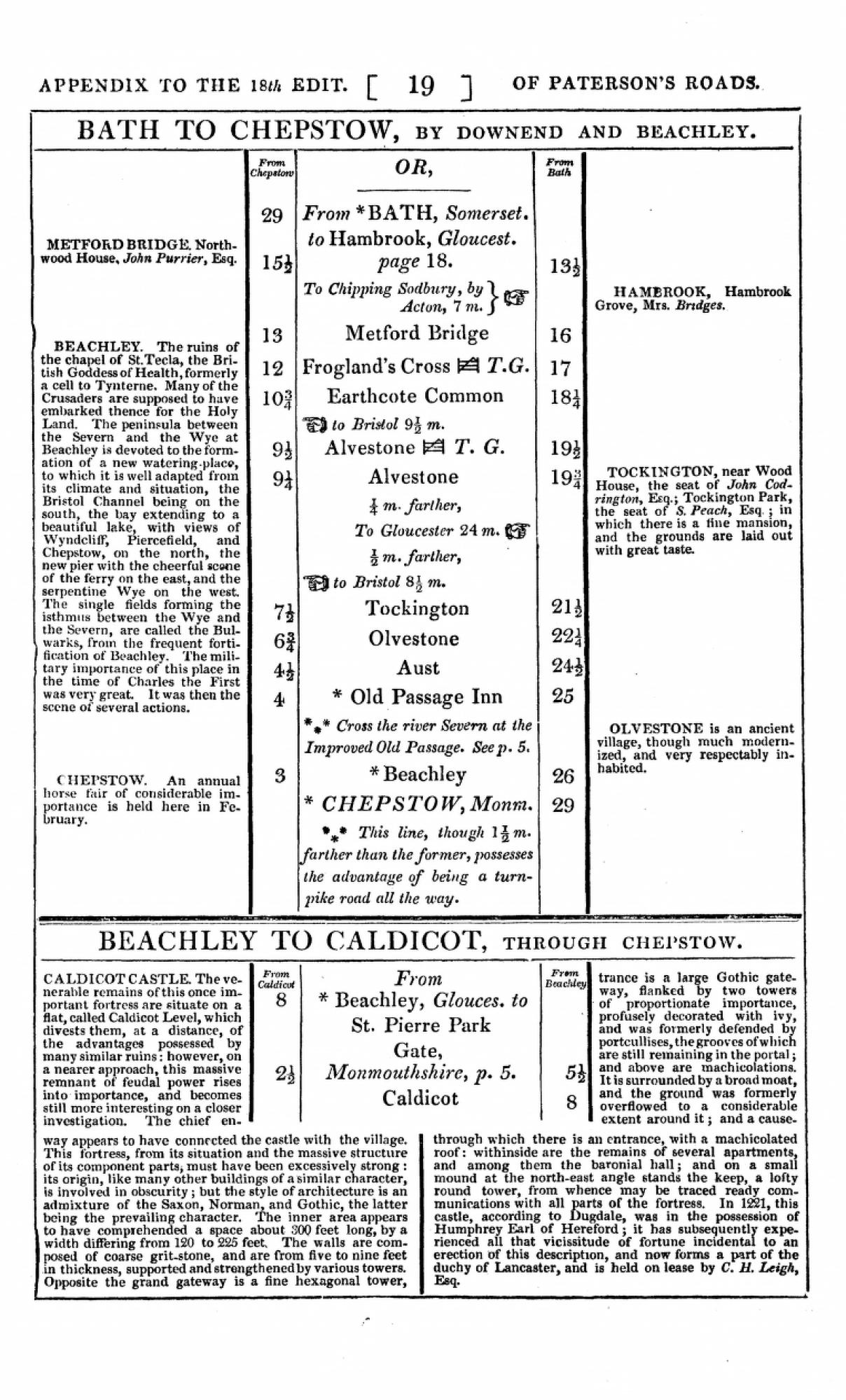
“London to Chepstow” Reproduced from Paterson’s Roads; Being an Entirely Original and Accurate Description of all the Direct and Principal Cross Roads in England and Wales, with Part of the Roads of Scotland. Appendix by Edward Mogg London: Printed for C.J.G. and F. Rivington, [&etc.], c.1829 |


|
“Cross Roads. Bath to Chepstow” Reproduced from Paterson’s Roads; Being an Entirely Original and Accurate Description of all the Direct and Principal Cross Roads in England and Wales, with Part of the Roads of Scotland. Appendix by Edward Mogg London: printed for C.J.G. and F. Rivington [& etc.], c.1829 Appendix pp.18-20 Daniel Paterson, an army officer, produced guides in use for roughly sixty years. They were even used to calculate the distances and expenses of military marches.37 Paterson’s Roads was begun in 1771 when the author was an ensign in the 30th Regiment of Foot. From a modest volume of Indexes and Itineraries it would grow through 22 editions into an 848-page work. The emphasis of the work is not primarily on maps, but rather on laying out in sequential order the stages of a specific journey. The 147 mile trip from London to Tintern-Chepstow, and the shorter route from Bath to Tintern-Chepstow are reproduced in this exhibition. With its notices of landmarks, coaching inns, bridges, turnpikes and distances, Paterson’s Roads vividly records the stops, starts, and challenges of post-chaise travel in the period. Examining this one understands why Mrs. Morland in Austen’s Northanger Abbey is impressed that her teenage daughter is capable of traveling seventy miles on her own: “my dear Catherine, you always were a sad little shatter-brained creature; but now you must have been forced to have your wits about you, with so much changing of chaises and so forth.”38 In 1822 Edward Mogg became the editor of Paterson’s Roads. The 16th edition, published under his direction, sports new type and arrangement as well as re-engraved maps, making it “the final development of the road-book of the pre-railway era.” The 18th edition included an additional appendix and a separate map of The Banks of the Wye.39 The General Map of the Roads of England and Wales displayed here was commissioned by Mogg and first published Aug. 1, 1826. |

|
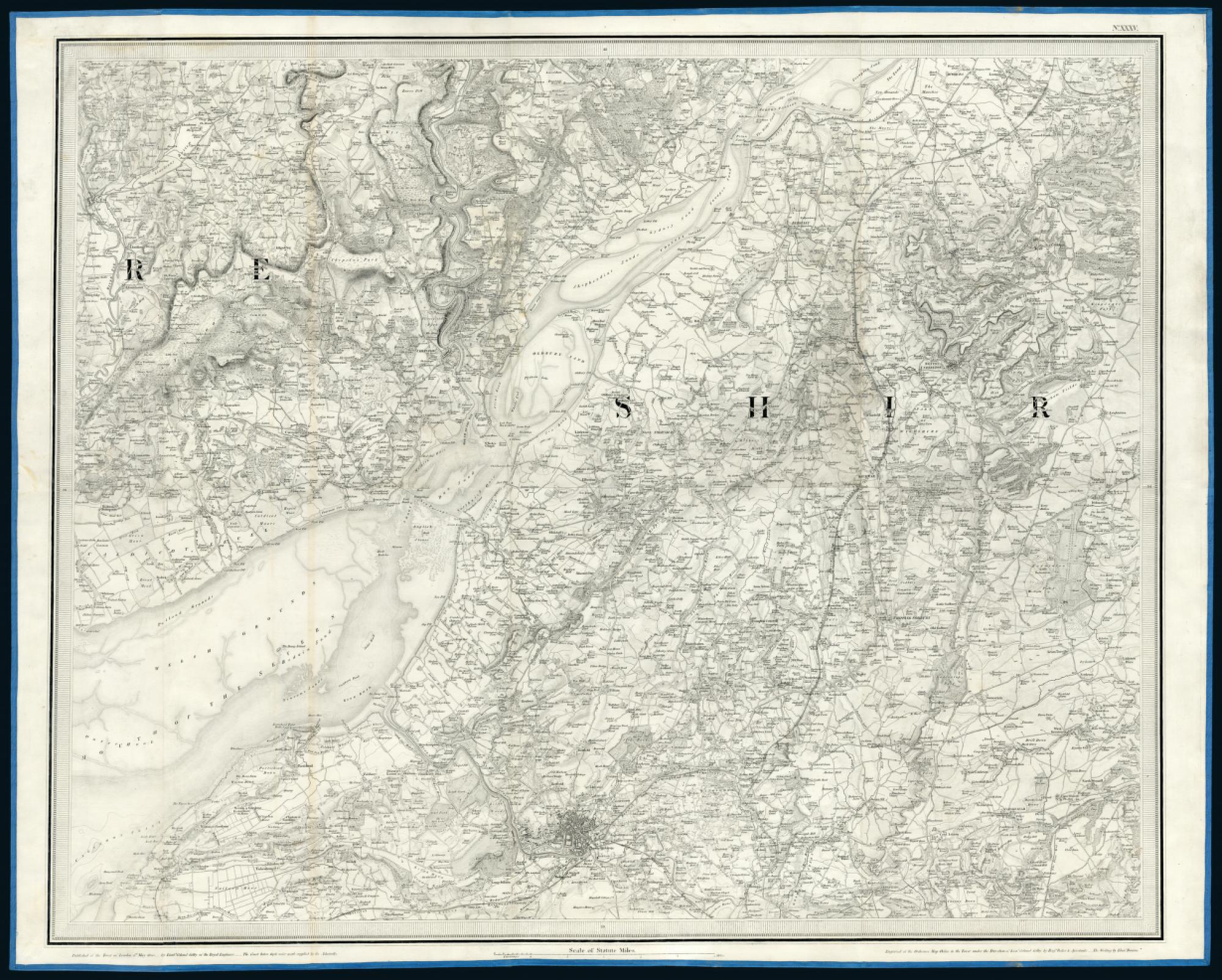
Ordnance Survey “Old Series”, Sheet XXXV Published at the Tower of London the 1st of May, 1830 by Lieut. Col. Colby of the Royal Engineers. Engraved by Benjamin Baker et.al. London: 1830 Loaned from the Map Library, University of Michigan |

|
Ordnance Survey “Old Series”, Sheet No. XLIII
Published at the Tower of London the 29th Sept. 1831 by Lieut. Col. Colby of the Royal Engineers. Engraved by Benjamin Baker et.al. London: 1831 These two maps of the border area between the counties of Monmouthshire and Gloucestershire are part of the “Old Series” Ordnance Survey maps at a scale of one inch per mile. They are based on a survey that began c.1784 and concluded in 1869. Sheet XXXV includes the city of Bristol, twenty-three miles from Tintern, and two ferry routes, the Old Passage and the New Passage, across the mouth of the Severn River. The River Wye joins the Severn at Chepstow and is tidal as far as Brockweir, just above Tintern. The Ordnance Survey maps offer highly detailed information about the topography, elevations, and features of each region. Their impact on travel in the period was considerable. In the 1830s, a few years after their publication, Thomas Roscoe describes exploring the upper reaches of the River Wye with the relevant maps in hand: My sole guides were those right faithful ones the maps of the Ordnance Survey, and occasionally ‘forgathering’ with a wayside gossip, and making enquiries or remarks on the neighborhood, the utter astonishment manifested by my honest friends at my accurate knowledge of each locality, although now traversing the district for the first time, was highly amusing. They seemed in good truth, to imagine I was ‘no canny,’ as the Scotch say — and once, on my rightly naming a hill we were about to pass, my then companion, looking at me with a most comical mixture of fear and puzzlement in his face, exclaimed ‘Then the tevil himself told ye’ — nor was a sight of my magical map any argument in favour of my innocence of forbidden knowledge — I must certainly be either a conjuror, or the ‘tevil huself,’ to know the names of places I had never seen before.40 |

|
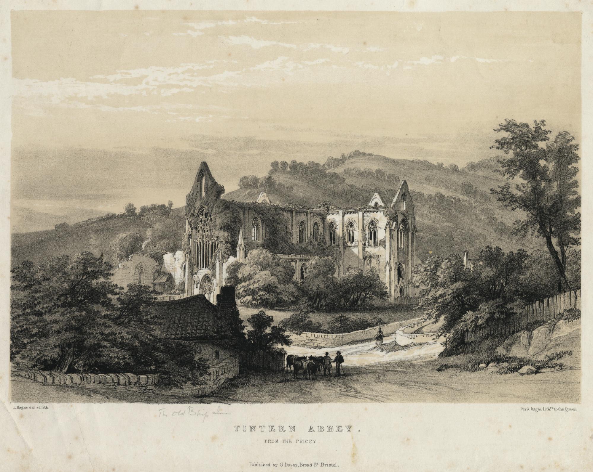
L. Haghe, artist and lithographer Tintern Abbey from the Priory. Day & Haghe Lithographers to the Queen Bristol: G. Davey, [c.1840] Tinted lithograph Loaned from a private collection |

|
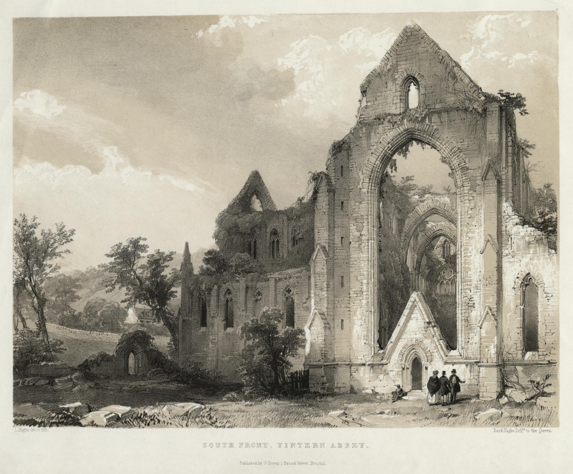
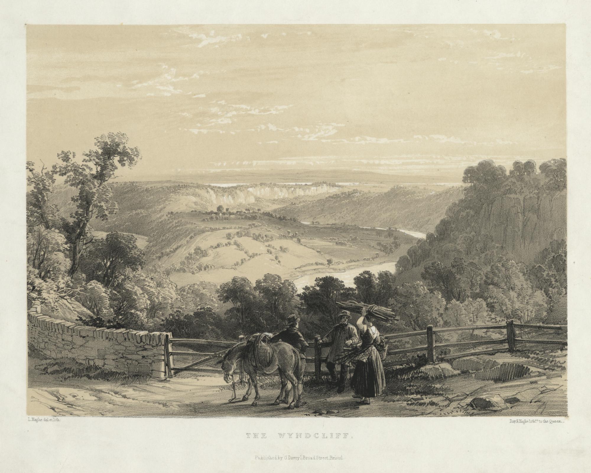
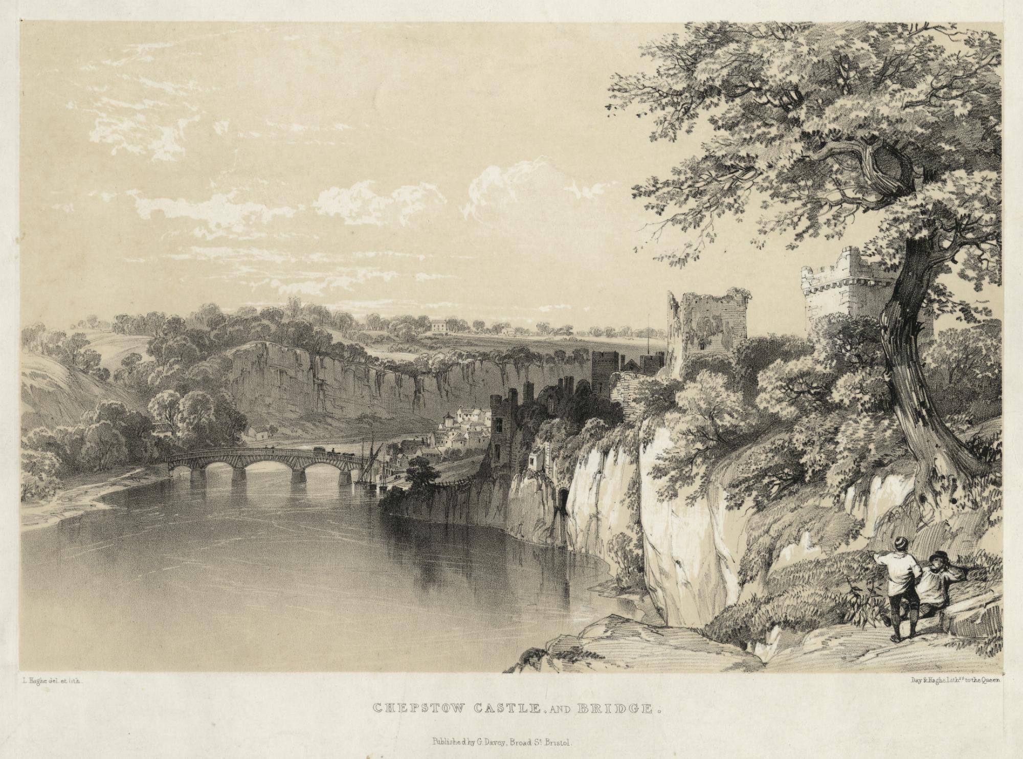
L. Haghe, artist and lithographer South Front, Tintern Abbey. Day & Haghe Lithographers to the Queen Bristol: G. Davey, [c.1840] Tinted lithograph Loaned from a private collection These two views of Tintern Abbey by Haghe and the companion views of Chepstow Castle and The Wyndcliff (below) are part of a set of 8 lithographs depicting Wye Valley scenery. The luminosity of the images is the result of a layered printing process designed to mimic the effects of a watercolour drawing. |


|
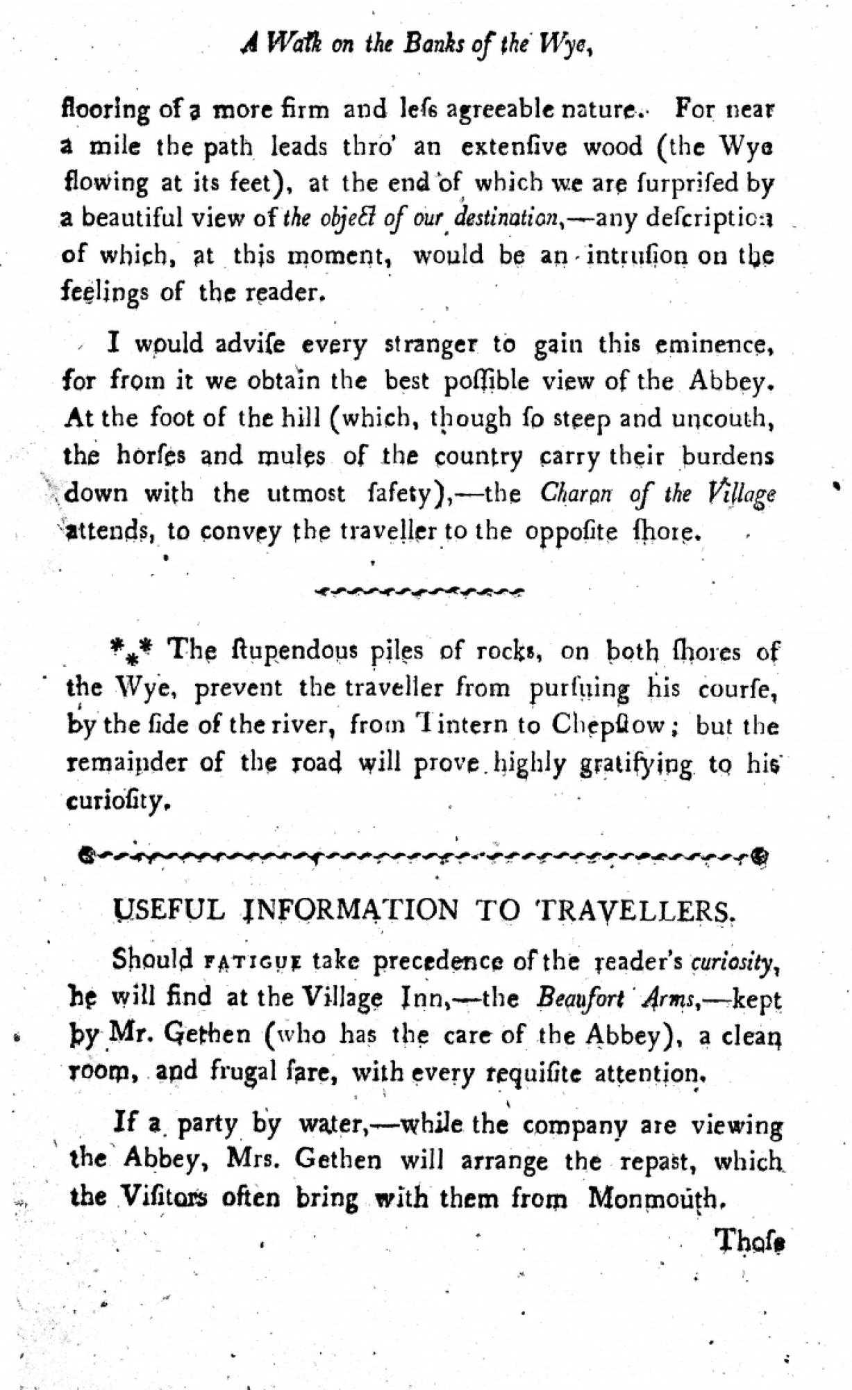
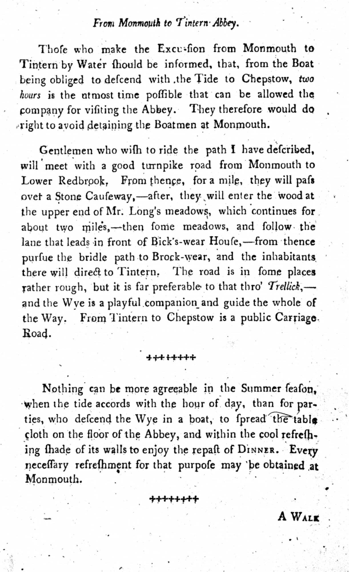
“Useful Information to Travellers” Reproduced from Charles Heath: Historical and Descriptive Accounts of the Ancient and Present State of Tintern Abbey Monmouth: Charles Heath, 1803 |

|
L. Haghe, artist and lithographer The Wyndcliff. Day & Haghe Lithographers to the Queen Bristol: G. Davey, [c.1840] Tinted lithograph Loaned from a private collection |

|
L. Haghe, artist and lithographer Chepstow Castle and Bridge. Day & Haghe Lithographers to the Queen Bristol: G. Davey, [c.1840] Tinted lithograph Loaned from a private collection |