“WREATHS OF SMOKE”
Industrial Tintern
“Here, now no bell calls Monks to morning prayer,
Daws only chaunt their early matins here;
Black forges smoke, and noisy hammers beat ”
— S. Davis, “Poetical Description of Tintern”
Wordsworth may imagine in “Lines, Written a Few Miles Above Tintern Abbey” that the smoke rising with “uncertain notice” from the trees signals the presence of gypsies or a hermit, but in fact, Tintern was the site of a substantial iron foundry, the location of Great Britain's first industrial blast furnace, and home to a long-established wire works.
The region was shaped economically and environmentally by the presence of iron ore and coal in the hills, a ready source of charcoal in the adjacent Forest of Dean, and the transportation route created by the river. The vicinity of Tintern was also pocked with ancient and working limestone quarries. Coleridge narrowly escaped riding his borrowed horse into a quarry in 1795 when he and his companions lost their way to Tintern in the dark (see Cottle: Early Recollections).
Travelers descending the ten mile stretch of the River Wye between Goodrich Castle and New Weir would see hills dotted with lime-kilns, stone quarries, an iron works known as Bishop's Wood Furnace, and “a very plentiful mine” called the Lidbrooke Colliery.24 At New Weir, the natural chasm and cascade (delightfully categorized under the heading “Rocks Characterised by Terror” in Whateley's Observations on Modern Gardening) was juxtaposed with a lock and “an Iron Forge, covered with a black cloud of smoak, and surrounded with half-burned ore, with coal, and with cinders. The fuel for it is brought down a path worn into steps, narrow and steep, and winding among precipices; and near it is an open space of barren moor, about which are scattered the huts of workmen.”
The bucolic ten-mile stretch of the river between Monmouth and Tintern, the last segment of the Wye before the Abbey, was punctuated by the Redbrook iron and tin works, the Whitebrook paper mills, and busy Brockweir, “a commodious little port,”where one might see “several sloops and schooners from 30 to 80 tons...discharging and taking in their cargoes”.25 One Bristol shipping firm even had a Wye trow (a strong, flat-bottomed boat for inland navigation) named “Abbey Tintern.”26
It was common for tourists to visit the natural, industrial and archeological sites of Tintern in sequence. The industrial sublime thus qualified the architectural sublime of the Abbey and the picturesque features of its setting. Tintern's industrial patrimony (reaching back, in fact, to ancient iron works in the hills around the village) is a crucial element in the valuation and experience of the Abbey in the period. To Romantic viewers, the contrast between the frantic activity and clamor of the foundries, and the old silences of the Abbey was just the touch needed to push poignancy into better-grade melancholy.
Works on Display:
- “The Manner of Wire Work at Tintern”
- A Walk Through Wales
- “Iron Foundry”
- “View on the Wye”
- “A Tour to the West of England in 1788”
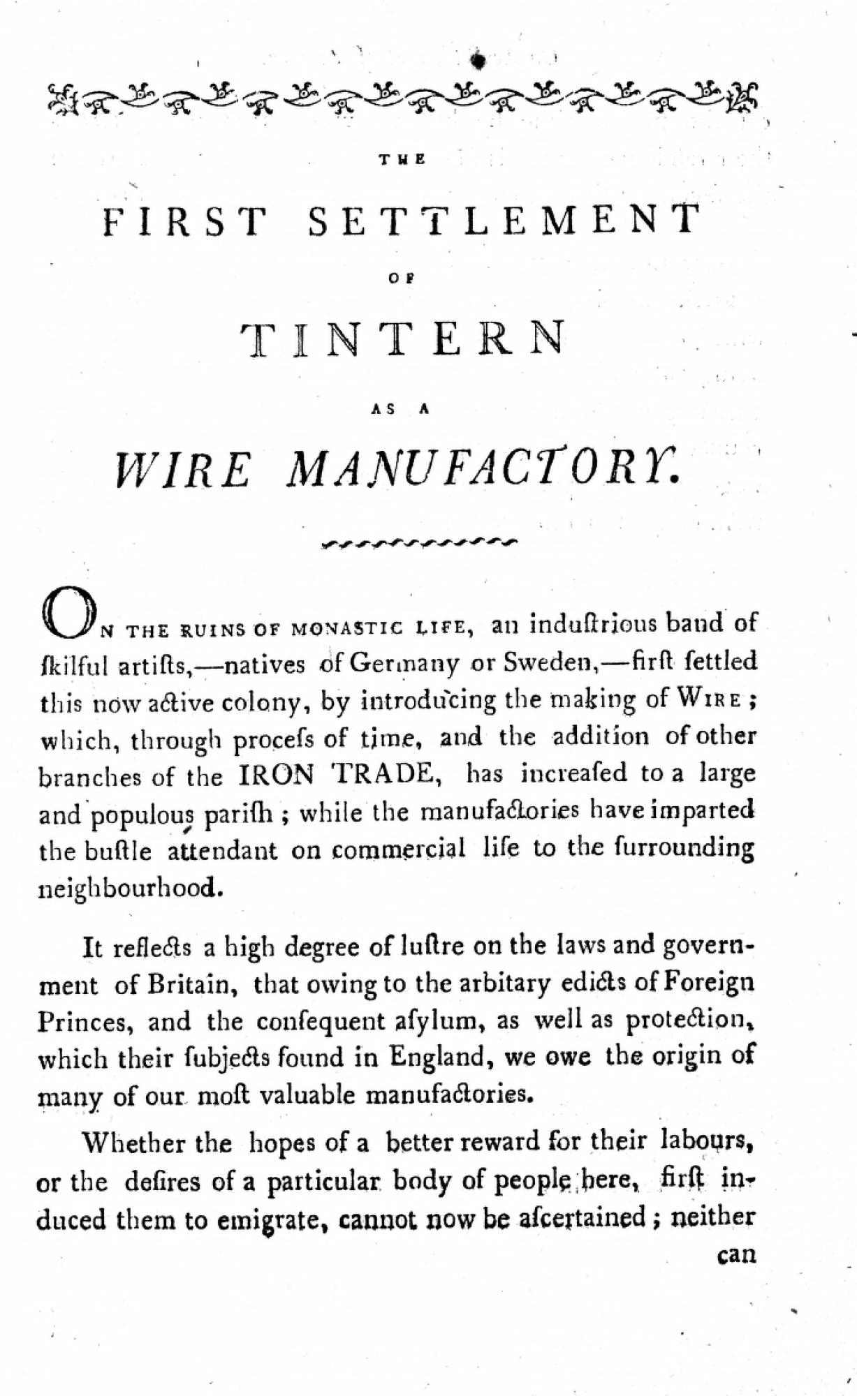
- “The First Settlement of Tintern Abbey as a Wire Manufactory”
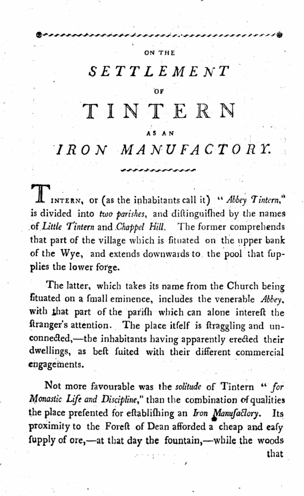
- “Settlement of Tintern as an Iron Manufactory”
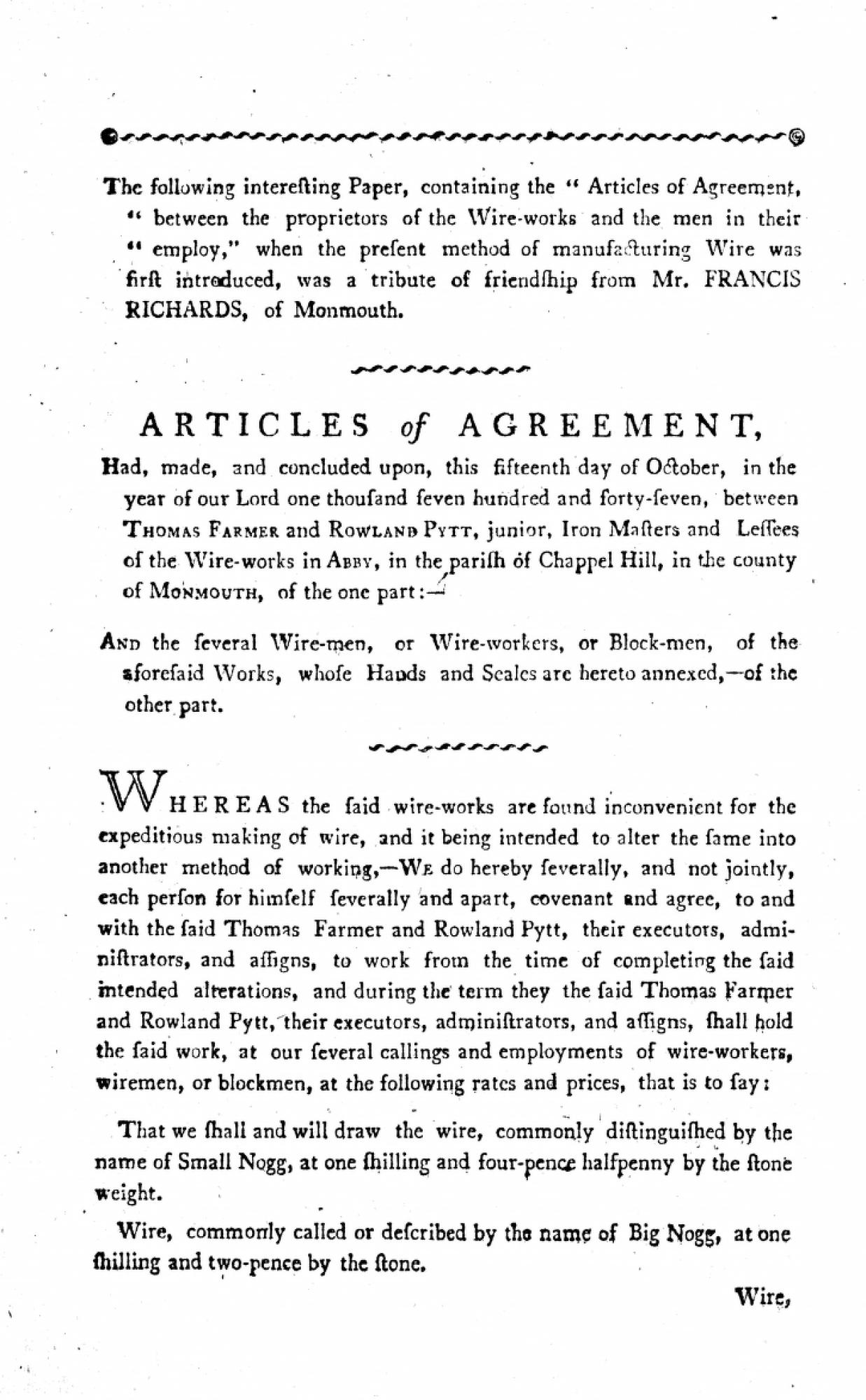
- “Articles of Agreement”
- Map of the County of Gloucester
- “London to Chepstow”
- Map of the County of Monmouth


|
John Ray “The Manner of the Wire Work at Tintern.” From A Compleat Collection of English Proverbs; also the Most Celebrated Proverbs of the Scotch, Italian, French, Spanish, and other Languages, the Whole Methodically Digested and Illustrated with Annotations, and Proper Explications. London: printed for W. Otridge, S. Bladon [& etc.], 1768. |

view related images |
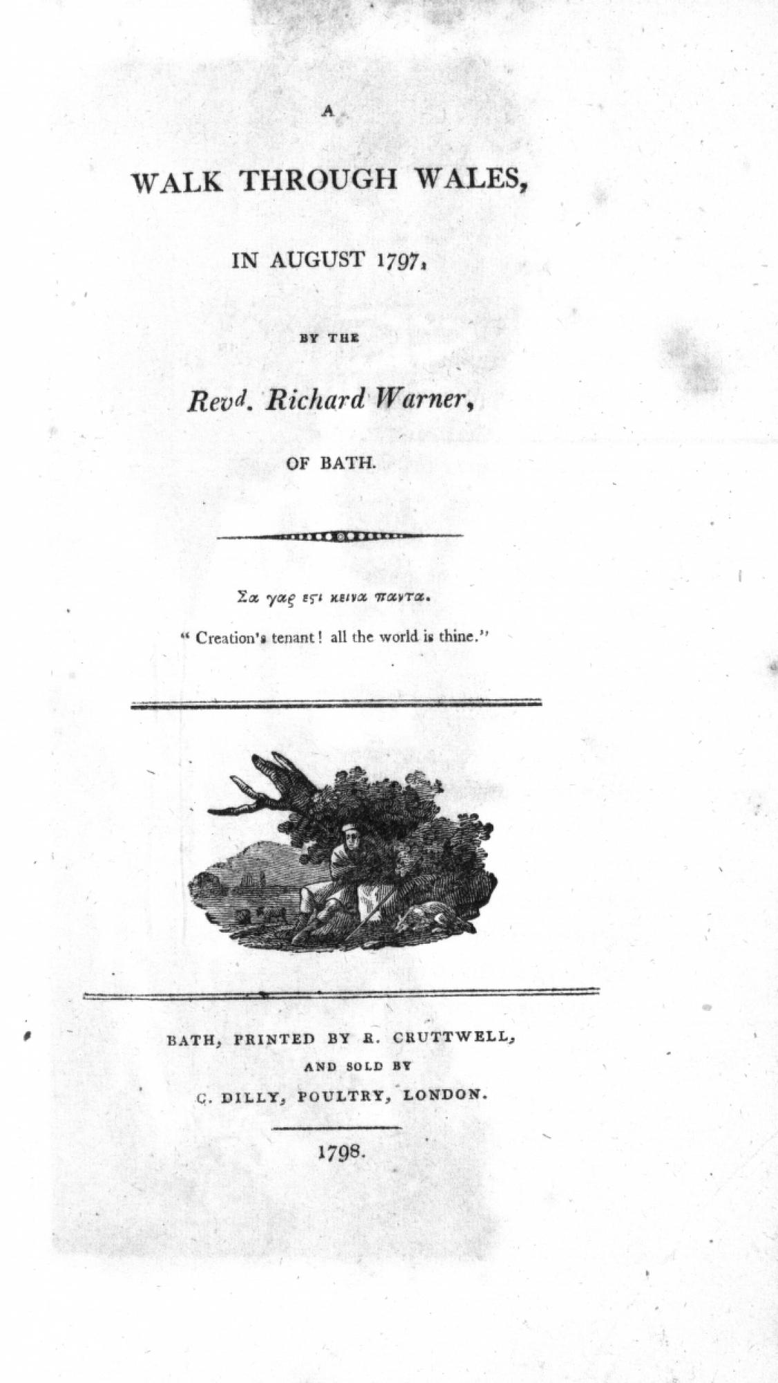
Rev. Richard Warner A Walk Through Wales, in August 1797. Bath: printed by R. Cruttwell, 1798. Richard Warner, antiquary, clergyman and author, was a protegeé of the influential William Gilpin. Warner produced a number of historical works that show his skill at synthesis rather than originality, as well as a novel with an antiquarian setting, Netley Abbey: A Gothic Story, published by the Minerva press. On August 14th, 1797 Warner, then a curate in Bath, embarked on a two-week tour that took him from the Georgian spa-town to Caernarvon and back. By his own calculation he had walked a total of 462 miles at the end of the month. Not surprisingly, he recommends pedestrianism as an “independent mode of traveling [that] enables him to catch beauties in his walk through an Alpine country, which the incumbrances of a carriage, and even the indulgence of a horse, prevents another traveller from enjoying.” Warner begins his account of Tintern Abbey on Aug. 30th and concludes in an August 31st letter written from Chepstow. While his reaction to the ruin itself is conventionally enthusiastic—once he masters his irritability over the gate key being mislaid—his absorption with the industrial spectacle is striking. His description of a midnight scene at the iron forge might have fallen out of a painting by Josiah Wright of Derby. The “horrible employment” of the furnaces and the “solemn majesty” of the Abbey seem to shape his impressions of Tintern in equal measure. A Walk Through Wales, in August 1797, shown here in a first edition, was republished at least twice by 1801. Its sequel, A Second Walk through Wales, by the Revd. Richard Warner, ... in August and September 1798 was published in 1799. |


|
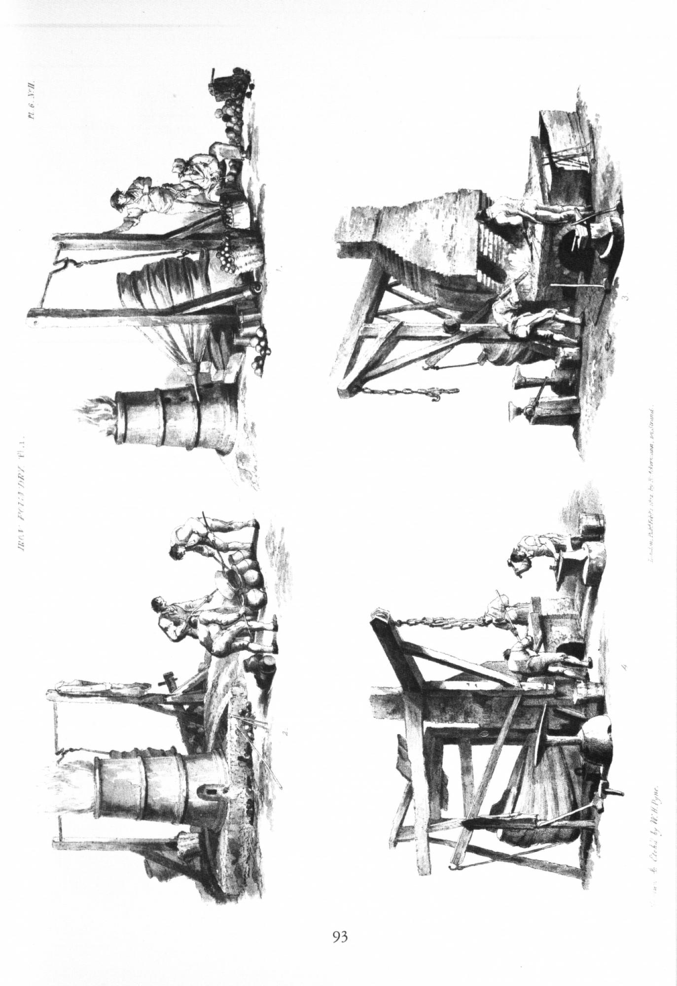
“Iron Foundry” Reproduced from Microcosm; or, A Picturesque Delineation of the Arts, Agriculture, and Manufactures of Great Britain in a Series of Above a Thousand Groups of Small Figures for the Embellishment of Landscape. Original published 1845; reprinted New York: Blom, 1971. |

view related images |
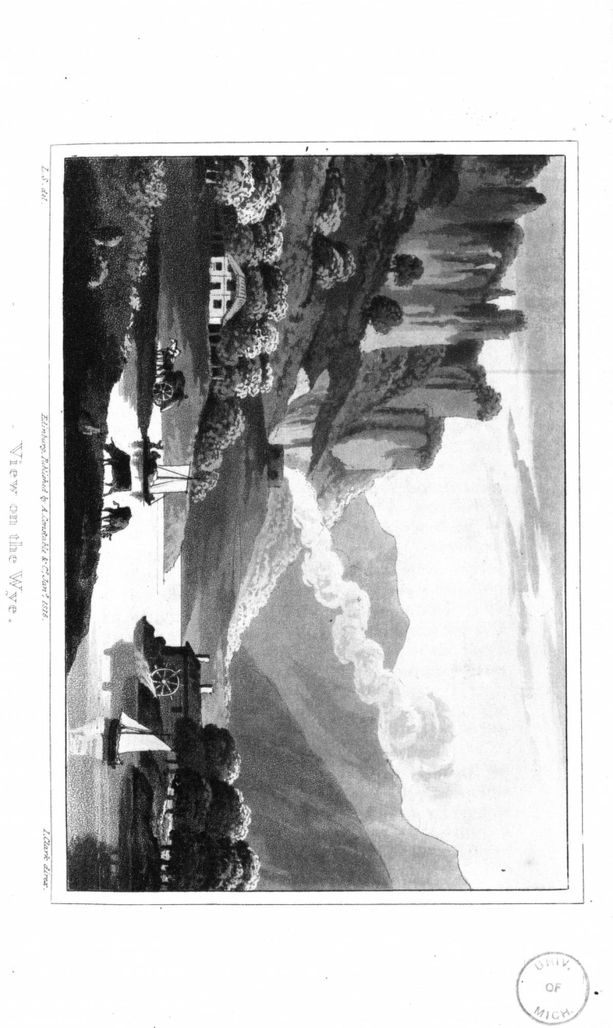
Louis Simond, artist. I. Clark, supervisor of engravers. “View on the Wye”. Jan.1, 1815. Reproduced from Journal of a Tour and Residence in Great Britain, During the Years 1810 and 1811 by a French traveller : with Remarks of the Country, its Arts, Literature, and Politics, and on the Manners and Customs of its Inhabitants. Edinburgh: printed by G. Ramsay, for A. Constable, 1815. Aquatint. Simond's picturesque view, rendered in aquatint by I. Clark, includes several of the industrial features that would be visible along the banks of the River Wye. The cliffs resemble those near Symonds Yat above Monmouth or at Wintour's Leap down-river from Tintern, although the plate may be intended as a compilation of elements rather than a depiction of a specific spot. Nonplused cows in the foreground lead the eye toward a sloop off-loading goods onto a heavy cart, and across the river to a working water-mill. A hill in the background is topped by what appears to be a lime-kiln, its smoke rising to echo the diagonals of the surrounding mountain slopes. “Industry” occupies the center of the composition, framed by the natural scene but not disrupting or displacing it. Simond did not visit the forges at Tintern, but later toured an iron and copper works near Swansea. He observed there that “the workmen looked very sickly” and he “found, on inquiry, their salary but little higher than that of common labourers.” |


|
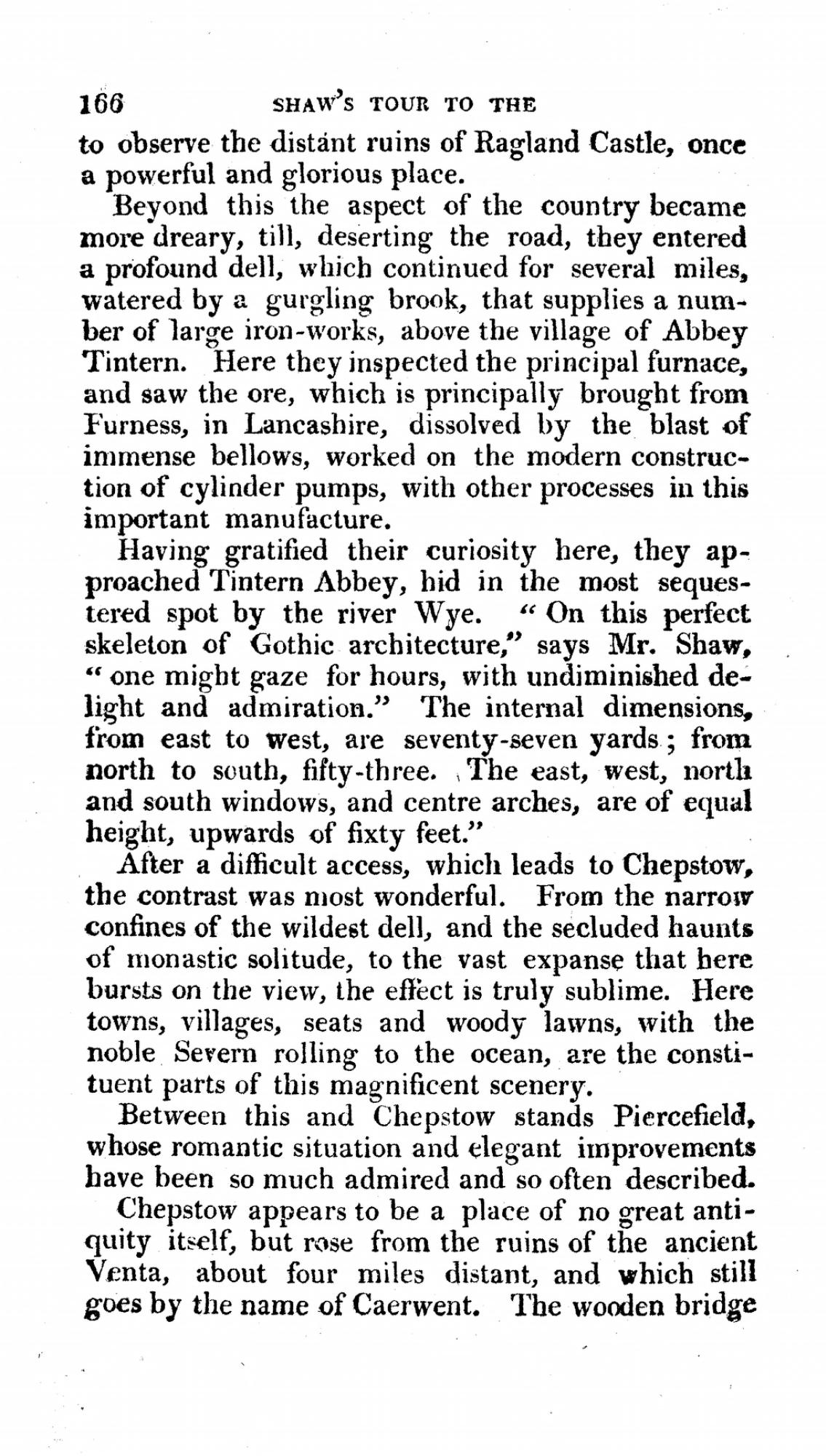
Rev. Stebbing Shaw “A Tour to the West of England in 1788". Excerpt from William Fordyce Mavor: British Tourists, or Traveller's Pocket Companion, Through England, Wales, Scotland and Ireland. Comprehending the most celebrated tours in the British Islands by. Volume 3 of 6. London: printed for Richard Phillips, 1809. The Rev. Stebbing Shaw, historian and rector of Hartshorne, Derbyshire undertook a 1,070 mile circuit of the western counties of England and Wales in August 1788. As the distance covered in this period indicates, Shaw travelled mostly by carriage, although he took the recommended water passage from Ross down to Monmouth. (In 1788 this boat trip set him back one and a half guineas.) Shaw is largely focused upon antiquities and natural history; he promises readers—unconvincingly as it turns out—that his “unadorned narration of history” will be leavened by “digressions of fancy.” His descriptions are interspersed with references to fellow clergyman William Gilpin. Goodrich Castle viewed from the Wye, for instance, is now enshrined as “Gilpin's second landscape.” Observations on the River Wye, then in its second edition, has swept all before it. Shaw disembarks at Monmouth and travels by land to Tintern: a mistake over the “hollow and uncouth tracks, seldom attempted by any carriage but those of the natives.” His route takes him first to the furnaces and forges above Tintern owned by the Duke of Beaufort and managed by David Tanner. He inspects the principal furnace, fed with imported ore from Lancashire, and the various forges for turning iron from the “broadest bars to the finest wires.” Although Tintern Abbey is the “venerable object of our deviation”, Shaw inspects and contextualizes the iron works with the same sustained seriousness that he does the Abbey. A Tour to the West of England was well-regarded in the period, as suggested by its inclusion in William Mavor's six-volume travel anthology British Tourists. Charles Heath also includes an excerpt in his Historical and Descriptive Account of Tintern Abbey. |

view related images |
“The First Settlement of Tintern Abbey as a Wire Manufactory” Reproduced from Charles Heath: Historical and Descriptive Accounts of the Ancient and Present State of Tintern Abbey. Monmouth: Charles Heath, 1803. |

view related images |
“Settlement of Tintern as an Iron Manufactory.” Reproduced from Charles Heath: Historical and Descriptive Accounts of the Ancient and Present State of Tintern Abbey. Monmouth: Charles Heath, 1803. |


|
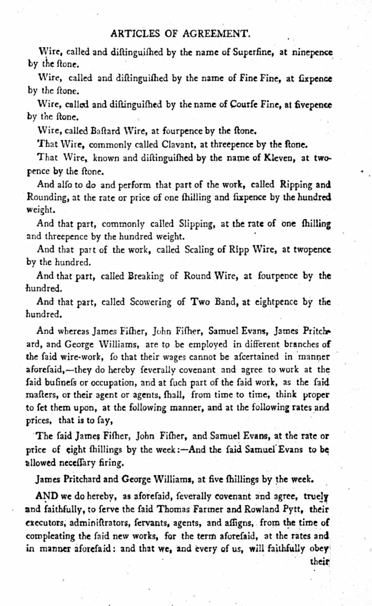
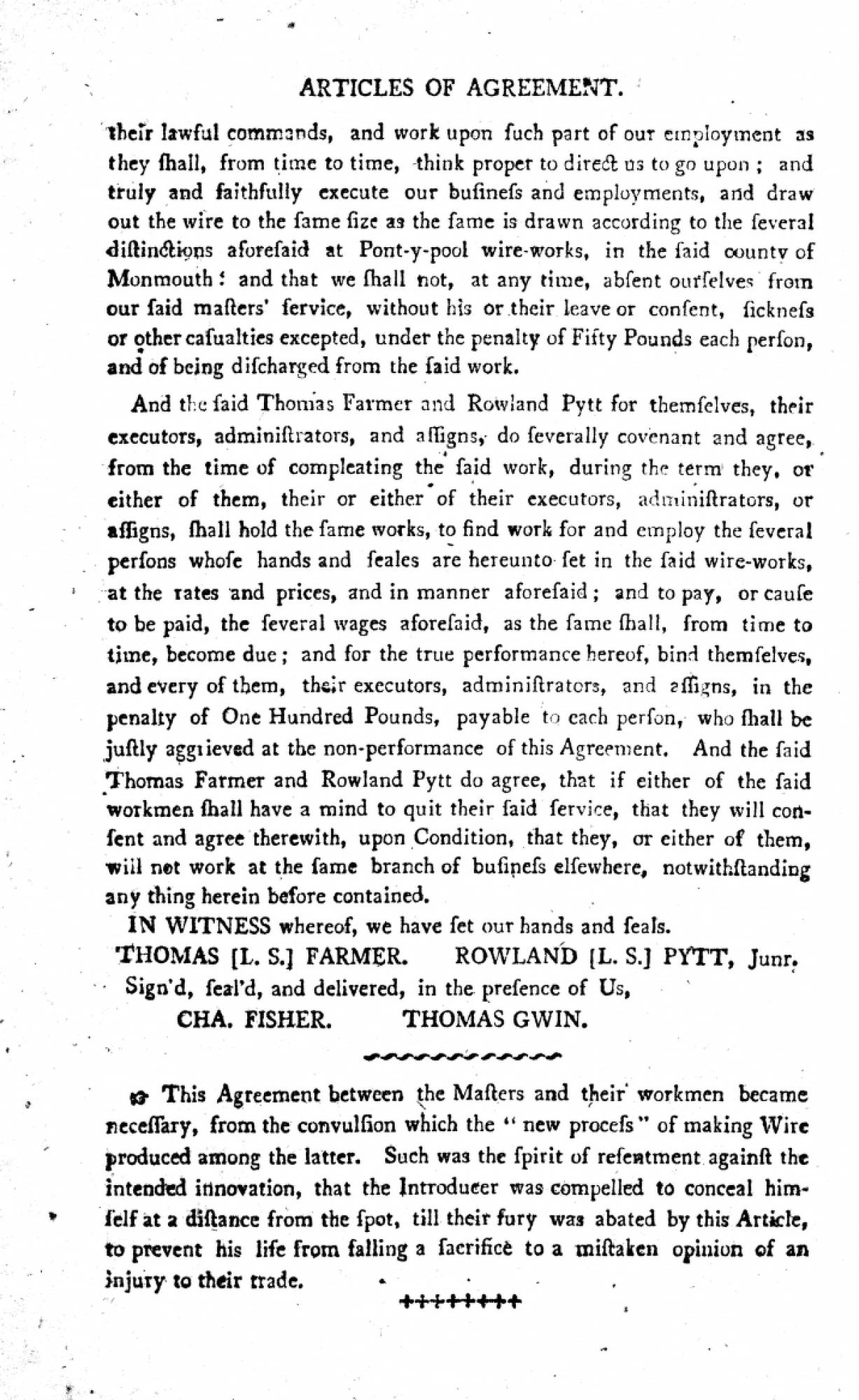
“Articles of Agreement, between Proprietors of the Wire Works and the Men in their Employ” Reproduced from Charles Heath: Historical and Descriptive Accounts of the Ancient and Present State of Tintern Abbey. Monmouth: Charles Heath, 1803. |

|
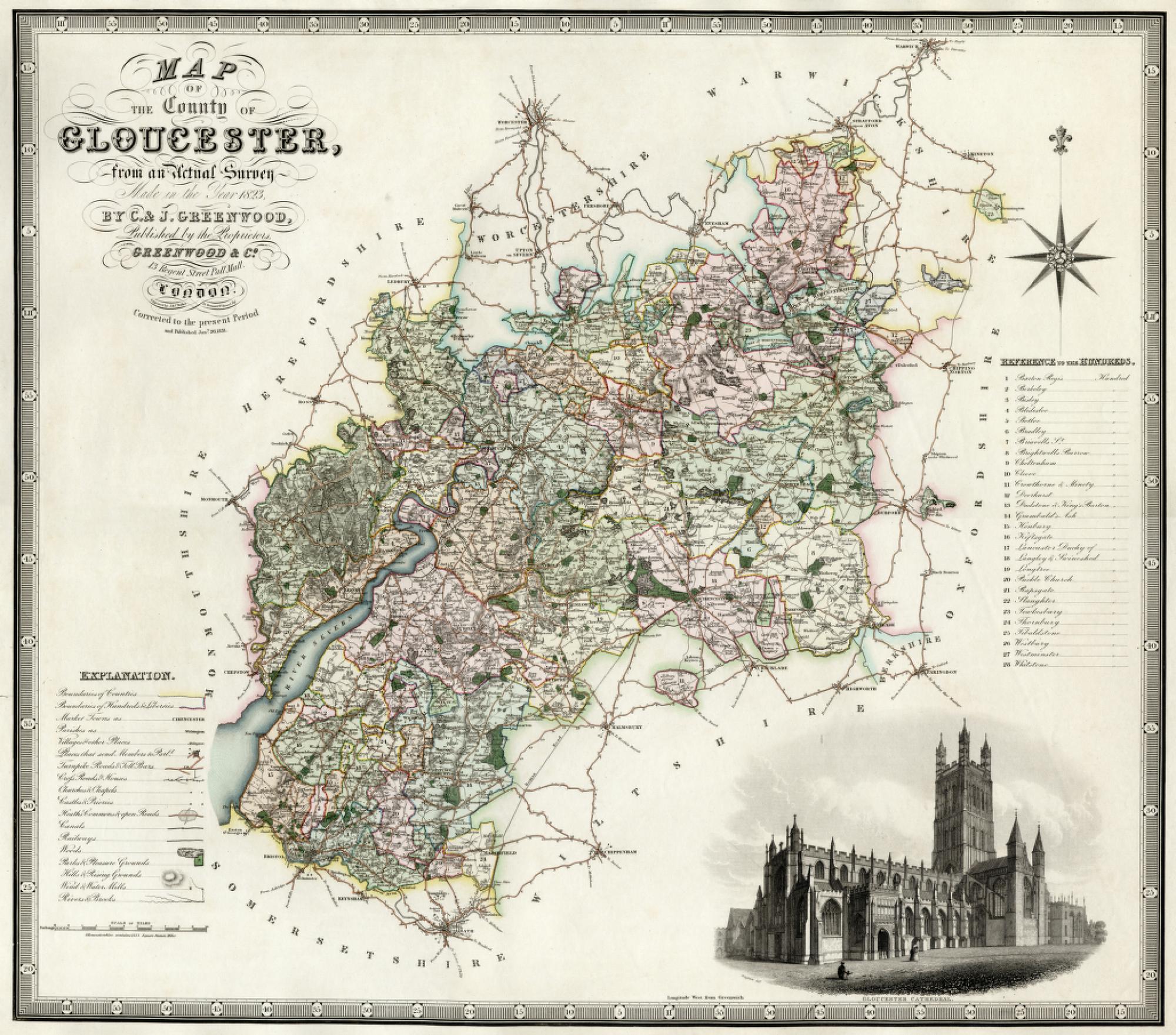
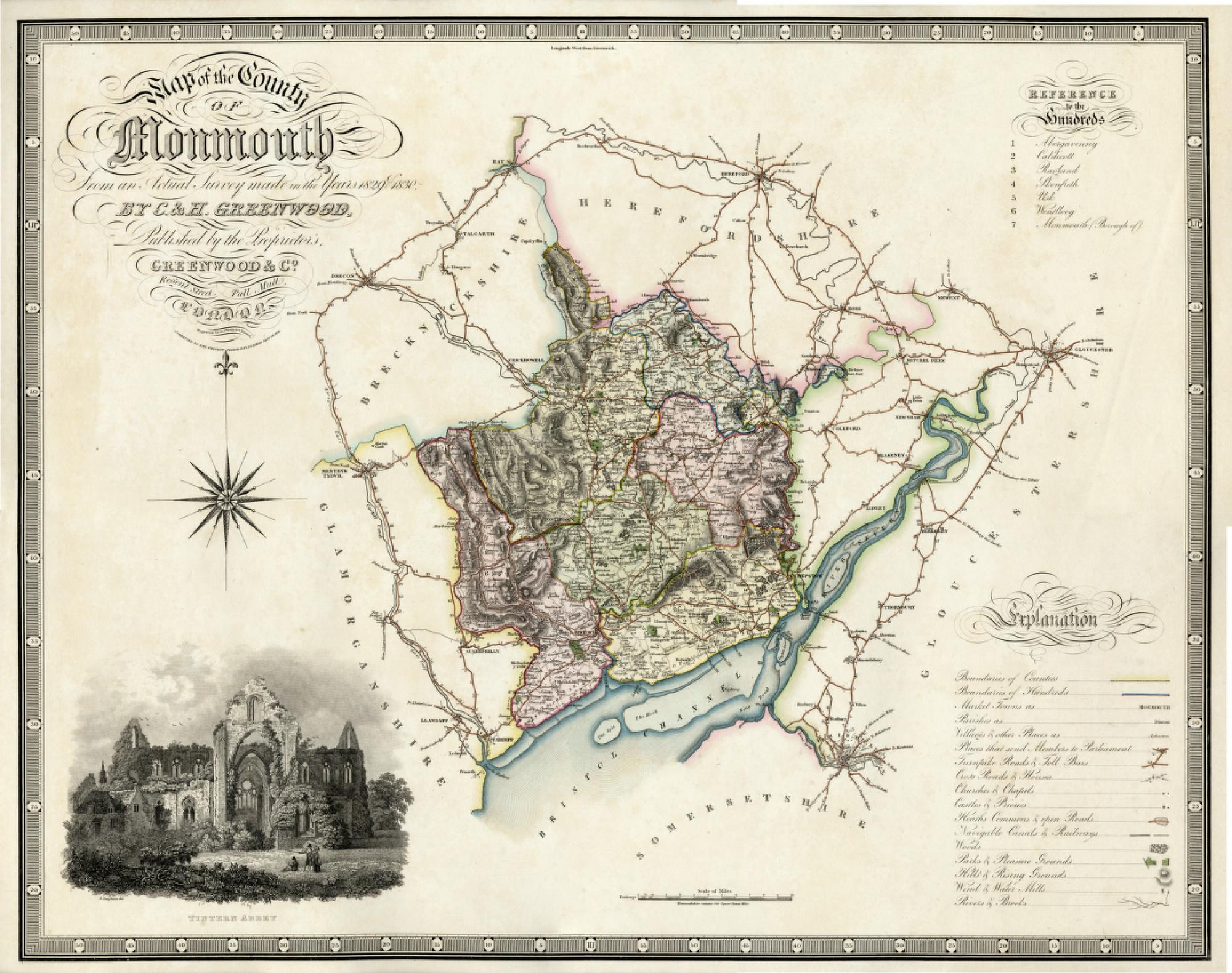
C. and J. Greenwood.
Map of the County of Gloucester, from an Actual Survey Made in the Year 1823. London: Greenwood and Co., 1831. Engraved by J. S. C. Walker. Loaned from the Map Library. The Greenwoods produced large-scale maps of the counties between 1817 and 1830 to rival the publications of the Ordnance Survey office (see “Vagrant Dwellers”: Tours & Excursions Ordnance Survey “Old Series”, Sheet XXXV and Ordnance Survey “Old Series” Sheet No. XLIII).27 Like the OS maps, the scale of this map is 1 inch per mile. Some historians feel that the Greenwood maps are superior to the OS maps in more clearly distinguishing county and parish boundaries.28 Additionally, each map is embellished by a beautiful vignette of an important county monument or landmark: Hereford Cathedral for Gloucester, and Tintern Abbey for Monmouth. Both vignettes are engraved by R. Creighton. Hereford Cathedral, home of the Mappa Mundi, must be high on the list of treasures for any cartographer. The two enlargements show the River Wye from the English or Gloucestershire side, taken from the present map, and from the Welsh side as reproduced from the map of Monmouth. |

view related images |
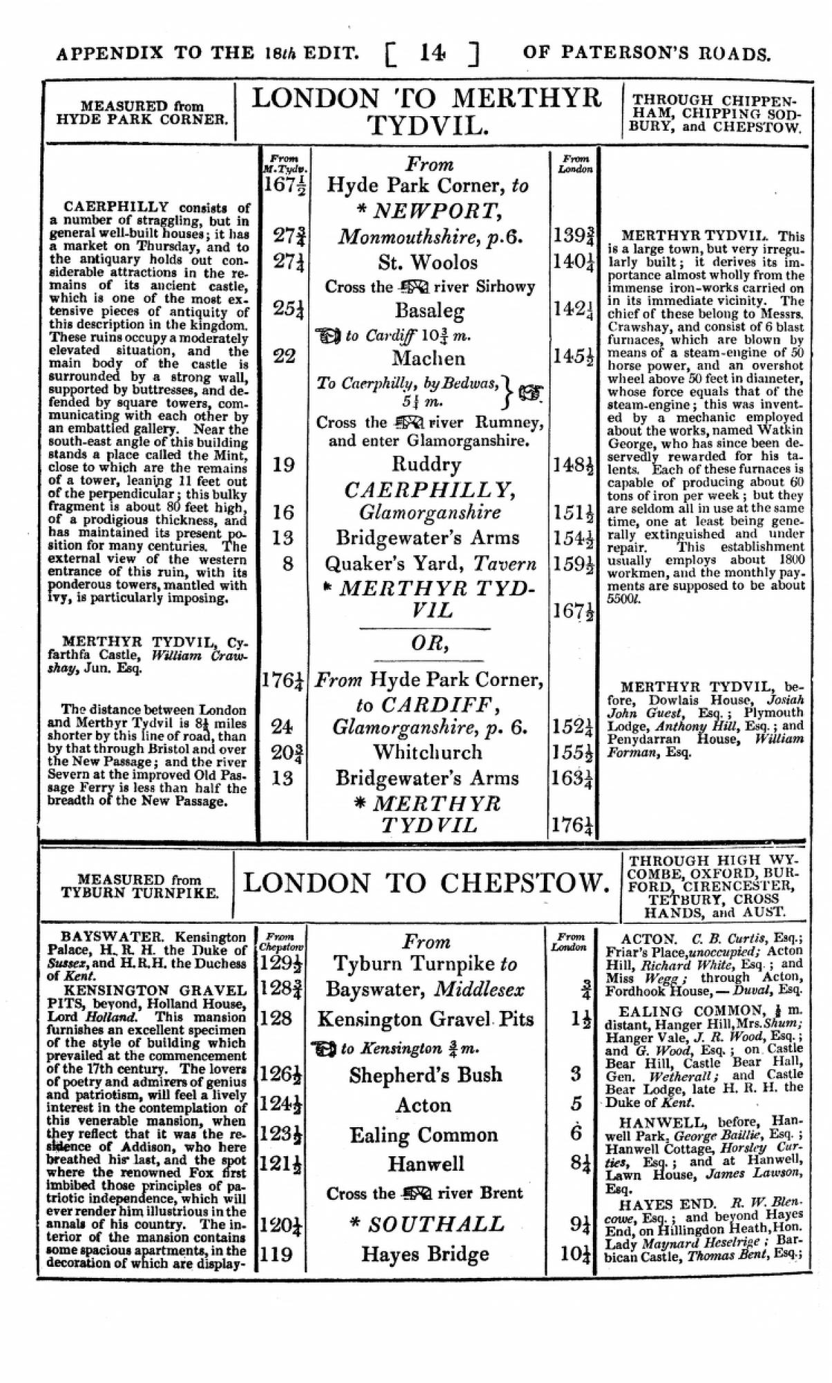
“London to Chepstow” Reproduced from: Paterson’s Roads; Being an Entirely Original and Accurate Description of all the Direct and Principal Cross Roads in England and Wales, with Part of the Roads of Scotland. Appendix by Edward Mogg. London: printed for C.J.G. and F. Rivington [& etc.], c.1829. Appendix pp.14-17. |

|
C. and H. Greenwood.
Map of the County of Monmouth, from an Actual Survey Made in the Years 1829 & 1830. London: Greenwood and Co., 1831. Engraved by J. Neele. Loaned from the Map Library. |