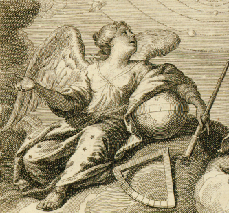
IntroductionAs other commentators have pointed out, an exhibition of astronomical maps requires little justification. Few other publications throughout history have achieved such an impressive synthesis of artistic beauty and practical scientific value, and in few other areas of human endeavor have four hundred years of continuous progress in scientific and artistic technology conspired to produce an unbroken lineage of scientific publications, each more ambitious than the last. Divine Sky: The Artistry of Astronomical Maps showcases a small selection from this canon. The history of astronomical maps stretches from prehistory through the present, but Divine Sky focuses on the fertile period between 1600 and 1900 that produced some of astronomy’s greatest treasures. This astronomical Golden Age was a time when “the art of science and the science of art enjoyed a unique period of reciprocity.”1 In revisiting it we are transported to a world where art and science were well balanced and in each other’s service, where the universe seemed smaller, and where the skies were filled with familiar characters from myth and legend. Divine Sky is divided into four sections. Two deal with star charts: single-sheet celestial maps, and atlases, which form their own genre. All are examples of celestial cartography, a largely mathematical discipline whose goal is to accurately translate the celestial sphere onto the two-dimensional space of the printed page. In contrast, other astronomical maps focuses on diagrams that represent various cosmological theories; these provide insight into historical scientific debates over the structure of the cosmos, and into the evolution of the individual’s relationship with the universe. Drawings and early photographs contains drawings of specific astronomical objects and phenomena, providing a more personal insight into one astronomer’s way of seeing. All of the items in this exhibit come from the collections of the University of Michigan libraries. Not all are particularly rare, nor are they necessarily the best copies available, but they have been included because of a unique history that is tied to the University of Michigan and its libraries. This is a permanent and growing exhibit; the materials gathered here represent only a small fraction of the astronomical maps in the library’s collections, and the intention is to add more as they are digitized. I hope this exhibit can serve as an introduction to the fascinating world of astronomical maps. I also hope it will spur interest in the University of Michigan’s world-class collections in this area, of which I have here presented but a small sample. Jacob Glenn Sources and Further Reading[Ashworth] Ashworth, William B., Jr. Out of This World: The golden age of the celestial atlas. Kansas City, Missouri: Linda Hall Library, 2007. [Brown] Brown, Basil J. W. Astronomical Atlases, Maps & Charts: An historical & General guide. London: Search Publishing Co., 1932. [BUAG 1985] Boston University Art Gallery. Celestial Images: Astronomical charts from 1500 to 1900. Boston, Mass.: Boston University Art Gallery, 1985. [BUAG 2005] Boston University Art Gallery. Celestial Images: Antiquarian astronomical charts and maps from the Mendillo collection. Boston, Mass.: Boston University Art Gallery, 2005. [Burnham] Burnham, Patricia. “Celestial images: an overview.” Celestial Images: Antiquarian astronomical charts and maps from the Mendillo collection. Boston, Mass.: Boston University Art Gallery, 2005. 11-15. [Kanas] Kanas, Nick. Star Maps: History, Artistry, and Cartography. Chichester, UK: Springer/Praxis, 2007. [Trouvelot] Trouvelot, tienne Lopold. The Trouvelot Astronomical Drawings Manual. New York: C. Scribner’s Sons, 1882. [Van Gent] Van Gent, Robert H. The finest atlas of the heavens. Hong Kong; Los Angeles: Taschen, 2006. [Warner 1979] Warner, Deborah J. The Sky Explored: Celestial Cartography 1500-1800. Amsterdam: Theatrum Orbis Terrarum Ltd., 1979. [Warner 2005] Warner, Deborah J. “Star charts: their lore and meaning.” Celestial Images: Antiquarian astronomical charts and maps from the Mendillo collection. Boston, Mass.: Boston University Art Gallery, 2005. 17-20. 1 Burnham 11. |
 |


